close
-
Layers w
- Weather Layers
- Pro
- Pro
- Pro
- Pro
- Pro
- Pro
- More Layers
- Pro
- Pro
- Pro
- Pro
-
Upgrade to

3D
Trail Conditions
- Unknown
- Snow Groomed
- Snow Packed
- Snow Covered
- Snow Cover Partial
- Freeze/thaw Cycle
- Icy
- Prevalent Mud
- Wet
- Variable
- Ideal
- Dry
- Very Dry
Trail Flow (Ridden Direction)
Trailforks scans users ridelogs to determine the most popular direction each trail is ridden. A good flowing trail network will have most trails flowing in a single direction according to their intension.
The colour categories are based on what percentage of riders are riding a trail in its intended direction.
The colour categories are based on what percentage of riders are riding a trail in its intended direction.
- > 96%
- > 90%
- > 80%
- > 70%
- > 50%
- < 50%
- bi-directional trail
- no data
Trail Last Ridden
Trailforks scans ridelogs to determine the last time a trail was ridden.
- < 2 days
- < 1 week
- < 2 weeks
- < 1 month
- < 6 months
- > 6 months
Trail Ridden Direction
The intended direction a trail should be ridden.
- Downhill Only
- Downhill Primary
- Both Directions
- Uphill Primary
- Uphill Only
- One Direction
Contribute Details
Colors indicate trail is missing specified detail.
- Description
- Photos
- Description & Photos
- Videos
Trail Popularity ?
Trailforks scans ridelogs to determine which trails are ridden the most in the last 9 months.
Trails are compared with nearby trails in the same city region with a possible 25 colour shades.
Think of this as a heatmap, more rides = more kinetic energy = warmer colors.
- most popular
- popular
- less popular
- not popular
ATV/ORV/OHV Filter
Max Vehicle Width
inches
US Cell Coverage
Legend

Radar Time
Activity Recordings
Trailforks uses anonymized public activity data.
?
Activity Recordings
Trailforks uses anonymized public activity data.
?
Personal Heatmap
▶
Activity Types
all
/
none
▶
Options
2
Date range
month
–
Winter Trails
Warning
A routing network for winter maps does not exist. Selecting trails using the winter trails layer has been disabled.
Missing Trails
Most Popular
Least Popular
Trails are colored based on popularity. The more popular a trail is, the more red. Less popular trails trend towards green.
Jump Magnitude Heatmap
Heatmap of where riders jump on trails. Zoom in to see individual jumps, click circles to view jump details.
BC Backroad Status
![map legend]()
Service Road Atlas is a free to use, community-driven service for viewing and creating reports on the numerous back-country service roads around B.C. and Alberta.

Slope Aspect
Direction the slope faces
Trails Deemphasized
Trails are shown in grey.
Only show trails with no bike usage.
Suggested Layers
Based on selected activity type
Save the current map location and zoom level as your default home location whenever this page is loaded.
SavePopular Trail Networks
view all areas »
No description for Southeast Ohio has been added yet!
Login or register to submit one.
Region Details
- 345
- 1
- 115
- 222
- 48
- 1
- 1
Stats
- Avg Trail Rating
- Trails (view details)
- 1,141
- Trails Mountain Bike
- 733
- Trails E-Bike
- 483
- Trails Gravel Bike
- 465
- Trails Adaptive Bike
- 54
- Trails Winter Fat Bike
- 30
- Trails Horse
- 177
- Trails Hike
- 1,133
- Trails Trail Running
- 1,133
- Trails Dirtbike/Moto
- 64
- Trails Observed Trials
- 1
- Trails ATV/ORV/OHV
- 64
- Trails Snowmobile
- 1
- Trails Snowshoe
- 11
- Trails Nordic Ski
- 11
- Total Distance
- 1,579 miles
- Total Descent
- 169,519 ft
- Total Vertical
- 745 ft
- Highest Trailhead
- 1,279 ft
- Reports
- 4,561
- Photos
- 714
- Ridden Counter
- 23,693
Sub Regions
- Athens County (88)
- Athens (81)
- Baileys Trail System (46)
- Gore (1)
- Strouds Run State Park (14)
- Coolville (3)
- Glouster (3)
- Nelsonville (38)
- Athens (81)
- Belmont County (0)
- Belmont (0)
- Gallia County (31)
- Guernsey County (26)
- Cambridge (26)
- Cambridge (26)
- Hocking County (62)
- Jackson County (0)
- Jackson (0)
- Jackson (0)
- Lawrence County (3)
- Ironton (29)
- Meigs County (0)
- Reedsville (0)
- Reedsville (0)
- Monroe County (3)
- Morgan County (49)
- Muskingum County (67)
- Cumberland (36)
- The Wilds (36)
- Zanesville (32)
- Cumberland (36)
- Noble County (41)
- Belle Valley (33)
- Dexter City (7)
- Belle Valley (33)
- Pike County (23)
- Latham (4)
- Morgantown (6)
- Newfane (4)
- Latham (4)
- Ross County (141)
- Bainbridge (0)
- Chillicothe (131)
- Frankfort (2)
- Londonderry (6)
- Richmond Dale (2)
- Bainbridge (0)
- Scioto County (23)
- Otway (0)
- Portsmouth (0)
- Shawnee State Park (12)
- West Portsmouth (23)
- Otway (0)
- Vinton County (48)
- Zaleski (36)
- Lake Hope State Park (36)
- Zaleski (36)
- Washington County (124)
- Wayne National Forest - Ironton Unit (26)
- Coshocton (3)
- Coshocton (3)
Popular Southeast Ohio Mountain Biking Trails
• 95 ★ 4.7 • 2 miles • 146 ft • 360 •
is an intermediate natural surface trail with tightly-banked switchbacks punctuated with pleasant scenic views of wetlands and surrounding hillsides. From , you’ll start your descent to West Bailey Run, traveling through a recently...
• 65 ★ 4.8 • 5 miles • 458 ft • 330 •
is a fast flowy intermediate level trail that connects the end of to Trail. has its own trailhead that can be accessed on West Bailey Rd. The Eastern most section of the trail (on the east side of West Bailey Rd) descends to possibly...
• 100 ★ 2.0 • 1,759 ft • 46 ft • 324 •
The is a surfaced beginner trail directly connected to the Chauncey-Dover Community Park, which serves as the main trailhead of the Baileys Trail System. The trail gives a nod to the original Chauncey train depot. and can be directly...
• 100 ★ 3.8 • 863 ft • 38 ft • 313 •
The is a beginner natural surface trail named for the piles of gob, a legacy of coal mining, that you can see along the trail. climbs gently and circumnavigates a small hill above the park. The trail also functions as a connector...
• 90 ★ 4.5 • 3 miles • 277 ft • 269 •
is named for the historic salt mining operations located here just outside the village of Chauncey. This trail is an easy to intermediate rating. The preferred direction of travel is clockwise, in which direction you will find a nice...
• 85 ★ 4.9 • 4 miles • 342 ft • 258 •
is an intermediate natural surface trail that serves as the backbone of trails between Chauncey and Doanville, connecting to at its eastern terminus, at its western terminus, and , , and in between. You’ll find yourself weaving around...
• 100 ★ 5.0 • 545 ft • 0 ft • 246 •
The is a surfaced beginner trail directly connected to the Chauncey-Dover Community Park, which serves as the main trailhead of the Baileys Trail System. The trail gives a nod to the original Chauncey train depot. and can be directly...
• 95 ★ 4.5 • 4 miles • 253 ft • 243 •
is a beginner natural surface trail with a few B-lines for the more adventurous soul. The name acknowledges both the region’s history and the personality of the trail. You can access the by either or . If you want to take the most...
Southeast Ohio Mountain Bike Routes
★ 5.0 • 37 miles • 4,521 ft • 4 • Loop •
This is the biggest, most epic, backcountry mountain bike ride in the state! Allow 6-8 hours to finish the...
16 miles • 1,368 ft • 6 • Loop •
Intermediate MTB ride showcasing the best Marietta has to offer. You will experience a uniquely urban...
24 miles • 2,175 ft • 5 • Loop •
This route is 24m in length. Estimating 2,400ft of elevation. It is a figure 8 pattern looping past Utah...
5 miles • 350 ft • 5 •
Join us for the first Baileys Dirt Fondo and Fundraiser on Saturday, October 14, 2023, presented by Trek!...
35 miles • 3,248 ft • 1 •
The Hawk: This GRAVEL loop serves up just over 35 miles and 3400 feet of elevation.
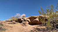
Photos of Southeast Ohio Mountain Bike
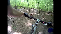
Videos of Southeast Ohio Mountain Bike
trail: Snake Hollow Trail
0:08 |
521 |
Jan 7, 2022

trail: Bunker Hill
14:47 |
57 |
Oct 28, 2025 , Chillicothe

trail: Bobcat
8:42 |
312 |
Aug 25, 2011

trail: Wildcat
5:09 |
424 |
Aug 24, 2011

trail: Bobcat
5:28 |
384 |
Jun 11, 2011
trail: Copperhead
0:27 |
348 |
Jun 6, 2011

trail: Bobcat
3:30 |
258 |
Jun 3, 2011

trail: Bong Hill
3:33 |
146 |
Apr 19, 2024 , Athens
Current Trail Warnings
| status | trail | date | condition | user | info |
|---|---|---|---|---|---|
| Name TBD Baileys Trail System | Jun 15, 2026 @ 2:45pm (America/Los_Angeles) Jun 15, 2026 | Unknown | TeamLizard ABC | Large tree down across trail, blocking trail | |
| Salt Works Baileys Trail System | Jun 15, 2026 @ 2:06pm (America/New_York) Jun 15, 2026 | Prevalent Mud | TeamLizard ABC | Lower section is worse than the upper one. | |
| Beech Drop Baileys Trail System | Jun 13, 2026 @ 10:43am (America/Los_Angeles) Jun 13, 2026 | Variable | TeamLizard ABC | Large tree down across trail, blocking trail |
Recent Trail Reports
Activity Feed
| username | action | type | title | date |
|---|---|---|---|---|
| benbrewster-athensbicycleclub | add | report | activity #97332374 | Jun 19, 2026 @ 11:22am 7 hours |
| benbrewster-athensbicycleclub | add | report | activity #97332371 and 1 more | Jun 19, 2026 @ 11:22am 7 hours |
| YetiOhio | add | report | activity #97311260 and 2 more | Jun 19, 2026 @ 6:02am 13 hours |
| bobeichenberg | update | region | activity #97232219 | Jun 17, 2026 @ 9:55pm 2 days |
| TeamLizard | add | report | activity #97187128 | Jun 17, 2026 @ 8:49am 2 days |
Recent Comments
| username | type | title | comment | date |
|---|---|---|---|---|
| report | This should be minor issue and not listed as clear | Jun 15, 2026 @ 5:19pm Jun 15, 2026 | ||
| trail | Removed By ABC May 30th. | Jun 1, 2026 @ 2:40am Jun 1, 2026 | ||
| report | Rides nice just had a couple of wet spots mid... | May 31, 2026 @ 12:42pm May 31, 2026 | ||
| trail | Beautiful trail and very challenging!! Well... | May 12, 2026 @ 6:10am May 12, 2026 | ||
| trail | Maybe not green but definitely blue. It was... | Apr 3, 2026 @ 9:51pm Apr 3, 2026 |
Local Badges
-

Epic Mountain Bike Climb 2k0 awarded -

Climbing 10k Badge0 awarded -
Climbing 10k Badge0 awarded -
Epic Mountain Bike Climb 2k0 awarded -
Epic Mountain Bike Climb 2k0 awarded -

10 Blue Trails0 awarded
Bike & Skill Parks
| name | type | city | rating |
|---|---|---|---|
| Fly MX Park | skill park | Marietta | |
| Fast Traxx Motoplex | skill park | Athens | |
| Chilitown MX | skill park | Chillicothe | |
| Sunday Creek Raceway | skill park | ||
| COCR | skill park |
Upcoming Local Events
Activity Type Stats
| activitytype | trails | distance | descent | descent distance | total vertical | rating | global rank | state rank | photos | reports | routes | ridelogs |
|---|---|---|---|---|---|---|---|---|---|---|---|---|
| Mountain Bike | 733 | 916 miles | 83,747 ft | 352 miles | 719 ft | 637 | 4,543 | 27 | 18,849 | |||
| E-Bike | 483 | 553 miles | 43,068 ft | 208 miles | 689 ft | 2 | 3,113 | 11 | 1,177 | |||
| Gravel Bike | 465 | 589 miles | 41,270 ft | 220 miles | 673 ft | 413 | 146 | |||||
| Adaptive Bike | 54 | 85 miles | 3,717 ft | 23 miles | 571 ft | 348 | ||||||
| Winter Fat Bike | 30 | 16 miles | 1,716 ft | 6 miles | 522 ft | 102 | 1 | |||||
| Horse | 177 | 354 miles | 44,278 ft | 149 miles | 692 ft | 1 | 769 | 1 | 79 | |||
| Hike | 1,133 | 1,576 miles | 168,990 ft | 628 miles | 745 ft | 49 | 4,421 | 5 | 3,433 | |||
| Trail Running | 1,133 | 1,576 miles | 168,990 ft | 628 miles | 745 ft | 1 | 4,419 | 1 | 859 | |||
| Dirtbike/Moto | 64 | 137 miles | 14,747 ft | 58 miles | 489 ft | 2 | 718 | 67 | ||||
| Observed Trials | 1 | 1 mile | 207 ft | 3,068 ft | 207 ft | 11 | 4 | |||||
| ATV/ORV/OHV | 64 | 136 miles | 14,925 ft | 58 miles | 489 ft | 718 | 22 | |||||
| Snowmobile | 1 | 4 miles | 302 ft | 1 mile | 272 ft | 92 | ||||||
| Snowshoe | 11 | 10 miles | 1,302 ft | 4 miles | 364 ft | 101 | 1 | |||||
| Nordic Ski | 11 | 10 miles | 1,302 ft | 4 miles | 364 ft | 98 | 19 |
Activities
- Southeast Ohio Mountain Biking Trails
- Southeast Ohio E-Biking Trails
- Southeast Ohio Gravel Biking Trails
- Southeast Ohio Adaptive Biking Trails
- Southeast Ohio Winter Fat Biking Trails
- Southeast Ohio Horseback Trails
- Southeast Ohio Hiking Trails
- Southeast Ohio Trail Running Trails
- Southeast Ohio Dirtbiking Trails
- Southeast Ohio ATVing/Offroading Trails
- Southeast Ohio Snowshoeing Trails
- Southeast Ohio Nordic Skiing Trails
Trails
- By markholloway
 Trailforks Map Team & contributors
 - Admins: Chris-Campbell
- #22815 - 5,988 views
- southeast ohio activity log | embed map of Southeast Ohio mountain bike trails | southeast ohio mountain biking points of interest
Downloading of trail gps tracks in kml & gpx formats is enabled for Southeast Ohio.
You must login to download files.