close
-
Layers w
- Weather Layers
- Pro
- Pro
- Pro
- Pro
- Pro
- Pro
- More Layers
- Pro
- Pro
- Pro
- Pro
-
Upgrade to

3D
Trail Conditions
- Unknown
- Snow Groomed
- Snow Packed
- Snow Covered
- Snow Cover Partial
- Freeze/thaw Cycle
- Icy
- Prevalent Mud
- Wet
- Variable
- Ideal
- Dry
- Very Dry
Trail Flow (Ridden Direction)
Trailforks scans users ridelogs to determine the most popular direction each trail is ridden. A good flowing trail network will have most trails flowing in a single direction according to their intension.
The colour categories are based on what percentage of riders are riding a trail in its intended direction.
The colour categories are based on what percentage of riders are riding a trail in its intended direction.
- > 96%
- > 90%
- > 80%
- > 70%
- > 50%
- < 50%
- bi-directional trail
- no data
Trail Last Ridden
Trailforks scans ridelogs to determine the last time a trail was ridden.
- < 2 days
- < 1 week
- < 2 weeks
- < 1 month
- < 6 months
- > 6 months
Trail Ridden Direction
The intended direction a trail should be ridden.
- Downhill Only
- Downhill Primary
- Both Directions
- Uphill Primary
- Uphill Only
- One Direction
Contribute Details
Colors indicate trail is missing specified detail.
- Description
- Photos
- Description & Photos
- Videos
Trail Popularity ?
Trailforks scans ridelogs to determine which trails are ridden the most in the last 9 months.
Trails are compared with nearby trails in the same city region with a possible 25 colour shades.
Think of this as a heatmap, more rides = more kinetic energy = warmer colors.
- most popular
- popular
- less popular
- not popular
ATV/ORV/OHV Filter
Max Vehicle Width
inches
US Cell Coverage
Legend

Radar Time
Activity Recordings
Trailforks uses anonymized public activity data.
?
Activity Recordings
Trailforks uses anonymized public activity data.
?
Personal Heatmap
▶
Activity Types
all
/
none
▶
Options
2
Date range
month
–
Winter Trails
Warning
A routing network for winter maps does not exist. Selecting trails using the winter trails layer has been disabled.
Missing Trails
Most Popular
Least Popular
Trails are colored based on popularity. The more popular a trail is, the more red. Less popular trails trend towards green.
Jump Magnitude Heatmap
Heatmap of where riders jump on trails. Zoom in to see individual jumps, click circles to view jump details.
BC Backroad Status
![map legend]()
Service Road Atlas is a free to use, community-driven service for viewing and creating reports on the numerous back-country service roads around B.C. and Alberta.

Slope Aspect
Direction the slope faces
Trails Deemphasized
Trails are shown in grey.
Only show trails with no bike usage.
Suggested Layers
Based on selected activity type
Save the current map location and zoom level as your default home location whenever this page is loaded.
SaveThe south of the South Island of New Zealand.
Activities Click to view
- Mountain Bike
135 trails
- E-Bike
113 trails
- Hike
163 trails
- Trail Running
166 trails
Stats
- Avg Trail Rating
- Trails (view details)
- 173
- Trails Mountain Bike
- 135
- Trails E-Bike
- 113
- Trails Horse
- 2
- Trails Hike
- 163
- Trails Trail Running
- 166
- Total Distance
- 354 miles
- Total Descent
- 42,378 ft
- Total Vertical
- 4,776 ft
- Highest Trailhead
- 4,780 ft
- Reports
- 678
- Photos
- 316
- Ridden Counter
- 8,974
Popular Trail Networks
view all areas »Sub Regions
- Bluff (50)
- Invercargill (69)
- Sandy Point (60)
- Outautau (2)
- Te Anau (32)
- Outflow (14)
- Perenuka Mountain Bike Park (12)
- Fiordland National Park (2)
- Rakiura National Park (0)
Popular Southland District Mountain Biking Trails
• 80 ★ 3.3 • 18 miles • 870 ft • 142 •
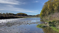
Lake2Lake Trail from Te Anau to Manapouri. Mostly wide gravel trail. A few loose off-camber corners to watch out for.
• 90 ★ 4.0 • 1,614 ft • 0 ft • 140 •
Popular blue difficulty singletrack. This mountain bike primary trail can be used downhill primary. On average it takes 2 minutes to complete this trail.
• 70 ★ 4.0 • 1 mile • 10 ft • 140 •
Popular blue difficulty singletrack. This mountain bike primary trail can be used downhill only. On average it takes 7 minutes to complete this trail.
• 90 ★ 4.0 • 4,318 ft • 24 ft • 138 •
Popular blue difficulty singletrack. This mountain bike primary trail can be used one direction and has a easy overall physical rating with a 24 ft blue climb. On average it takes 4 minutes to complete this trail.
• 85 ★ 4.0 • 1 mile • 31 ft • 135 •
Popular blue difficulty singletrack. This mountain bike primary trail can be used one direction and has a easy overall physical rating with a 31 ft green climb. Trail visibility is always easy to follow. On average it takes 6 minutes to complete this trail.
• 75 ★ 3.0 • 1,644 ft • 0 ft • 122 •
Rattle Ya Daggs is an access track, climbing from the Perenuka MTB Park entrance up to the start of the trails. Passing through a charming tunnel within a tree lane it has a couple of short sections of wide boardwalk, but as an exit...
• 85 ★ 4.7 • 672 ft • 2 ft • 117 •
Highly rated popular black diamond difficulty singletrack. This mountain bike primary trail can be used downhill primary and has a moderate overall physical rating with a 2 ft black diamond climb. It features berm and jump. On average it takes 1 minutes to complete this trail.
Photos of Southland District Mountain Bike
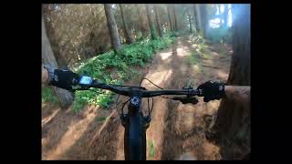
Videos of Southland District Mountain Bike
trail: Whitestone River B
0:41 |
17 |
Apr 13, 2023
trail: Whitestone River B
0:15 |
4 |
Apr 13, 2023
trail: I'm Rock I Am
0:04 |
515 |
Jul 2, 2021

trail: Pat
3:18 |
159 |
Apr 14, 2023 , Invercargill

trail: Beadle
0:51 |
146 |
Apr 14, 2023 , Invercargill

trail: Big Mac
6:24 |
207 |
Apr 14, 2023 , Invercargill
trail: Short
0:43 |
83 |
Apr 14, 2023 , Invercargill

trail: Rattle Ya Dags
1095 |
May 7, 2019 , Te Anau
Current Trail Warnings
| status | trail | date | condition | user | info |
|---|---|---|---|---|---|
| Fern Hurdle Outflow | Jun 7, 2026 @ 11:44am (Pacific/Auckland) Jun 6, 2026 | Unknown | Bike1Bike1Bike | Start and end of trail has been damaged... |
Recent Trail Reports
| status | trail | date | condition | info | user |
|---|---|---|---|---|---|
| Off Piste Outflow | Jun 16, 2026 @ 6:27pm (Pacific/Auckland) Jun 15, 2026 | Variable | Bike1Bike1Bike | ||
| 5G Outflow | Jun 16, 2026 @ 11:05am (Pacific/Auckland) Jun 15, 2026 | Variable | Bike1Bike1Bike | ||
| What's Up Doc Outflow | Jun 16, 2026 @ 11:04am (Pacific/Auckland) Jun 15, 2026 | Variable | Bike1Bike1Bike | ||
| Central Trail Sandy Point | Jun 2, 2026 @ 1:03pm (Pacific/Auckland) Jun 1, 2026 | Unknown | Roydo | ||
| Waihopai left bank Sandy Point | Mar 14, 2026 @ 6:50pm (Pacific/Auckland) Mar 13, 2026 | Ideal | KiwiFrog | ||
| Kōhūhū Bluff | Mar 11, 2026 @ 6:46pm (Pacific/Auckland) Mar 10, 2026 | Ideal | mark1055 | ||
| The Fixx Motupōhue Adventure Park (Bluff Hill) | Mar 11, 2026 @ 6:46pm (Pacific/Auckland) Mar 10, 2026 | Variable | mark1055 | ||
| Weezer Motupōhue Adventure Park (Bluff Hill) | Mar 11, 2026 @ 6:46pm (Pacific/Auckland) Mar 10, 2026 | Variable | mark1055 | ||
| Lower Crawlies Bluff | Feb 24, 2026 @ 11:52am (Pacific/Auckland) Feb 23, 2026 | Ideal | KiwiFrog | ||
| Lower Fixx Motupōhue Adventure Park (Bluff Hill) | Feb 24, 2026 @ 11:52am (Pacific/Auckland) Feb 23, 2026 | Ideal | KiwiFrog |
Activity Feed
| username | action | type | title | date |
|---|---|---|---|---|
| Bike1Bike1Bike | add | report | activity #97089965 | Jun 15, 2026 @ 11:27pm Jun 15, 2026 |
| Bike1Bike1Bike | add | report | activity #97071240 and 1 more | Jun 15, 2026 @ 4:04pm Jun 15, 2026 |
| Martinmcnamara | wishlist | trail | activity #96438079 | Jun 7, 2026 @ 2:14am Jun 7, 2026 |
| Martinmcnamara | wishlist | trail | activity #96438026 | Jun 7, 2026 @ 2:13am Jun 7, 2026 |
| Bike1Bike1Bike | add | report | activity #96415795 | Jun 6, 2026 @ 4:45pm Jun 6, 2026 |
Recent Comments
| username | type | title | comment | date |
|---|---|---|---|---|
| trail | Trail is closed due to a dangerous hung up... | Dec 11, 2025 @ 11:33am Dec 11, 2025 | ||
| trail | Excellent track with great up and down hills.... | Sep 21, 2025 @ 12:09am Sep 21, 2025 | ||
| trail | Track currently closed due to trees down. | Sep 18, 2025 @ 6:56pm Sep 18, 2025 | ||
| trail | Is this a route? | Jul 8, 2025 @ 4:15am Jul 8, 2025 | ||
| trail | This is a route spanning over multiple... | Jul 7, 2025 @ 2:26am Jul 7, 2025 |
Local Badges
-

Big Ride 30k57 awarded -

Epic Ride 50k37 awarded -
Big Ride 30k402 awarded -
Big Ride 30k1,601 awarded -

Descent 100k Badge2 awarded -
Descent 100k Badge0 awarded
Bike & Skill Parks
| name | type | city | rating |
|---|---|---|---|
| Southland BMX Track | skill park | Invercargill | |
| Te Anau Pumptrack and Skatepark | skill park | Te Anau | |
| Otatara Pump Track | skill park | Invercargill | |
| Myers Reserve Jumps | skill park | Invercargill |
Local Trail Supporters
- TACI
- T.A.C.I
![]()
- Fiordland Nursery
- Meridian Energry
- Meridian Energy
- Te Anau Enduro
Local Trail Association
Activity Type Stats
| activitytype | trails | distance | descent | descent distance | total vertical | rating | global rank | state rank | photos | reports | routes | ridelogs |
|---|---|---|---|---|---|---|---|---|---|---|---|---|
| Mountain Bike | 135 | 213 miles | 10,597 ft | 76 miles | 2,615 ft | 283 | 678 | 13,410 | ||||
| E-Bike | 113 | 196 miles | 9,114 ft | 71 miles | 2,615 ft | 2 | 598 | 330 | ||||
| Horse | 2 | 696 ft | 59 ft | 574 ft | 135 ft | 117 | ||||||
| Hike | 163 | 342 miles | 39,324 ft | 133 miles | 4,777 ft | 30 | 607 | 2,369 | ||||
| Trail Running | 166 | 345 miles | 39,426 ft | 134 miles | 4,777 ft | 621 | 358 |
Frequently Asked Questions About Southland District
▼
What are the best places to ride in Southland District?
Southland District has 9 areas to explore for mountain biking. The top rated areas are:
▼
What are the highest rated mountain biking trails in Southland District?
The highest rated mountain biking trails in Southland District are:
- I'm Rock I Am (4.4/5)
- Pork Pie (4.3/5)
- Bull Rush! (4.2/5)
- access road (4.1/5)
- Taurapa (4.1/5)
▼
What is the best time of the year to ride in Southland District?
Based on ride log data, the most popular months to ride in Southland District are:
- February (89 activities)
- October (73 activities)
- December (59 activities)
▼
What is the longest trail in Southland District?
The longest trail in Southland District is Lake2Lake Te Anau to Manapouri at 18.4 miles. View all trails sorted by distance.
Activities
Trails
Points of Interest
- Boatshed Hut Cabin
- Bus Stop Shelter Cabin
- [helipad] Lake Mintaro Helipad Other
- [falls] Dudleigh Falls Other
- Dudleigh Falls Lookout Viewpoint
- Lindsay Falls Lookout Viewpoint
- Lindsay Falls Lookout Viewpoint
- Dumpling Hut Cabin
- Bell Rock Viewpoint
- Boatshed Shelter Cabin
- Toh Atin Mesa (6,627 ft)
- Mount Lyall (6,106 ft)
- Dry Mesa (5,892 ft)
- By brenthillier
 NSMBA TRAILFORKS & contributors
 - Admins: TFNZ, lintbagger, Alps2Ocean-Cycle-Trail
- #3657 - 8,651 views
- southland district activity log | embed map of Southland District mountain bike trails | southland district mountain biking points of interest
Downloading of trail gps tracks in kml & gpx formats is enabled for Southland District.
You must login to download files.