close
-
Layers w
- Weather Layers
- Pro
- Pro
- Pro
- Pro
- Pro
- Pro
- More Layers
- Pro
- Pro
- Pro
- Pro
-
Upgrade to

3D
Trail Conditions
- Unknown
- Snow Groomed
- Snow Packed
- Snow Covered
- Snow Cover Partial
- Freeze/thaw Cycle
- Icy
- Prevalent Mud
- Wet
- Variable
- Ideal
- Dry
- Very Dry
Trail Flow (Ridden Direction)
Trailforks scans users ridelogs to determine the most popular direction each trail is ridden. A good flowing trail network will have most trails flowing in a single direction according to their intension.
The colour categories are based on what percentage of riders are riding a trail in its intended direction.
The colour categories are based on what percentage of riders are riding a trail in its intended direction.
- > 96%
- > 90%
- > 80%
- > 70%
- > 50%
- < 50%
- bi-directional trail
- no data
Trail Last Ridden
Trailforks scans ridelogs to determine the last time a trail was ridden.
- < 2 days
- < 1 week
- < 2 weeks
- < 1 month
- < 6 months
- > 6 months
Trail Ridden Direction
The intended direction a trail should be ridden.
- Downhill Only
- Downhill Primary
- Both Directions
- Uphill Primary
- Uphill Only
- One Direction
Contribute Details
Colors indicate trail is missing specified detail.
- Description
- Photos
- Description & Photos
- Videos
Trail Popularity ?
Trailforks scans ridelogs to determine which trails are ridden the most in the last 9 months.
Trails are compared with nearby trails in the same city region with a possible 25 colour shades.
Think of this as a heatmap, more rides = more kinetic energy = warmer colors.
- most popular
- popular
- less popular
- not popular
ATV/ORV/OHV Filter
Max Vehicle Width
inches
US Cell Coverage
Legend

Radar Time
Activity Recordings
Trailforks uses anonymized public activity data.
?
Activity Recordings
Trailforks uses anonymized public activity data.
?
Personal Heatmap
▶
Activity Types
all
/
none
▶
Options
2
Date range
month
–
Winter Trails
Warning
A routing network for winter maps does not exist. Selecting trails using the winter trails layer has been disabled.
Missing Trails
Most Popular
Least Popular
Trails are colored based on popularity. The more popular a trail is, the more red. Less popular trails trend towards green.
Jump Magnitude Heatmap
Heatmap of where riders jump on trails. Zoom in to see individual jumps, click circles to view jump details.
BC Backroad Status
![map legend]()
Service Road Atlas is a free to use, community-driven service for viewing and creating reports on the numerous back-country service roads around B.C. and Alberta.

Slope Aspect
Direction the slope faces
Trails Deemphasized
Trails are shown in grey.
Only show trails with no bike usage.
Suggested Layers
Based on selected activity type
Save the current map location and zoom level as your default home location whenever this page is loaded.
Save
No description for Spanish Fork has been added yet!
Login or register to submit one.
Links
Activities Click to view
- Mountain Bike
151 trails
- E-Bike
116 trails
- Gravel Bike
0 trails
- Adaptive Bike
0 trails
- Winter Fat Bike
0 trails
- Horse
92 trails
- Hike
160 trails
- Trail Running
157 trails
- Dirtbike/Moto
64 trails
- ATV/ORV/OHV
43 trails
- Snowmobile
19 trails
- Snowshoe
14 trails
Region Details
- 21
- 21
- 30
- 52
- 26
- 1
Region Status
Caution as of Jun 17, 2026Stats
- Avg Trail Rating
- Trails (view details)
- 163
- Trails Mountain Bike
- 151
- Trails E-Bike
- 116
- Trails Horse
- 92
- Trails Hike
- 160
- Trails Trail Running
- 157
- Trails Dirtbike/Moto
- 64
- Trails Observed Trials
- 1
- Trails ATV/ORV/OHV
- 43
- Trails Snowmobile
- 19
- Trails Snowshoe
- 14
- Trails Backcountry Ski
- 2
- Total Distance
- 276 miles
- Total Descent
- 31,442 ft
- Total Vertical
- 5,216 ft
- Highest Trailhead
- 9,756 ft
- Reports
- 1,950
- Photos
- 387
- Ridden Counter
- 8,676
Sub Regions
-
Diamond Fork
- 6
- 19
- 7
-
Lake Fork Mountain
- 2
- 6
- 2
-
Mt. Loafer Wildlife Management Area
- 1
- 1
- 1
-
Spanish Fork Canyon
- 12
- 13
- 7
-
Spanish Oaks
- 7
- 12
- 9
- 1
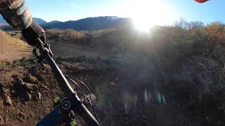
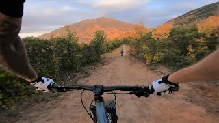
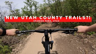
Popular Spanish Fork Mountain Biking Trails
• 100 ★ 4.7 • 3,698 ft • 0 ft • 566 •
Now Open!. Brand new racecourse built by Spanish Fork City. This section swoops down the mountainside with lots of high banks, moguls, and jump.
• 100 ★ 4.5 • 2,759 ft • 155 ft • 539 •
This section switchbacks up an oak-covered hillside, with climbs and rest sections.
• 100 ★ 4.0 • 1,942 ft • 153 ft • 430 •
Red Knoll Run primarily uphill route to the Red Knoll saddle
• 100 ★ 4.0 • 912 ft • 69 ft • 393 •
Kind of a flow trail with pretty big berms, but the turns are pretty tight to go fast. Easy climb up as you can use the berms to keep your speed up through the turns. Often used as a climbing trail to get to the main Trail.
• 95 ★ 4.5 • 2,493 ft • 252 ft • 378 •
A third mountain bike loop; this climbing trail is a consistent uphill, but is better than the parallel "gully washer"
• 95 ★ 4.0 • 1,709 ft • 130 ft • 300 •
A very wide trail leading up to the Spanish Oaks . Will be a paved trail.
• 100 ★ 3.8 • 4,268 ft • 112 ft • 295 •
Pretty easy climbing, I think I like the flow best at the top going counter clockwise. Mostly smooth with small sandy spots in the sun and some sections that have some minor protruding rocks and little drops that you can air out on with...
Spanish Fork Mountain Bike Routes
1 mile • 260 ft • 4 • Loop •
Beginner route starting with a mid-mountain climb on to then counter-clockwise loops on the lower section...
2 miles • 457 ft • 5 •
Intermediate route starting with a climb on to upper-middle then counterclockwise loops on the...
3 miles • 621 ft • 11 • Loop •
Advanced route starting with a climb on to the upper section of then descend to the upper section of...
4 miles • 801 ft • 6 •
Route that takes in Red Knoll Run Loop, and Canyon Run Loop
2 miles • 318 ft • 4 •
A great starting loop at Spanish Oaks with not to much climbing with plenty of recovery along the way...
19 miles • 3,480 ft • 3 •
Photos of Spanish Fork Mountain Bike
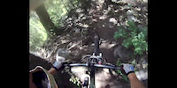
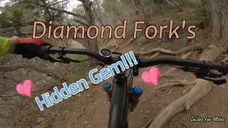
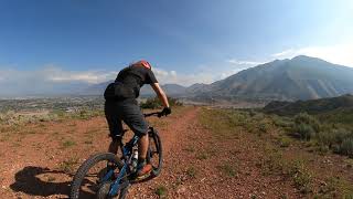
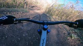
Videos of Spanish Fork Mountain Bike
2:37 |
692 |
Oct 8, 2012
15:23 |
283 |
May 2, 2022 , Spanish Fork
trail: Red Knoll Run Downhill
2:26 |
837 |
Aug 22, 2021 , Spanish Fork
trail: Red Knoll Run Downhill
2:06 |
630 |
May 5, 2021 , Spanish Fork

trail: Red Knoll Run Downhill
2:31 |
626 |
May 4, 2021 , Spanish Fork
trail: Canyon Run Downhill
0:33 |
896 |
Apr 20, 2021 , Spanish Fork
trail: Red Knoll Run Downhill
7:47 |
669 |
Sep 25, 2020 , Spanish Fork
trail: Hidden Oaks Trail (lower)
6:56 |
336 |
Sep 3, 2020 , Spanish Fork
Recent Trail Reports
| status | trail | date | condition | info | user |
|---|---|---|---|---|---|
| Canyon Run Downhill | Jun 17, 2026 @ 5:33pm (America/Boise) Jun 17, 2026 | Dry | fletchridesagain | ||
| Canyon Run (Climb) | Jun 17, 2026 @ 5:33pm (America/Boise) Jun 17, 2026 | Dry | fletchridesagain | ||
| Reservoir Trail | Jun 17, 2026 @ 5:33pm (America/Boise) Jun 17, 2026 | Dry | fletchridesagain | ||
| Jail Trail | Jun 17, 2026 @ 5:33pm (America/Boise) Jun 17, 2026 | Dry | fletchridesagain | ||
| Escalante Cross non-Shortcut | Jun 17, 2026 @ 5:33pm (America/Boise) Jun 17, 2026 | Dry | fletchridesagain | ||
| Escalante Cross | Jun 17, 2026 @ 5:33pm (America/Boise) Jun 17, 2026 | Dry | fletchridesagain | ||
| Spanish Oaks Loop | Jun 17, 2026 @ 5:33pm (America/Boise) Jun 17, 2026 | Dry | fletchridesagain | ||
| Curve Ball | Jun 17, 2026 @ 5:33pm (America/Boise) Jun 17, 2026 | Dry | fletchridesagain | ||
| Red Knoll Run (Lower Climb) | Jun 17, 2026 @ 5:33pm (America/Boise) Jun 17, 2026 | Dry | fletchridesagain | ||
| Red Knoll Run Downhill | Jun 17, 2026 @ 5:33pm (America/Boise) Jun 17, 2026 | Dry | fletchridesagain |
National Scenic Trails & Official Routes
-
Bonneville Shoreline Trail
- Mountain Bike
- E-Bike
- Horse
- Hike
- Trail Running
- Snowshoe
- Nordic Ski
-
Great Western Trail
- Mountain Bike
- E-Bike
- Horse
- Hike
- Trail Running
- Dirtbike/Moto
- ATV/ORV/OHV


Activity Feed
| username | action | type | title | date |
|---|---|---|---|---|
| TOFDkh | wishlist | trail | activity #97564946 | Jun 22, 2026 @ 8:50am 2 days |
| IVQ51Oh1 | difficultyvote | trail | activity #97270022 | Jun 18, 2026 @ 12:32pm Jun 18, 2026 |
| IVQ51Oh1 | ridden | trail | activity #97270015 | Jun 18, 2026 @ 12:32pm Jun 18, 2026 |
| fletchridesagain | add | report | activity #97224711 and 11 more | Jun 17, 2026 @ 6:50pm Jun 17, 2026 |
| DarinBrom3 | wishlist | region | activity #96463123 | Jun 7, 2026 @ 8:16am Jun 7, 2026 |
Recent Comments
| username | type | title | comment | date |
|---|---|---|---|---|
| trail | Very overgrown right now. Be careful | May 16, 2026 @ 6:17pm May 16, 2026 | ||
| trail | Fun trail, vegetation has been cleared out on... | May 14, 2026 @ 6:11pm May 14, 2026 | ||
| trail | Closed to bikes in early spring when the trail... | May 9, 2026 @ 8:26am May 9, 2026 | ||
| trail | Super boring jeep trail around brush and power... | Oct 25, 2025 @ 1:45pm Oct 25, 2025 | ||
| trail | Tried this on horses. Can’t access from the... | Sep 5, 2025 @ 6:24pm Sep 5, 2025 |
Local Badges
-

10 Green Trails46 awarded -

Descent 10k Badge33 awarded -

Descent 100k Badge0 awarded -

Epic Ride 50k826 awarded -

Epic Ride Descent 2k20 awarded -

Top 10 Trails0 awarded
Activity Type Stats
| activitytype | trails | distance | descent | descent distance | total vertical | rating | global rank | state rank | photos | reports | routes | ridelogs |
|---|---|---|---|---|---|---|---|---|---|---|---|---|
| Mountain Bike | 151 | 258 miles | 30,449 ft | 86 miles | 5,217 ft | #848 | #331 | 319 | 1,937 | 13 | 10,911 | |
| E-Bike | 116 | 194 miles | 25,377 ft | 69 miles | 4,432 ft | #655 | #743 | 4 | 1,869 | 1 | 745 | |
| Horse | 92 | 217 miles | 27,287 ft | 69 miles | 4,800 ft | #111 | #376 | 130 | 3 | |||
| Hike | 160 | 274 miles | 30,715 ft | 86 miles | 5,217 ft | #282 | #142 | 56 | 1,880 | 6 | 1,810 | |
| Trail Running | 157 | 273 miles | 30,869 ft | 86 miles | 5,217 ft | #478 | #186 | 1,880 | 6 | 1,326 | ||
| Dirtbike/Moto | 64 | 163 miles | 19,606 ft | 51 miles | 4,377 ft | #146 | #90 | 6 | 119 | 1 | 138 | |
| Observed Trials | 1 | 8 miles | 728 ft | 2 miles | 1,690 ft | 1 | 1 | |||||
| ATV/ORV/OHV | 43 | 96 miles | 8,652 ft | 25 miles | 3,776 ft | #254 | #83 | 104 | 12 | |||
| Snowmobile | 19 | 43 miles | 3,855 ft | 12 miles | 3,543 ft | #177 | #78 | 14 | 2 | |||
| Snowshoe | 14 | 26 miles | 1,509 ft | 4 miles | 2,759 ft | #731 | #321 | 38 | 4 | 18 | ||
| Backcountry Ski | 2 | 6 miles | 148 ft | 2,949 ft | 2,090 ft | 15 | 7 |
Frequently Asked Questions About Spanish Fork
▼
What are the best places to ride in Spanish Fork?
Spanish Fork has 5 areas to explore for mountain biking. The top rated areas are:
▼
What are the highest rated mountain biking trails in Spanish Fork?
The highest rated mountain biking trails in Spanish Fork are:
- Red Knoll Run Downhill (4.5/5)
- Canyon Run Downhill (4.4/5)
- Red Knoll Run (Climb) (4.2/5)
- Spanish Fork River Trail (4.2/5)
- Canyon Run (Climb) (4.2/5)
▼
What is the best time of the year to ride in Spanish Fork?
Based on ride log data, the most popular months to ride in Spanish Fork are:
- July (158 activities)
- June (86 activities)
- April (72 activities)
▼
Where can I park to ride in Spanish Fork?
There are 31 parking locations listed in Spanish Fork. The most popular parking spots are:
- Canyon View Park Trailhead
- Spanish Oaks Mountain Bike Parking
- Fairway Drive Parking
- Spanish Oaks Reservoir Parking
- Sports Park Trailhead
Activities
Trails
Points of Interest
- Upper Spanish Towers Arch Sight
- Dixon Peak Summit
- U.S. Coast & Geodetic Survey Triangulation Station Sight
- Balanced Rock Sight
- Diamond Fork Campground Camping
- Red Ledges Recreation Area Sight
- Fifth Water Hot Springs Sight
- Second Water Falls Sight
- First Water Falls Sight
- Washout TTF
- Baldy Mountain (9,429 ft)
- Little Baldy Mountain (9,209 ft)
- Teat Mountain (8,527 ft)
- By todd
 Trailforks & contributors
 - Admins: jkwilliamz, UtahJohn, jpmcghee, jasonmalczyk, URMB, UVTA
- #18733 - 16,319 views
- spanish fork activity log | embed map of Spanish Fork mountain bike trails | spanish fork mountain biking points of interest
Downloading of trail gps tracks in kml & gpx formats is enabled for Spanish Fork.
You must login to download files.