close
-
Layers w
- Weather Layers
- Pro
- Pro
- Pro
- Pro
- Pro
- Pro
- More Layers
- Pro
- Pro
- Pro
- Pro
-
Upgrade to

3D
Trail Conditions
- Unknown
- Snow Groomed
- Snow Packed
- Snow Covered
- Snow Cover Partial
- Freeze/thaw Cycle
- Icy
- Prevalent Mud
- Wet
- Variable
- Ideal
- Dry
- Very Dry
Trail Flow (Ridden Direction)
Trailforks scans users ridelogs to determine the most popular direction each trail is ridden. A good flowing trail network will have most trails flowing in a single direction according to their intension.
The colour categories are based on what percentage of riders are riding a trail in its intended direction.
The colour categories are based on what percentage of riders are riding a trail in its intended direction.
- > 96%
- > 90%
- > 80%
- > 70%
- > 50%
- < 50%
- bi-directional trail
- no data
Trail Last Ridden
Trailforks scans ridelogs to determine the last time a trail was ridden.
- < 2 days
- < 1 week
- < 2 weeks
- < 1 month
- < 6 months
- > 6 months
Trail Ridden Direction
The intended direction a trail should be ridden.
- Downhill Only
- Downhill Primary
- Both Directions
- Uphill Primary
- Uphill Only
- One Direction
Contribute Details
Colors indicate trail is missing specified detail.
- Description
- Photos
- Description & Photos
- Videos
Trail Popularity ?
Trailforks scans ridelogs to determine which trails are ridden the most in the last 9 months.
Trails are compared with nearby trails in the same city region with a possible 25 colour shades.
Think of this as a heatmap, more rides = more kinetic energy = warmer colors.
- most popular
- popular
- less popular
- not popular
ATV/ORV/OHV Filter
Max Vehicle Width
inches
US Cell Coverage
Legend

Radar Time
Activity Recordings
Trailforks uses anonymized public activity data.
?
Activity Recordings
Trailforks uses anonymized public activity data.
?
Personal Heatmap
▶
Activity Types
all
/
none
▶
Options
2
Date range
month
–
Winter Trails
Warning
A routing network for winter maps does not exist. Selecting trails using the winter trails layer has been disabled.
Missing Trails
Most Popular
Least Popular
Trails are colored based on popularity. The more popular a trail is, the more red. Less popular trails trend towards green.
Jump Magnitude Heatmap
Heatmap of where riders jump on trails. Zoom in to see individual jumps, click circles to view jump details.
BC Backroad Status
![map legend]()
Service Road Atlas is a free to use, community-driven service for viewing and creating reports on the numerous back-country service roads around B.C. and Alberta.

Slope Aspect
Direction the slope faces
Trails Deemphasized
Trails are shown in grey.
Only show trails with no bike usage.
Suggested Layers
Based on selected activity type
Save the current map location and zoom level as your default home location whenever this page is loaded.
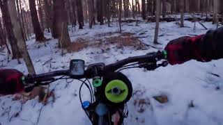
SaveAwesome lesser-known network of singletrack and doubletrack with mild elevation and some features including berms. A great place to rip a cross-country or all mountain bike around if you are in the area. Built and maintained by NEMBA and the Spaulding Youth Center. Parking found at the boat launch, trailhead is at edge of woods at the field.
Primary Trail Type: Cross-Country
 google parking directions
Links
Region Supporters & Maintainers
![]()
Central New Hampshire NEMBAMaintainer
Activities Click to view
- Mountain Bike
26 trails
- Hike
24 trails
- Trail Running
24 trails
- Snowshoe
20 trails
Region Details
- 6
- 13
Region Status
Caution as of Jul 29, 2025Stats
- Avg Trail Rating
- Trails (view details)
- 19
- Trails Mountain Bike
- 26
- Trails Hike
- 24
- Trails Trail Running
- 24
- Trails Snowshoe
- 20
- Total Distance
- 6 miles
- Total Descent
- 1,206 ft
- Total Vertical
- 270 ft
- Highest Trailhead
- 744 ft
- Reports
- 58
- Photos
- 19
- Ridden Counter
- 3,040
Popular Spaulding Woods Mountain Biking Trails
• 95 ★ 0.0 • 1,713 ft • 23 ft • 237 •
Popular green difficulty singletrack. This mountain bike primary trail can be used both directions. On average it takes 2 minutes to complete this trail.
• 95 ★ 4.0 • 2,532 ft • 147 ft • 234 •
Popular blue difficulty singletrack. This mountain bike primary trail. On average it takes 4 minutes to complete this trail.
• 85 ★ 5.0 • 2,674 ft • 0 ft • 223 •
is a trail worth climbing and descending. On the way up you will find switchbacks and pitch which compliment each other to make the moderate to difficult climb more manageable. On the way down there is enough flow with very little...
• 90 ★ 5.0 • 1,594 ft • 72 ft • 213 •
Popular blue difficulty singletrack. This mountain bike primary trail can be used both directions. On average it takes 3 minutes to complete this trail.
• 80 ★ 0.0 • 2,316 ft • 40 ft • 196 •
Popular green difficulty mixed. This mountain bike primary trail. On average it takes 7 minutes to complete this trail.
• 75 ★ 3.0 • 4,744 ft • 35 ft • 191 •
Start from the top of , and to the right is . It's a fun smooth flow on the first minute. The corners are not bermed, but the rhythm connects them perfectly. The second 1/2 of the trail is xc/climbing. .4 miles long with average grade...
• 85 ★ 0.0 • 2,684 ft • 81 ft • 186 •
Popular blue difficulty singletrack. This mountain bike primary trail can be used both directions and has a moderate overall physical rating with a 81 ft blue climb. Trail visibility is always easy to follow. On average it takes 7 minutes to complete this trail.
Videos of Spaulding Woods Mountain Bike

trail: Woodchuck Norris
0:50 |
41 |
Feb 11, 2024

trail: Loop Trail
0:29 |
24 |
Feb 10, 2024
trail: Yellow Dot
0:51 |
94 |
Feb 11, 2024 , Northfield
Recent Trail Reports
| status | trail | date | condition | info | user |
|---|---|---|---|---|---|
| River Trail | Jul 29, 2025 @ 11:16am Jul 29, 2025 | Ideal | LynettetzhlmT | ||
| Swamp Donkey Disco | Nov 12, 2024 @ 7:11am Nov 12, 2024 | Variable | parcelmike | ||
| Smallish Varmitt | Nov 2, 2024 @ 10:52am Nov 2, 2024 | Variable | Oldbikersam | ||
| Woodchuck Norris | Nov 2, 2024 @ 10:52am Nov 2, 2024 | Variable | Oldbikersam | ||
| Squirrelagator Down | Nov 2, 2024 @ 10:52am Nov 2, 2024 | Variable | Oldbikersam | ||
| Loop Connector | Nov 2, 2024 @ 10:52am Nov 2, 2024 | Variable | Oldbikersam | ||
| Loam Depot | Nov 2, 2024 @ 10:52am Nov 2, 2024 | Variable | Oldbikersam | ||
| Model T | Nov 2, 2024 @ 10:52am Nov 2, 2024 | Variable | Oldbikersam | ||
| Weeks Road | Nov 2, 2024 @ 10:52am Nov 2, 2024 | Variable | Oldbikersam | ||
| Loop Trail | Sep 15, 2024 @ 6:52am Sep 15, 2024 | Unknown | mtnfun2 CNH NEMBA |
Activity Feed
| username | action | type | title | date |
|---|---|---|---|---|
| mattb1414 | ridden | trail | activity #97247809 and 3 more | Jun 18, 2026 @ 6:32am Jun 18, 2026 |
| mattb1414 | ridden | trail | activity #97135301 and 6 more | Jun 16, 2026 @ 1:36pm Jun 16, 2026 |
| parcelmike | add | trail | activity #96093362 | Jun 2, 2026 @ 10:17am Jun 2, 2026 |
| Watikaa | wishlist | region | activity #89723622 | Feb 28, 2026 @ 1:35pm Feb 28, 2026 |
| BobHowenmg | wishlist | region | activity #88433970 | Feb 6, 2026 @ 8:07am Feb 6, 2026 |
Recent Comments
| username | type | title | comment | date |
|---|---|---|---|---|
| report | Cgifrur wye | May 29, 2023 @ 12:24pm May 29, 2023 |
Nearby Areas
| name | distance | ||||
|---|---|---|---|---|---|
| Highland XC Trails | 4 | 3 | 8 | 3 km | |
| Highland Mountain Bike Park | 10 | 10 | 8 | 10 | 3.2 km |
| Franklin Falls Dam | 16 | 2 | 1 | 5 km | |
| Veterans Memorial Recreation Area/Great Gains | 2 | 10 | 2 | 6 km | |
| Ahern State Park | 2 | 13 | 8.3 km |
Local Badges
-

Completionist0 awarded
Bike & Skill Parks
| name | type | city | rating |
|---|---|---|---|
| Spaulding Woods Skillpark | skill park | Northfield |
Activity Type Stats
| activitytype | trails | distance | descent | descent distance | total vertical | rating | global rank | state rank | photos | reports | routes | ridelogs |
|---|---|---|---|---|---|---|---|---|---|---|---|---|
| Mountain Bike | 26 | 6 miles | 1,204 ft | 2 miles | 269 ft | #6,231 | #2,340 | 19 | 58 | 1,233 | ||
| Hike | 24 | 6 miles | 1,204 ft | 2 miles | 269 ft | #13,230 | #5,605 | 58 | 72 | |||
| Trail Running | 24 | 6 miles | 1,204 ft | 2 miles | 269 ft | #12,319 | #4,921 | 58 | 19 | |||
| Snowshoe | 20 | 6 miles | 1,204 ft | 2 miles | 269 ft | #1,106 | #554 | 3 | 8 |
Frequently Asked Questions About Spaulding Woods
▼
What are the highest rated mountain biking trails in Spaulding Woods?
The highest rated mountain biking trails in Spaulding Woods are:
- Swamp Donkey Disco (4.1/5)
- Woodchuck Norris (4.1/5)
- SharkNado (4/5)
- Haul Road (3.8/5)
- Yellow Dot (3.7/5)
▼
What is the best time of the year to ride in Spaulding Woods?
Based on ride log data, the most popular months to ride in Spaulding Woods are:
- June (12 activities)
- July (12 activities)
- August (9 activities)
▼
Where can I park to ride in Spaulding Woods?
There are 1 parking locations listed in Spaulding Woods. The most popular parking spots are:
▼
What is the longest trail in Spaulding Woods?
The longest trail in Spaulding Woods is Yellow Dot at 1.4 km. View all trails sorted by distance.
Activities
- By GoRideYoBike & contributors
- Admins: CNH NEMBA, CNH NEMBA, UWV
- #6393 - 8,028 views
- spaulding woods activity log | embed map of Spaulding Woods mountain bike trails | spaulding woods mountain biking points of interest
Downloading of trail gps tracks in kml & gpx formats is enabled for Spaulding Woods.
You must login to download files.