close
-
Layers w
- Weather Layers
- Pro
- Pro
- Pro
- Pro
- Pro
- Pro
- More Layers
- Pro
- Pro
- Pro
- Pro
-
Upgrade to

3D
Trail Conditions
- Unknown
- Snow Groomed
- Snow Packed
- Snow Covered
- Snow Cover Partial
- Freeze/thaw Cycle
- Icy
- Prevalent Mud
- Wet
- Variable
- Ideal
- Dry
- Very Dry
Trail Flow (Ridden Direction)
Trailforks scans users ridelogs to determine the most popular direction each trail is ridden. A good flowing trail network will have most trails flowing in a single direction according to their intension.
The colour categories are based on what percentage of riders are riding a trail in its intended direction.
The colour categories are based on what percentage of riders are riding a trail in its intended direction.
- > 96%
- > 90%
- > 80%
- > 70%
- > 50%
- < 50%
- bi-directional trail
- no data
Trail Last Ridden
Trailforks scans ridelogs to determine the last time a trail was ridden.
- < 2 days
- < 1 week
- < 2 weeks
- < 1 month
- < 6 months
- > 6 months
Trail Ridden Direction
The intended direction a trail should be ridden.
- Downhill Only
- Downhill Primary
- Both Directions
- Uphill Primary
- Uphill Only
- One Direction
Contribute Details
Colors indicate trail is missing specified detail.
- Description
- Photos
- Description & Photos
- Videos
Trail Popularity ?
Trailforks scans ridelogs to determine which trails are ridden the most in the last 9 months.
Trails are compared with nearby trails in the same city region with a possible 25 colour shades.
Think of this as a heatmap, more rides = more kinetic energy = warmer colors.
- most popular
- popular
- less popular
- not popular
ATV/ORV/OHV Filter
Max Vehicle Width
inches
US Cell Coverage
Legend

Radar Time
Activity Recordings
Trailforks uses anonymized public activity data.
?
Activity Recordings
Trailforks uses anonymized public activity data.
?
Personal Heatmap
▶
Activity Types
all
/
none
▶
Options
2
Date range
month
–
Winter Trails
Warning
A routing network for winter maps does not exist. Selecting trails using the winter trails layer has been disabled.
Missing Trails
Most Popular
Least Popular
Trails are colored based on popularity. The more popular a trail is, the more red. Less popular trails trend towards green.
Jump Magnitude Heatmap
Heatmap of where riders jump on trails. Zoom in to see individual jumps, click circles to view jump details.
BC Backroad Status
![map legend]()
Service Road Atlas is a free to use, community-driven service for viewing and creating reports on the numerous back-country service roads around B.C. and Alberta.

Slope Aspect
Direction the slope faces
Trails Deemphasized
Trails are shown in grey.
Only show trails with no bike usage.
Suggested Layers
Based on selected activity type
Save the current map location and zoom level as your default home location whenever this page is loaded.
SaveBeginner and intermediate single track that winds through a mixture of ponderosa pines and boulder outcroppings, with one new double-diamond rock drop feature Spectacular valley views can be found from upper trails like West Side Story. Many new trails were recently funded by Hail the Trail, with even more yet to come.
source: Prescott National Forest
Primary Trail Type: Cross-Country
eBikes Allowed:
No
AKA: The Pines (EP)
Land Status: National Forest
 google parking directions
 Access Info:
The corner of Iron Springs Rd. and Granite Basin Rd. A new trail head will be built at Iron Springs road and Spence Springs road in 2018.
Activities Click to view
- Mountain Bike
37 trails
- Hike
37 trails
- Trail Running
37 trails
Region Details
- 2
- 8
- 13
- 6
Region Status
Open as of Jun 7, 2026Stats
- Avg Trail Rating
- Trails (view details)
- 29
- Trails Mountain Bike
- 37
- Trails E-Bike
- 3
- Trails Horse
- 1
- Trails Hike
- 37
- Trails Trail Running
- 37
- Trails Dirtbike/Moto
- 1
- Trails ATV/ORV/OHV
- 1
- Total Distance
- 40 miles
- Total Descent
- 3,856 ft
- Total Vertical
- 1,861 ft
- Highest Trailhead
- 6,959 ft
- Reports
- 1,042
- Photos
- 230
- Ridden Counter
- 21,251
Popular Spence Basin Mountain Biking Trails
• 95 ★ 3.6 • 3,806 ft • 30 ft • 1,606 •
Popular blue difficulty singletrack. This multi-use trail can be used both directions and has a easy overall physical rating with a 30 ft blue climb. On average it takes 6 minutes to complete this trail.
• 95 ★ 4.2 • 2 miles • 160 ft • 1,596 •
A wonderful connector trail that connects the area to Spence Basin.
• 100 ★ 4.1 • 2 miles • 321 ft • 1,518 •
Highly rated popular green difficulty singletrack. This multi-use trail can be used both directions and has a moderate overall physical rating with a 321 ft blue climb. On average it takes 14 minutes to complete this trail.
• 90 ★ 3.6 • 1 mile • 12 ft • 1,280 •
Nice sweeping trail through scrub oak, pines, and boulders along the trail.
• 90 ★ 4.0 • 2 miles • 206 ft • 1,183 •
Nice flowing trail skirting around the west side of The Pines.
• 85 ★ 4.0 • 1 mile • 218 ft • 1,046 •
Highly rated popular blue difficulty singletrack. This mountain bike primary trail can be used both directions and has a moderate overall physical rating with a 218 ft blue climb. On average it takes 15 minutes to complete this trail.
• 100 ★ 3.3 • 2 miles • 107 ft • 1,003 •
This trail is 4 feet wide and designed as a beginner loop.
• 95 ★ 4.3 • 1 mile • 163 ft • 993 •
Nice flowing trail through the Ponderosa Pines with the occasional rock out cropping to ride over. This trail if started from trail will end at a nice ride and then to the trail intersection.
Spence Basin Mountain Bike Routes
★ 4.0 • 13 miles • 1,266 ft • 7 •
13 miles around Spence Basin - Emmanuel Pines without overlap, in same direction.
7 miles • 648 ft • 2 •
Start with a moderate trail up to enjoy some great views and fun downhill on before ending with the...
17 miles • 1,699 ft • 7 • Point to Point •
Designed for intermediate-level riders, this 100% singletrack course includes many of the best trails...
18 miles • 1,650 ft • 8 • Loop •
This route is created to show off Spence Basins beauty. You will enjoy the views and the pines as you ride...
3 miles • 272 ft • 1 •
Spence Basin: Noodle Lower loop
14 miles • 1,204 ft • 4 • Loop •
A fun three lap tour of the Spence Basin trail network. All blue and green trails with some fun rock...
Photos of Spence Basin Mountain Bike
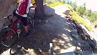
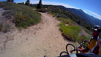
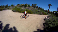
Videos of Spence Basin Mountain Bike
trail: 705 Happy Ending
0:00 |
167 |
Aug 5, 2019
trail: 712 Skyline
4:50 |
102 |
Aug 4, 2015
trail: 712 Skyline
8:04 |
61 |
Aug 4, 2015
trail: 712 Skyline
12:39 |
76 |
Aug 4, 2015

trail: 704 Willow Creek
3:47:18 |
45 |
Sep 4, 2025 , Prescott

trail: 707 Willy Nilly Tractor
3:47:18 |
46 |
Sep 4, 2025 , Prescott

trail: 760 Noodle Loop
3:47:18 |
42 |
Sep 4, 2025 , Prescott

trail: 706 Vista
3:47:18 |
47 |
Sep 4, 2025 , Prescott
Recent Trail Reports
| status | trail | date | condition | info | user |
|---|---|---|---|---|---|
| Spence Creek | Jun 7, 2026 @ 7:22am (America/Phoenix) Jun 7, 2026 | Dry | rmtrailhawk | ||
| To Clown Town | Jun 7, 2026 @ 7:22am (America/Phoenix) Jun 7, 2026 | Dry | rmtrailhawk | ||
| 721 Side Kick | Jun 7, 2026 @ 7:22am (America/Phoenix) Jun 7, 2026 | Dry | rmtrailhawk | ||
| 760 Noodle Loop | Jun 7, 2026 @ 7:22am (America/Phoenix) Jun 7, 2026 | Dry | rmtrailhawk | ||
| 735 Tatanka | Jun 6, 2026 @ 4:58am (America/Phoenix) Jun 6, 2026 | Dry | mej16489 | ||
| 706 Vista | Jun 6, 2026 @ 4:58am (America/Phoenix) Jun 6, 2026 | Dry | mej16489 | ||
| 760 Noodle | Jun 6, 2026 @ 4:58am (America/Phoenix) Jun 6, 2026 | Dry | mej16489 | ||
| Angus | Jun 6, 2026 @ 4:58am (America/Phoenix) Jun 6, 2026 | Dry | mej16489 | ||
| Russ T Fender to Zygomatic Connector | May 28, 2026 @ 11:33am (America/Phoenix) May 28, 2026 | Dry | mej16489 | ||
| 701 Juniper Gate | May 27, 2026 @ 6:20am (America/Phoenix) May 27, 2026 | Dry | mej16489 |
Activity Feed
| username | action | type | title | date |
|---|---|---|---|---|
| JackieL1o7dd | wishlist | region | activity #97003522 | Jun 14, 2026 @ 2:07pm Jun 14, 2026 |
| Jeremylownes | wishlist | route | activity #96763198 | Jun 11, 2026 @ 3:03pm Jun 11, 2026 |
| kevinhedges | wishlist | route | activity #96524991 | Jun 8, 2026 @ 12:39am Jun 8, 2026 |
| rmtrailhawk | add | report | activity #96482833 and 3 more | Jun 7, 2026 @ 11:34am Jun 7, 2026 |
| fetachz | wishlist | route | activity #96422930 | Jun 6, 2026 @ 6:47pm Jun 6, 2026 |
Recent Comments
| username | type | title | comment | date |
|---|---|---|---|---|
| report | Kllllllpj j jjj lol Lo | Apr 8, 2026 @ 2:41pm Apr 8, 2026 | ||
| trail | A short yet sweet trail through many cool... | Feb 13, 2026 @ 4:26pm Feb 13, 2026 | ||
| trail | This trail is tied with Quaky and West Spruce... | Nov 27, 2025 @ 5:28pm Nov 27, 2025 | ||
| trail | I am trying to generate interest an support to... | Sep 30, 2025 @ 4:00pm Sep 30, 2025 | ||
| trail | A quick calf-burner that gets you back up to... | Sep 21, 2025 @ 9:07pm Sep 21, 2025 |
Nearby Areas
| name | distance | ||||
|---|---|---|---|---|---|
| Thumb Butte | 1 | 39 | 6 | 2.1 km | |
| Granite Basin | 8 | 22 | 3 | 2.6 km | |
| Alto Pit | 1 | 4 | 3 km | ||
| Brownlow / Pioneer Park | 15 | 15 | 5 km | ||
| Bean Peaks | 4 | 17 | 1 | 7.3 km |
Local Badges
-

Completionist28 awarded
Local Mountain Biking Directory
-
Prescott Mountain Bike Alliance
![Prescott Mountain Bike Alliance]()
-
Soul Ride
![Soul Ride]()
-
Chain Events
![Chain Events]()
-
Bikesmith Cycle & FitnessBike Shop
-
Ironclad BicyclesBike Shop
![Ironclad Bicycles]()
-
High Gear Bike ShopBike Shop
![High Gear Bike Shop]()
Local Products
Activity Type Stats
| activitytype | trails | distance | descent | descent distance | total vertical | rating | global rank | state rank | photos | reports | routes | ridelogs |
|---|---|---|---|---|---|---|---|---|---|---|---|---|
| Mountain Bike | 37 | 40 miles | 3,855 ft | 15 miles | 1,860 ft | #701 | #269 | 222 | 1,042 | 36 | 16,357 | |
| E-Bike | 3 | 8 miles | 20 ft | 1,985 ft | 1,234 ft | 929 | 364 | |||||
| Horse | 1 | 2 miles | 269 ft | 2 miles | 269 ft | 97 | 4 | |||||
| Hike | 37 | 40 miles | 3,855 ft | 15 miles | 1,860 ft | #4,858 | #1,753 | 9 | 1,043 | 995 | ||
| Trail Running | 37 | 40 miles | 3,855 ft | 15 miles | 1,860 ft | #4,272 | #1,221 | 2 | 1,043 | 2 | 284 | |
| Dirtbike/Moto | 1 | 5,098 ft | 10 ft | 482 ft | 253 ft | 95 | 16 | |||||
| ATV/ORV/OHV | 1 | 5,098 ft | 10 ft | 482 ft | 253 ft | 95 | 5 |
Frequently Asked Questions About Spence Basin
▼
What are the highest rated mountain biking trails in Spence Basin?
The highest rated mountain biking trails in Spence Basin are:
- 705 Happy Ending (4.6/5)
- 721 Side Kick (4.4/5)
- 724 Missing Link (4.4/5)
- 714 Tunnel Vision (4.2/5)
- Little Italy (4.2/5)
▼
What is the best time of the year to ride in Spence Basin?
Based on ride log data, the most popular months to ride in Spence Basin are:
- July (249 activities)
- May (233 activities)
- June (226 activities)
▼
Where can I park to ride in Spence Basin?
There are 1 parking locations listed in Spence Basin. The most popular parking spots are:
▼
What is the longest trail in Spence Basin?
The longest trail in Spence Basin is Old Iron Springs Railroad Grade at 6.6 miles. View all trails sorted by distance.
Activities
- By DaveOfPrescott & contributors
- Admins: PMBA, UMC-s, rowbearto-Prescott, PMBA
- #5043 - 25,763 views
- spence basin activity log | embed map of Spence Basin mountain bike trails | spence basin mountain biking points of interest
Downloading of trail gps tracks in kml & gpx formats is enabled for Spence Basin.
You must login to download files.