close
-
Layers w
- Weather Layers
- Pro
- Pro
- Pro
- Pro
- Pro
- Pro
- More Layers
- Pro
- Pro
- Pro
- Pro
-
Upgrade to

3D
Trail Conditions
- Unknown
- Snow Groomed
- Snow Packed
- Snow Covered
- Snow Cover Partial
- Freeze/thaw Cycle
- Icy
- Prevalent Mud
- Wet
- Variable
- Ideal
- Dry
- Very Dry
Trail Flow (Ridden Direction)
Trailforks scans users ridelogs to determine the most popular direction each trail is ridden. A good flowing trail network will have most trails flowing in a single direction according to their intension.
The colour categories are based on what percentage of riders are riding a trail in its intended direction.
The colour categories are based on what percentage of riders are riding a trail in its intended direction.
- > 96%
- > 90%
- > 80%
- > 70%
- > 50%
- < 50%
- bi-directional trail
- no data
Trail Last Ridden
Trailforks scans ridelogs to determine the last time a trail was ridden.
- < 2 days
- < 1 week
- < 2 weeks
- < 1 month
- < 6 months
- > 6 months
Trail Ridden Direction
The intended direction a trail should be ridden.
- Downhill Only
- Downhill Primary
- Both Directions
- Uphill Primary
- Uphill Only
- One Direction
Contribute Details
Colors indicate trail is missing specified detail.
- Description
- Photos
- Description & Photos
- Videos
Trail Popularity ?
Trailforks scans ridelogs to determine which trails are ridden the most in the last 9 months.
Trails are compared with nearby trails in the same city region with a possible 25 colour shades.
Think of this as a heatmap, more rides = more kinetic energy = warmer colors.
- most popular
- popular
- less popular
- not popular
ATV/ORV/OHV Filter
Max Vehicle Width
inches
US Cell Coverage
Legend

Radar Time
Activity Recordings
Trailforks uses anonymized public activity data.
?
Activity Recordings
Trailforks uses anonymized public activity data.
?
Personal Heatmap
▶
Activity Types
all
/
none
▶
Options
2
Date range
month
–
Winter Trails
Warning
A routing network for winter maps does not exist. Selecting trails using the winter trails layer has been disabled.
Missing Trails
Most Popular
Least Popular
Trails are colored based on popularity. The more popular a trail is, the more red. Less popular trails trend towards green.
Jump Magnitude Heatmap
Heatmap of where riders jump on trails. Zoom in to see individual jumps, click circles to view jump details.
BC Backroad Status
![map legend]()
Service Road Atlas is a free to use, community-driven service for viewing and creating reports on the numerous back-country service roads around B.C. and Alberta.

Slope Aspect
Direction the slope faces
Trails Deemphasized
Trails are shown in grey.
Only show trails with no bike usage.
Suggested Layers
Based on selected activity type
Save the current map location and zoom level as your default home location whenever this page is loaded.
SaveFreeride oriented trail system outside of Whitefish, Montana with everything from flow trails to technical trails with Expert only features.
Primary Trail Type: All-Mountain & Downhill
Land Status: Regional Recreation Area
 google parking directions
 Access Info:
Head West of Whitefish on Highway 93, Spencer Lake will be on the left, take the next left on Twin Bridges Road. The trailhead is on your left.
Links
Activities Click to view
- Mountain Bike
20 trails
- Hike
18 trails
- Trail Running
18 trails
Region Details
- 2
- 1
- 11
- 3
- 3
Region Status
Caution as of Jun 16, 2026Stats
- Avg Trail Rating
- Trails (view details)
- 20
- Trails Mountain Bike
- 21
- Trails Horse
- 2
- Trails Hike
- 18
- Trails Trail Running
- 18
- Total Distance
- 20 miles
- Total Descent
- 5,554 ft
- Total Vertical
- 804 ft
- Highest Trailhead
- 3,898 ft
- Reports
- 353
- Photos
- 132
- Ridden Counter
- 9,035
Popular Spencer Mountain Mountain Biking Trails
• 100 ★ 4.0 • 3,255 ft • 176 ft • 1,218 •
Quick Climb that takes you from the Spencer Access Road to a multiple downhill trails. Follow the trail to the top of the ridge where you'll have a great view of the valley to the west. From there you can access, , , , , and .
• 95 ★ 4.3 • 1 mile • 15 ft • 876 •
Great trail with more rooty and rocky steep sections than but mostly natural; not as many built features as some other trails in this area. It has some optional smaller airs as well as some more technical downhill sections. A great next...
• 85 ★ 3.0 • 3,684 ft • 26 ft • 549 •
Opened in July 2020, this is an intermediate option down from the summit. This is a great setup trail to lead into to make a full lap.
• 95 ★ 4.4 • 2,900 ft • 13 ft • 492 •
Berms, jumps and drops to start. Natural, steep finish.
• 90 ★ 3.5 • 4,226 ft • 23 ft • 484 •
One of 2 two-way trails at North Spencer, going from the parking lot up to the / junction. Rides good in both directions. A great downhill option if is a little more than you bargained for. Please be aware, this trail is popular for...
• 90 ★ 4.9 • 2,470 ft • 12 ft • 398 •
Very large jumps and drops, this is the place to go if you like to leave the ground.
Spencer Mountain Mountain Bike Routes
★ 4.0 • 16 miles • 2,802 ft • 1 •
If your not shuttling this is the recommended pedal unless your up for a suffer fest.
• 18 miles • 3,750 ft • 17 •
• 15 miles • 3,216 ft • 10 •
• 13 miles • 2,727 ft • 9 •
• 6 miles • 1,352 ft • 6 •
• 6 miles • 1,187 ft • 2 •
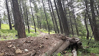
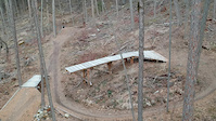
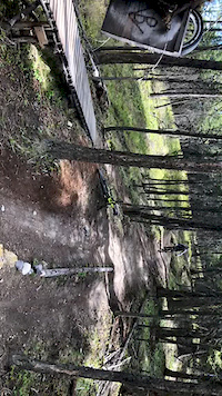
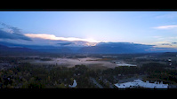
Photos of Spencer Mountain Mountain Bike
Videos of Spencer Mountain Mountain Bike

trail: Malice in Plunderland
0:11 |
41 |
Sep 3, 2025
trail: Otter Pop
0:12 |
149 |
Feb 21, 2021
trail: Malice in Plunderland
0:27 |
1164 |
Apr 20, 2020

trail: Otter Pop
0:00 |
280 |
Apr 8, 2020
trail: Otter Pop
0:07 |
237 |
May 13, 2019

trail: Spooky Pete's
2:23 |
1436 |
May 10, 2016
trail: Otter Pop
0:57 |
824 |
Oct 10, 2015

trail: Malice in Plunderland
2:50 |
1319 |
Aug 14, 2015
Current Trail Warnings
| status | trail | date | condition | user | info |
|---|---|---|---|---|---|
| The Whitefish Trail - East Spencer Loop | Jun 5, 2026 @ 1:47pm (America/Denver) Jun 5, 2026 | Prevalent Mud | toast2266 | north end of singletrack is completely... |
Recent Trail Reports
| status | trail | date | condition | info | user |
|---|---|---|---|---|---|
| South Ridge Trail | May 9, 2026 @ 4:20pm (America/Denver) May 9, 2026 | Ideal | easmith | ||
| Maple Syrup | Feb 11, 2026 @ 4:21pm (America/Denver) Feb 11, 2026 | Variable | toast2266 | ||
| Otter Pop | Feb 11, 2026 @ 4:18pm (America/Denver) Feb 11, 2026 | Variable | toast2266 | ||
| Flow Factory | Aug 30, 2025 @ 4:31pm Aug 30, 2025 | Dry | Fanderson | ||
| Big Gulps, Eh? | Aug 30, 2025 @ 4:31pm Aug 30, 2025 | Ideal | Fanderson | ||
| Malice in Plunderland | Aug 30, 2025 @ 4:31pm Aug 30, 2025 | Dry | Fanderson | ||
| Spooky Pete's | Aug 30, 2025 @ 4:31pm Aug 30, 2025 | Ideal | Fanderson | ||
| Lookout Trail | Aug 30, 2025 @ 4:31pm Aug 30, 2025 | Dry | Fanderson | ||
| The Goods | Jun 29, 2025 @ 9:34am Jun 29, 2025 | Ideal | FAMB FAMB | ||
| The Whitefish Trail / Lookout Trail - Spencer Mountain | May 9, 2025 @ 1:12pm May 9, 2025 | Ideal | FAMB FAMB |
Activity Feed
| username | action | type | title | date |
|---|---|---|---|---|
| 2998BqZ9 | wishlist | route | activity #97198680 | Jun 17, 2026 @ 11:29am Jun 17, 2026 |
| aamcgee | wishlist | region | activity #96780573 | Jun 11, 2026 @ 7:58pm Jun 11, 2026 |
| oiSJQC2q | comment | trail | activity #96421477 | Jun 6, 2026 @ 6:21pm Jun 6, 2026 |
| toast2266 | add | report | activity #96315677 | Jun 5, 2026 @ 12:47pm Jun 5, 2026 |
| BrookePiperydU | wishlist | trail | activity #96276926 | Jun 4, 2026 @ 10:11pm Jun 4, 2026 |
Recent Comments
| username | type | title | comment | date |
|---|---|---|---|---|
| trail | yup! a good progress trail---:) | Jun 6, 2026 @ 6:24pm Jun 6, 2026 | ||
| trail | for sure---i need a clinic for those... | Jun 6, 2026 @ 6:23pm Jun 6, 2026 | ||
| trail | Oh Otter Pop---your bank turns get me EVERY... | Jun 6, 2026 @ 6:21pm Jun 6, 2026 | ||
| trail | Awesome trail, in great shape, fast. flowy,... | May 29, 2026 @ 7:17pm May 29, 2026 | ||
| trail | Not my favourite trail. Can’t tell if it... | Sep 14, 2025 @ 2:06pm Sep 14, 2025 |
Nearby Areas
| name | distance | ||||
|---|---|---|---|---|---|
| Lion Mountain | 1 | 1.7 km | |||
| Whitefish Legacy Center | 3 | 3 | 2.9 km | ||
| Beaver Lakes Trails | 21 | 8 | 4.1 km | ||
| Pig Farms | 29 | 52 | 4.8 km | ||
| Haskill Basin | 2 | 1 | 5.9 km |
Local Badges
-

Completionist0 awarded
Local Trail Supporters
- Flathead Fat Tires
![]()
Activity Type Stats
| activitytype | trails | distance | descent | descent distance | total vertical | rating | global rank | state rank | photos | reports | routes | ridelogs |
|---|---|---|---|---|---|---|---|---|---|---|---|---|
| Mountain Bike | 20 | 20 miles | 5,554 ft | 9 miles | 804 ft | #3,490 | #1,219 | 132 | 368 | 1 | 6,949 | |
| Horse | 2 | 1 mile | 597 ft | 1 mile | 650 ft | 85 | 1 | |||||
| Hike | 18 | 18 miles | 4,144 ft | 7 miles | 804 ft | #1,449 | #669 | 1 | 337 | 140 | ||
| Trail Running | 18 | 18 miles | 4,144 ft | 7 miles | 804 ft | #8,153 | #2,826 | 338 | 75 |
Frequently Asked Questions About Spencer Mountain
▼
What are the highest rated mountain biking trails in Spencer Mountain?
The highest rated mountain biking trails in Spencer Mountain are:
- Malice in Plunderland (4.5/5)
- Otter Pop (4.5/5)
- Maple Syrup (4.2/5)
- Flow Factory (4.2/5)
- Spooky Pete's (4.1/5)
▼
What is the best time of the year to ride in Spencer Mountain?
Based on ride log data, the most popular months to ride in Spencer Mountain are:
- July (125 activities)
- September (109 activities)
- May (105 activities)
▼
Where can I park to ride in Spencer Mountain?
There are 8 parking locations listed in Spencer Mountain. The most popular parking spots are:
- Spencer Parking Lot
- South Spencer Trailhead
- Limited roadside parking
- Limited roadside parking
- Limited Parking
▼
What is the longest trail in Spencer Mountain?
The longest trail in Spencer Mountain is The Whitefish Trail - East Spencer Loop at 3.5 miles. View all trails sorted by distance.
Activities
Trails
Points of Interest
- By FAMB
 FAMB & contributors
 - Admins: FAMB, FAMB, JeffVonKiper
- #4670 - 29,152 views
- spencer mountain activity log | embed map of Spencer Mountain mountain bike trails | spencer mountain mountain biking points of interest
Downloading of trail gps tracks in kml & gpx formats is enabled for Spencer Mountain.
You must login to download files.