close
-
Layers w
- Weather Layers
- Pro
- Pro
- Pro
- Pro
- Pro
- Pro
- More Layers
- Pro
- Pro
- Pro
- Pro
-
Upgrade to

3D
Trail Conditions
- Unknown
- Snow Groomed
- Snow Packed
- Snow Covered
- Snow Cover Partial
- Freeze/thaw Cycle
- Icy
- Prevalent Mud
- Wet
- Variable
- Ideal
- Dry
- Very Dry
Trail Flow (Ridden Direction)
Trailforks scans users ridelogs to determine the most popular direction each trail is ridden. A good flowing trail network will have most trails flowing in a single direction according to their intension.
The colour categories are based on what percentage of riders are riding a trail in its intended direction.
The colour categories are based on what percentage of riders are riding a trail in its intended direction.
- > 96%
- > 90%
- > 80%
- > 70%
- > 50%
- < 50%
- bi-directional trail
- no data
Trail Last Ridden
Trailforks scans ridelogs to determine the last time a trail was ridden.
- < 2 days
- < 1 week
- < 2 weeks
- < 1 month
- < 6 months
- > 6 months
Trail Ridden Direction
The intended direction a trail should be ridden.
- Downhill Only
- Downhill Primary
- Both Directions
- Uphill Primary
- Uphill Only
- One Direction
Contribute Details
Colors indicate trail is missing specified detail.
- Description
- Photos
- Description & Photos
- Videos
Trail Popularity ?
Trailforks scans ridelogs to determine which trails are ridden the most in the last 9 months.
Trails are compared with nearby trails in the same city region with a possible 25 colour shades.
Think of this as a heatmap, more rides = more kinetic energy = warmer colors.
- most popular
- popular
- less popular
- not popular
ATV/ORV/OHV Filter
Max Vehicle Width
inches
US Cell Coverage
Legend

Radar Time
Activity Recordings
Trailforks uses anonymized public activity data.
?
Activity Recordings
Trailforks uses anonymized public activity data.
?
Personal Heatmap
▶
Activity Types
all
/
none
▶
Options
2
Date range
month
–
Winter Trails
Warning
A routing network for winter maps does not exist. Selecting trails using the winter trails layer has been disabled.
Missing Trails
Most Popular
Least Popular
Trails are colored based on popularity. The more popular a trail is, the more red. Less popular trails trend towards green.
Jump Magnitude Heatmap
Heatmap of where riders jump on trails. Zoom in to see individual jumps, click circles to view jump details.
BC Backroad Status
![map legend]()
Service Road Atlas is a free to use, community-driven service for viewing and creating reports on the numerous back-country service roads around B.C. and Alberta.

Slope Aspect
Direction the slope faces
Trails Deemphasized
Trails are shown in grey.
Only show trails with no bike usage.
Suggested Layers
Based on selected activity type
Save the current map location and zoom level as your default home location whenever this page is loaded.
Save
No description for Spokane Valley has been added yet!
Login or register to submit one.
Activities Click to view
- Mountain Bike
34 trails
- E-Bike
14 trails
- Gravel Bike
0 trails
- Adaptive Bike
0 trails
- Winter Fat Bike
1 trails
- Horse
16 trails
- Hike
42 trails
- Trail Running
42 trails
- Snowshoe
11 trails
Region Details
- 7
- 10
- 6
- 1
- 1
Region Status
Open as of Apr 28, 2026Local Trail Association
Stats
- Avg Trail Rating
- Trails (view details)
- 31
- Trails Mountain Bike
- 34
- Trails E-Bike
- 14
- Trails Winter Fat Bike
- 1
- Trails Horse
- 16
- Trails Hike
- 42
- Trails Trail Running
- 42
- Trails Snowshoe
- 11
- Total Distance
- 26 miles
- Total Descent
- 6,134 ft
- Total Vertical
- 1,680 ft
- Highest Trailhead
- 3,671 ft
- Reports
- 373
- Photos
- 218
- Ridden Counter
- 4,807
Sub Regions
-
Dishman Hills Natural Area
-
Glenrose - Phillips Creek
- 4
- 2
-
Iller Creek Conservation Area
- 5
- 4
- 1
- 1
Popular Spokane Valley Mountain Biking Trails
• 85 ★ 3.8 • 3 miles • 1,116 ft • 287 •
While this is technically 2 way its really a climbing trail if you are mt biking. Would not recommend descending this side. Solid climb. Once you make it to the junction, stay left, and you'll get to bypass the old, straight up, first...
• 85 ★ 3.2 • 2 miles • 64 ft • 217 •
Access is extremely easy from holman rd trailhead. just head straight west past the port a potty if you are climbing this trail. recommended riding pattern is clockwise riding iller east up then iller west down. first few miles up trail...
• 100 ★ 5.0 • 2 miles • 52 ft • 210 •
Trail built summer 2020 collaboration between Spokane Mountaineers, WTA and Evergreen East. Trail begins at Phillips Creek Trail Head in the Spokane Valley and traverses through some beautiful Ponderosa Pine forest before breaking out...
• 65 ★ 3.0 • 1,053 ft • 56 ft • 173 •
Short trail connects east and west trails. Awesome views of Big Rock at the top. Steep climb but views are worth it.
• 90 ★ 0.0 • 2,365 ft • 220 ft • 165 •
to Cliffs direct route. Moderate climbing trail at it's high point gains connector road. A quick bit to the north on the connector reaches the Cliffs trail. From here follow the single track portion of the Cliffs trail to the north to...
• 100 ★ 5.0 • 4,449 ft • 10 ft • 160 •
The trail is easily accessed from the Glenrose trailhead providing views of sprawling Spokane. This trail can be ridden in either direction but riding counterclockwise will provide more flow after an initial climb up the trail. A great...
• 80 ★ 2.7 • 4,055 ft • 88 ft • 132 •
A quick and easy way to connect over from the west fork to east ridge or vice versa
Spokane Valley Mountain Bike Routes
7 miles • 1,345 ft • 5 •
Route starting from the Glenrose trailhead that utilizes the new on the Phillips Creek Side.
5 miles • 1,184 ft • 2 • Loop •
Fun all single track with an incredible view of the Palouse as a main course and fun decent for desert....
• 3 miles • 743 ft • 3 •
• 6 miles • 1,103 ft • 4 •
• 7 miles • 1,593 ft • 5 •
• 8 miles • 1,654 ft • 8 •
Photos of Spokane Valley Mountain Bike
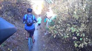
Videos of Spokane Valley Mountain Bike

trail: Iller Creek (West Fork)
18:05 |
538 |
Jul 14, 2019 , Spokane Valley
trail: Iller Creek (East Ridge)
1225 |
May 30, 2016 , Spokane Valley
Recent Trail Reports
| status | trail | date | condition | info | user |
|---|---|---|---|---|---|
| Flying L | Apr 28, 2026 @ 4:48pm (America/Creston) Apr 28, 2026 | Ideal | Shockley | ||
| Blue Bunch | Apr 28, 2026 @ 4:48pm (America/Creston) Apr 28, 2026 | Ideal | Shockley | ||
| Glenrose Cliffs | Apr 28, 2026 @ 4:48pm (America/Creston) Apr 28, 2026 | Ideal | Shockley | ||
| Inside Passage | Apr 25, 2026 @ 9:28am (America/Creston) Apr 25, 2026 | Ideal | theprofessionaljerry | ||
| Iller Creek (West Fork) | Apr 25, 2026 @ 9:28am (America/Creston) Apr 25, 2026 | Ideal | theprofessionaljerry | ||
| Iller Creek (East Ridge) | Apr 25, 2026 @ 9:28am (America/Creston) Apr 25, 2026 | Ideal | theprofessionaljerry | ||
| Ponderosa Springs | Feb 28, 2026 @ 1:18pm (America/Los_Angeles) Feb 28, 2026 | Ideal | bizango-x | ||
| Little East Face | Feb 2, 2026 @ 7:46am (America/Vancouver) Feb 2, 2026 | Prevalent Mud | MarkMichaelis | ||
| Upper Valley Trail | Feb 2, 2026 @ 7:45am (America/Vancouver) Feb 2, 2026 | Prevalent Mud | MarkMichaelis | ||
| Coyote Divide | Jan 23, 2026 @ 12:40pm (America/Los_Angeles) Jan 23, 2026 | Variable | idsnowghost |
Activity Feed
| username | action | type | title | date |
|---|---|---|---|---|
| John48 | ridden | trail | activity #94356426 | May 9, 2026 @ 10:25am May 9, 2026 |
| hdobson188 | update | trail | activity #94170854 and 1 more | May 6, 2026 @ 12:08pm May 6, 2026 |
| Ayni | wishlist | region | activity #93854448 | May 2, 2026 @ 6:45am May 2, 2026 |
| Shockley | add | report | activity #93665356 and 3 more | Apr 29, 2026 @ 12:23pm Apr 29, 2026 |
| Shockley | vote | trail | activity #93665031 and 4 more | Apr 29, 2026 @ 12:16pm Apr 29, 2026 |
Recent Comments
| username | type | title | comment | date |
|---|---|---|---|---|
| trail | Very rutted out in many spots. So if you're... | May 4, 2024 @ 12:38pm May 4, 2024 | ||
| report | Has been Cleared | Jan 15, 2024 @ 3:39pm Jan 15, 2024 | ||
| report | Cleared | Jan 15, 2024 @ 3:38pm Jan 15, 2024 | ||
| report | Building and maintaining trails is a lot of... | Oct 24, 2023 @ 11:40pm Oct 24, 2023 | ||
| trail | Serious drainage issues | May 16, 2022 @ 6:56am May 16, 2022 |
Local Badges
-

Epic Mountain Bike Climb 2k3 awarded -

Climbing 10k Badge34 awarded -

Mountain Biking 100k Badge0 awarded -

Epic Ride Descent 2k3 awarded -

Descent 10k Badge34 awarded -

Descent 100k Badge0 awarded
Activity Type Stats
| activitytype | trails | distance | descent | descent distance | total vertical | rating | global rank | state rank | photos | reports | routes | ridelogs |
|---|---|---|---|---|---|---|---|---|---|---|---|---|
| Mountain Bike | 34 | 21 miles | 5,620 ft | 9 miles | 1,670 ft | #5,468 | #1,836 | 208 | 372 | 2 | 7,297 | |
| E-Bike | 14 | #8,884 | #2,715 | 230 | 1 | 321 | ||||||
| Winter Fat Bike | 1 | #400 | #1,172 | 1 | ||||||||
| Horse | 16 | 7 miles | 1,785 ft | 4 miles | 820 ft | #2,653 | #1,473 | 108 | ||||
| Hike | 42 | 26 miles | 6,135 ft | 10 miles | 1,680 ft | #3,181 | #1,126 | 23 | 378 | 1,707 | ||
| Trail Running | 42 | 26 miles | 6,135 ft | 10 miles | 1,680 ft | #5,553 | #1,758 | 2 | 378 | 997 | ||
| Snowshoe | 11 | 4 miles | 1,001 ft | 2 miles | 604 ft | #1,505 | #846 | 35 | 9 |
Frequently Asked Questions About Spokane Valley
▼
What are the best places to ride in Spokane Valley?
Spokane Valley has 3 areas to explore for mountain biking. The top rated areas are:
▼
What are the highest rated mountain biking trails in Spokane Valley?
The highest rated mountain biking trails in Spokane Valley are:
- Flying L (4.3/5)
- Ponderosa Springs (4.2/5)
- Blue Bunch (4.1/5)
- Glenrose Cliffs (3.9/5)
- Iller Creek (East Ridge) (3.8/5)
▼
What is the best time of the year to ride in Spokane Valley?
Based on ride log data, the most popular months to ride in Spokane Valley are:
- July (123 activities)
- August (94 activities)
- June (83 activities)
▼
Where can I park to ride in Spokane Valley?
There are 8 parking locations listed in Spokane Valley. The most popular parking spots are: View all parking and trailhead locations on the map to plan your visit.
Activities
Trails
- By grabo82
 & contributors
 - Admins: EMBA-EC, NEWATrails, NEWAT
- #5627 - 5,894 views
- spokane valley activity log | embed map of Spokane Valley mountain bike trails | spokane valley mountain biking points of interest
Downloading of trail gps tracks in kml & gpx formats is enabled for Spokane Valley.
You must login to download files.