close
-
Layers w
- Weather Layers
- Pro
- Pro
- Pro
- Pro
- Pro
- Pro
- More Layers
- Pro
- Pro
- Pro
- Pro
-
Upgrade to

3D
Trail Conditions
- Unknown
- Snow Groomed
- Snow Packed
- Snow Covered
- Snow Cover Partial
- Freeze/thaw Cycle
- Icy
- Prevalent Mud
- Wet
- Variable
- Ideal
- Dry
- Very Dry
Trail Flow (Ridden Direction)
Trailforks scans users ridelogs to determine the most popular direction each trail is ridden. A good flowing trail network will have most trails flowing in a single direction according to their intension.
The colour categories are based on what percentage of riders are riding a trail in its intended direction.
The colour categories are based on what percentage of riders are riding a trail in its intended direction.
- > 96%
- > 90%
- > 80%
- > 70%
- > 50%
- < 50%
- bi-directional trail
- no data
Trail Last Ridden
Trailforks scans ridelogs to determine the last time a trail was ridden.
- < 2 days
- < 1 week
- < 2 weeks
- < 1 month
- < 6 months
- > 6 months
Trail Ridden Direction
The intended direction a trail should be ridden.
- Downhill Only
- Downhill Primary
- Both Directions
- Uphill Primary
- Uphill Only
- One Direction
Contribute Details
Colors indicate trail is missing specified detail.
- Description
- Photos
- Description & Photos
- Videos
Trail Popularity ?
Trailforks scans ridelogs to determine which trails are ridden the most in the last 9 months.
Trails are compared with nearby trails in the same city region with a possible 25 colour shades.
Think of this as a heatmap, more rides = more kinetic energy = warmer colors.
- most popular
- popular
- less popular
- not popular
ATV/ORV/OHV Filter
Max Vehicle Width
inches
US Cell Coverage
Legend

Radar Time
Activity Recordings
Trailforks uses anonymized public activity data.
?
Activity Recordings
Trailforks uses anonymized public activity data.
?
Personal Heatmap
▶
Activity Types
all
/
none
▶
Options
2
Date range
month
–
Winter Trails
Warning
A routing network for winter maps does not exist. Selecting trails using the winter trails layer has been disabled.
Missing Trails
Most Popular
Least Popular
Trails are colored based on popularity. The more popular a trail is, the more red. Less popular trails trend towards green.
Jump Magnitude Heatmap
Heatmap of where riders jump on trails. Zoom in to see individual jumps, click circles to view jump details.
BC Backroad Status
![map legend]()
Service Road Atlas is a free to use, community-driven service for viewing and creating reports on the numerous back-country service roads around B.C. and Alberta.

Slope Aspect
Direction the slope faces
Trails Deemphasized
Trails are shown in grey.
Only show trails with no bike usage.
Suggested Layers
Based on selected activity type
Save the current map location and zoom level as your default home location whenever this page is loaded.
Save
No description for Springdale has been added yet!
Login or register to submit one.
Activities Click to view
- Mountain Bike
48 trails
- E-Bike
42 trails
- Gravel Bike
0 trails
- Adaptive Bike
0 trails
- Winter Fat Bike
0 trails
- Horse
0 trails
- Hike
47 trails
- Trail Running
47 trails
- Dirtbike/Moto
0 trails
- Observed Trials
0 trails
- ATV/ORV/OHV
9 trails
Region Details
- 10
- 17
- 10
- 9
- 4
- 2
Region Status
Caution as of May 26, 2026Stats
- Avg Trail Rating
- Trails (view details)
- 52
- Trails Mountain Bike
- 50
- Trails E-Bike
- 42
- Trails Hike
- 47
- Trails Trail Running
- 47
- Trails ATV/ORV/OHV
- 9
- Total Distance
- 31 miles
- Total Descent
- 2,861 ft
- Total Vertical
- 444 ft
- Highest Trailhead
- 1,639 ft
- Reports
- 921
- Photos
- 173
- Ridden Counter
- 13,766
Sub Regions
-
Mount Fitzgerald
- 8
- 7
- 2
- 2
-
Runway Bike Park
- 1
- 1
- 1
- 1
-
Thunder Chicken
- 3
- 1
- 1
Popular Springdale Mountain Biking Trails
• 90 ★ 3.6 • 3 miles • 396 ft • 816 •
Fast, flowy trail with a lot of berms, some doubles, and some gap jumps. There are a few technical rock sections as well. It also features a rock wall ride/berm that is a work of art! Flow in either direction, although the rock wall is...
• 100 ★ 4.2 • 2 miles • 198 ft • 785 •
Highly rated popular blue difficulty singletrack. This multi-use trail can be used both directions and has a moderate overall physical rating with a 198 ft green climb. On average it takes 16 minutes to complete this trail.
• 80 ★ 4.3 • 3,202 ft • 18 ft • 739 •
A rocky decent from the hub. Much better to go down than climb.
• 95 ★ 3.8 • 554 ft • 20 ft • 704 •
Popular double black diamond difficulty singletrack. This multi-use trail can be used both directions and has a hard overall physical rating with a 20 ft double black diamond climb. It features drop, rock face and rock garden. On average it takes 1 minutes to complete this trail.
• 90 ★ 4.0 • 2,900 ft • 19 ft • 704 •
A short loop off the hub. A flow trail with a few rocks.
• 90 ★ 4.7 • 1,040 ft • 17 ft • 614 •
Popular double black diamond difficulty singletrack. This multi-use trail can be used downhill only and has a extreme overall physical rating with a 17 ft double black diamond climb. It features jump and gap jump. Trail visibility is always easy to follow. On average it takes 3 minutes to complete this trail.
• 85 ★ 4.0 • 888 ft • 11 ft • 576 •
Popular blue difficulty singletrack. This multi-use trail can be used downhill only and has a hard overall physical rating with a 11 ft blue climb. On average it takes 2 minutes to complete this trail.
Springdale Mountain Bike Routes
9 miles • 1,009 ft • 18 •
One day at Mount ? This route hits all the highlights. If you want an extra challenge, ride (south to...
4 miles • 255 ft • 7 •
Quick, fun loop on Mt. . You can add the , but don't expect it to be the ...
1,040 ft • 34 ft • 0 • Out & Back •
This connects the parking lot to the main trail head at Mountain Trails
• 3 miles • 219 ft • 5 •
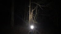
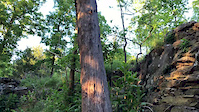
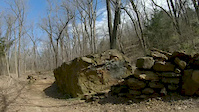
Photos of Springdale Mountain Bike
Videos of Springdale Mountain Bike
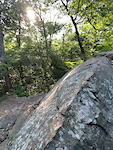
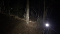
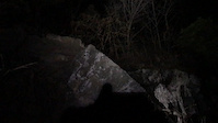
trail: Coyote Cave
0:06 |
345 |
Jun 21, 2022
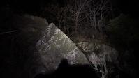
trail: Coyote Cave
0:05 |
94 |
Dec 9, 2020
trail: Butterfield
0:07 |
69 |
Dec 9, 2020
trail: Butterfield
0:09 |
|
Dec 9, 2020
trail: Coyote Cave
0:12 |
|
Dec 9, 2020
trail: Coyote Cave
0:12 |
199 |
May 7, 2020
trail: Butterfield
0:15 |
257 |
Mar 9, 2020

trail: Fitzgerald
0:06 |
138 |
May 25, 2019
Recent Trail Reports
| status | trail | date | condition | info | user |
|---|---|---|---|---|---|
| Wagon Ride | May 26, 2026 @ 4:56am (America/Chicago) May 26, 2026 | Ideal | robbiethetrailtroll OORC | ||
| Last Frontier | May 26, 2026 @ 4:56am (America/Chicago) May 26, 2026 | Ideal | robbiethetrailtroll OORC | ||
| Coyote Cave | May 26, 2026 @ 4:52am (America/Chicago) May 26, 2026 | Ideal | robbiethetrailtroll OORC | ||
| Butterfield | May 23, 2026 @ 8:02am (America/Indiana/Vincennes) May 23, 2026 | Ideal | robbiethetrailtroll OORC | ||
| Heading Home | May 23, 2026 @ 8:02am (America/Indiana/Vincennes) May 23, 2026 | Ideal | robbiethetrailtroll OORC | ||
| Stage Coach Access | May 23, 2026 @ 8:02am (America/Indiana/Vincennes) May 23, 2026 | Ideal | robbiethetrailtroll OORC | ||
| Butterfield (East) | May 13, 2026 @ 5:06am (America/Chicago) May 13, 2026 | Ideal | robbiethetrailtroll OORC | ||
| Old Wire | May 12, 2026 @ 5:48pm (America/Chicago) May 12, 2026 | Ideal | robbiethetrailtroll OORC | ||
| 1857 | May 12, 2026 @ 5:48pm (America/Chicago) May 12, 2026 | Ideal | robbiethetrailtroll OORC | ||
| Fitzgerald | May 12, 2026 @ 5:48pm (America/Chicago) May 12, 2026 | Ideal | robbiethetrailtroll OORC |
Activity Feed
| username | action | type | title | date |
|---|---|---|---|---|
| pshw | ridden | trail | activity #97599041 | Jun 22, 2026 @ 7:08pm 1 day |
| kconnolly44 | wishlist | route | activity #96598134 | Jun 9, 2026 @ 5:16am Jun 9, 2026 |
| OzarkMtnBiker | ridden | trail | activity #96303190 and 1 more | Jun 5, 2026 @ 9:37am Jun 5, 2026 |
| pharcydemtnbiker | wishlist | region | activity #96084632 | Jun 2, 2026 @ 8:02am Jun 2, 2026 |
| robbiethetrailtroll | add | report | activity #95551789 and 7 more | May 26, 2026 @ 2:51am May 26, 2026 |
Recent Comments
| username | type | title | comment | date |
|---|---|---|---|---|
| trail | Clockwise has a rocky down hill enduro feel... | May 13, 2026 @ 5:05pm May 13, 2026 | ||
| trail | Easy and fun little loop trail at the top of... | Jan 22, 2026 @ 9:18pm Jan 22, 2026 | ||
| trail | This is a great trail! So well designed with... | Oct 18, 2025 @ 8:45am Oct 18, 2025 | ||
| trail | Better than buttered cornbread. Great trail.... | Oct 18, 2025 @ 8:37am Oct 18, 2025 | ||
| report | Can confirm. | Jun 3, 2025 @ 2:05pm Jun 3, 2025 |
Local Badges
-

Epic Ride Climb 2k1 awarded -

Climbing 10k Badge18 awarded -

Climbing 100k Badge1 awarded -

Epic Ride Descent 2k1 awarded -

Descent 10k Badge18 awarded -

Descent 100k Badge1 awarded
Bike & Skill Parks
| name | type | city | rating |
|---|---|---|---|
| Thunder Chicken Skills Park | skill park | Springdale | |
| Runway Bike Park | skill park | Springdale |
Activity Type Stats
| activitytype | trails | distance | descent | descent distance | total vertical | rating | global rank | state rank | photos | reports | routes | ridelogs |
|---|---|---|---|---|---|---|---|---|---|---|---|---|
| Mountain Bike | 48 | 31 miles | 2,861 ft | 11 miles | 443 ft | #2,183 | #782 | 180 | 934 | 5 | 8,210 | |
| E-Bike | 42 | 29 miles | 2,690 ft | 10 miles | 443 ft | #814 | #766 | 902 | 1 | 319 | ||
| Hike | 47 | 27 miles | 2,648 ft | 10 miles | 443 ft | #5,622 | #1,978 | 4 | 921 | 217 | ||
| Trail Running | 47 | 27 miles | 2,648 ft | 10 miles | 443 ft | #5,038 | #1,580 | 921 | 220 | |||
| ATV/ORV/OHV | 9 | 1 mile | 82 ft | 1,713 ft | 171 ft | #813 | #362 | 17 | 12 |
Frequently Asked Questions About Springdale
▼
What are the best places to ride in Springdale?
Springdale has 3 areas to explore for mountain biking. The top rated areas are:
▼
What are the highest rated mountain biking trails in Springdale?
The highest rated mountain biking trails in Springdale are:
- Thunder Chicken (4.3/5)
- Bridge Is Out (4.2/5)
- Coyote Cave (4.2/5)
- Thunder Chicken CrossRoad (4.1/5)
- Spring Creek Trail (4.1/5)
▼
What is the best time of the year to ride in Springdale?
Based on ride log data, the most popular months to ride in Springdale are:
- July (89 activities)
- May (64 activities)
- April (59 activities)
▼
Where can I park to ride in Springdale?
There are 3 parking locations listed in Springdale. The most popular parking spots are: View all parking and trailhead locations on the map to plan your visit.
Activities
Trails
- By brenthillier
 NSMBA TRAILFORKS & contributors
 - Admins: OZ TRAILS, thomcerny
- #3745 - 6,623 views
- springdale activity log | embed map of Springdale mountain bike trails | springdale mountain biking points of interest
Downloading of trail gps tracks in kml & gpx formats is enabled for Springdale.
You must login to download files.