close
-
Layers w
- Weather Layers
- Pro
- Pro
- Pro
- Pro
- Pro
- Pro
- More Layers
- Pro
- Pro
- Pro
- Pro
-
Upgrade to

3D
Trail Conditions
- Unknown
- Snow Groomed
- Snow Packed
- Snow Covered
- Snow Cover Partial
- Freeze/thaw Cycle
- Icy
- Prevalent Mud
- Wet
- Variable
- Ideal
- Dry
- Very Dry
Trail Flow (Ridden Direction)
Trailforks scans users ridelogs to determine the most popular direction each trail is ridden. A good flowing trail network will have most trails flowing in a single direction according to their intension.
The colour categories are based on what percentage of riders are riding a trail in its intended direction.
The colour categories are based on what percentage of riders are riding a trail in its intended direction.
- > 96%
- > 90%
- > 80%
- > 70%
- > 50%
- < 50%
- bi-directional trail
- no data
Trail Last Ridden
Trailforks scans ridelogs to determine the last time a trail was ridden.
- < 2 days
- < 1 week
- < 2 weeks
- < 1 month
- < 6 months
- > 6 months
Trail Ridden Direction
The intended direction a trail should be ridden.
- Downhill Only
- Downhill Primary
- Both Directions
- Uphill Primary
- Uphill Only
- One Direction
Contribute Details
Colors indicate trail is missing specified detail.
- Description
- Photos
- Description & Photos
- Videos
Trail Popularity ?
Trailforks scans ridelogs to determine which trails are ridden the most in the last 9 months.
Trails are compared with nearby trails in the same city region with a possible 25 colour shades.
Think of this as a heatmap, more rides = more kinetic energy = warmer colors.
- most popular
- popular
- less popular
- not popular
ATV/ORV/OHV Filter
Max Vehicle Width
inches
US Cell Coverage
Legend

Radar Time
Activity Recordings
Trailforks uses anonymized public activity data.
?
Activity Recordings
Trailforks uses anonymized public activity data.
?
Personal Heatmap
▶
Activity Types
all
/
none
▶
Options
2
Date range
month
–
Winter Trails
Warning
A routing network for winter maps does not exist. Selecting trails using the winter trails layer has been disabled.
Missing Trails
Most Popular
Least Popular
Trails are colored based on popularity. The more popular a trail is, the more red. Less popular trails trend towards green.
Jump Magnitude Heatmap
Heatmap of where riders jump on trails. Zoom in to see individual jumps, click circles to view jump details.
BC Backroad Status
![map legend]()
Service Road Atlas is a free to use, community-driven service for viewing and creating reports on the numerous back-country service roads around B.C. and Alberta.

Slope Aspect
Direction the slope faces
Trails Deemphasized
Trails are shown in grey.
Only show trails with no bike usage.
Suggested Layers
Based on selected activity type
Save the current map location and zoom level as your default home location whenever this page is loaded.
Save
No description for Springfield has been added yet!
Login or register to submit one.
Activities Click to view
- Mountain Bike
92 trails
- E-Bike
36 trails
- Adaptive Bike
0 trails
- Winter Fat Bike
0 trails
- Horse
4 trails
- Hike
118 trails
- Trail Running
113 trails
Region Details
- 15
- 5
- 41
- 16
Region Status
Open as of Jun 14, 2026Stats
- Avg Trail Rating
- Trails (view details)
- 103
- Trails Mountain Bike
- 92
- Trails E-Bike
- 36
- Trails Horse
- 4
- Trails Hike
- 118
- Trails Trail Running
- 113
- Total Distance
- 123 miles
- Total Descent
- 6,313 ft
- Total Vertical
- 619 ft
- Highest Trailhead
- 1,353 ft
- Reports
- 676
- Photos
- 116
- Ridden Counter
- 8,671
Sub Regions
-
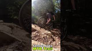
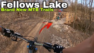
Fellows Lake
- 25
- 4
-
Ritter Springs Park
-
Sac River Trails
- 12
- 10
Popular Springfield Mountain Biking Trails
• 90 ★ 5.0 • 5 miles • 366 ft • 234 •
Popular green difficulty singletrack. This multi-use trail can be used both directions and has a easy overall physical rating with a 366 ft green climb. Trail visibility is always easy to follow. On average it takes 28 minutes to complete this trail.
• 100 ★ 4.0 • 3,704 ft • 40 ft • 208 •
Popular green difficulty family friendly singletrack. This mountain bike primary trail can be used both directions and has a easy overall physical rating with a 40 ft green climb. Trail visibility is always easy to follow. On average it takes 3 minutes to complete this trail.
• 90 ★ 5.0 • 4,308 ft • 88 ft • 207 •
Popular green difficulty singletrack. This mountain bike primary trail can be used both directions. On average it takes 7 minutes to complete this trail.
• 85 ★ 5.0 • 2 miles • 213 ft • 197 •
Popular green difficulty singletrack. This multi-use trail can be used both directions and has a easy overall physical rating with a 213 ft green climb. Trail visibility is always easy to follow. On average it takes 14 minutes to complete this trail.
• 95 ★ 4.0 • 1 mile • 112 ft • 196 •
Popular green difficulty singletrack. This mountain bike primary trail can be used both directions. It features ladder bridge and skinny. Trail visibility is always easy to follow. On average it takes 8 minutes to complete this trail.
• 85 ★ 5.0 • 4 miles • 322 ft • 183 •
Popular green difficulty family friendly singletrack. This mountain bike primary trail can be used both directions and has a easy overall physical rating with a 322 ft green climb. Trail visibility is always easy to follow. On average it takes 29 minutes to complete this trail.
• 80 ★ 4.0 • 1 mile • 102 ft • 183 •
Popular blue difficulty singletrack. This mountain bike primary trail can be used one direction. It features jump. Trail visibility is always easy to follow. On average it takes 8 minutes to complete this trail.
• 95 ★ 0.0 • 413 ft • 0 ft • 179 •
Popular green difficulty singletrack. This mountain bike primary trail can be used both directions. On average it takes 1 minutes to complete this trail.
Springfield Mountain Bike Routes
8 miles • 678 ft • 6 • Loop •
Nice 8 mile connection of a few of the best trails/loops at fellows.
4 miles • 353 ft • 5 •
Omba Caramba 2023 Elite Cat 1, Sport Cat 2, Marathon, Single Speed & E-Bike
36 miles • 2,394 ft • 8 •
yeeeeeeeeeeeeeeeee all the north side trail too much overlap
Photos of Springfield Mountain Bike
Videos of Springfield Mountain Bike

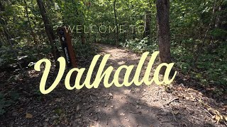
trail: Valhalla
9:44 |
62 |
Oct 14, 2025 , Springfield
trail: Fellows Lake Nature Trail
9:44 |
43 |
Oct 2, 2025 , Springfield
youtuber
![Fellows Lake Mountain Bike Tail: Local Lore]()
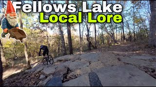
trail: Local Lore Loop
3:39 |
516 |
Dec 23, 2021 , Springfield
youtuber
![A Crazy MTB Flat Rock Trail]()
0:16 |
292 |
Jul 30, 2021
youtuber
![The Dam MTB Trails at Fellows Lake: Fast Fun Loops]()
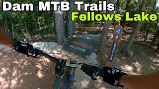
trail: That Dam Downhill
3:59 |
461 |
Jul 26, 2021 , Springfield
youtuber
![Fun Feature at Fellows Lake MTB Trail]()
0:33 |
324 |
May 1, 2021
youtuber
![Fellows Lake Mountain Bike Tails: Brand New...]()
8:07 |
787 |
Mar 18, 2021
youtuber
![]()
trail: The Outsider
10:34 |
556 |
Oct 29, 2020 , Springfield
Recent Trail Reports
Activity Feed
| username | action | type | title | date |
|---|---|---|---|---|
| NathanKen | ridden | trail | activity #97353304 | Jun 19, 2026 @ 4:42pm 1 day |
| NathanKen | ridden | trail | activity #97353257 and 1 more | Jun 19, 2026 @ 4:41pm 1 day |
| zron55 | wishlist | region | activity #95661677 | May 27, 2026 @ 2:33pm May 27, 2026 |
| RyanLrooF1 | ridden | trail | activity #95524717 and 1 more | May 25, 2026 @ 2:39pm May 25, 2026 |
| Shelandcourt | ridden | trail | activity #94272278 and 1 more | May 8, 2026 @ 6:49am May 8, 2026 |
Recent Comments
| username | type | title | comment | date |
|---|---|---|---|---|
| trail | Watch out for thorns in your tires. | Apr 10, 2025 @ 9:45am Apr 10, 2025 | ||
| trail | Bring a tire repair kit. I pulled six 1/2” -... | Apr 10, 2025 @ 9:44am Apr 10, 2025 | ||
| trail | Says it’s closed | Jun 10, 2024 @ 9:09am Jun 10, 2024 | ||
| trail | 15 years since my last real ride and it was a... | Apr 29, 2024 @ 11:39pm Apr 29, 2024 | ||
| report | vizier b.x 5 uh @z oh O | Aug 21, 2023 @ 5:27pm Aug 21, 2023 |
Local Badges
-

10 Blue Trails65 awarded -

Epic Ride Climb 2k4 awarded -

Climbing 10k Badge45 awarded -

Climbing 100k Badge5 awarded -

Epic Ride Descent 2k4 awarded -

Descent 10k Badge44 awarded
Bike & Skill Parks
| name | type | city | rating |
|---|---|---|---|
| Spokes BMX | skill park | Springfield | |
| Buffalo MX | skill park | Springfield |
Activity Type Stats
| activitytype | trails | distance | descent | descent distance | total vertical | rating | global rank | state rank | photos | reports | routes | ridelogs |
|---|---|---|---|---|---|---|---|---|---|---|---|---|
| Mountain Bike | 92 | 105 miles | 5,105 ft | 40 miles | 620 ft | #1,362 | #517 | 111 | 691 | 10 | 16,070 | |
| E-Bike | 36 | 54 miles | 2,507 ft | 20 miles | 620 ft | #2,697 | #1,055 | 578 | 1 | 436 | ||
| Horse | 4 | 5 miles | 180 ft | 2 miles | 121 ft | #2,339 | #1,294 | 140 | ||||
| Hike | 118 | 123 miles | 6,312 ft | 47 miles | 620 ft | #1,559 | #699 | 6 | 687 | 343 | ||
| Trail Running | 113 | 120 miles | 6,125 ft | 47 miles | 620 ft | #1,379 | #495 | 687 | 886 |
Frequently Asked Questions About Springfield
▼
What are the best places to ride in Springfield?
Springfield has 5 areas to explore for mountain biking. The top rated areas are:
▼
What are the highest rated mountain biking trails in Springfield?
The highest rated mountain biking trails in Springfield are:
- Liberty Loop (4.3/5)
- Uncle Frank (4.2/5)
- Jerry's Progress (4.2/5)
- That Dam Return (4.1/5)
- Connector (4.1/5)
▼
What is the best time of the year to ride in Springfield?
Based on ride log data, the most popular months to ride in Springfield are:
- September (90 activities)
- July (89 activities)
- August (86 activities)
▼
Where can I park to ride in Springfield?
There are 23 parking locations listed in Springfield. The most popular parking spots are: View all parking and trailhead locations on the map to plan your visit.
Activities
Trails
Points of Interest
- By Freeride-Digger & contributors
- Admins: MORC, MDC-SW, thomcerny
- #6844 - 7,958 views
- springfield activity log | embed map of Springfield mountain bike trails | springfield mountain biking points of interest polygons
Downloading of trail gps tracks in kml & gpx formats is enabled for Springfield.
You must login to download files.