close
-
Layers w
- Weather Layers
- Pro
- Pro
- Pro
- Pro
- Pro
- Pro
- More Layers
- Pro
- Pro
- Pro
- Pro
-
Upgrade to

3D
Trail Conditions
- Unknown
- Snow Groomed
- Snow Packed
- Snow Covered
- Snow Cover Partial
- Freeze/thaw Cycle
- Icy
- Prevalent Mud
- Wet
- Variable
- Ideal
- Dry
- Very Dry
Trail Flow (Ridden Direction)
Trailforks scans users ridelogs to determine the most popular direction each trail is ridden. A good flowing trail network will have most trails flowing in a single direction according to their intension.
The colour categories are based on what percentage of riders are riding a trail in its intended direction.
The colour categories are based on what percentage of riders are riding a trail in its intended direction.
- > 96%
- > 90%
- > 80%
- > 70%
- > 50%
- < 50%
- bi-directional trail
- no data
Trail Last Ridden
Trailforks scans ridelogs to determine the last time a trail was ridden.
- < 2 days
- < 1 week
- < 2 weeks
- < 1 month
- < 6 months
- > 6 months
Trail Ridden Direction
The intended direction a trail should be ridden.
- Downhill Only
- Downhill Primary
- Both Directions
- Uphill Primary
- Uphill Only
- One Direction
Contribute Details
Colors indicate trail is missing specified detail.
- Description
- Photos
- Description & Photos
- Videos
Trail Popularity ?
Trailforks scans ridelogs to determine which trails are ridden the most in the last 9 months.
Trails are compared with nearby trails in the same city region with a possible 25 colour shades.
Think of this as a heatmap, more rides = more kinetic energy = warmer colors.
- most popular
- popular
- less popular
- not popular
ATV/ORV/OHV Filter
Max Vehicle Width
inches
US Cell Coverage
Legend

Radar Time
Activity Recordings
Trailforks uses anonymized public activity data.
?
Activity Recordings
Trailforks uses anonymized public activity data.
?
Personal Heatmap
▶
Activity Types
all
/
none
▶
Options
2
Date range
month
–
Winter Trails
Warning
A routing network for winter maps does not exist. Selecting trails using the winter trails layer has been disabled.
Missing Trails
Most Popular
Least Popular
Trails are colored based on popularity. The more popular a trail is, the more red. Less popular trails trend towards green.
Jump Magnitude Heatmap
Heatmap of where riders jump on trails. Zoom in to see individual jumps, click circles to view jump details.
BC Backroad Status
![map legend]()
Service Road Atlas is a free to use, community-driven service for viewing and creating reports on the numerous back-country service roads around B.C. and Alberta.

Slope Aspect
Direction the slope faces
Trails Deemphasized
Trails are shown in grey.
Only show trails with no bike usage.
Suggested Layers
Based on selected activity type
Save the current map location and zoom level as your default home location whenever this page is loaded.
Save
No description for Springville has been added yet!
Login or register to submit one.
Links
Region Supporters & Maintainers
![]()
Hobble Creek Bicycle AssociationSponsor![Springville City, Utah]()
Springville City, UtahMaintainer
Activities Click to view
- Mountain Bike
78 trails
- E-Bike
47 trails
- Gravel Bike
0 trails
- Adaptive Bike
0 trails
- Winter Fat Bike
0 trails
- Horse
51 trails
- Hike
80 trails
- Trail Running
80 trails
- Dirtbike/Moto
24 trails
- ATV/ORV/OHV
17 trails
- Snowmobile
7 trails
- Snowshoe
11 trails
Region Details
- 14
- 1
- 10
- 25
- 19
- 1
Region Status
Caution as of May 16, 2026Stats
- Avg Trail Rating
- Trails (view details)
- 77
- Trails Mountain Bike
- 78
- Trails E-Bike
- 47
- Trails Horse
- 51
- Trails Hike
- 80
- Trails Trail Running
- 80
- Trails Dirtbike/Moto
- 24
- Trails ATV/ORV/OHV
- 17
- Trails Snowmobile
- 7
- Trails Snowshoe
- 11
- Trails Backcountry Ski
- 1
- Trails Nordic Ski
- 2
- Total Distance
- 145 miles
- Total Descent
- 27,572 ft
- Total Vertical
- 5,013 ft
- Highest Trailhead
- 9,499 ft
- Reports
- 422
- Photos
- 206
- Ridden Counter
- 4,270
Sub Regions
-
Hobble Creek
- 4
- 14
- 15
- 1
-
Spring Canyon
- 3
- 3
- 1
Popular Springville Mountain Biking Trails
• 100 ★ 4.5 • 5 miles • 190 ft • 325 •
Paved bike path that goes up the canyon. Most popular for walking, running, and longboarding.
• 60 ★ 3.7 • 5 miles • 1,055 ft • 131 •
This is probably the best "walk in the woods" kind of trail in Utah County: a shady, relatively level trail along a creek. It would be green except for a couple short steep climbs around places where stream erosion removed the original...
• 80 ★ 3.8 • 2 miles • 833 ft • 104 •
Super fast, super fun section of trail. Very smooth, and one of the best ways to get up to trail. The lower end through the meadow was recently realigned to a more sustainable route, so please follow the trail that goes straight up...
• 90 ★ 3.4 • 2,768 ft • 194 ft • 101 •
Not part of the official BST, but a much nicer high alternative single-track across the white tailings pile (now a good viewpoint) above the maze of double-track.
• 100 ★ 1.0 • 561 ft • 78 ft • 98 •
Popular green difficulty family friendly singletrack. This mountain bike primary trail can be used both directions and has a easy overall physical rating with a 78 ft green climb. Trail visibility is always easy to follow.
• 75 ★ 4.4 • 3 miles • 56 ft • 94 •
Follows a side canyon for a while, then climbs up onto the ridge. Usually combined with the trail on the ridge (#013) to connect to Diamond Fork or Maple Canyon. For bikers, a super fun downhill, with a mix of different terrain. Uphill...
• 100 ★ 1.0 • 771 ft • 109 ft • 94 •
Popular green difficulty family friendly singletrack. This multi-use trail can be used uphill primary and has a easy overall physical rating with a 109 ft green climb. Trail visibility is always easy to follow.
• 95 ★ 4.0 • 1,270 ft • 3 ft • 90 •
Popular black diamond difficulty singletrack. This multi-use trail can be used downhill only and has a hard overall physical rating. It features roller coaster. Trail visibility is always easy to follow.
Springville Mountain Bike Routes
48 miles • 7,402 ft • 4 •
Potential bikepacking route to strawberry reservoir. Route that navigates down from strawberry ridge road...
13 miles • 2,251 ft • 6 • Shuttled •
Shuttle route to experience many of the trails in Hobble Creek. For about 2,000' of climbing (800' or so...
11 miles • 1,744 ft • 1 •
7 miles • 1,672 ft • 4 • Loop •
Nearly all the uphill is on gravel roads, which can be shuttled, and the downhill is a fun mix of...
5 miles • 1,824 ft • 2 •
10 miles • 3,231 ft • 3 •
Photos of Springville Mountain Bike
Videos of Springville Mountain Bike

trail: 2400 N Springville
0:15 |
|
Sep 13, 2024
trail: 2400 N Springville
0:15 |
22 |
Sep 13, 2024
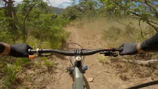
trail: Right Fork Hobble Creek
8:27 |
349 |
Jul 18, 2022 , Springville
youtuber
![The Ultimate 'Backyard' Trail | Riding The...]()

4:16 |
384 |
Sep 28, 2020 , Springville
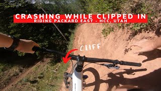
trail: Packard Cutoff
8:03 |
357 |
Sep 3, 2020 , Springville
youtuber
![The Perfect Trail For A Plus Bike | 29 Plus...]()

trail: Packard East
8:03 |
366 |
Sep 3, 2020 , Springville
youtuber
![How I've Learned To Handle Climbs On A MTB]()
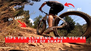
trail: Wardsworth Canyon Trail
7:38 |
468 |
Sep 3, 2020 , Springville

trail: Dry Creek Cutoff #1
8:13 |
490 |
Sep 3, 2020 , Springville
Recent Trail Reports
National Scenic Trails & Official Routes
-
Bonneville Shoreline Trail
- Mountain Bike
- E-Bike
- Horse
- Hike
- Trail Running
- Snowshoe
- Nordic Ski
-
Great Western Trail
- Mountain Bike
- E-Bike
- Horse
- Hike
- Trail Running
- Dirtbike/Moto
- ATV/ORV/OHV


Activity Feed
| username | action | type | title | date |
|---|---|---|---|---|
| piperksadler | wishlist | trail | activity #97276462 | Jun 18, 2026 @ 2:32pm Jun 18, 2026 |
| piperksadler | wishlist | trail | activity #97276443 | Jun 18, 2026 @ 2:32pm Jun 18, 2026 |
| jmack54 | wishlist | trail | activity #97199133 | Jun 17, 2026 @ 11:35am Jun 17, 2026 |
| MedstudentOutside | ridden | trail | activity #96622296 | Jun 9, 2026 @ 12:12pm Jun 9, 2026 |
| GREGORYl1bqmM | wishlist | trail | activity #95430949 | May 24, 2026 @ 11:37am May 24, 2026 |
Recent Comments
| username | type | title | comment | date |
|---|---|---|---|---|
| trail | Great trail just one of the wooden berms is... | Mar 13, 2026 @ 6:39pm Mar 13, 2026 | ||
| trail | Actually such a fun jump line with well built... | Mar 13, 2026 @ 6:38pm Mar 13, 2026 | ||
| trail | Steep uphill climb from the South side, and a... | Aug 26, 2024 @ 1:04pm Aug 26, 2024 | ||
| trail | Trail ran, beautiful trail, slightly overgrown... | Jun 16, 2024 @ 9:34pm Jun 16, 2024 | ||
| trail | Several mandatory creek crossings before the... | Oct 23, 2023 @ 4:09pm Oct 23, 2023 |
Local Badges
-

Epic Ride Climb 2k12 awarded -

Climbing 10k Badge20 awarded -

Climbing 100k Badge2 awarded -

Epic Ride Descent 2k12 awarded -

Descent 10k Badge21 awarded -

Descent 100k Badge2 awarded
Activity Type Stats
| activitytype | trails | distance | descent | descent distance | total vertical | rating | global rank | state rank | photos | reports | routes | ridelogs |
|---|---|---|---|---|---|---|---|---|---|---|---|---|
| Mountain Bike | 78 | 139 miles | 26,020 ft | 59 miles | 4,915 ft | #2,121 | #759 | 172 | 418 | 12 | 5,090 | |
| E-Bike | 47 | 86 miles | 15,912 ft | 41 miles | 4,915 ft | #2,070 | #931 | 4 | 352 | 4 | 328 | |
| Horse | 51 | 102 miles | 20,285 ft | 44 miles | 5,013 ft | #540 | #511 | 145 | 2 | |||
| Hike | 80 | 144 miles | 27,405 ft | 60 miles | 5,013 ft | #576 | #267 | 13 | 418 | 11 | 741 | |
| Trail Running | 80 | 144 miles | 27,533 ft | 60 miles | 5,013 ft | #550 | #212 | 8 | 418 | 12 | 714 | |
| Dirtbike/Moto | 24 | 75 miles | 15,318 ft | 36 miles | 4,134 ft | #535 | #180 | 6 | 124 | 2 | 174 | |
| ATV/ORV/OHV | 17 | 57 miles | 10,272 ft | 27 miles | 4,134 ft | #444 | #145 | 105 | 8 | |||
| Snowmobile | 7 | 22 miles | 5,112 ft | 14 miles | 4,134 ft | #248 | #120 | 4 | ||||
| Snowshoe | 11 | 21 miles | 5,531 ft | 13 miles | 3,307 ft | #834 | #386 | 3 | 7 | 5 | 13 | |
| Backcountry Ski | 1 | 6 miles | 869 ft | 3 miles | 1,299 ft | 3 | 27 | |||||
| Nordic Ski | 2 | 7 miles | 2,431 ft | 6 miles | 2,556 ft | 3 | 12 |
Frequently Asked Questions About Springville
▼
What are the best places to ride in Springville?
Springville has 2 areas to explore for mountain biking. The top rated areas are:
▼
What are the highest rated mountain biking trails in Springville?
The highest rated mountain biking trails in Springville are:
- Kirkman Hollow Trail (4.2/5)
- Rabbitbrush (4.1/5)
- Hobble Creek Parkway (4.1/5)
- Packard Cutoff (4.1/5)
- Kirkman Alternate (4/5)
▼
What is the best time of the year to ride in Springville?
Based on ride log data, the most popular months to ride in Springville are:
- July (38 activities)
- June (35 activities)
- September (32 activities)
▼
Where can I park to ride in Springville?
There are 14 parking locations listed in Springville. The most popular parking spots are:
- Hobble Creek Reservoir parking
- Parking
- Dry Canyon Trailhead
- Kirkman Hollow Trailhead Parking
- 2080 East BST access
Activities
Trails
Points of Interest
- By jed-campbell
 & contributors
 - Admins: jkwilliamz, UtahJohn, jpmcghee, jasonmalczyk, cdm10069232, URMB, UVTA
- #13983 - 8,202 views
- springville activity log | embed map of Springville mountain bike trails | springville mountain biking points of interest
Downloading of trail gps tracks in kml & gpx formats is enabled for Springville.
You must login to download files.