close
-
Layers w
- Weather Layers
- Pro
- Pro
- Pro
- Pro
- Pro
- Pro
- More Layers
- Pro
- Pro
- Pro
- Pro
-
Upgrade to

3D
Trail Conditions
- Unknown
- Snow Groomed
- Snow Packed
- Snow Covered
- Snow Cover Partial
- Freeze/thaw Cycle
- Icy
- Prevalent Mud
- Wet
- Variable
- Ideal
- Dry
- Very Dry
Trail Flow (Ridden Direction)
Trailforks scans users ridelogs to determine the most popular direction each trail is ridden. A good flowing trail network will have most trails flowing in a single direction according to their intension.
The colour categories are based on what percentage of riders are riding a trail in its intended direction.
The colour categories are based on what percentage of riders are riding a trail in its intended direction.
- > 96%
- > 90%
- > 80%
- > 70%
- > 50%
- < 50%
- bi-directional trail
- no data
Trail Last Ridden
Trailforks scans ridelogs to determine the last time a trail was ridden.
- < 2 days
- < 1 week
- < 2 weeks
- < 1 month
- < 6 months
- > 6 months
Trail Ridden Direction
The intended direction a trail should be ridden.
- Downhill Only
- Downhill Primary
- Both Directions
- Uphill Primary
- Uphill Only
- One Direction
Contribute Details
Colors indicate trail is missing specified detail.
- Description
- Photos
- Description & Photos
- Videos
Trail Popularity ?
Trailforks scans ridelogs to determine which trails are ridden the most in the last 9 months.
Trails are compared with nearby trails in the same city region with a possible 25 colour shades.
Think of this as a heatmap, more rides = more kinetic energy = warmer colors.
- most popular
- popular
- less popular
- not popular
ATV/ORV/OHV Filter
Max Vehicle Width
inches
US Cell Coverage
Legend

Radar Time
Activity Recordings
Trailforks uses anonymized public activity data.
?
Activity Recordings
Trailforks uses anonymized public activity data.
?
Personal Heatmap
▶
Activity Types
all
/
none
▶
Options
2
Date range
month
–
Winter Trails
Warning
A routing network for winter maps does not exist. Selecting trails using the winter trails layer has been disabled.
Missing Trails
Most Popular
Least Popular
Trails are colored based on popularity. The more popular a trail is, the more red. Less popular trails trend towards green.
Jump Magnitude Heatmap
Heatmap of where riders jump on trails. Zoom in to see individual jumps, click circles to view jump details.
BC Backroad Status
![map legend]()
Service Road Atlas is a free to use, community-driven service for viewing and creating reports on the numerous back-country service roads around B.C. and Alberta.

Slope Aspect
Direction the slope faces
Trails Deemphasized
Trails are shown in grey.
Only show trails with no bike usage.
Suggested Layers
Based on selected activity type
Save the current map location and zoom level as your default home location whenever this page is loaded.
SaveUphill access on the Thunder Mtn trail only. Bikes are not allowed on the Tram. Yield to hikers.
View region descriptions for other activity types
Generic
Welcome to Squaw Valley | Alpine Meadows. Info for Summer 2021 activities can be found at this link: http://https://www.squawalpine.com/high-camp-experience.Here's a few tips to make the most out of your day on the mountain.
- Wear sturdy shoes or hiking boots. Many of the mountain trails traverse rugged terrain.
- Squaw’s mountain environment is prone to sudden weather and temperature changes so please carry adequate clothing.
- Bring plenty of water (never drink directly from a stream) and a snack or energy bar.
- Always use sunscreen and wear a hat and sunglasses for protection from the high altitude sun.
- Please respect Squaw Valley’s beautiful natural environment by observing all signs and staying on designated trails and roads. Do not cut switchbacks. Stay out of any construction or roped off areas.
- In case of an emergency, dial 0 from a phone at the base of our lifts or have a Squaw Valley team member contact an EMT.
- Please stay off chairlifts and towers. During our summer maintenance, lifts may be started without warning.
- Lightning travels at the speed of light. If lightning is in the area, ALL Tram operations will be suspended until lightning clears.
- No smoking, please. The fire danger in this area is very high during the summer.
- Last tram down is at 4:30, pending weather.
Mountain Bike
Uphill access on the Thunder Mtn trail only. Bikes are not allowed on the Tram. Yield to hikers. E-Bike
Available as part of a 1.5 hour guided tour on the upper mountain. Intermediate to advanced, fireroad to singletrack. Book at Squaw Alpine.com and for further details. Hike
Hikers intending to catch the Tram down the mountain: Last ride down is at 4:30, pending weather (Summer 2021).Primary Trail Type: Cross-Country
Disclaimer:
No biking or hiking on the summer road system (excluding the Ridge Road to Squaw Peak or Emigrant Peak).
Links
Activities Click to view
- Mountain Bike
42 trails
- E-Bike
6 trails
- Horse
18 trails
- Hike
45 trails
- Trail Running
44 trails
Region Details
- 17
- 2
- 2
- 13
- 6
- 2
Region Status
Caution as of May 31, 2026Stats
- Avg Trail Rating
- Trails (view details)
- 46
- Trails Mountain Bike
- 42
- Trails E-Bike
- 6
- Trails Gravel Bike
- 14
- Trails Horse
- 18
- Trails Hike
- 45
- Trails Trail Running
- 44
- Trails Downhill Ski
- 1
- Total Distance
- 37 miles
- Total Descent
- 10,646 ft
- Total Vertical
- 2,697 ft
- Highest Trailhead
- 8,814 ft
- Reports
- 183
- Photos
- 20
- Ridden Counter
- 5,611
Popular Olympic Valley at Palisades Tahoe Summer Trails
• 100 ★ 5.0 • 2 miles • 10 ft • 587 •
Popular white difficulty paved path. This mountain bike primary trail can be used both directions and has a easy overall physical rating with a 10 ft green climb. On average it takes 10 minutes to complete this trail.
• 95 ★ 0.0 • 2,734 ft • 58 ft • 258 •
Popular white difficulty family friendly paved path. This mountain bike primary trail can be used both directions. On average it takes 2 minutes to complete this trail.
• 85 ★ 3.7 • 3,169 ft • 6 ft • 170 •
Popular blue difficulty singletrack. This multi-use trail can be used both directions. On average it takes 3 minutes to complete this trail.
• 85 ★ 4.0 • 4,639 ft • 114 ft • 121 •
Popular blue difficulty singletrack. This multi-use trail can be used both directions and has a moderate overall physical rating with a 114 ft blue climb. On average it takes 10 minutes to complete this trail.
• 65 ★ 0.0 • 1,460 ft • 49 ft • 95 •
Moderately popular blue difficulty singletrack. This multi-use trail can be used both directions. On average it takes 2 minutes to complete this trail.
• 75 ★ 3.4 • 3,038 ft • 182 ft • 85 •
Popular blue difficulty singletrack. This multi-use trail can be used both directions. On average it takes 13 minutes to complete this trail.
• 45 ★ 1.0 • 4,144 ft • 0 ft • 61 •
Use this trail to access the national historic and scenic designated Western States Trail, which stretches from Salt Lake City, Utah to Sacramento, California.
• 65 ★ 5.0 • 1,079 ft • 6 ft • 52 •
Moderately popular blue difficulty singletrack. This multi-use trail can be used both directions. On average it takes 1 minutes to complete this trail.
Mountain Bike Routes
★ 2.2 • 14 miles • 1,625 ft • 5 • Loop •
Climb Western States to the Tahoe Rim Trail and enjoy River and Lake views from Glass Mountain. Descend...
16 miles • 2,757 ft • 10 • Out & Back •
This out and back includes several of the best trails in the area as well as great views. Park at the...
★ 2.5 • 13 miles • 2,172 ft • 18 •
Up Painted Rock (Western States) to OTB with a decent on Deer Creek.
16 miles • 1,319 ft • 8 • Loop •
loop from parking lot squaw park along river trail to start dirt at lower rawhide. Back to river trail at...
Photos of Olympic Valley at Palisades Tahoe Summer Mountain Bike
Videos of Olympic Valley at Palisades Tahoe Summer Mountain Bike
5:36 |
54 |
Oct 1, 2025 , Olympic Valley

5:36 |
35 |
Oct 1, 2025 , Olympic Valley
Recent Trail Reports
Activity Feed
| username | action | type | title | date |
|---|---|---|---|---|
| christopherlewis90 | ridden | route | activity #97647091 | Jun 23, 2026 @ 12:52pm 9 hours |
| christopherlewis90 | wishlist | route | activity #97647075 | Jun 23, 2026 @ 12:52pm 9 hours |
| mkaslin | wishlist | region | activity #97488328 | Jun 21, 2026 @ 8:36am 3 days |
| haut2000 | wishlist | route | activity #96879354 | Jun 13, 2026 @ 8:16am Jun 13, 2026 |
| TurtleheadTim | wishlist | route | activity #94871016 | May 16, 2026 @ 8:16pm May 16, 2026 |
Recent Comments
| username | type | title | comment | date |
|---|---|---|---|---|
| trail | This trail was created by Andy Pertzborn... | Aug 4, 2025 @ 11:29am Aug 4, 2025 | ||
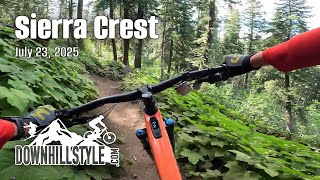
| trail | Nice warm up trail before Sierra Crest, loop... | Aug 2, 2024 @ 10:25pm Aug 2, 2024 | ||
| trail | This blue portion is smooth and running great... | Oct 11, 2023 @ 11:52am Oct 11, 2023 | ||
| trail | The first line of the description nails it... | Jul 31, 2023 @ 11:54pm Jul 31, 2023 | ||
| trail | Trail runs from the face of Exhibition around... | Jul 31, 2023 @ 11:41pm Jul 31, 2023 |
Nearby Areas
| name | distance | ||||
|---|---|---|---|---|---|
| Painted Rock | 7 | 4 | 2.8 km | ||
| Alpine Meadows Palisades Tahoe | 2 | 9 | 3 | 3.1 km | |
| Five Creeks | 4 | 1 | 3.6 km | ||
| Deer Creek | 1 | 5 | 3.9 km | ||
| Paige Meadows | 23 | 8 | 2 | 4.2 km |
Local Badges
-

Completionist0 awarded
Activity Type Stats
| activitytype | trails | distance | descent | descent distance | total vertical | rating | global rank | state rank | photos | reports | routes | ridelogs |
|---|---|---|---|---|---|---|---|---|---|---|---|---|
| Mountain Bike | 42 | 29 miles | 6,752 ft | 15 miles | 2,697 ft | #5,444 | #1,977 | 19 | 182 | 5 | 2,538 | |
| E-Bike | 6 | 3 miles | 925 ft | 2 miles | 1,732 ft | #8,075 | #2,472 | 141 | 215 | |||
| Gravel Bike | 14 | 10 miles | 1,470 ft | 5 miles | 2,697 ft | #5,406 | #2,348 | 52 | 2 | |||
| Horse | 18 | 19 miles | 5,236 ft | 10 miles | 2,385 ft | #1,478 | #753 | 119 | 2 | |||
| Hike | 45 | 37 miles | 10,430 ft | 21 miles | 2,697 ft | #5,047 | #1,827 | 181 | 1 | 925 | ||
| Trail Running | 44 | 37 miles | 10,381 ft | 21 miles | 2,697 ft | #4,004 | #1,128 | 181 | 2 | 860 | ||
| Downhill Ski | 1 | 1,102 ft | 213 ft | 1,043 ft | 213 ft | #714 | #303 | 4 | 167 |
Frequently Asked Questions About Olympic Valley at Palisades Tahoe Summer
▼
What are the highest rated mountain biking trails in Olympic Valley at Palisades Tahoe Summer?
The highest rated mountain biking trails in Olympic Valley at Palisades Tahoe Summer are:
- Sierra Crest Trail Road to Western States Trail connector (4.1/5)
- Olympic Valley Bike Path (4.1/5)
- Lower WST/Thunder Mountain Connector (4.1/5)
- Olympic Valley/Western States Trail Connection (4.1/5)
- Western States Trail (Snow King) (4/5)
▼
What is the best time of the year to ride in Olympic Valley at Palisades Tahoe Summer?
Based on ride log data, the most popular months to ride in Olympic Valley at Palisades Tahoe Summer are:
- June (66 activities)
- July (63 activities)
- October (42 activities)
▼
Where can I park to ride in Olympic Valley at Palisades Tahoe Summer?
Check the Olympic Valley at Palisades Tahoe Summer trail map for trailhead and parking information. Community members regularly update access and parking details for trails in the area.
▼
What is the longest trail in Olympic Valley at Palisades Tahoe Summer?
The longest trail in Olympic Valley at Palisades Tahoe Summer is Thunder Mountain Trail at 5.0 km. View all trails sorted by distance.
Activities
Trails
- Hard trails in Olympic Valley at Palisades Tahoe Summer
- Easy trails in Olympic Valley at Palisades Tahoe Summer
- Favorite trails in Olympic Valley at Palisades Tahoe Summer
- Most ridden trails in Olympic Valley at Palisades Tahoe Summer
- Singletrack in Olympic Valley at Palisades Tahoe Summer
- Race routes in Olympic Valley at Palisades Tahoe Summer
- By pedrodelmonte
 & contributors
 - Admins: Indorhino
- #20536 - 12,897 views
- olympic valley at palisades tahoe summer activity log | embed map of Olympic Valley at Palisades Tahoe Summer mountain bike trails | olympic valley at palisades tahoe summer mountain biking points of interest
Downloading of trail gps tracks in kml & gpx formats is enabled for Olympic Valley at Palisades Tahoe Summer.
You must login to download files.