close
-
Layers w
- Weather Layers
- Pro
- Pro
- Pro
- Pro
- Pro
- Pro
- More Layers
- Pro
- Pro
- Pro
- Pro
-
Upgrade to

3D
Trail Conditions
- Unknown
- Snow Groomed
- Snow Packed
- Snow Covered
- Snow Cover Partial
- Freeze/thaw Cycle
- Icy
- Prevalent Mud
- Wet
- Variable
- Ideal
- Dry
- Very Dry
Trail Flow (Ridden Direction)
Trailforks scans users ridelogs to determine the most popular direction each trail is ridden. A good flowing trail network will have most trails flowing in a single direction according to their intension.
The colour categories are based on what percentage of riders are riding a trail in its intended direction.
The colour categories are based on what percentage of riders are riding a trail in its intended direction.
- > 96%
- > 90%
- > 80%
- > 70%
- > 50%
- < 50%
- bi-directional trail
- no data
Trail Last Ridden
Trailforks scans ridelogs to determine the last time a trail was ridden.
- < 2 days
- < 1 week
- < 2 weeks
- < 1 month
- < 6 months
- > 6 months
Trail Ridden Direction
The intended direction a trail should be ridden.
- Downhill Only
- Downhill Primary
- Both Directions
- Uphill Primary
- Uphill Only
- One Direction
Contribute Details
Colors indicate trail is missing specified detail.
- Description
- Photos
- Description & Photos
- Videos
Trail Popularity ?
Trailforks scans ridelogs to determine which trails are ridden the most in the last 9 months.
Trails are compared with nearby trails in the same city region with a possible 25 colour shades.
Think of this as a heatmap, more rides = more kinetic energy = warmer colors.
- most popular
- popular
- less popular
- not popular
ATV/ORV/OHV Filter
Max Vehicle Width
inches
US Cell Coverage
Legend

Radar Time
Activity Recordings
Trailforks uses anonymized public activity data.
?
Activity Recordings
Trailforks uses anonymized public activity data.
?
Personal Heatmap
▶
Activity Types
all
/
none
▶
Options
2
Date range
month
–
Winter Trails
Warning
A routing network for winter maps does not exist. Selecting trails using the winter trails layer has been disabled.
Missing Trails
Most Popular
Least Popular
Trails are colored based on popularity. The more popular a trail is, the more red. Less popular trails trend towards green.
Jump Magnitude Heatmap
Heatmap of where riders jump on trails. Zoom in to see individual jumps, click circles to view jump details.
BC Backroad Status
![map legend]()
Service Road Atlas is a free to use, community-driven service for viewing and creating reports on the numerous back-country service roads around B.C. and Alberta.

Slope Aspect
Direction the slope faces
Trails Deemphasized
Trails are shown in grey.
Only show trails with no bike usage.
Suggested Layers
Based on selected activity type
Save the current map location and zoom level as your default home location whenever this page is loaded.
Save
No description for St Arnaud has been added yet!
Login or register to submit one.
AKA: Nelson Lakes
Activities Click to view
- Mountain Bike
31 trails
- E-Bike
5 trails
- Gravel Bike
0 trails
- Adaptive Bike
0 trails
- Winter Fat Bike
0 trails
- Hike
58 trails
- Trail Running
78 trails
Region Details
- 4
- 6
- 9
- 2
- 4
Region Status
Caution as of May 30, 2026Local Trail Association
Stats
- Avg Trail Rating
- Trails (view details)
- 38
- Trails Mountain Bike
- 31
- Trails E-Bike
- 5
- Trails Hike
- 78
- Trails Trail Running
- 78
- Total Distance
- 66 miles
- Total Descent
- 14,360 ft
- Total Vertical
- 2,807 ft
- Highest Trailhead
- 4,354 ft
- Reports
- 163
- Photos
- 210
- Ridden Counter
- 3,225
Sub Regions
-
Beebys Knob
- 1
- 4
- 3
-
Teetotal
- 4
- 4
- 1
- 1
Popular St Arnaud Mountain Biking Trails
• 100 ★ 4.4 • 2 miles • 753 ft • 321 •
This trail is by far the best, and most popular means of climbing to the top of the park. A nice, flowing descent too (and an easier option than the other tracks).
• 80 ★ 3.6 • 1 mile • 67 ft • 222 •
is an intermediate grade track, but quite a technical one as it twists and turns down through the beech forest from 850m to 600m.
• 85 ★ 4.2 • 1 mile • 44 ft • 188 •
Advanced Trail to enjoy after the big climb up Kaka, Awesome forest with rocks and roots
• 90 ★ 2.5 • 1 mile • 316 ft • 128 •
Popular green difficulty singletrack. This mountain bike primary trail can be used both directions and has a moderate overall physical rating with a 316 ft green climb. On average it takes 14 minutes to complete this trail.
• 75 ★ 4.0 • 4 miles • 1,992 ft • 104 •
Uphill access to . Mixture of farm 4WD track and machine groomed switchbacks. Track starts on 4WD road but often detours left and right of the road to make the gradient of the climb much nicer.
• 70 ★ 4.7 • 3 miles • 211 ft • 96 •
Tight twisty trail through stunted beech forest then very steep rooty 160 metre descent through mature red beech forest to a saddle. Short climb to another saddle then turn left at a marker post and sidle along a ridge 600 metres before...
• 85 ★ 0.0 • 3,160 ft • 40 ft • 90 •
Climbing and/or down hill trail trail which replaces old steep Big Bush exit. Easy switch backs connect top of to the forestry road below.
St Arnaud Mountain Bike Routes
★ 5.0 • 13 miles • 3,431 ft • 0 •
Overview The singletrack is a natural surface through sub-alpine native bush with many technical...
• 6 miles • 1,516 ft • 2 •
• 14 miles • 2,751 ft • 4 •
• 9 miles • 1,360 ft • 3 •
• 3 miles • 235 ft • 0 •
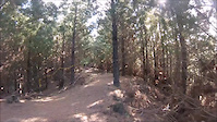
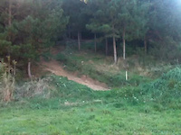
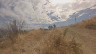
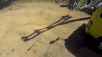
Photos of St Arnaud Mountain Bike
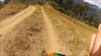
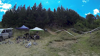
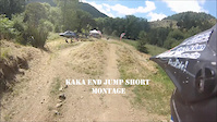
Videos of St Arnaud Mountain Bike
trail: Kaka (Up)
0:13 |
234 |
Aug 23, 2014
trail: Kaka (Up)
0:12 |
270 |
Apr 6, 2014
trail: Kaka (Up)
2:29 |
381 |
Mar 2, 2014
trail: Kaka (Up)
4:39 |
355 |
Feb 6, 2014
trail: Kaka (Up)
4:24 |
422 |
Feb 4, 2014
trail: Kaka (Up)
4:43 |
681 |
Feb 4, 2014

trail: Kaka (Up)
0:53 |
201 |
Jan 31, 2014
trail: Kaka (Up)
0:33 |
430 |
Dec 16, 2013
Recent Trail Reports
| status | trail | date | condition | info | user |
|---|---|---|---|---|---|
| Unhinged | May 29, 2026 @ 11:29am (Pacific/Auckland) May 28, 2026 | Ideal | jamgol | ||
| Missing Doc Link Track | May 29, 2026 @ 11:29am (Pacific/Auckland) May 28, 2026 | Dry | jamgol | ||
| Duck Down Track | Feb 12, 2026 @ 6:54am (Pacific/Auckland) Feb 11, 2026 | Ideal | Kmccarlie | ||
| Maitland Ridge | Jan 8, 2026 @ 2:30pm (Pacific/Auckland) Jan 7, 2026 | Ideal | drgmk | ||
| Wots Up DoC | Jan 7, 2026 @ 7:19pm (Pacific/Auckland) Jan 6, 2026 | Dry | drgmk | ||
| Kaka (Up) | Jan 6, 2026 @ 9:37pm (Pacific/Auckland) Jan 6, 2026 | Unknown | Richard1HF2QC | ||
| Louis Creek Track | Dec 28, 2025 @ 9:47pm (Pacific/Auckland) Dec 28, 2025 | Wet | deanhayton | ||
| Village Link | May 31, 2025 @ 10:23am May 31, 2025 | Ideal | jamgol | ||
| Sidewinder | May 31, 2025 @ 10:23am May 31, 2025 | Variable | jamgol | ||
| Robin Banks | May 31, 2025 @ 10:23am May 31, 2025 | Ideal | jamgol |
Activity Feed
| username | action | type | title | date |
|---|---|---|---|---|
| rustybalboa | comment | trail | activity #96068933 | Jun 2, 2026 @ 1:51am Jun 2, 2026 |
| rustybalboa | comment | trail | activity #96068782 and 2 more | Jun 2, 2026 @ 1:45am Jun 2, 2026 |
| jamgol | add | report | activity #95902545 and 2 more | May 30, 2026 @ 6:16pm May 30, 2026 |
| jamgol | add | report | activity #95755409 and 1 more | May 28, 2026 @ 9:04pm May 28, 2026 |
| mat3986 | wishlist | route | activity #93755656 | Apr 30, 2026 @ 9:05pm Apr 30, 2026 |
Recent Comments
| username | type | title | comment | date |
|---|---|---|---|---|
| trail | Good fun all round , great for ending your day... | Jun 2, 2026 @ 1:51am Jun 2, 2026 | ||
| trail | Tried it after a couple of days of rain , made... | Jun 2, 2026 @ 1:50am Jun 2, 2026 | ||
| trail | Great upclimb , well made and maintained. Bird... | Jun 2, 2026 @ 1:46am Jun 2, 2026 | ||
| trail | Good little warm up loop before you head on to... | Jun 2, 2026 @ 1:45am Jun 2, 2026 | ||
| trail | Love unhinged! I cut a fallen log off it a... | Jan 12, 2026 @ 2:13am Jan 12, 2026 |
Local Badges
-

Epic Ride Climb 2k43 awarded -

Climbing 10k Badge8 awarded -

Climbing 100k Badge0 awarded -

Epic Ride Descent 2k41 awarded -

Descent 10k Badge10 awarded -

Descent 100k Badge0 awarded
Activity Type Stats
| activitytype | trails | distance | descent | descent distance | total vertical | rating | global rank | state rank | photos | reports | routes | ridelogs |
|---|---|---|---|---|---|---|---|---|---|---|---|---|
| Mountain Bike | 31 | 46 miles | 13,156 ft | 23 miles | 2,808 ft | #2,649 | #46 | 210 | 162 | 2 | 1,447 | |
| E-Bike | 5 | 9 miles | 4,587 ft | 6 miles | 2,772 ft | #3,274 | #53 | 107 | 196 | |||
| Hike | 58 | 66 miles | 14,360 ft | 31 miles | 2,808 ft | #2,203 | #41 | 163 | 2 | 1,230 | ||
| Trail Running | 78 | 66 miles | 14,360 ft | 31 miles | 2,808 ft | #1,990 | #31 | 163 | 2 | 268 |
Frequently Asked Questions About St Arnaud
▼
What are the best places to ride in St Arnaud?
St Arnaud has 2 areas to explore for mountain biking. The top rated areas are:
▼
What are the highest rated mountain biking trails in St Arnaud?
The highest rated mountain biking trails in St Arnaud are:
- Unhinged (4.3/5)
- Kaka (Up) (4.2/5)
- Rotoiti Link (4.2/5)
- Duck Down Track (4.2/5)
- Maitland Ridge (4.2/5)
▼
What is the best time of the year to ride in St Arnaud?
Based on ride log data, the most popular months to ride in St Arnaud are:
- March (16 activities)
- January (15 activities)
- December (12 activities)
▼
Where can I park to ride in St Arnaud?
There are 7 parking locations listed in St Arnaud. The most popular parking spots are:
- Teetotal Carpark
- Kerr Bay Campsite Carpark
- West Bay Campsite Carpark
- Peninsula Nature Walk Carpark
- Red Hills Car Park
Activities
Trails
Points of Interest
- Lake Rotoiti Viewpoint
- Teetotal Campgroud (DoC) Camping
- Bird Sounds Board Other
- Angelus Hut Cabin
- Angelus Peak Summit
- Sunset Saddle Viewpoint
- Flagtop Summit
- Lees Creek Hut Cabin
- [playground] West Bay Campsite Carpark Playground Other
- West Bay Campsite Camping
- Mount Hopeless (2,213 m)
- Pinnacle (2,085 m)
- Maniniaro / Angelus Peak (2,062 m)
- By YogiNZ & contributors
- Admins: Alps2Ocean-Cycle-Trail, MTBTT
- #10576 - 13,127 views
- st arnaud activity log | embed map of St Arnaud mountain bike trails | st arnaud mountain biking points of interest
Downloading of trail gps tracks in kml & gpx formats is enabled for St Arnaud.
You must login to download files.