close
-
Layers w
- Weather Layers
- Pro
- Pro
- Pro
- Pro
- Pro
- Pro
- More Layers
- Pro
- Pro
- Pro
- Pro
-
Upgrade to

3D
Trail Conditions
- Unknown
- Snow Groomed
- Snow Packed
- Snow Covered
- Snow Cover Partial
- Freeze/thaw Cycle
- Icy
- Prevalent Mud
- Wet
- Variable
- Ideal
- Dry
- Very Dry
Trail Flow (Ridden Direction)
Trailforks scans users ridelogs to determine the most popular direction each trail is ridden. A good flowing trail network will have most trails flowing in a single direction according to their intension.
The colour categories are based on what percentage of riders are riding a trail in its intended direction.
The colour categories are based on what percentage of riders are riding a trail in its intended direction.
- > 96%
- > 90%
- > 80%
- > 70%
- > 50%
- < 50%
- bi-directional trail
- no data
Trail Last Ridden
Trailforks scans ridelogs to determine the last time a trail was ridden.
- < 2 days
- < 1 week
- < 2 weeks
- < 1 month
- < 6 months
- > 6 months
Trail Ridden Direction
The intended direction a trail should be ridden.
- Downhill Only
- Downhill Primary
- Both Directions
- Uphill Primary
- Uphill Only
- One Direction
Contribute Details
Colors indicate trail is missing specified detail.
- Description
- Photos
- Description & Photos
- Videos
Trail Popularity ?
Trailforks scans ridelogs to determine which trails are ridden the most in the last 9 months.
Trails are compared with nearby trails in the same city region with a possible 25 colour shades.
Think of this as a heatmap, more rides = more kinetic energy = warmer colors.
- most popular
- popular
- less popular
- not popular
ATV/ORV/OHV Filter
Max Vehicle Width
inches
US Cell Coverage
Legend

Radar Time
Activity Recordings
Trailforks uses anonymized public activity data.
?
Activity Recordings
Trailforks uses anonymized public activity data.
?
Personal Heatmap
▶
Activity Types
all
/
none
▶
Options
2
Date range
month
–
Winter Trails
Warning
A routing network for winter maps does not exist. Selecting trails using the winter trails layer has been disabled.
Missing Trails
Most Popular
Least Popular
Trails are colored based on popularity. The more popular a trail is, the more red. Less popular trails trend towards green.
Jump Magnitude Heatmap
Heatmap of where riders jump on trails. Zoom in to see individual jumps, click circles to view jump details.
BC Backroad Status
![map legend]()
Service Road Atlas is a free to use, community-driven service for viewing and creating reports on the numerous back-country service roads around B.C. and Alberta.

Slope Aspect
Direction the slope faces
Trails Deemphasized
Trails are shown in grey.
Only show trails with no bike usage.
Suggested Layers
Based on selected activity type
Save the current map location and zoom level as your default home location whenever this page is loaded.
Save
No description for St. Augustine has been added yet!
Login or register to submit one.
Activities Click to view
- Mountain Bike
38 trails
- Gravel Bike
14 trails
- Adaptive Bike
0 trails
- Winter Fat Bike
0 trails
- Horse
31 trails
- Hike
45 trails
- Trail Running
45 trails
Region Details
- 11
- 9
- 4
Region Status
Caution as of May 31, 2026Stats
- Avg Trail Rating
- Trails (view details)
- 31
- Trails Mountain Bike
- 38
- Trails Gravel Bike
- 14
- Trails Horse
- 31
- Trails Hike
- 45
- Trails Trail Running
- 45
- Total Distance
- 48 miles
- Total Descent
- 121 ft
- Total Vertical
- 26 ft
- Highest Trailhead
- 27 ft
- Reports
- 265
- Photos
- 75
- Ridden Counter
- 1,274
Sub Regions
-
Anastasia State Park
- 1
-
GTM Research Reserve
- 5
-
Guana River Wildlife Management Area
- 2
- 1
-
Moses Creek
- 1
-
Nocatee Preserve
- 3
Popular St. Augustine Mountain Biking Trails
• 100 ★ 3.5 • 5 miles • 62 ft • 199 •
The trail has large sections with palm roots and some tight switchbacks which tend to slow the flow down on the first half of the trail. There are also some bridges and technical features. The second half of the trail has somewhat of a...
• 60 ★ 2.8 • 2 miles • 0 ft • 125 •
a fun trail with lots of twists & turns, hardly any elevation gain, scattered about are wood features and some natural features
• 80 ★ 3.4 • 4,825 ft • 0 ft • 110 •
Nice singletrack that follows the greenway dirt road and provides a nice loop back option.
• 75 ★ 0.0 • 2 miles • 10 ft • 44 •
Popular green difficulty singletrack. This multi-use trail can be used both directions. On average it takes 13 minutes to complete this trail.
• 85 ★ 0.0 • 3 miles • 5 ft • 40 •
Popular green difficulty singletrack. This multi-use trail can be used both directions. On average it takes 11 minutes to complete this trail.
• 70 ★ 3.0 • 1 mile • 3 ft • 30 •
Popular blue difficulty singletrack. This mountain bike primary trail can be used both directions and has a easy overall physical rating with a 3 ft green climb. On average it takes 14 minutes to complete this trail.
• 55 ★ 0.0 • 2,283 ft • 0 ft • 26 •
Moderately popular green difficulty singletrack. This multi-use trail can be used both directions. On average it takes 3 minutes to complete this trail.
• 50 ★ 0.0 • 1,886 ft • 0 ft • 12 •
Moderately popular green difficulty singletrack. This multi-use trail can be used both directions. On average it takes 3 minutes to complete this trail.
St. Augustine Mountain Bike Routes
★ 3.0 • 5 miles • 2 ft • 0 •
located in the Nocatee Greenway.. park at the end of Davis Park rd, past the Ponte Vedra high school.
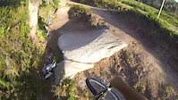
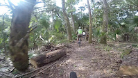
Photos of St. Augustine Mountain Bike


Recent Trail Reports
| status | trail | date | condition | info | user |
|---|---|---|---|---|---|
| West | May 31, 2026 @ 3:27pm (America/New_York) May 31, 2026 | Ideal | mkav | ||
| Moses Creek Trail | May 22, 2026 @ 5:17pm (America/New_York) May 22, 2026 | Ideal | falcon013 | ||
| Wright Road Loop | May 20, 2026 @ 9:13am (America/Nassau) May 20, 2026 | Wet | Orangecycle1 | ||
| Savannah Loop | May 20, 2026 @ 9:13am (America/Nassau) May 20, 2026 | Dry | Orangecycle1 | ||
| Blue Trail | May 20, 2026 @ 9:13am (America/Nassau) May 20, 2026 | Ideal | Orangecycle1 | ||
| Yellow Track | May 20, 2026 @ 9:13am (America/Nassau) May 20, 2026 | Dry | Orangecycle1 | ||
| Red South Spur | May 20, 2026 @ 9:13am (America/Nassau) May 20, 2026 | Dry | Orangecycle1 | ||
| Red Trail | May 20, 2026 @ 9:13am (America/Nassau) May 20, 2026 | Ideal | Orangecycle1 | ||
| Purple Trail | May 20, 2026 @ 9:13am (America/Nassau) May 20, 2026 | Ideal | Orangecycle1 | ||
| Wright Road | May 20, 2026 @ 9:13am (America/Nassau) May 20, 2026 | Dry | Orangecycle1 |
Activity Feed
| username | action | type | title | date |
|---|---|---|---|---|
| mkav | checkin | trail | activity #97397908 | Jun 20, 2026 @ 8:22am 2 days |
| mkav | difficultyvote | trail | activity #97397831 | Jun 20, 2026 @ 8:21am 2 days |
| mkav | comment | trail | activity #96510990 | Jun 7, 2026 @ 5:37pm Jun 7, 2026 |
| mkav | checkin | trail | activity #96510869 | Jun 7, 2026 @ 5:35pm Jun 7, 2026 |
| mkav | wishlist | trail | activity #96185142 | Jun 3, 2026 @ 3:41pm Jun 3, 2026 |
Recent Comments
| username | type | title | comment | date |
|---|---|---|---|---|
| trail | Trail has been 2/3 cleared and raked. New... | Jun 7, 2026 @ 5:37pm Jun 7, 2026 | ||
| report | New trail boss has been keeping trail clear. ... | May 19, 2026 @ 5:22pm May 19, 2026 | ||
| trail | The backside had a few water pools on it. | Sep 15, 2025 @ 8:24am Sep 15, 2025 | ||
| trail | Trail is in great condition. There is just one... | Jan 8, 2025 @ 3:39pm Jan 8, 2025 | ||
| trail | Rode today, 9/9/2024/. Trail needs a fair... | Sep 9, 2024 @ 12:27pm Sep 9, 2024 |
Local Badges
-

Epic Mountain Bike Climb 2k0 awarded -

Climbing 10k Badge0 awarded -

Mountain Biking 100k Badge0 awarded -

Epic Ride Descent 2k0 awarded -

Descent 10k Badge0 awarded -

Descent 100k Badge0 awarded
Activity Type Stats
| activitytype | trails | distance | descent | descent distance | total vertical | rating | global rank | state rank | photos | reports | routes | ridelogs |
|---|---|---|---|---|---|---|---|---|---|---|---|---|
| Mountain Bike | 38 | 47 miles | 121 ft | 3 miles | 26 ft | #5,769 | #1,947 | 74 | 265 | 1 | 6,176 | |
| Gravel Bike | 14 | #521 | #1,078 | 2 | 234 | |||||||
| Horse | 31 | 31 miles | 33 ft | 2 miles | 13 ft | #1,592 | #925 | 101 | 1 | |||
| Hike | 45 | 48 miles | 121 ft | 3 miles | 26 ft | #4,883 | #1,727 | 1 | 263 | 1 | 184 | |
| Trail Running | 45 | 48 miles | 121 ft | 3 miles | 26 ft | #4,619 | #1,427 | 263 | 1 | 230 |
Frequently Asked Questions About St. Augustine
▼
What are the best places to ride in St. Augustine?
St. Augustine has 5 areas to explore for mountain biking. The top rated areas are:
▼
What are the highest rated mountain biking trails in St. Augustine?
The highest rated mountain biking trails in St. Augustine are:
- Scrub Loop (4/5)
- South (3.8/5)
- West (3.8/5)
- Moses Creek Trail (3.7/5)
- East (3.5/5)
▼
What is the best time of the year to ride in St. Augustine?
Based on ride log data, the most popular months to ride in St. Augustine are:
- February (29 activities)
- July (28 activities)
- December (27 activities)
▼
Where can I park to ride in St. Augustine?
There are 5 parking locations listed in St. Augustine. The most popular parking spots are: View all parking and trailhead locations on the map to plan your visit.
Activities
Trails
Points of Interest
- By pinnityafairy & contributors
- Admins: FASTR
- #6257 - 8,358 views
- st. augustine activity log | embed map of St. Augustine mountain bike trails | st. augustine mountain biking points of interest
Downloading of trail gps tracks in kml & gpx formats is enabled for St. Augustine.
You must login to download files.