close
-
Layers w
- Weather Layers
- Pro
- Pro
- Pro
- Pro
- Pro
- Pro
- More Layers
- Pro
- Pro
- Pro
- Pro
-
Upgrade to

3D
Trail Conditions
- Unknown
- Snow Groomed
- Snow Packed
- Snow Covered
- Snow Cover Partial
- Freeze/thaw Cycle
- Icy
- Prevalent Mud
- Wet
- Variable
- Ideal
- Dry
- Very Dry
Trail Flow (Ridden Direction)
Trailforks scans users ridelogs to determine the most popular direction each trail is ridden. A good flowing trail network will have most trails flowing in a single direction according to their intension.
The colour categories are based on what percentage of riders are riding a trail in its intended direction.
The colour categories are based on what percentage of riders are riding a trail in its intended direction.
- > 96%
- > 90%
- > 80%
- > 70%
- > 50%
- < 50%
- bi-directional trail
- no data
Trail Last Ridden
Trailforks scans ridelogs to determine the last time a trail was ridden.
- < 2 days
- < 1 week
- < 2 weeks
- < 1 month
- < 6 months
- > 6 months
Trail Ridden Direction
The intended direction a trail should be ridden.
- Downhill Only
- Downhill Primary
- Both Directions
- Uphill Primary
- Uphill Only
- One Direction
Contribute Details
Colors indicate trail is missing specified detail.
- Description
- Photos
- Description & Photos
- Videos
Trail Popularity ?
Trailforks scans ridelogs to determine which trails are ridden the most in the last 9 months.
Trails are compared with nearby trails in the same city region with a possible 25 colour shades.
Think of this as a heatmap, more rides = more kinetic energy = warmer colors.
- most popular
- popular
- less popular
- not popular
ATV/ORV/OHV Filter
Max Vehicle Width
inches
US Cell Coverage
Legend

Radar Time
Activity Recordings
Trailforks uses anonymized public activity data.
?
Activity Recordings
Trailforks uses anonymized public activity data.
?
Personal Heatmap
▶
Activity Types
all
/
none
▶
Options
2
Date range
month
–
Winter Trails
Warning
A routing network for winter maps does not exist. Selecting trails using the winter trails layer has been disabled.
Missing Trails
Most Popular
Least Popular
Trails are colored based on popularity. The more popular a trail is, the more red. Less popular trails trend towards green.
Jump Magnitude Heatmap
Heatmap of where riders jump on trails. Zoom in to see individual jumps, click circles to view jump details.
BC Backroad Status
![map legend]()
Service Road Atlas is a free to use, community-driven service for viewing and creating reports on the numerous back-country service roads around B.C. and Alberta.

Slope Aspect
Direction the slope faces
Trails Deemphasized
Trails are shown in grey.
Only show trails with no bike usage.
Suggested Layers
Based on selected activity type
Save the current map location and zoom level as your default home location whenever this page is loaded.
Save
No description for St. Charles has been added yet!
Login or register to submit one.
Primary Trail Type: Cross-Country
Activities Click to view
- Mountain Bike
82 trails
- E-Bike
26 trails
- Gravel Bike
0 trails
- Adaptive Bike
0 trails
- Horse
7 trails
- Hike
81 trails
- Trail Running
81 trails
Region Details
- 3
- 16
- 22
- 25
- 6
Region Status
Open as of Jun 14, 2026Stats
- Avg Trail Rating
- Trails (view details)
- 76
- Trails Mountain Bike
- 82
- Trails E-Bike
- 26
- Trails Horse
- 7
- Trails Hike
- 81
- Trails Trail Running
- 81
- Total Distance
- 130 miles
- Total Descent
- 9,221 ft
- Total Vertical
- 348 ft
- Highest Trailhead
- 770 ft
- Reports
- 735
- Photos
- 129
- Ridden Counter
- 9,675
Sub Regions
-
370 Lakeside Park
- 4
-
Bangert Island
- 4
-
Broemmelsiek Park
- 2
-
Indian Camp Creek Park
- 3
- 2
-
Klondike Park
- 1
- 2
- 6
- 3
-
Lost Valley
- 6
- 1
- 3
-
Matson Hill Park
- 5
- 6
- 4
-
Quail Ridge Park
- 4
- 5
Popular St. Charles Mountain Biking Trails
• 100 ★ 4.6 • 11 miles • 615 ft • 479 •
Highly rated popular blue difficulty singletrack. This mountain bike primary trail can be used both directions and has a moderate overall physical rating with a 615 ft blue climb. On average it takes 1 hour10 minutes to complete this trail.
• 65 ★ 4.4 • 3 miles • 303 ft • 340 •
Highly rated moderately popular blue difficulty singletrack. This mountain bike primary trail can be used both directions and has a hard overall physical rating with a 303 ft blue climb. It features berm and rock garden. Trail visibility is always easy to follow. On average it takes 17 minutes to complete this trail.
• 100 ★ 3.0 • 1,227 ft • 17 ft • 293 •
Popular blue difficulty singletrack. This mountain bike primary trail can be used both directions and has a hard overall physical rating with a 17 ft blue climb. On average it takes minutes to complete this trail.
• 85 ★ 4.8 • 2 miles • 288 ft • 293 •
Highly rated popular blue difficulty singletrack. This mountain bike primary trail can be used both directions and has a moderate overall physical rating with a 288 ft blue climb. It features berm and drop. Trail visibility is always easy to follow. On average it takes 15 minutes to complete this trail.
• 75 ★ 3.0 • 1 mile • 217 ft • 274 •
Popular white difficulty doubletrack. This multi-use trail can be used both directions and has a moderate overall physical rating with a 217 ft blue climb. Trail visibility is always easy to follow. On average it takes 9 minutes to complete this trail.
• 70 ★ 4.0 • 2 miles • 169 ft • 272 •
Highly rated popular blue difficulty singletrack. This mountain bike primary trail can be used both directions and has a hard overall physical rating with a 169 ft blue climb. On average it takes 12 minutes to complete this trail.
• 70 ★ 0.0 • 10 miles • 531 ft • 249 •
The Katy Trail is a 240 mile rail trail stretching across most of Missouri. In the St. Louis area it also serves as a link to several off-road trails near it which may be combined using the Katy into a multi-trail ride. Trails adjacent...
• 85 ★ 5.0 • 5 miles • 568 ft • 212 •
Popular blue difficulty singletrack. This mountain bike primary trail can be used both directions and has a moderate overall physical rating with a 568 ft blue climb. On average it takes 42 minutes to complete this trail.
St. Charles Mountain Bike Routes
★ 4.0 • 50 miles • 2,969 ft • 12 • Out & Back •
Also known as the St. Charles County Epic, this ride uses the Katy and s to access 3 popular area trail...
★ 1.0 • 20 miles • 1,625 ft • 3 • Out & Back •
Out and back on from the Mound. Max singletrack with probably minimum doubletrack.
8 miles • 783 ft • 4 • Loop •
Race Loop for the Matson Hill Mauler, June 11, 2023
9 miles • 594 ft • 3 •
Stages 5-7 for St Gnarles 2023.
37 miles • 1,221 ft • 0 • Loop •
Great ride from the mound. Several good hills. Includes time on KATY trail
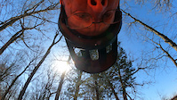
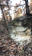
Photos of St. Charles Mountain Bike
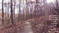
Videos of St. Charles Mountain Bike
trail: Jack's Loop
20:55 |
45 |
Mar 12, 2024
trail: Donkey Kong
0:10 |
266 |
Dec 13, 2021

trail: Slough Loop
3:47 |
49 |
Oct 29, 2021

trail: Slough Loop
3:47 |
38 |
Oct 20, 2021

trail: Matson Hill Loop
6:28 |
40 |
Sep 21, 2021
0:16 |
|
Sep 14, 2021
0:38 |
|
Sep 14, 2021
trail: Hays Trail
0:22 |
305 |
Nov 20, 2016
Current Trail Warnings
| status | trail | date | condition | user | info |
|---|---|---|---|---|---|
| Judgement Tree | Jun 7, 2026 @ 8:08am (America/Indiana/Vincennes) Jun 7, 2026 | Variable | foysr |
Recent Trail Reports
Activity Feed
| username | action | type | title | date |
|---|---|---|---|---|
| BWalker119 | add | report | activity #97003676 and 1 more | Jun 14, 2026 @ 2:10pm Jun 14, 2026 |
| Toddv5ZDxw | comment | trail | activity #96805527 | Jun 12, 2026 @ 8:15am Jun 12, 2026 |
| Toddv5ZDxw | ridden | trail | activity #96805063 | Jun 12, 2026 @ 8:08am Jun 12, 2026 |
| foysr | add | report | activity #96477069 and 6 more | Jun 7, 2026 @ 10:36am Jun 7, 2026 |
| bsquared59 | ridden | route | activity #96332536 | Jun 5, 2026 @ 5:30pm Jun 5, 2026 |
Recent Comments
| username | type | title | comment | date |
|---|---|---|---|---|
| trail | Rode CW. Fairly challenging trail with several... | Jun 12, 2026 @ 8:15am Jun 12, 2026 | ||
| trail | Don’t kill yourself trying to pedal up this... | Oct 18, 2025 @ 12:07pm Oct 18, 2025 | ||
| trail | Was a great ride yesterday. One tree down... | Jul 27, 2025 @ 11:39am Jul 27, 2025 | ||
| trail | Trail is open to mountain bikes. | Jul 27, 2024 @ 11:17am Jul 27, 2024 | ||
| trail | The parks department closes this trail to... | Jul 3, 2024 @ 2:39pm Jul 3, 2024 |
Local Badges
-

10 Green Trails104 awarded -

Epic Ride Climb 2k19 awarded -

Climbing 10k Badge104 awarded -

Climbing 100k Badge9 awarded -

Epic Ride Descent 2k20 awarded -

Descent 10k Badge104 awarded
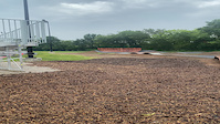
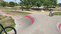
Bike & Skill Parks
| name | type | city | rating |
|---|---|---|---|
| Kinetic Park | skill park | St. Charles |
Activity Type Stats
| activitytype | trails | distance | descent | descent distance | total vertical | rating | global rank | state rank | photos | reports | routes | ridelogs |
|---|---|---|---|---|---|---|---|---|---|---|---|---|
| Mountain Bike | 82 | 121 miles | 8,127 ft | 48 miles | 348 ft | #1,126 | #435 | 120 | 733 | 8 | 27,291 | |
| E-Bike | 26 | 8 miles | 1,250 ft | 4 miles | 269 ft | #4,705 | #1,503 | 592 | 5 | 880 | ||
| Horse | 7 | 12 miles | 620 ft | 3 miles | 279 ft | #1,933 | #1,084 | 113 | ||||
| Hike | 81 | 129 miles | 8,530 ft | 50 miles | 348 ft | #1,866 | #813 | 3 | 730 | 1,212 | ||
| Trail Running | 81 | 128 miles | 8,530 ft | 50 miles | 335 ft | #1,446 | #515 | 4 | 730 | 706 |
Frequently Asked Questions About St. Charles
▼
What are the best places to ride in St. Charles?
St. Charles has 8 areas to explore for mountain biking. The top rated areas are:
▼
What are the highest rated mountain biking trails in St. Charles?
The highest rated mountain biking trails in St. Charles are:
- Hays Trail (4.5/5)
- Lost Valley Trail (4.3/5)
- Boone's Burl (4.3/5)
- Strip Mine (4.3/5)
- Matson Hill Loop (4.3/5)
▼
What is the best time of the year to ride in St. Charles?
Based on ride log data, the most popular months to ride in St. Charles are:
- July (220 activities)
- June (188 activities)
- August (162 activities)
▼
Where can I park to ride in St. Charles?
There are 23 parking locations listed in St. Charles. The most popular parking spots are:
- Weldon Spring Trailhead
- Busch Greenway Trailhead
- Parking
- Matson Hill Park Trailhead Parking
- Mound Parking
Activities
Trails
- By pilznr
 GORC & contributors
 - Admins: GORC
- #10236 - 24,095 views
- st. charles activity log | embed map of St. Charles mountain bike trails | st. charles mountain biking points of interest
Downloading of trail gps tracks in kml & gpx formats is enabled for St. Charles.
You must login to download files.