close
-
Layers w
- Weather Layers
- Pro
- Pro
- Pro
- Pro
- Pro
- Pro
- More Layers
- Pro
- Pro
- Pro
- Pro
-
Upgrade to

3D
Trail Conditions
- Unknown
- Snow Groomed
- Snow Packed
- Snow Covered
- Snow Cover Partial
- Freeze/thaw Cycle
- Icy
- Prevalent Mud
- Wet
- Variable
- Ideal
- Dry
- Very Dry
Trail Flow (Ridden Direction)
Trailforks scans users ridelogs to determine the most popular direction each trail is ridden. A good flowing trail network will have most trails flowing in a single direction according to their intension.
The colour categories are based on what percentage of riders are riding a trail in its intended direction.
The colour categories are based on what percentage of riders are riding a trail in its intended direction.
- > 96%
- > 90%
- > 80%
- > 70%
- > 50%
- < 50%
- bi-directional trail
- no data
Trail Last Ridden
Trailforks scans ridelogs to determine the last time a trail was ridden.
- < 2 days
- < 1 week
- < 2 weeks
- < 1 month
- < 6 months
- > 6 months
Trail Ridden Direction
The intended direction a trail should be ridden.
- Downhill Only
- Downhill Primary
- Both Directions
- Uphill Primary
- Uphill Only
- One Direction
Contribute Details
Colors indicate trail is missing specified detail.
- Description
- Photos
- Description & Photos
- Videos
Trail Popularity ?
Trailforks scans ridelogs to determine which trails are ridden the most in the last 9 months.
Trails are compared with nearby trails in the same city region with a possible 25 colour shades.
Think of this as a heatmap, more rides = more kinetic energy = warmer colors.
- most popular
- popular
- less popular
- not popular
ATV/ORV/OHV Filter
Max Vehicle Width
inches
US Cell Coverage
Legend

Radar Time
Activity Recordings
Trailforks uses anonymized public activity data.
?
Activity Recordings
Trailforks uses anonymized public activity data.
?
Personal Heatmap
▶
Activity Types
all
/
none
▶
Options
2
Date range
month
–
Winter Trails
Warning
A routing network for winter maps does not exist. Selecting trails using the winter trails layer has been disabled.
Missing Trails
Most Popular
Least Popular
Trails are colored based on popularity. The more popular a trail is, the more red. Less popular trails trend towards green.
Jump Magnitude Heatmap
Heatmap of where riders jump on trails. Zoom in to see individual jumps, click circles to view jump details.
BC Backroad Status
![map legend]()
Service Road Atlas is a free to use, community-driven service for viewing and creating reports on the numerous back-country service roads around B.C. and Alberta.

Slope Aspect
Direction the slope faces
Trails Deemphasized
Trails are shown in grey.
Only show trails with no bike usage.
Suggested Layers
Based on selected activity type
Save the current map location and zoom level as your default home location whenever this page is loaded.
Save
No description for St. Gallen has been added yet!
Login or register to submit one.
Links
This region uses the Uk/Euro style trail grading system.
Activities Click to view
- Mountain Bike
83 trails
- E-Bike
82 trails
- Hike
71 trails
- Trail Running
72 trails
Region Details
- 21
- 15
- 43
- 2
Region Status
Open as of Sep 6, 2025Local Trail Association
Stats
- Avg Trail Rating
- Trails (view details)
- 81
- Trails Mountain Bike
- 83
- Trails E-Bike
- 82
- Trails Hike
- 71
- Trails Trail Running
- 72
- Total Distance
- 18 miles
- Total Descent Distance
- 11 miles
- Total Descent
- 6,775 ft
- Total Vertical
- 1,672 ft
- Highest Trailhead
- 3,539 ft
- Reports
- 123
- Photos
- 7
- Ridden Counter
- 1,651
Popular St. Gallen Mountain Biking Trails
• 100 ★ 4.0 • 2,277 ft • 37 ft • 105 •
Popular blue difficulty singletrack. This mountain bike primary trail can be used downhill primary with a 37 ft blue climb. On average it takes 5 minutes to complete this trail.
• 100 ★ 5.0 • 1,427 ft • 0 ft • 46 •
Der erneuerte bzw. erweiterte Waldeggtrail wurde am Sonntag, 6. Oktober 2024 offiziell eröffnet.
• 80 ★ 0.0 • 430 ft • 0 ft • 45 •
Popular green difficulty singletrack. This mountain bike primary trail can be used downhill primary. It features jump. On average it takes minutes to complete this trail.
• 85 ★ 5.0 • 594 ft • 0 ft • 40 •
Popular blue difficulty singletrack. This mountain bike primary trail. It features berm, jump and gap jump. Trail visibility is always easy to follow. On average it takes 2 minutes to complete this trail.
• 65 ★ 5.0 • 3,340 ft • 31 ft • 39 •
Moderately popular blue difficulty singletrack. This mountain bike primary trail can be used downhill primary. It features ladder bridge.
• 95 ★ 5.0 • 1,322 ft • 0 ft • 35 •
Popular blue difficulty singletrack. This mountain bike primary trail can be used downhill primary. On average it takes 1 minutes to complete this trail.
• 70 ★ 5.0 • 715 ft • 0 ft • 34 •
Popular blue difficulty singletrack. This mountain bike primary trail can be used one direction. On average it takes 1 hour21 minutes to complete this trail.
St. Gallen Mountain Bike Routes
10 miles • 1,703 ft • 0 • Loop •
Der Anstieg auf die Waldegg ist abwechslungsreich. Den grössten Teil befindet man sich auf Kieswegen. Zu...
Videos of St. Gallen Mountain Bike
youtuber
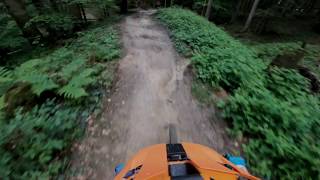
![Good for practising jumps - Waldegg Trail]()

trail: Waldegg Trail Section 02
8:24 |
280 |
Dec 30, 2023 , St. Gallen
youtuber
![Good for practising jumps - Waldegg Trail]()

trail: Waldegg Trail Section 01
8:24 |
364 |
Dec 30, 2023 , St. Gallen
trail: Waldegg Trail Section 01
4:16 |
2894 |
Jun 10, 2020 , St. Gallen
Recent Trail Reports
| status | trail | date | condition | info | user |
|---|---|---|---|---|---|
| Unterer Brand - Appenzellerbahn | Sep 6, 2025 @ 5:40am Sep 6, 2025 | Variable | VTTJ | ||
| Waldeggtrail Sektor J | Jun 14, 2025 @ 10:38am Jun 14, 2025 | Ideal | photonikus BTOS | ||
| Waldegg Trail Section 02 | Jun 14, 2025 @ 10:38am Jun 14, 2025 | Ideal | photonikus BTOS | ||
| Waldegg Trail Section 01 | Jun 14, 2025 @ 10:38am Jun 14, 2025 | Ideal | photonikus BTOS | ||
| Connector | May 8, 2025 @ 6:59pm May 8, 2025 | Ideal | Tombone7 | ||
| Hagenbuchwald Trail | May 8, 2025 @ 6:59pm May 8, 2025 | Ideal | Tombone7 | ||
| Wiesenweidstrasse | May 8, 2025 @ 6:59pm May 8, 2025 | Ideal | Tombone7 | ||
| Berneggwaldweg | May 8, 2025 @ 6:59pm May 8, 2025 | Ideal | Tombone7 | ||
| Berneggweg | May 8, 2025 @ 6:59pm May 8, 2025 | Ideal | Tombone7 | ||
| Connector | Apr 14, 2025 @ 6:35pm Apr 14, 2025 | Ideal | photonikus BTOS |
Activity Feed
| username | action | type | title | date |
|---|---|---|---|---|
| openminded | ridden | trail | activity #97341208 | Jun 19, 2026 @ 1:28pm Jun 19, 2026 |
| parrot96 | wishlist | route | activity #96722315 | Jun 11, 2026 @ 12:36am Jun 11, 2026 |
| PascalfVCO5d | wishlist | trail | activity #95921492 | May 31, 2026 @ 3:26am May 31, 2026 |
| PascalfVCO5d | wishlist | trail | activity #95472258 | May 25, 2026 @ 2:10am May 25, 2026 |
| Trunzito | comment | report | activity #93596875 | Apr 28, 2026 @ 11:55am Apr 28, 2026 |
Recent Comments
| username | type | title | comment | date |
|---|---|---|---|---|
| report | Outdated. Open. Enjoy! | Apr 28, 2026 @ 11:55am Apr 28, 2026 | ||
| trail | It's completely closed by vegetation | Aug 3, 2025 @ 10:19am Aug 3, 2025 | ||
| trail | Video youtube: fC4C1cQx4QQ | Jul 10, 2022 @ 1:19am Jul 10, 2022 | ||
| trail | Another well named trail in the region.... | May 15, 2021 @ 8:49am May 15, 2021 | ||
| trail | Well named. Plenty of mud. Lots of options and... | May 15, 2021 @ 8:48am May 15, 2021 |
Local Badges
-

Epic Mountain Bike Climb 2k17 awarded -

Climbing 10k Badge24 awarded -

Mountain Biking 100k Badge1 awarded -

Epic Ride Descent 2k17 awarded -

Descent 10k Badge25 awarded -

Descent 100k Badge1 awarded
Local Trail Supporters
- https://www.waldeggtrail.ch/sponsoren/
- Ortsbürgergemeinde St.Gallen
- Stadt St.Gallen
Activity Type Stats
| activitytype | trails | distance | descent | descent distance | total vertical | rating | global rank | state rank | photos | reports | routes | ridelogs |
|---|---|---|---|---|---|---|---|---|---|---|---|---|
| Mountain Bike | 83 | 18 miles | 6,775 ft | 11 miles | 1,673 ft | #4,459 | #90 | 6 | 123 | 1 | 4,663 | |
| E-Bike | 82 | 18 miles | 6,565 ft | 11 miles | 1,673 ft | #2,882 | #109 | 123 | 775 | |||
| Hike | 71 | 15 miles | 4,869 ft | 8 miles | 1,604 ft | #4,399 | #91 | 111 | 1 | 427 | ||
| Trail Running | 72 | 15 miles | 5,003 ft | 9 miles | 1,604 ft | #4,415 | #93 | 111 | 1 | 331 |
Frequently Asked Questions About St. Gallen
▼
What are the highest rated mountain biking trails in St. Gallen?
The highest rated mountain biking trails in St. Gallen are:
- Waldegg Trail Section 01 (4.3/5)
- Waldeggtrail Sektor J (4.2/5)
- Unterer Brand - Appenzellerbahn (4.1/5)
- Bresga Trail Section 01 (4.1/5)
- Bresga Trail Section 03 (4.1/5)
▼
What is the best time of the year to ride in St. Gallen?
Based on ride log data, the most popular months to ride in St. Gallen are:
- December (10 activities)
- May (5 activities)
- October (4 activities)
▼
Where can I park to ride in St. Gallen?
Check the St. Gallen trail map for trailhead and parking information. Community members regularly update access and parking details for trails in the area.
▼
What is the longest trail in St. Gallen?
The longest trail in St. Gallen is Waldegg Trail Section 01 at 1.2 km. View all trails sorted by distance.
Activities
Trails
Points of Interest
- By Christoballo & contributors
- Admins: BTOS
- #5726 - 5,692 views
- st. gallen activity log | embed map of St. Gallen mountain bike trails | st. gallen mountain biking points of interest
Downloading of trail gps tracks in kml & gpx formats is enabled for St. Gallen.
You must login to download files.