close
-
Layers w
- Weather Layers
- Pro
- Pro
- Pro
- Pro
- Pro
- Pro
- More Layers
- Pro
- Pro
- Pro
- Pro
-
Upgrade to

3D
Trail Conditions
- Unknown
- Snow Groomed
- Snow Packed
- Snow Covered
- Snow Cover Partial
- Freeze/thaw Cycle
- Icy
- Prevalent Mud
- Wet
- Variable
- Ideal
- Dry
- Very Dry
Trail Flow (Ridden Direction)
Trailforks scans users ridelogs to determine the most popular direction each trail is ridden. A good flowing trail network will have most trails flowing in a single direction according to their intension.
The colour categories are based on what percentage of riders are riding a trail in its intended direction.
The colour categories are based on what percentage of riders are riding a trail in its intended direction.
- > 96%
- > 90%
- > 80%
- > 70%
- > 50%
- < 50%
- bi-directional trail
- no data
Trail Last Ridden
Trailforks scans ridelogs to determine the last time a trail was ridden.
- < 2 days
- < 1 week
- < 2 weeks
- < 1 month
- < 6 months
- > 6 months
Trail Ridden Direction
The intended direction a trail should be ridden.
- Downhill Only
- Downhill Primary
- Both Directions
- Uphill Primary
- Uphill Only
- One Direction
Contribute Details
Colors indicate trail is missing specified detail.
- Description
- Photos
- Description & Photos
- Videos
Trail Popularity ?
Trailforks scans ridelogs to determine which trails are ridden the most in the last 9 months.
Trails are compared with nearby trails in the same city region with a possible 25 colour shades.
Think of this as a heatmap, more rides = more kinetic energy = warmer colors.
- most popular
- popular
- less popular
- not popular
ATV/ORV/OHV Filter
Max Vehicle Width
inches
US Cell Coverage
Legend

Radar Time
Activity Recordings
Trailforks uses anonymized public activity data.
?
Activity Recordings
Trailforks uses anonymized public activity data.
?
Personal Heatmap
▶
Activity Types
all
/
none
▶
Options
2
Date range
month
–
Winter Trails
Warning
A routing network for winter maps does not exist. Selecting trails using the winter trails layer has been disabled.
Missing Trails
Most Popular
Least Popular
Trails are colored based on popularity. The more popular a trail is, the more red. Less popular trails trend towards green.
Jump Magnitude Heatmap
Heatmap of where riders jump on trails. Zoom in to see individual jumps, click circles to view jump details.
BC Backroad Status
![map legend]()
Service Road Atlas is a free to use, community-driven service for viewing and creating reports on the numerous back-country service roads around B.C. and Alberta.

Slope Aspect
Direction the slope faces
Trails Deemphasized
Trails are shown in grey.
Only show trails with no bike usage.
Suggested Layers
Based on selected activity type
Save the current map location and zoom level as your default home location whenever this page is loaded.
Save
No description for Stadtwald has been added yet!
Login or register to submit one.
 google parking directions
Primary Trail Type: All-Mountain & Downhill
AKA: Stadtwald
Land Status: National Forest
google parking directionsThis region uses the Uk/Euro style trail grading system.
Activities Click to view
- Mountain Bike
28 trails
- E-Bike
28 trails
- Hike
5 trails
- Trail Running
5 trails
Region Details
- 3
- 4
- 15
- 4
Region Status
Caution as of Jun 7, 2026Stats
- Avg Trail Rating
- Trails (view details)
- 26
- Trails Mountain Bike
- 28
- Trails E-Bike
- 28
- Trails Hike
- 5
- Trails Trail Running
- 5
- Total Distance
- 17 miles
- Total Descent Distance
- 9 miles
- Total Descent
- 5,783 ft
- Total Vertical
- 1,046 ft
- Highest Trailhead
- 1,297 ft
- Reports
- 411
- Photos
- 20
- Ridden Counter
- 3,802
Popular Stadtwald Mountain Biking Trails
• 100 ★ 4.8 • 1,670 ft • 0 ft • 236 •
Highly rated popular blue difficulty singletrack. This mountain bike primary trail can be used downhill only and has a moderate overall physical rating. On average it takes 2 minutes to complete this trail.
• 95 ★ 4.0 • 1,886 ft • 11 ft • 194 •
Highly rated popular green difficulty singletrack. This mountain bike primary trail can be used downhill only and has a moderate overall physical rating. On average it takes 1 minutes to complete this trail.
• 100 ★ 4.1 • 2,352 ft • 0 ft • 173 •
Highly rated popular red difficulty singletrack. This mountain bike primary trail can be used downhill only and has a moderate overall physical rating. On average it takes 6 minutes to complete this trail.
• 95 ★ 3.7 • 1,102 ft • 17 ft • 168 •
Popular blue difficulty singletrack. This mountain bike primary trail can be used downhill only. On average it takes 1 minutes to complete this trail.
• 85 ★ 4.8 • 3,054 ft • 40 ft • 160 •
Disclaimer: Despite its popularity, the is not part of the official trail network in the Koblenz Stadtwald area.
• 90 ★ 4.8 • 2,231 ft • 0 ft • 159 •
Highly rated popular red difficulty singletrack. This mountain bike primary trail can be used downhill only and has a moderate overall physical rating. It features jump and rock garden. On average it takes 5 minutes to complete this trail.
• 100 ★ 4.0 • 863 ft • 0 ft • 154 •
Highly rated popular blue difficulty singletrack. This mountain bike primary trail and has a moderate overall physical rating. On average it takes minutes to complete this trail.
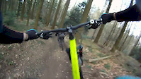
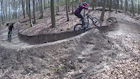
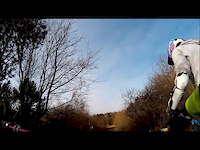
Videos of Stadtwald Mountain Bike
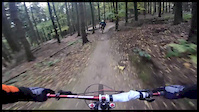
trail: Jumpline
4:10 |
454 |
Dec 19, 2016
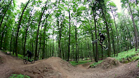
trail: Jumpline
2:28 |
310 |
Oct 31, 2016
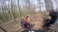
trail: Jumpline
0:54 |
153 |
Aug 4, 2016
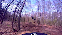
trail: Jumpline
0:17 |
524 |
Jun 13, 2016
trail: Jumpline
0:19 |
90 |
Apr 17, 2016
trail: Jumpline
0:20 |
382 |
Apr 9, 2016
trail: Jumpline
0:17 |
207 |
Mar 26, 2016
trail: Jumpline
2:32 |
227 |
Dec 28, 2015
Current Trail Warnings
| status | trail | date | condition | user | info |
|---|---|---|---|---|---|
| Layer Kopf DH | Jun 7, 2026 @ 12:07pm (Europe/Berlin) Jun 7, 2026 | Unknown | Sympathikus | ||
| Big Bamboo | May 23, 2026 @ 9:54pm (Europe/Berlin) May 23, 2026 | Unknown | renedoerper |
Recent Trail Reports
| status | trail | date | condition | info | user |
|---|---|---|---|---|---|
| Layer Trail | Apr 28, 2026 @ 9:55pm (Europe/Berlin) Apr 28, 2026 | Dry | Rines | ||
| 4seasons | Mar 22, 2026 @ 9:42pm (Europe/Berlin) Mar 22, 2026 | Dry | Rines | ||
| Fischerpfad | Mar 22, 2026 @ 9:41pm (Europe/Berlin) Mar 22, 2026 | Dry | Rines | ||
| Tube-Trail | Mar 21, 2026 @ 1:12pm (Europe/Luxembourg) Mar 21, 2026 | Prevalent Mud | Lemel333 | ||
| Turm Oben Rechts | Mar 6, 2026 @ 6:34am (Europe/Berlin) Mar 5, 2026 | Ideal | Rines | ||
| Eggiline / Röder Trail | Mar 6, 2026 @ 6:34am (Europe/Berlin) Mar 5, 2026 | Ideal | Rines | ||
| Jumpline | Jan 18, 2026 @ 11:18am (Europe/Berlin) Jan 18, 2026 | Prevalent Mud | prange | ||
| Kondertal Uphill | Jan 18, 2026 @ 11:18am (Europe/Berlin) Jan 18, 2026 | Variable | prange | ||
| Köba | Jul 6, 2025 @ 10:40am Jul 6, 2025 | Variable | prange | ||
| Schießbahn Climb | Apr 21, 2025 @ 9:35am Apr 21, 2025 | Dry | balduini |
Activity Feed
| username | action | type | title | date |
|---|---|---|---|---|
| JulianevCFE2G | wishlist | trail | activity #97191634 | Jun 17, 2026 @ 9:54am Jun 17, 2026 |
| Andre386 | ridden | trail | activity #96619040 and 2 more | Jun 9, 2026 @ 11:22am Jun 9, 2026 |
| JanQaDkyn | ridden | trail | activity #96459853 | Jun 7, 2026 @ 7:42am Jun 7, 2026 |
| JanQaDkyn | vote | trail | activity #96459774 | Jun 7, 2026 @ 7:41am Jun 7, 2026 |
| Sympathikus | add | report | activity #96440914 | Jun 7, 2026 @ 3:07am Jun 7, 2026 |
Recent Comments
| username | type | title | comment | date |
|---|---|---|---|---|
| trail | Der geht stellenweise auch als leicht schwarz... | Jan 22, 2026 @ 9:30am Jan 22, 2026 | ||
| trail | Richtig gut!! | Jan 22, 2026 @ 9:27am Jan 22, 2026 | ||
| trail | Die Tage war der Trail noch frei, heute lag im... | Nov 13, 2025 @ 7:41am Nov 13, 2025 | ||
| trail | Ganz gesperrt wegen Baum arbeiten | Aug 4, 2025 @ 12:52pm Aug 4, 2025 | ||
| trail | Blue?? Red-Black! | Jul 10, 2025 @ 1:39am Jul 10, 2025 |
Nearby Areas
| name | distance | ||||
|---|---|---|---|---|---|
| Lahnstein | 1 | 2 | 2.7 km | ||
| Malberg | 1 | 2 | 6.1 km | ||
| Emser Bikepark | 1 | 8.2 km | |||
| Baybachtal Area | 13 km | ||||
| Flowtrail Heidenrod | 1 | 2 | 21.4 km |
Local Badges
-

Completionist0 awarded
Activity Type Stats
| activitytype | trails | distance | descent | descent distance | total vertical | rating | global rank | state rank | photos | reports | routes | ridelogs |
|---|---|---|---|---|---|---|---|---|---|---|---|---|
| Mountain Bike | 28 | 17 miles | 5,784 ft | 9 miles | 1,047 ft | #1,879 | #22 | 20 | 411 | 3,867 | ||
| E-Bike | 28 | 17 miles | 5,784 ft | 9 miles | 1,047 ft | #1,820 | #29 | 386 | 1,029 | |||
| Hike | 5 | 9 miles | 791 ft | 1 mile | 1,043 ft | #3,161 | #39 | 331 | 62 | |||
| Trail Running | 5 | 9 miles | 791 ft | 1 mile | 1,043 ft | #2,396 | #33 | 331 | 36 |
Frequently Asked Questions About Stadtwald
▼
What are the highest rated mountain biking trails in Stadtwald?
The highest rated mountain biking trails in Stadtwald are:
- 4seasons (4.5/5)
- Fischerpfad (4.5/5)
- Köba (4.5/5)
- Snake Trail (4.4/5)
- Big Bamboo (4.3/5)
▼
What is the best time of the year to ride in Stadtwald?
Based on ride log data, the most popular months to ride in Stadtwald are:
- August (23 activities)
- April (19 activities)
- May (16 activities)
▼
Where can I park to ride in Stadtwald?
There are 1 parking locations listed in Stadtwald. The most popular parking spots are:
▼
What is the longest trail in Stadtwald?
The longest trail in Stadtwald is Griesenbachtal Trail at 1.3 km. View all trails sorted by distance.
Activities
- By toaser & contributors
- Admins: MTB Koblenz
- #12525 - 12,503 views
- stadtwald activity log | embed map of Stadtwald mountain bike trails | stadtwald mountain biking points of interest
Downloading of trail gps tracks in kml & gpx formats is enabled for Stadtwald.
You must login to download files.