close
-
Layers w
- Weather Layers
- Pro
- Pro
- Pro
- Pro
- Pro
- Pro
- More Layers
- Pro
- Pro
- Pro
- Pro
-
Upgrade to

3D
Trail Conditions
- Unknown
- Snow Groomed
- Snow Packed
- Snow Covered
- Snow Cover Partial
- Freeze/thaw Cycle
- Icy
- Prevalent Mud
- Wet
- Variable
- Ideal
- Dry
- Very Dry
Trail Flow (Ridden Direction)
Trailforks scans users ridelogs to determine the most popular direction each trail is ridden. A good flowing trail network will have most trails flowing in a single direction according to their intension.
The colour categories are based on what percentage of riders are riding a trail in its intended direction.
The colour categories are based on what percentage of riders are riding a trail in its intended direction.
- > 96%
- > 90%
- > 80%
- > 70%
- > 50%
- < 50%
- bi-directional trail
- no data
Trail Last Ridden
Trailforks scans ridelogs to determine the last time a trail was ridden.
- < 2 days
- < 1 week
- < 2 weeks
- < 1 month
- < 6 months
- > 6 months
Trail Ridden Direction
The intended direction a trail should be ridden.
- Downhill Only
- Downhill Primary
- Both Directions
- Uphill Primary
- Uphill Only
- One Direction
Contribute Details
Colors indicate trail is missing specified detail.
- Description
- Photos
- Description & Photos
- Videos
Trail Popularity ?
Trailforks scans ridelogs to determine which trails are ridden the most in the last 9 months.
Trails are compared with nearby trails in the same city region with a possible 25 colour shades.
Think of this as a heatmap, more rides = more kinetic energy = warmer colors.
- most popular
- popular
- less popular
- not popular
ATV/ORV/OHV Filter
Max Vehicle Width
inches
US Cell Coverage
Legend

Radar Time
Activity Recordings
Trailforks uses anonymized public activity data.
?
Activity Recordings
Trailforks uses anonymized public activity data.
?
Personal Heatmap
▶
Activity Types
all
/
none
▶
Options
2
Date range
month
–
Winter Trails
Warning
A routing network for winter maps does not exist. Selecting trails using the winter trails layer has been disabled.
Missing Trails
Most Popular
Least Popular
Trails are colored based on popularity. The more popular a trail is, the more red. Less popular trails trend towards green.
Jump Magnitude Heatmap
Heatmap of where riders jump on trails. Zoom in to see individual jumps, click circles to view jump details.
BC Backroad Status
![map legend]()
Service Road Atlas is a free to use, community-driven service for viewing and creating reports on the numerous back-country service roads around B.C. and Alberta.

Slope Aspect
Direction the slope faces
Trails Deemphasized
Trails are shown in grey.
Only show trails with no bike usage.
Suggested Layers
Based on selected activity type
Save the current map location and zoom level as your default home location whenever this page is loaded.
Save
No description for Stanley has been added yet!
Login or register to submit one.
Activities Click to view
- Mountain Bike
103 trails
- E-Bike
37 trails
- Gravel Bike
7 trails
- Adaptive Bike
7 trails
- Winter Fat Bike
0 trails
- Horse
54 trails
- Hike
141 trails
- Trail Running
138 trails
- Dirtbike/Moto
71 trails
- ATV/ORV/OHV
15 trails
- Snowmobile
5 trails
- Snowshoe
17 trails
- Backcountry Ski
3 trails
- Nordic Ski
18 trails
Region Details
- 22
- 1
- 3
- 20
- 45
- 4
Region Status
Caution as of Jun 14, 2026Local Trail Association
Stats
- Avg Trail Rating
- Trails (view details)
- 155
- Trails Mountain Bike
- 104
- Trails E-Bike
- 37
- Trails Gravel Bike
- 7
- Trails Adaptive Bike
- 7
- Trails Horse
- 54
- Trails Hike
- 141
- Trails Trail Running
- 138
- Trails Dirtbike/Moto
- 73
- Trails Observed Trials
- 2
- Trails ATV/ORV/OHV
- 15
- Trails Snowmobile
- 5
- Trails Snowshoe
- 17
- Trails Backcountry Ski
- 3
- Trails Nordic Ski
- 18
- Total Distance
- 626 miles
- Total Descent
- 122,447 ft
- Total Vertical
- 5,342 ft
- Highest Trailhead
- 10,184 ft
- Reports
- 388
- Photos
- 416
- Ridden Counter
- 10,517
Sub Regions
-
Alturas Lake
-
Bull Trout Lake
- 5
- 1
-
East of Stanley
- 3
- 9
-
North of Stanley
- 5
- 5
-
Red Fish Lake
- 2
- 1
- 2
-
West of Stanley
- 3
- 1
-
White Clouds
- 1
- 2
- 11
- 1
-
Yankee Fork
- 1
- 8
- 2
Popular Stanley Mountain Biking Trails
• 100 ★ 4.7 • 7 miles • 530 ft • 1,122 •
William Creek is the downhill part of one of the most popular loops in the region: Fisher-Williams Loop. The Road is a fairly mellow road pedal up, with some steep and loose climbing near the end. Then it's down into for tons of buff...
• 100 ★ 4.0 • 1 mile • 38 ft • 876 •
Connector trail for the climb to the descent. Primarily through a burn area, so soil can be sandy and dry. The corners on the descent can get pretty blown out. Enjoy the views before the descent to the junction with . Note: Dirtbike...
• 100 ★ 4.0 • 4 miles • 190 ft • 400 •
Fast, smooth single track through the meadows and then through forest section and another meadow.
• 100 ★ 4.5 • 2 miles • 54 ft • 398 •
If descending, expect a rocky more technical ride until the sign. It can all be ridden but might be harder for beginners to descend.
• 95 ★ 3.4 • 3 miles • 225 ft • 379 •
Trail is a mix of single track and forest service roads. At the start of trail there are some rollers. Use caution at the start of the season as the trail crosses some meadows which turn into bogs.
• 95 ★ 4.0 • 6 miles • 1,576 ft • 208 •
Narrow canyon...with many wildflower meadows and a few old mining ruins along the way. The trail ends in a beautiful meadow with excellent views of the highest peak in the Sawtooths, Thompson Peak. Multiple creek crossings
• 90 ★ 4.4 • 7 miles • 112 ft • 170 •
Highly rated popular black diamond difficulty singletrack. This mountain bike primary trail can be used downhill primary. On average it takes 1 hour3 minutes to complete this trail.
• 90 ★ 3.1 • 7 miles • 1,943 ft • 147 •
Popular black diamond difficulty singletrack. This mountain bike primary trail can be used both directions. On average it takes 1 hour55 minutes to complete this trail.
Stanley Mountain Bike Routes
★ 5.0 • 17 miles • 2,031 ft • 4 • Loop •
Fast flow downhill after gravel road climb.
★ 4.4 • 19 miles • 4,081 ft • 3 • Loop •
32 km loop to the top and back down epic singletrack.
★ 4.0 • 21 miles • 3,949 ft • 6 • Point to Point •
A way to get the Williams creek descent, with a ton more singletrack along the way.
11 miles • 962 ft • 3 •
Added some details for those with adaptive equipment.
22 miles • 1,592 ft • 5 • Loop •
Loop around then an out and back to see BridalVeil Falls.
Photos of Stanley Mountain Bike
Videos of Stanley Mountain Bike
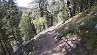
trail: Big Casino Creek
23:02 |
26 |
Sep 28, 2023
youtuber
![Best scenic, flowy mountain bike trail in...]()
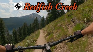
trail: Redfish Creek Trail
9:31 |
235 |
Mar 18, 2025 , Stanley
youtuber
![Mountain Biking Around Redfish Lake / Stanley, ID]()
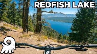
trail: Grand Mogul
12:57 |
147 |
Nov 26, 2024 , Stanley
youtuber
![Take advantage of this time]()
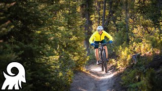
trail: Williams Creek
13:38 |
325 |
Aug 15, 2023 , Stanley
9:29 |
170 |
Sep 19, 2022 , Stanley

trail: Little Boulder Creek
4:58 |
226 |
Aug 18, 2022 , Stanley

trail: Martin Creek Trail
4:49 |
245 |
Aug 16, 2022 , Stanley

trail: Martin Creek Trail
3:38 |
280 |
Aug 16, 2022 , Stanley
Current Trail Warnings
| status | trail | date | condition | user | info |
|---|---|---|---|---|---|
| Trap Creek | Jun 10, 2026 @ 10:27am (America/Boise) Jun 10, 2026 | Unknown | Zepler | Lots of trees, moto users have been... | |
| Grand Mogul | May 26, 2026 @ 2:51pm (America/Boise) May 26, 2026 | Dry | ccmski | I tried going from the Sockeye CG on 5/25... |
Recent Trail Reports
| status | trail | date | condition | info | user |
|---|---|---|---|---|---|
| Redfish-Stanley Trail | Jun 14, 2026 @ 5:03pm (America/Boise) Jun 14, 2026 | Variable | chatownd | ||
| Pigtail | Jun 7, 2026 @ 12:03pm (America/Boise) Jun 7, 2026 | Dry | ccmski | ||
| Williams Creek | Jun 7, 2026 @ 12:03pm (America/Boise) Jun 7, 2026 | Ideal | ccmski | ||
| Decker Flat Road | May 27, 2026 @ 12:31pm (America/Boise) May 27, 2026 | Dry | ccmski | ||
| Redfish Creek Trail | May 26, 2026 @ 2:57pm (America/Boise) May 26, 2026 | Dry | ccmski | ||
| Fisher Creek | May 25, 2026 @ 2:04pm (America/Boise) May 25, 2026 | Unknown | Torboschen | ||
| Redfish Ridge | May 24, 2026 @ 12:02pm (America/Boise) May 24, 2026 | Dry | Galenaerin | ||
| Dry Creek Rd | Nov 16, 2025 @ 1:56pm (America/Boise) Nov 16, 2025 | Freeze/thaw Cycle | Mkluver | ||
| Elk Meadows | Nov 16, 2025 @ 1:56pm (America/Boise) Nov 16, 2025 | Freeze/thaw Cycle | Mkluver | ||
| Elk Meadows | Nov 16, 2025 @ 1:56pm (America/Boise) Nov 16, 2025 | Freeze/thaw Cycle | Mkluver |
National Scenic Trails & Official Routes
-
Idaho Centennial Trail
- Mountain Bike
- Hike
- Trail Running
Activity Feed
| username | action | type | title | date |
|---|---|---|---|---|
| chatownd | add | report | activity #97010920 | Jun 14, 2026 @ 4:03pm Jun 14, 2026 |
| AaronDzFuKF | wishlist | route | activity #96876289 | Jun 13, 2026 @ 7:46am Jun 13, 2026 |
| ccmski | like | report | activity #96686392 | Jun 10, 2026 @ 11:31am Jun 10, 2026 |
| Zepler | add | report | activity #96678209 | Jun 10, 2026 @ 9:27am Jun 10, 2026 |
| 7Howardm8padu | wishlist | route | activity #96676443 | Jun 10, 2026 @ 8:56am Jun 10, 2026 |
Recent Comments
| username | type | title | comment | date |
|---|---|---|---|---|
| report | One patch of snow to cross, otherwise great | May 24, 2026 @ 1:34pm May 24, 2026 | ||
| trail | Primary Moto trail. Open to Motos so keep that... | Sep 16, 2025 @ 11:33am Sep 16, 2025 | ||
| trail | I rode it today. Out and back. Wish it was 50... | Sep 1, 2025 @ 9:01pm Sep 1, 2025 | ||
| trail | I rode it today. All good. | Sep 1, 2025 @ 8:58pm Sep 1, 2025 | ||
| trail | O | Sep 1, 2025 @ 8:16pm Sep 1, 2025 |
Local Badges
-

10 Blue Trails47 awarded -

10 Black Trails13 awarded -

Epic Ride Climb 2k56 awarded -

Climbing 10k Badge16 awarded -

Climbing 100k Badge0 awarded -

Epic Ride Descent 2k62 awarded
Local Products
Activity Type Stats
| activitytype | trails | distance | descent | descent distance | total vertical | rating | global rank | state rank | photos | reports | routes | ridelogs |
|---|---|---|---|---|---|---|---|---|---|---|---|---|
| Mountain Bike | 103 | 403 miles | 77,192 ft | 180 miles | 5,105 ft | #516 | #190 | 369 | 370 | 9 | 5,059 | |
| E-Bike | 37 | 118 miles | 20,827 ft | 47 miles | 3,757 ft | #1,467 | #867 | 7 | 241 | 1 | 414 | |
| Gravel Bike | 7 | #549 | #1,094 | 10 | 32 | |||||||
| Adaptive Bike | 7 | #497 | #1,822 | 1 | ||||||||
| Horse | 54 | 196 miles | 46,201 ft | 98 miles | 4,495 ft | #139 | #390 | 103 | 3 | 14 | ||
| Hike | 141 | 559 miles | 116,660 ft | 259 miles | 5,341 ft | #166 | #94 | 24 | 385 | 8 | 3,145 | |
| Trail Running | 138 | 547 miles | 114,396 ft | 254 miles | 5,341 ft | #167 | #73 | 2 | 382 | 4 | 338 | |
| Dirtbike/Moto | 71 | 289 miles | 50,689 ft | 125 miles | 5,039 ft | #29 | #13 | 8 | 140 | 54 | ||
| Observed Trials | 2 | 2 miles | 82 ft | 3,209 ft | 161 ft | 4 | 1 | |||||
| ATV/ORV/OHV | 15 | 41 miles | 3,652 ft | 8 miles | 3,189 ft | #519 | #182 | 8 | 69 | 2 | ||
| Snowmobile | 5 | 12 miles | 2,956 ft | 8 miles | 2,992 ft | #221 | #103 | 3 | 1 | |||
| Snowshoe | 17 | 25 miles | 3,885 ft | 13 miles | 2,992 ft | #659 | #274 | 3 | 86 | |||
| Backcountry Ski | 3 | 5 miles | 2,851 ft | 4 miles | 2,992 ft | #499 | #129 | 3 | 703 | |||
| Nordic Ski | 18 | 27 miles | 3,911 ft | 13 miles | 2,992 ft | #125 | #30 | 3 | 331 |
Frequently Asked Questions About Stanley
▼
What are the best places to ride in Stanley?
Stanley has 9 areas to explore for mountain biking. The top rated areas are:
▼
What are the highest rated mountain biking trails in Stanley?
The highest rated mountain biking trails in Stanley are:
- Williams Creek (4.5/5)
- Livingston Mill-Castle Divide (4.4/5)
- Boundary Creek (4.4/5)
- Williams Creek (Upper) (4.3/5)
- East Fork Valley (4.2/5)
▼
What is the best time of the year to ride in Stanley?
Based on ride log data, the most popular months to ride in Stanley are:
- July (152 activities)
- August (142 activities)
- June (115 activities)
▼
Where can I park to ride in Stanley?
There are 26 parking locations listed in Stanley. The most popular parking spots are: View all parking and trailhead locations on the map to plan your visit.
Activities
- Stanley Mountain Biking Trails
- Stanley E-Biking Trails
- Stanley Gravel Biking Trails
- Stanley Adaptive Biking Trails
- Stanley Horseback Trails
- Stanley Hiking Trails
- Stanley Trail Running Trails
- Stanley Dirtbiking Trails
- Stanley ATVing/Offroading Trails
- Stanley Snowmobiling Trails
- Stanley Snowshoeing Trails
- Stanley Nordic Skiing Trails
Trails
Points of Interest
- Redfish Inlet Trailhead Information
- Marten Lake Sight
- Sunny Gulch Campground Camping
- Chinook Bay Campground Camping
- Mountain View Campground Camping
- Lola Creek Campground Camping
- Lady Face Falls Sight
- Iron Creek Campground Camping
- Ross Forks Lakes Camping
- Fir Creek Campground Camping
- Ryan Peak (11,683 ft)
- Glassford Peak (11,555 ft)
- Lee Peak (11,332 ft)
- By chuktA
 TRAILFORKS NFTA & contributors
 - Admins: CCTA, WRTC
- #6576 - 20,291 views
- stanley activity log | embed map of Stanley mountain bike trails | stanley mountain biking points of interest
Downloading of trail gps tracks in kml & gpx formats is enabled for Stanley.
You must login to download files.