close
-
Layers w
- Weather Layers
- Pro
- Pro
- Pro
- Pro
- Pro
- Pro
- More Layers
- Pro
- Pro
- Pro
- Pro
-
Upgrade to

3D
Trail Conditions
- Unknown
- Snow Groomed
- Snow Packed
- Snow Covered
- Snow Cover Partial
- Freeze/thaw Cycle
- Icy
- Prevalent Mud
- Wet
- Variable
- Ideal
- Dry
- Very Dry
Trail Flow (Ridden Direction)
Trailforks scans users ridelogs to determine the most popular direction each trail is ridden. A good flowing trail network will have most trails flowing in a single direction according to their intension.
The colour categories are based on what percentage of riders are riding a trail in its intended direction.
The colour categories are based on what percentage of riders are riding a trail in its intended direction.
- > 96%
- > 90%
- > 80%
- > 70%
- > 50%
- < 50%
- bi-directional trail
- no data
Trail Last Ridden
Trailforks scans ridelogs to determine the last time a trail was ridden.
- < 2 days
- < 1 week
- < 2 weeks
- < 1 month
- < 6 months
- > 6 months
Trail Ridden Direction
The intended direction a trail should be ridden.
- Downhill Only
- Downhill Primary
- Both Directions
- Uphill Primary
- Uphill Only
- One Direction
Contribute Details
Colors indicate trail is missing specified detail.
- Description
- Photos
- Description & Photos
- Videos
Trail Popularity ?
Trailforks scans ridelogs to determine which trails are ridden the most in the last 9 months.
Trails are compared with nearby trails in the same city region with a possible 25 colour shades.
Think of this as a heatmap, more rides = more kinetic energy = warmer colors.
- most popular
- popular
- less popular
- not popular
ATV/ORV/OHV Filter
Max Vehicle Width
inches
US Cell Coverage
Legend

Radar Time
Activity Recordings
Trailforks uses anonymized public activity data.
?
Activity Recordings
Trailforks uses anonymized public activity data.
?
Personal Heatmap
▶
Activity Types
all
/
none
▶
Options
2
Date range
month
–
Winter Trails
Warning
A routing network for winter maps does not exist. Selecting trails using the winter trails layer has been disabled.
Missing Trails
Most Popular
Least Popular
Trails are colored based on popularity. The more popular a trail is, the more red. Less popular trails trend towards green.
Jump Magnitude Heatmap
Heatmap of where riders jump on trails. Zoom in to see individual jumps, click circles to view jump details.
BC Backroad Status
![map legend]()
Service Road Atlas is a free to use, community-driven service for viewing and creating reports on the numerous back-country service roads around B.C. and Alberta.

Slope Aspect
Direction the slope faces
Trails Deemphasized
Trails are shown in grey.
Only show trails with no bike usage.
Suggested Layers
Based on selected activity type
Save the current map location and zoom level as your default home location whenever this page is loaded.
SaveThis city hosts Rothrock State Forest, which is known for it's dense network, and classic PA ridge riding.
Activities Click to view
- Mountain Bike
504 trails
- E-Bike
496 trails
- Gravel Bike
64 trails
- Adaptive Bike
84 trails
- Winter Fat Bike
9 trails
- Horse
24 trails
- Hike
618 trails
- Trail Running
617 trails
- Snowmobile
5 trails
- Snowshoe
38 trails
- Downhill Ski
15 trails
- Backcountry Ski
15 trails
- Nordic Ski
7 trails
Region Details
- 103
- 41
- 136
- 129
- 72
- 21
Region Status
Open as of Jun 14, 2026Stats
- Avg Trail Rating
- Trails (view details)
- 648
- Trails Mountain Bike
- 504
- Trails E-Bike
- 496
- Trails Gravel Bike
- 64
- Trails Adaptive Bike
- 84
- Trails Winter Fat Bike
- 9
- Trails Horse
- 24
- Trails Hike
- 618
- Trails Trail Running
- 617
- Trails ATV/ORV/OHV
- 1
- Trails Snowmobile
- 5
- Trails Snowshoe
- 38
- Trails Downhill Ski
- 15
- Trails Backcountry Ski
- 15
- Trails Nordic Ski
- 7
- Total Distance
- 748 miles
- Total Descent
- 106,404 ft
- Total Vertical
- 1,776 ft
- Highest Trailhead
- 2,432 ft
- Reports
- 3,935
- Photos
- 952
- Ridden Counter
- 42,269
Sub Regions
-
Black Moshannon State Park
- 13
- 9
- 3
-
Colyer Lake
- 4
- 3
- 2
-
Coopers Gap (Rothrock State Forest)
- 4
- 16
- 14
- 4
-
Galbraith Gap (Rothrock State Forest)
- 1
- 11
- 19
- 20
- 13
-
Harvest Fields Community Trails
- 7
- 6
- 5
-
Kepler Road (Rothrock State Forest)
- 5
- 12
- 2
-
Musser Gap (Rothrock State Forest)
- 11
- 6
- 14
- 8
- 4
-
Penn State
- 8
- 36
- 17
- 2
- 1
-
Poe Paddy State Park
- 1
-
Scotia
- 10
- 19
- 1
-
Seven Mountains
- 7
- 18
- 10
-
Shaver's Creek
Popular State College Mountain Biking Trails
• 100 ★ 4.6 • 2 miles • 17 ft • 788 •
Also known as the magic carpet ride this in the down direction is a fun fast flowing trail that end with a short fast drop down the "yellow brick rd" (a rock armoured section) just before . This is a great beginner through experienced...
• 100 ★ 3.9 • 968 ft • 0 ft • 772 •
Short that is traditional used in the downward direction from back to the Parking area. This trail has long been known to the locals as Carcass Trail. The Black diamond rating applies to the latter portion that would be accessed by...
• 100 ★ 4.4 • 3 miles • 104 ft • 635 •
is one of the best and well know trails in Rothrock. It offers great views and great ridge riding. A must do trail. Known to the locals as the Ridge. You can ride it as an out and back starting from off or from Bear Meadows Road. Ride...
• 100 ★ 4.3 • 509 ft • 0 ft • 601 •
Short that is traditional used in the downward direction from back to the Parking area. This trail has long been known to the locals as Carcass Trail. The Black diamond rating applies to the latter portion that would be accessed by...
• 95 ★ 4.4 • 1,739 ft • 13 ft • 559 •
from to Lornberger. Has wicked rock garden that presents a great challenge to all and also 3 separate bridges to be crossed
• 100 ★ 4.0 • 2 miles • 32 ft • 539 •
Flowing single track. One of the newer trails in Coopers Gap, replacing the actual "spring" portion of . This trail meanders fairly close to Cooper's Gap Road and several recently timbered areas, so it isn't as remote feeling as some of...
• 100 ★ 3.5 • 4,781 ft • 112 ft • 523 •
In either direction, is both pleasure and pain. In spots, it has rocks as far as the eye can see, and in other spots it has a great twisty flow that keeps you moving. has been a staple of endurance events in the area since 2002 and it...
• 95 ★ 3.5 • 3,563 ft • 39 ft • 512 •
This is a typical central PA rock garden type trail that is rideable with effort
State College Mountain Bike Routes
★ 5.0 • 12 miles • 1,404 ft • 12 •
This is very similar to the Clotheshanger Loop route, but it adds the additional Leniency / extension for...
★ 4.6 • 26 miles • 2,708 ft • 16 • Loop •
This covers all the greatness found in Coopers Gap and is an IMBA epic ride Be very careful during hunting...
★ 5.0 • 10 miles • 846 ft • 7 •
This is the most basic version of a very popular ride plan out of in Rothrock State Forest. This version...
★ 3.7 • 35 miles • 4,277 ft • 25 • Loop •
Overview The 36-mile Rothrock TrailMix course provides a combination of some of the best trails within...
★ 5.0 • 7 miles • 750 ft • 7 •
Good beginner/intermediate route with an easy climb up Bear Meadows Road, then some technical climbing up...
★ 5.0 • 32 miles • 3,886 ft • 18 •
This is a close relative to the Rothrock TrailMix NMBA Epic, but with two changes: one, it starts in a...
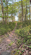
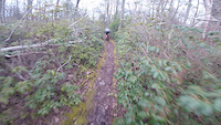
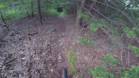
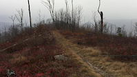
Photos of State College Mountain Bike
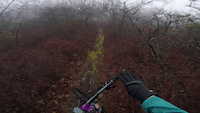
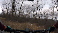
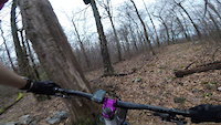
Videos of State College Mountain Bike
trail: Kettle Trail
0:12 |
38 |
May 28, 2022
trail: Greenshoot Trail
8:24 |
114 |
Jan 6, 2021
trail: Upper Shingletown Gap Trail
3:14 |
94 |
Jan 6, 2021
trail: Sand Spring Trail - South
0:53 |
76 |
Jan 6, 2021
trail: Spruce Gap
2:36 |
111 |
Jan 5, 2021
trail: Ross Trail
8:15 |
775 |
Jun 13, 2019
trail: Tussey Mountain Trail
0:24 |
218 |
Nov 28, 2016
trail: Galbraith Gap Trail
3:40 |
16273 |
Oct 11, 2016
Recent Trail Reports
| status | trail | date | condition | info | user |
|---|---|---|---|---|---|
| Beautiful Trail | Jun 10, 2026 @ 12:45pm (America/New_York) Jun 10, 2026 | Ideal | Jkerickon | ||
| Sand Spring Trail - South | Jun 7, 2026 @ 9:57pm (America/New_York) Jun 7, 2026 | Dry | arrich | ||
| Detweiler Run Trail | Jun 5, 2026 @ 9:41pm (America/New_York) Jun 5, 2026 | Ideal | Jmanning1050 | ||
| Thickhead Mtn Rd Trail | Jun 5, 2026 @ 9:39pm (America/New_York) Jun 5, 2026 | Ideal | Jmanning1050 | ||
| Shitaka Trail (Upper) | May 14, 2026 @ 3:39pm (America/New_York) May 14, 2026 | Ideal | b3rnardino | ||
| Brush Ridge Extension | May 14, 2026 @ 3:39pm (America/New_York) May 14, 2026 | Variable | b3rnardino | ||
| Chestnut Spring | May 14, 2026 @ 3:39pm (America/New_York) May 14, 2026 | Ideal | b3rnardino | ||
| Sand Hole Trail | May 14, 2026 @ 3:39pm (America/New_York) May 14, 2026 | Ideal | b3rnardino | ||
| Shitaka Trail (Lower) | May 14, 2026 @ 3:39pm (America/New_York) May 14, 2026 | Ideal | b3rnardino | ||
| Shitaka - Chicken Peter Connector | May 14, 2026 @ 3:39pm (America/New_York) May 14, 2026 | Ideal | b3rnardino |
Activity Feed
| username | action | type | title | date |
|---|---|---|---|---|
| dparse | wishlist | route | activity #97408555 | Jun 20, 2026 @ 10:06am 20 hours |
| jhuaang | wishlist | route | activity #97361110 | Jun 19, 2026 @ 7:13pm 1 day |
| mydogzeb | wishlist | route | activity #97327361 | Jun 19, 2026 @ 10:13am 2 days |
| dparse | wishlist | route | activity #97320338 | Jun 19, 2026 @ 8:37am 2 days |
| xBIAdD | wishlist | route | activity #97313592 | Jun 19, 2026 @ 6:49am 2 days |
Recent Comments
| username | type | title | comment | date |
|---|---|---|---|---|
| trail | Path was not marked, nor could I find it. I... | Jun 12, 2026 @ 6:31pm Jun 12, 2026 | ||
| trail | Super flowy, fun downhill | May 29, 2026 @ 6:03am May 29, 2026 | ||
| trail | Pretty fun trail that appears to not be used... | Apr 12, 2026 @ 5:32pm Apr 12, 2026 | ||
| trail | Great trail. Some loose rocks due to dirt... | Oct 5, 2025 @ 4:03pm Oct 5, 2025 | ||
| trail | Fun trail but it is super rocky. It should be... | Oct 5, 2025 @ 4:01pm Oct 5, 2025 |
Local Badges
-

Completionist0 awarded -
Completionist0 awarded -
Completionist0 awarded -
Completionist0 awarded -
Completionist0 awarded -

Top 10 Trails4 awarded
Bike & Skill Parks
| name | type | city | rating |
|---|---|---|---|
| Hamer Bike Skills Park | skill park | State College | |
| Wildride Motocross Track | skill park | State College | |
| Slabtown Pump Track | skill park | State College |
Local Mountain Biking Directory
-
Nittany Mountain Bike Association
![Nittany Mountain Bike Association]()
-
Happy Valley Woemen's Cycling
![Happy Valley Woemen's Cycling]()
-
Freeze Thaw CyclesBike Shop
![Freeze Thaw Cycles]()
-
The Bicycle ShopBike Shop
![The Bicycle Shop]()
-
Eddie's Bicycles And Sport EquipmentBike Shop
![Eddie's Bicycles And Sport Equipment]()
Local Trail Supporters
- http://nittanymba.org/
![]()
![Save Colyer Lake]()
- http://www.dcnr.state.pa.us/forestry/stateforests/rothrock/index.htm
Activity Type Stats
| activitytype | trails | distance | descent | descent distance | total vertical | rating | global rank | state rank | photos | reports | routes | ridelogs |
|---|---|---|---|---|---|---|---|---|---|---|---|---|
| Mountain Bike | 504 | 584 miles | 79,731 ft | 291 miles | 1,775 ft | #167 | #63 | 930 | 3,834 | 94 | 26,729 | |
| E-Bike | 496 | 575 miles | 78,953 ft | 289 miles | 1,775 ft | #74 | #646 | 3,031 | 17 | 1,296 | ||
| Gravel Bike | 64 | 145 miles | 12,477 ft | 66 miles | 1,749 ft | #48 | #746 | 2 | 452 | 2 | 397 | |
| Adaptive Bike | 84 | 202 miles | 18,392 ft | 88 miles | 1,745 ft | #17 | #1,177 | 1 | 510 | 1 | ||
| Winter Fat Bike | 9 | 18 miles | 1,168 ft | 7 miles | 892 ft | #207 | #976 | 20 | 14 | |||
| Horse | 24 | 91 miles | 9,760 ft | 45 miles | 1,480 ft | #487 | #498 | 1 | 1,307 | 1 | 7 | |
| Hike | 618 | 744 miles | 104,163 ft | 359 miles | 1,775 ft | #61 | #42 | 13 | 3,834 | 9 | 1,490 | |
| Trail Running | 617 | 725 miles | 103,799 ft | 352 miles | 1,775 ft | #68 | #39 | 2 | 3,834 | 6 | 2,031 | |
| ATV/ORV/OHV | 1 | 19 miles | 364 ft | 7 miles | 223 ft | 1,211 | 6 | |||||
| Snowmobile | 5 | 42 miles | 2,625 ft | 19 miles | 1,414 ft | #150 | #63 | 4 | ||||
| Snowshoe | 38 | 68 miles | 8,156 ft | 33 miles | 1,286 ft | #308 | #75 | 291 | 6 | |||
| Downhill Ski | 15 | 3 miles | 1,939 ft | 2 miles | 466 ft | #486 | #201 | 183 | ||||
| Backcountry Ski | 15 | 31 miles | 3,789 ft | 15 miles | 1,421 ft | #362 | #75 | 47 | 68 | |||
| Nordic Ski | 7 | 14 miles | 1,562 ft | 7 miles | 968 ft | #700 | #253 | 18 | 146 |
Frequently Asked Questions About State College
▼
What are the best places to ride in State College?
State College has 15 areas to explore for mountain biking. The top rated areas are:
▼
What are the highest rated mountain biking trails in State College?
The highest rated mountain biking trails in State College are:
- Sass-XX (4.6/5)
- Croyle Run Trail (4.5/5)
- Wildcat Gap Trail (4.4/5)
- Ruff Gap Trail (4.4/5)
- Lonberger Path (4.4/5)
▼
What is the best time of the year to ride in State College?
Based on ride log data, the most popular months to ride in State College are:
- July (315 activities)
- September (276 activities)
- April (264 activities)
▼
Where can I park to ride in State College?
There are 32 parking locations listed in State College. The most popular parking spots are: View all parking and trailhead locations on the map to plan your visit.
Activities
- State College Mountain Biking Trails
- State College E-Biking Trails
- State College Gravel Biking Trails
- State College Adaptive Biking Trails
- State College Winter Fat Biking Trails
- State College Horseback Trails
- State College Hiking Trails
- State College Trail Running Trails
- State College Snowmobiling Trails
- State College Snowshoeing Trails
- State College Skiing Trails
- State College Backcountry Skiing Trails
- State College Nordic Skiing Trails
Trails
Points of Interest
- Penn's Valley Overlook Viewpoint
- Ralph's Majestic View Viewpoint
- Tussey Vista Viewpoint
- David's Vista Viewpoint
- Hubler Gap Vista Viewpoint
- Roman Tower Viewpoint
- Beer Tap Sight
- Indian Lookout Viewpoint
- Nittany Mall Overlook Viewpoint
- Tom Smyth Overlook Viewpoint
- Big Flat (2,415 ft)
- Little Flat (2,411 ft)
- Thickhead Mountain (2,408 ft)
- By Saclydesdale
 NMBA & contributors
 - Admins: NMBA
- #6332 - 21,534 views
- state college activity log | embed map of State College mountain bike trails | state college mountain biking points of interest polygons
Downloading of trail gps tracks in kml & gpx formats is enabled for State College.
You must login to download files.