close
-
Layers w
- Weather Layers
- Pro
- Pro
- Pro
- Pro
- Pro
- Pro
- More Layers
- Pro
- Pro
- Pro
- Pro
-
Upgrade to

3D
Trail Conditions
- Unknown
- Snow Groomed
- Snow Packed
- Snow Covered
- Snow Cover Partial
- Freeze/thaw Cycle
- Icy
- Prevalent Mud
- Wet
- Variable
- Ideal
- Dry
- Very Dry
Trail Flow (Ridden Direction)
Trailforks scans users ridelogs to determine the most popular direction each trail is ridden. A good flowing trail network will have most trails flowing in a single direction according to their intension.
The colour categories are based on what percentage of riders are riding a trail in its intended direction.
The colour categories are based on what percentage of riders are riding a trail in its intended direction.
- > 96%
- > 90%
- > 80%
- > 70%
- > 50%
- < 50%
- bi-directional trail
- no data
Trail Last Ridden
Trailforks scans ridelogs to determine the last time a trail was ridden.
- < 2 days
- < 1 week
- < 2 weeks
- < 1 month
- < 6 months
- > 6 months
Trail Ridden Direction
The intended direction a trail should be ridden.
- Downhill Only
- Downhill Primary
- Both Directions
- Uphill Primary
- Uphill Only
- One Direction
Contribute Details
Colors indicate trail is missing specified detail.
- Description
- Photos
- Description & Photos
- Videos
Trail Popularity ?
Trailforks scans ridelogs to determine which trails are ridden the most in the last 9 months.
Trails are compared with nearby trails in the same city region with a possible 25 colour shades.
Think of this as a heatmap, more rides = more kinetic energy = warmer colors.
- most popular
- popular
- less popular
- not popular
ATV/ORV/OHV Filter
Max Vehicle Width
inches
US Cell Coverage
Legend

Radar Time
Activity Recordings
Trailforks uses anonymized public activity data.
?
Activity Recordings
Trailforks uses anonymized public activity data.
?
Personal Heatmap
▶
Activity Types
all
/
none
▶
Options
2
Date range
month
–
Winter Trails
Warning
A routing network for winter maps does not exist. Selecting trails using the winter trails layer has been disabled.
Missing Trails
Most Popular
Least Popular
Trails are colored based on popularity. The more popular a trail is, the more red. Less popular trails trend towards green.
Jump Magnitude Heatmap
Heatmap of where riders jump on trails. Zoom in to see individual jumps, click circles to view jump details.
BC Backroad Status
![map legend]()
Service Road Atlas is a free to use, community-driven service for viewing and creating reports on the numerous back-country service roads around B.C. and Alberta.

Slope Aspect
Direction the slope faces
Trails Deemphasized
Trails are shown in grey.
Only show trails with no bike usage.
Suggested Layers
Based on selected activity type
Save the current map location and zoom level as your default home location whenever this page is loaded.
SaveSome of the best legal single track trails in the NYC region with the most options over 30 miles of trails to ride in multiple riding areas, Please do not modify or build new trails without our permission. Please wear a helmet and help us keep the park clean.
Staten Island is well-known as the “borough of parks” Explore all the natural splendor and fun activities that this beautiful borough has to offer. Here are some of our favorite places to see in the greenest borough! Be sure to use #onStatenIsland for rides use #NYCMTB to share your next park photo.
With over 1000 hours of trail work and clean up completed to date (1/22-04/10) the trails are in the best shape they have ever been. The trails at Wolfes Pond Park are marked now White Trail crosses the whole park. You can pick it up by Wolfes Pond or at the Trail head behind Tottenville High School. The Red Trail (The Phoenix Trail) starts by dog park and is a 3 mile adventure (do the tail of the trail in reverse to the dog park after completion for a challenging 4 miles). Orange Loop consisting of the Panda Express and Matterra's Madness trail is fun twisty two miles with a few surprises along the way. You can pick up the Orange trail off of the White Trail just inside the trail head off of Hylan Blvd and Holten St. The Blue trail is solid 2 mile ride of awesome. Several bridges and a few water crossings definitely add to the ride. You can catch the Blue trail off the Matterra's Madness Trail (Orange Loop) by Acme Pond or off the White Trail at numerous intersections. Burke’s Bumps (Dirt Jumps) are coming along nicely.
Mt Loretto North Woods State Forest is a hidden Gem and can easily be connected to your Wolfes Pond Ride using Hylan Blvd. bike lane or Amboy Rd, Filled with fun Single track a few double track options and some great rolling terrain, Be on the look out for some flow trails on the Long Pond side.
Ocean Breeze Park is full of double track fun. It is a perfect place for family or beginner rides. Bonus boardwalk across the street and bike path connecting several neighborhoods to the trails
Be sure to refresh your trail apps frequently as we are always updating, creating and re-working trails to give you the best possible trail experience.
source: ...
Disclaimer:
Use Trails at your own Risk, Hidden Hazards May Exist....
Activities Click to view
- Mountain Bike
197 trails
- E-Bike
22 trails
- Gravel Bike
0 trails
- Adaptive Bike
0 trails
- Winter Fat Bike
1 trails
- Horse
54 trails
- Hike
266 trails
- Trail Running
262 trails
- Snowshoe
216 trails
- Backcountry Ski
14 trails
- Nordic Ski
126 trails
Region Details
- 10
- 20
- 69
- 74
- 4
Region Status
Open as of Jun 7, 2026Stats
- Avg Trail Rating
- Trails (view details)
- 244
- Trails Mountain Bike
- 198
- Trails E-Bike
- 22
- Trails Winter Fat Bike
- 1
- Trails Horse
- 54
- Trails Hike
- 266
- Trails Trail Running
- 262
- Trails Snowshoe
- 216
- Trails Backcountry Ski
- 14
- Trails Nordic Ski
- 126
- Total Distance
- 119 miles
- Total Descent Distance
- 36 miles
- Total Descent
- 3,757 ft
- Total Vertical
- 363 ft
- Highest Trailhead
- 363 ft
- Reports
- 1,373
- Photos
- 102
- Ridden Counter
- 3,901
Sub Regions
-
Arden Woods
- 4
-
Bloomingdale Park
- 1
- 1
- 5
-
Brookfield Park
- 2
- 2
-
Clay Pit Pond
- 4
-
Freshkills
- 1
- 6
- 15
-
Lemon Creek Tidal Wetland
-
Mariners Marsh
- 6
-
Mt Loretto North State Forest
- 7
- 21
-
Ocean Breeze
- 9
- 1
-
Silver Lake Park
- 5
-
Staten Island Greenbelt
- 7
- 10
- 11
-
Wolfes Pond
- 4
- 12
- 20
- 4
Popular Staten Island Mountain Biking Trails
• 85 ★ 5.0 • 5,236 ft • 8 ft • 119 •
Built in 2002 by members of FDNY Ladder 5/Engine 24 to honor members of Ladder 5 who perished on 911. This trail is surprising technical with roots tight turns and water crossings. On this almost 3 miles trail.
• 85 ★ 4.0 • 686 ft • 13 ft • 93 •
A fun fast addition to your trail ride, we love to include this in our Phoenix loop.
• 95 ★ 5.0 • 4,521 ft • 31 ft • 86 •
Popular blue difficulty singletrack. This multi-use trail can be used both directions and has a moderate overall physical rating with a 31 ft green climb. It features berm, bridge, jump and skinny. Trail visibility is always easy to follow. On average it takes 8 minutes to complete this trail.
• 100 ★ 5.0 • 2,520 ft • 21 ft • 76 •
Popular blue difficulty singletrack. This multi-use trail can be used both directions and has a moderate overall physical rating with a 21 ft blue climb. Trail visibility is sometimes hard to follow. On average it takes 4 minutes to complete this trail.
• 100 ★ 4.0 • 482 ft • 19 ft • 75 •
Popular green difficulty singletrack. This mountain bike primary trail can be used both directions. On average it takes 1 minutes to complete this trail.
• 90 ★ 5.0 • 2,070 ft • 30 ft • 71 •
Popular blue difficulty singletrack. This multi-use trail can be used both directions and has a moderate overall physical rating with a 30 ft blue climb. It features bridge, drop and other. Trail visibility is always easy to follow. On average it takes 5 minutes to complete this trail.
• 85 ★ 4.4 • 4,649 ft • 64 ft • 70 •
Popular blue difficulty singletrack. This multi-use trail can be used both directions and has a moderate overall physical rating with a 64 ft blue climb. It features bridge, drop and other. Trail visibility is always easy to follow. On average it takes 10 minutes to complete this trail.
• 80 ★ 3.4 • 4,009 ft • 37 ft • 64 •
Mattera's Madness (Orange Trail) was built in 2022 in memory of a staple of the Staten Island trail and Mountain Bike Community. with some tight turns and a few features along the the way, adding the Mattera Madness trail to your ride...
Staten Island Mountain Bike Routes
★ 4.0 • 5 • Loop •
Fun and Fast, Use Strava to beat out other riders or challenge yourself to track improvements.
4 miles • 246 ft • 1 • Loop •
Ladder 5 Loop is the section below Hylan Blvd (Ocean Side). The majority of these trails where built...
43 miles • 2,736 ft • 37 •
Incudes the greenbelt and via Hylan Blvd goes also to Wolfs Pond Park
2 miles • 68 ft • 4 • Loop •
We find this to be the fastest most flowie route in the Park, Will you be the fastest? Doubt it...
Photos of Staten Island Mountain Bike
Videos of Staten Island Mountain Bike

0:07 |
13 |
Aug 6, 2024
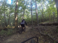
trail: The Phoenix (Red Trail)
0:19 |
164 |
May 17, 2022
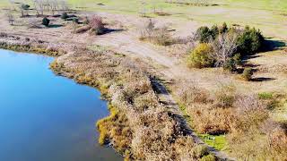
trail: Freshkills
4:04 |
405 |
Dec 1, 2023 , Staten Island
Recent Trail Reports
| status | trail | date | condition | info | user |
|---|---|---|---|---|---|
| Fort Wadsworth Greenway | Jun 7, 2026 @ 9:27am (America/New_York) Jun 7, 2026 | Ideal | RobJSinger | ||
| The Mechanic | May 23, 2026 @ 10:24am (America/New_York) May 23, 2026 | Ideal | Maimo | ||
| Eastern Block | May 23, 2026 @ 10:20am (America/New_York) May 23, 2026 | Ideal | Maimo | ||
| Mike C ecret | May 23, 2026 @ 10:20am (America/New_York) May 23, 2026 | Ideal | Maimo | ||
| Birdie | May 23, 2026 @ 10:20am (America/New_York) May 23, 2026 | Ideal | Maimo | ||
| S.I.R.T. | Apr 18, 2026 @ 4:55pm (America/New_York) Apr 18, 2026 | Ideal | hacksaw3242 | ||
| The Phoenix (Red Trail) | Apr 18, 2026 @ 4:55pm (America/New_York) Apr 18, 2026 | Ideal | hacksaw3242 | ||
| The Phoenix (Red Trail) 4 | Apr 18, 2026 @ 4:55pm (America/New_York) Apr 18, 2026 | Ideal | hacksaw3242 | ||
| Shaolin Connector | Apr 18, 2026 @ 4:55pm (America/New_York) Apr 18, 2026 | Wet | hacksaw3242 | ||
| Auto Shop | Apr 18, 2026 @ 4:55pm (America/New_York) Apr 18, 2026 | Ideal | hacksaw3242 |
Activity Feed
| username | action | type | title | date |
|---|---|---|---|---|
| ghostslamr | wishlist | region | activity #96542970 | Jun 8, 2026 @ 8:56am Jun 8, 2026 |
| RobJSinger | add | report | activity #96492327 | Jun 7, 2026 @ 1:18pm Jun 7, 2026 |
| RobJSinger | add | report | activity #95971571 | May 31, 2026 @ 1:07pm May 31, 2026 |
| Maimo | add | report | activity #95315519 and 3 more | May 23, 2026 @ 7:22am May 23, 2026 |
| RobJSinger | add | report | activity #94855214 | May 16, 2026 @ 3:07pm May 16, 2026 |
Recent Comments
| username | type | title | comment | date |
|---|---|---|---|---|
| trail | I enjoy this trails tough climbs and quick... | Aug 3, 2024 @ 2:49pm Aug 3, 2024 | ||
| trail | Can’t say enough about this segment. The... | Aug 3, 2024 @ 2:47pm Aug 3, 2024 | ||
| trail | This trail has been some of the toughest... | Aug 3, 2024 @ 2:45pm Aug 3, 2024 | ||
| trail | The work done on this area in Staten Island... | Aug 3, 2024 @ 2:43pm Aug 3, 2024 | ||
| trail | Maybe the fastest and the funniest section. ... | Jul 30, 2024 @ 7:52pm Jul 30, 2024 |
Local Badges
-

Completionist0 awarded -
Completionist0 awarded -

10 Blue Trails40 awarded -

10 Green Trails23 awarded -

Epic Mountain Bike Climb 2k0 awarded -

Climbing 10k Badge9 awarded
Bike & Skill Parks
| name | type | city | rating |
|---|---|---|---|
| Burkes Bumps | skill park | Staten Island |
Activity Type Stats
| activitytype | trails | distance | descent | descent distance | total vertical | rating | global rank | state rank | photos | reports | routes | ridelogs |
|---|---|---|---|---|---|---|---|---|---|---|---|---|
| Mountain Bike | 197 | 87 miles | 1,831 ft | 24 miles | 295 ft | #1,778 | #657 | 94 | 1,369 | 21 | 6,352 | |
| E-Bike | 22 | 20 miles | 295 ft | 5 miles | 295 ft | #4,638 | #1,489 | 1,115 | 5 | 580 | ||
| Winter Fat Bike | 1 | #366 | #1,121 | 4 | 2 | |||||||
| Horse | 54 | 18 miles | 479 ft | 6 miles | 240 ft | #1,544 | #906 | 55 | ||||
| Hike | 266 | 110 miles | 3,714 ft | 34 miles | 364 ft | #593 | #275 | 3 | 1,271 | 2 | 314 | |
| Trail Running | 262 | 108 miles | 3,668 ft | 33 miles | 364 ft | #1,153 | #420 | 1,271 | 8 | 217 | ||
| Snowshoe | 216 | 90 miles | 3,199 ft | 28 miles | 364 ft | #145 | #36 | 78 | 3 | 2 | ||
| Backcountry Ski | 14 | 7 miles | 259 ft | 2 miles | 331 ft | #544 | #160 | 1 | ||||
| Nordic Ski | 126 | 53 miles | 1,699 ft | 15 miles | 364 ft | #417 | #116 | 66 | 2 | 2 |
Frequently Asked Questions About Staten Island
▼
What are the best places to ride in Staten Island?
Staten Island has 15 areas to explore for mountain biking. The top rated areas are:
▼
What are the highest rated mountain biking trails in Staten Island?
The highest rated mountain biking trails in Staten Island are:
- Red Trail 1 (4.2/5)
- Red Trail 2 (4.2/5)
- Pirate Trail (Blue) (4.2/5)
- Blue Trail 3 (4.2/5)
- Kingdom Trail (4.1/5)
▼
What is the best time of the year to ride in Staten Island?
Based on ride log data, the most popular months to ride in Staten Island are:
- June (48 activities)
- July (44 activities)
- May (42 activities)
▼
Where can I park to ride in Staten Island?
There are 23 parking locations listed in Staten Island. The most popular parking spots are: View all parking and trailhead locations on the map to plan your visit.
Activities
Trails
Points of Interest
- [Train Station] Prince's Bay Other
- Swimming Beach Other
- Lieutenant John H. Martinson Playground Other
- [Trail Head] Other
- The Bike Shop Other
- Turtle Resort Viewpoint
- [Train Station] Huguenot Other
- [Train Station] Pleasant Plains Other
- [Train Station] Richmond Valley Other
- [Train Station] Oakwood Heights Other
- By brenthillier
 NSMBA TRAILFORKS & contributors
 - Admins: NYCMTB
- #9217 - 10,010 views
- staten island activity log | embed map of Staten Island mountain bike trails | staten island mountain biking points of interest
Downloading of trail gps tracks in kml & gpx formats is enabled for Staten Island.
You must login to download files.