close
-
Layers w
- Weather Layers
- Pro
- Pro
- Pro
- Pro
- Pro
- Pro
- More Layers
- Pro
- Pro
- Pro
- Pro
-
Upgrade to

3D
Trail Conditions
- Unknown
- Snow Groomed
- Snow Packed
- Snow Covered
- Snow Cover Partial
- Freeze/thaw Cycle
- Icy
- Prevalent Mud
- Wet
- Variable
- Ideal
- Dry
- Very Dry
Trail Flow (Ridden Direction)
Trailforks scans users ridelogs to determine the most popular direction each trail is ridden. A good flowing trail network will have most trails flowing in a single direction according to their intension.
The colour categories are based on what percentage of riders are riding a trail in its intended direction.
The colour categories are based on what percentage of riders are riding a trail in its intended direction.
- > 96%
- > 90%
- > 80%
- > 70%
- > 50%
- < 50%
- bi-directional trail
- no data
Trail Last Ridden
Trailforks scans ridelogs to determine the last time a trail was ridden.
- < 2 days
- < 1 week
- < 2 weeks
- < 1 month
- < 6 months
- > 6 months
Trail Ridden Direction
The intended direction a trail should be ridden.
- Downhill Only
- Downhill Primary
- Both Directions
- Uphill Primary
- Uphill Only
- One Direction
Contribute Details
Colors indicate trail is missing specified detail.
- Description
- Photos
- Description & Photos
- Videos
Trail Popularity ?
Trailforks scans ridelogs to determine which trails are ridden the most in the last 9 months.
Trails are compared with nearby trails in the same city region with a possible 25 colour shades.
Think of this as a heatmap, more rides = more kinetic energy = warmer colors.
- most popular
- popular
- less popular
- not popular
ATV/ORV/OHV Filter
Max Vehicle Width
inches
US Cell Coverage
Legend

Radar Time
Activity Recordings
Trailforks uses anonymized public activity data.
?
Activity Recordings
Trailforks uses anonymized public activity data.
?
Personal Heatmap
▶
Activity Types
all
/
none
▶
Options
2
Date range
month
–
Winter Trails
Warning
A routing network for winter maps does not exist. Selecting trails using the winter trails layer has been disabled.
Missing Trails
Most Popular
Least Popular
Trails are colored based on popularity. The more popular a trail is, the more red. Less popular trails trend towards green.
Jump Magnitude Heatmap
Heatmap of where riders jump on trails. Zoom in to see individual jumps, click circles to view jump details.
BC Backroad Status
![map legend]()
Service Road Atlas is a free to use, community-driven service for viewing and creating reports on the numerous back-country service roads around B.C. and Alberta.

Slope Aspect
Direction the slope faces
Trails Deemphasized
Trails are shown in grey.
Only show trails with no bike usage.
Suggested Layers
Based on selected activity type
Save the current map location and zoom level as your default home location whenever this page is loaded.
SaveA mainstay of Lakes riding, many routes from this starting point. Including Nan Bield and Garburn Pass. Wilfs Cafe, Wheelbase and Hawkshead brewery all situated at the car park.
Primary Trail Type: All-Mountain & Downhill
AKA: Kentmere
Land Status: National Park
Access Info:
Wheelbase at Staveley
This region uses the Uk/Euro style trail grading system.
Activities Click to view
- Mountain Bike
6 trails
- Hike
7 trails
- Trail Running
7 trails
Region Details
- 2
- 2
- 1
Region Status
Open as of Oct 4, 2025Stats
- Avg Trail Rating
- Trails (view details)
- 6
- Trails Mountain Bike
- 7
- Trails Hike
- 7
- Trails Trail Running
- 7
- Total Distance
- 11 miles
- Total Descent
- 4,790 ft
- Total Vertical
- 1,588 ft
- Highest Trailhead
- 2,042 ft
- Reports
- 30
- Photos
- 42
- Ridden Counter
- 2,358
Popular Staveley Mountain Biking Trails
• 100 ★ 2.8 • 1 mile • 8 ft • 344 •
Nice descent to valley road. First section is grassy and rutted and is slippy in the wet. The lower part after the second river crossing is a rocky track which is easy apart from one rocky step towards the bottom. Both river crossings...
• 90 ★ 4.5 • 4,447 ft • 4 ft • 306 •
Popular blue difficulty singletrack. This mountain bike primary trail can be used downhill primary. On average it takes 3 minutes to complete this trail.
• 45 ★ 4.0 • 1 mile • 10 ft • 263 •
Fast descent on a mix of rutted grassy track and stony track. Beware of the gates.
• 75 ★ 0.0 • 5,012 ft • 24 ft • 227 •
Steep rocky descent down sunken bridleway with occasional small drops
• 30 ★ 3.0 • 1 mile • 4 ft • 225 •
Less popular black difficulty alpine singletrack. This mountain bike primary trail can be used downhill primary and has a hard overall physical rating. It features berm and rock garden. Trail visibility is sometimes hard to follow. On average it takes 12 minutes to complete this trail.
• 15 ★ 3.4 • 5 miles • 1,412 ft • 112 •
From Mountain Bike Rider Magazine (3 Feb 2014) This ride is all about reaching the infamous and experiencing the Kentmere Common descent that follows it. Sunken alpine hairpins, fast stony singletrack, sketchy, mucky gambles, sudden...
Staveley Mountain Bike Routes
★ 4.4 • 11 miles • 1,358 ft • 1 • Loop •
Mostly off-road loop around Kentmere from Staveley.
19 miles • 1,034 ft • 0 • Loop •
Escape to the country and away from the crowds!
• 8 miles • 674 ft • 1 •
• 8 miles • 687 ft • 1 •
• 9 miles • 795 ft • 2 •
Photos of Staveley Mountain Bike
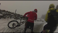
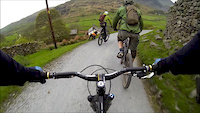
Videos of Staveley Mountain Bike

trail: Nan Bield Pass
4:38 |
266 |
Nov 20, 2016
0:56 |
291 |
Feb 15, 2015
trail: Nan Bield Pass
8:44 |
936 |
May 8, 2014

6:22 |
550 |
Jul 4, 2019 , My City

8:03 |
540 |
Mar 13, 2019 , My City
Recent Trail Reports
| status | trail | date | condition | info | user |
|---|---|---|---|---|---|
| 3 Rivers | Jun 14, 2025 @ 11:37am Jun 14, 2025 | Wet | RadBikeBro NCTC | ||
| Green Quarter Descent | Jun 14, 2025 @ 11:37am Jun 14, 2025 | Wet | RadBikeBro NCTC | ||
| Garburn Pass Descent Eastwards | May 5, 2025 @ 9:22am May 5, 2025 | Dry | kY3sc7 | ||
| WA-hoooooo Hall Wood Descent | Jul 20, 2024 @ 12:15am Jul 20, 2024 | Ideal | kY3sc7 | ||
| Nan Bield Pass | Oct 16, 2022 @ 2:04am Oct 16, 2022 | Wet | ssulinski | ||
| HP Plantation | Jul 5, 2020 @ 4:01am Jul 5, 2020 | Wet | johnnyboy11000 | ||
| Gatescarth Pass | Dec 28, 2019 @ 5:08am Dec 28, 2019 | Ideal | RobbieCooper |
Activity Feed
| username | action | type | title | date |
|---|---|---|---|---|
| htHtd5 | wishlist | route | activity #97005486 | Jun 14, 2026 @ 2:36pm Jun 14, 2026 |
| yman98 | wishlist | trail | activity #96983844 | Jun 14, 2026 @ 10:27am Jun 14, 2026 |
| Gorilla-Brakes | add | photo | activity #96611683 | Jun 9, 2026 @ 9:37am Jun 9, 2026 |
| pcaesl | ridden | route | activity #96231094 | Jun 4, 2026 @ 8:49am Jun 4, 2026 |
| Germanslayer | wishlist | route | activity #93631814 and 1 more | Apr 29, 2026 @ 12:24am Apr 29, 2026 |
Recent Comments
| username | type | title | comment | date |
|---|---|---|---|---|
| trail | Do loop from Troutbeck and enjoy the scenery. ... | Aug 4, 2025 @ 2:14am Aug 4, 2025 | ||
| trail | Yes, done it on a 120mm hardtail | Mar 27, 2024 @ 2:36am Mar 27, 2024 | ||
| trail | Straightforward open single-track. A bit boggy... | Jul 22, 2023 @ 3:30am Jul 22, 2023 | ||
| trail | Scary as only my second downhill Trail! But... | Jul 22, 2023 @ 3:28am Jul 22, 2023 | ||
| trail | Brilliant first ever proper downhill trail.... | Jul 22, 2023 @ 3:22am Jul 22, 2023 |
Nearby Areas
| name | distance | ||||
|---|---|---|---|---|---|
| Grizedale Forest | 1 | 6 | 5 | 9.7 km | |
| Lake District National Park | 10.5 km | ||||
| Farleton | 2 | 14.8 km | |||
| Eskdale | 18.1 km | ||||
| Whinlatter | 7 | 20 km |
Activity Type Stats
| activitytype | trails | distance | descent | descent distance | total vertical | rating | global rank | state rank | photos | reports | routes | ridelogs |
|---|---|---|---|---|---|---|---|---|---|---|---|---|
| Mountain Bike | 6 | 11 miles | 4,790 ft | 8 miles | 1,588 ft | #6,535 | #206 | 42 | 40 | 4 | 2,525 | |
| Hike | 7 | 11 miles | 4,790 ft | 8 miles | 1,588 ft | #8,719 | #225 | 39 | 271 | |||
| Trail Running | 7 | 11 miles | 4,790 ft | 8 miles | 1,588 ft | #7,997 | #212 | 39 | 118 |
Frequently Asked Questions About Staveley
▼
What are the highest rated mountain biking trails in Staveley?
The highest rated mountain biking trails in Staveley are:
- WA-hoooooo Hall Wood Descent (4.1/5)
- Garburn Pass Descent Eastwards (4/5)
- Green Quarter Descent (4/5)
- Gatescarth Pass (3.8/5)
- Nan Bield Pass (3.6/5)
▼
What is the best time of the year to ride in Staveley?
Based on ride log data, the most popular months to ride in Staveley are:
- July (18 activities)
- August (14 activities)
- June (11 activities)
▼
Where can I park to ride in Staveley?
Check the Staveley trail map for trailhead and parking information. Community members regularly update access and parking details for trails in the area.
▼
What is the longest trail in Staveley?
The longest trail in Staveley is Nan Bield Pass at 7.7 km. View all trails sorted by distance.
- By pmbaenduro PMBA & contributors
- Admins: wisey, MathieuC, cemoorelife
- #7238 - 12,008 views
- staveley activity log | embed map of Staveley mountain bike trails |
Downloading of trail gps tracks in kml & gpx formats is enabled for Staveley.
You must login to download files.