close
-
Layers w
- Weather Layers
- Pro
- Pro
- Pro
- Pro
- Pro
- Pro
- More Layers
- Pro
- Pro
- Pro
- Pro
-
Upgrade to

3D
Trail Conditions
- Unknown
- Snow Groomed
- Snow Packed
- Snow Covered
- Snow Cover Partial
- Freeze/thaw Cycle
- Icy
- Prevalent Mud
- Wet
- Variable
- Ideal
- Dry
- Very Dry
Trail Flow (Ridden Direction)
Trailforks scans users ridelogs to determine the most popular direction each trail is ridden. A good flowing trail network will have most trails flowing in a single direction according to their intension.
The colour categories are based on what percentage of riders are riding a trail in its intended direction.
The colour categories are based on what percentage of riders are riding a trail in its intended direction.
- > 96%
- > 90%
- > 80%
- > 70%
- > 50%
- < 50%
- bi-directional trail
- no data
Trail Last Ridden
Trailforks scans ridelogs to determine the last time a trail was ridden.
- < 2 days
- < 1 week
- < 2 weeks
- < 1 month
- < 6 months
- > 6 months
Trail Ridden Direction
The intended direction a trail should be ridden.
- Downhill Only
- Downhill Primary
- Both Directions
- Uphill Primary
- Uphill Only
- One Direction
Contribute Details
Colors indicate trail is missing specified detail.
- Description
- Photos
- Description & Photos
- Videos
Trail Popularity ?
Trailforks scans ridelogs to determine which trails are ridden the most in the last 9 months.
Trails are compared with nearby trails in the same city region with a possible 25 colour shades.
Think of this as a heatmap, more rides = more kinetic energy = warmer colors.
- most popular
- popular
- less popular
- not popular
ATV/ORV/OHV Filter
Max Vehicle Width
inches
US Cell Coverage
Legend

Radar Time
Activity Recordings
Trailforks uses anonymized public activity data.
?
Activity Recordings
Trailforks uses anonymized public activity data.
?
Personal Heatmap
▶
Activity Types
all
/
none
▶
Options
2
Date range
month
–
Winter Trails
Warning
A routing network for winter maps does not exist. Selecting trails using the winter trails layer has been disabled.
Missing Trails
Most Popular
Least Popular
Trails are colored based on popularity. The more popular a trail is, the more red. Less popular trails trend towards green.
Jump Magnitude Heatmap
Heatmap of where riders jump on trails. Zoom in to see individual jumps, click circles to view jump details.
BC Backroad Status
![map legend]()
Service Road Atlas is a free to use, community-driven service for viewing and creating reports on the numerous back-country service roads around B.C. and Alberta.

Slope Aspect
Direction the slope faces
Trails Deemphasized
Trails are shown in grey.
Only show trails with no bike usage.
Suggested Layers
Based on selected activity type
Save the current map location and zoom level as your default home location whenever this page is loaded.
SavePopular Trail Networks
view all areas »
No description for Steiermark has been added yet!
Login or register to submit one.
AKA: Styria
This region uses the Uk/Euro style trail grading system.
Region Details
- 86
- 1
- 43
- 73
- 34
- 23
Stats
- Avg Trail Rating
- Trails (view details)
- 276
- Trails Mountain Bike
- 274
- Trails E-Bike
- 175
- Trails Gravel Bike
- 5
- Trails Adaptive Bike
- 1
- Trails Horse
- 3
- Trails Hike
- 172
- Trails Trail Running
- 173
- Trails Dirtbike/Moto
- 1
- Trails ATV/ORV/OHV
- 1
- Trails Snowmobile
- 3
- Trails Snowshoe
- 4
- Trails Downhill Ski
- 43
- Trails Backcountry Ski
- 9
- Trails Nordic Ski
- 11
- Total Distance
- 286 miles
- Total Descent
- 107,026 ft
- Total Vertical
- 6,979 ft
- Highest Trailhead
- 7,841 ft
- Reports
- 1,429
- Photos
- 612
- Ridden Counter
- 26,295
Articles
Race Report: International Rookies Championships in Schladming 2023
Sep 25, 2023 from pinkbike.com
For more than 300 young athletes, the highlight of the season was on the agenda last weekend.
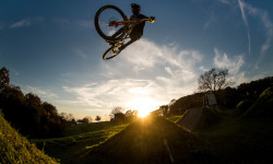
Photo Epic: The Dirt Farmer - At Home with David Trummer
Jan 10, 2023 from pinkbike.com
Gorge on these glorious golden hour shots from Steirmark, Austria.
Video: POV of Tracey Hannah As She Pins It For A Lap Down Schladming
Jun 9, 2022 from pinkbike.com
Corners to die for.
Video: One Hell of a Year in the Alps
Dec 29, 2020 from pinkbike.com
Luis Gerstner moved full time to the Austrian Alps and spent a lot of time in Leogang, Schladming, and Saalbach.
Sub Regions
- Bruck-Mürzzuschlag (78)
- Aflenz (8)
- Bikearena Aflenz (8)
- Bruck an der Mur (22)
- Kapfenberg (41)
- Mariazell (7)
- Aflenz (8)
- Deutschlandsberg (15)
- Leibnitz (2)
- Leoben (13)
- Leoben (9)
- Trofaiach (2)
- Bike Arena Präbichl (6)
- Leoben (9)
- Liezen (48)
- Bad Aussee (1)
- Schladming (36)
- Schladming-Dachstein (20)
- Bad Aussee (1)
- Murau (6)
- Murtal (20)
- Judenburg (11)
- Knittelfeld (9)
- Judenburg (11)
- Südoststeiermark (34)
- Bad Gleichenberg (34)
- Bad Gleichenberg (34)
- Weiz (13)
- Weiz (10)
- Funbase Holzmeisterlift (3)
- Trail Land Miesenbach (10)
- Weiz (10)
- Graz (30)
- Judendorf (1)
- Riegersburg (1)
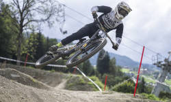
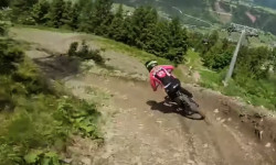
Popular Steiermark Mountain Biking Trails
• 65 ★ 3.2 • 1 mile • 0 ft • 1,037 •
Downtown Line (Nr. 411) (mittel) - ist mit Brechsandbelag versehen sowie mit einigen leichten Hindernissen bestückt. Dazu zählen Tables, kleine Step-Ups und Step-Downs.
• 55 ★ 3.6 • 4,685 ft • 8 ft • 960 •
Kessler Line (Nr.407) (mittel) Dieser Trail führt im mittleren Schwierigkeitsgrad durch Wald und Wiesen Richtung Tal, bevor er in die Downtownline mündet. Viele Kurven, verspielte Wellen und kleine Sprünge zeichnen diesen Trail aus.
• 95 ★ 4.9 • 1 mile • 0 ft • 875 •
Pro Downhill (Nr. 403) (schwer) längst legendär ist Österreichs längste Downhillstrecke auf der Planai. Der Start befindet sich auf 1.830 m und ist mit der Planai Seilbahn erreichbar. Anschließend geht es in naturbelassener...
• 95 ★ 3.8 • 3,990 ft • 13 ft • 434 •
Die Streckenführung des ersten Abschnittes des Schnepfenwald Trails punktet mit vielen Wellen, die schnelle Biker überspringen können.
• 95 ★ 3.2 • 4,026 ft • 11 ft • 427 •
Der zweite Abschnitt des Schnepfenwaldtrails beginnt nach einer kurzen Fahrt auf der und überzeugt mit seiner sehr abwechslungsreichen, mit Holzelementen bestückten Streckenführung, direkt bis hin zur Preunegg Jet Talstation.
• 95 ★ 4.2 • 4,177 ft • 41 ft • 371 •
Die „Route 66“, benannt nach der alten Wanderwegnummer, ist ein flowiger Waldweg mit weichem, nadelbedecktem Boden. Nach einer kurzen Forstweg-Passage beginnt ein neu gebauter, schmaler Trailabschnitt, mit engeren Anliegerkurven.
• 85 ★ 4.2 • 3 miles • 91 ft • 351 •
Direkt an der Bergstation Preunegg Jet beginnt der , der sich auch für Einsteiger bestens eignet. Die Strecke ist frei von Hindernissen und Stufen und lädt mit dem flowigen Verlauf dazu ein, die Bremsen offen zu lassen. Nach 300 m auf...
• 60 ★ 3.5 • 1 mile • 0 ft • 340 •
Der überzeugt mit seiner naturnahen Bauweise. Elemente wie Felsplatten und Steine, sowie die natürlichen Kurven machen diese Line zu der idealen Strecke für Trail-Einsteiger die, nach den blauen Abschnitten eine neue Herausforderung...
Steiermark Mountain Bike Routes
116 miles • 19,090 ft • 2 • Loop •
"The Grand Jogl Tour" takes the cyclist along a wide variety of paths, roads and trails around the...
7 miles • 1,463 ft • 2 • Loop •
Official MTB tour to . Allowed usage: - May to mid September: 7 a.m. to 6 p.m. - mid September to mid...
4 miles • 852 ft • 1 • Loop •
Official MTB loop Allowed usage: - May to mid September: 7 a.m. to 6 p.m. - mid September to mid October:...
9 miles • 1,540 ft • 1 • Loop •
Official MTB loop to Tollinghöhe. Allowed usage: - May to mid September: 7 a.m. to 6 p.m. - mid September...
21 miles • 3,771 ft • 1 • Loop •
Official MTB route onto the "Mugel" Allowed usage: - May to mid September: 7 a.m. to 6 p.m. - mid...
7 miles • 2,684 ft • 1 • Out & Back •
Official MTB tour from Leoben-Seegraben towards Himbergereck. Allowed usage: - May to mid September: 7...
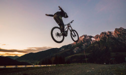
Photos of Steiermark Mountain Bike
Videos of Steiermark Mountain Bike
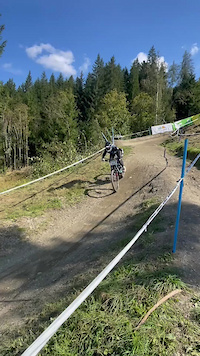
trail: Rookie Downhill
0:14 |
21 |
Apr 30, 2025
0:05 |
14 |
Jul 7, 2024
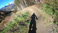
trail: 99 Jumpline
6:51 |
51 |
Nov 11, 2022

trail: Ois z'Spath
0:05 |
366 |
Aug 27, 2021
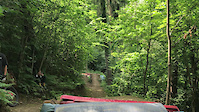
trail: Ois z'Spath
0:05 |
|
Aug 27, 2021
trail: Getscho
0:08 |
374 |
Apr 13, 2021
trail: Gibim
0:06 |
438 |
Mar 30, 2021
trail: Gibim
0:52 |
100 |
Jan 5, 2021
Recent Trail Reports
Activity Feed
| username | action | type | title | date |
|---|---|---|---|---|
| ktm-boy-69 | update | trail | activity #97172909 | Jun 17, 2026 @ 4:10am Jun 17, 2026 |
| SlayerHippie | add | trail | activity #97172818 | Jun 17, 2026 @ 4:08am Jun 17, 2026 |
| nizeps | add | video | activity #97089117 and 2 more | Jun 15, 2026 @ 10:57pm Jun 15, 2026 |
| VodruamvomBergqnt1hT | add | report | activity #97046539 and 3 more | Jun 15, 2026 @ 9:22am Jun 15, 2026 |
| FloImSchnee | add | report | activity #97038634 | Jun 15, 2026 @ 7:05am Jun 15, 2026 |
Recent Comments
| username | type | title | comment | date |
|---|---|---|---|---|
| trail | uphill quite challenging | May 10, 2026 @ 10:56pm May 10, 2026 | ||
| trail | Wir sind heute den schönen Trail gefahren.... | Oct 29, 2025 @ 9:57am Oct 29, 2025 | ||
| trail | Wintersperre ist erst ab 14. November gemäß... | Oct 22, 2025 @ 12:25am Oct 22, 2025 | ||
| trail | Is the trail opened ? | Oct 21, 2025 @ 12:50pm Oct 21, 2025 | ||
| trail | Stimmt das wirklich? Bzw. wurde er wieder... | Sep 1, 2025 @ 1:54pm Sep 1, 2025 |
Local Badges
-

Top 10 Trails0 awarded -

Epic Ride 50k171 awarded -
Epic Ride 50k90 awarded -
Top 10 Trails0 awarded -
Top 10 Trails1 awarded -
Top 10 Trails0 awarded
Bike & Skill Parks
| name | type | city | rating |
|---|---|---|---|
| Bikepark Schladming | bike park | Schladming | |
| Schöckl Trail Area | bike park | Graz | |
| Bikealps Mariazeller Bürgeralpe | bike park | Mariazell | |
| Bikearena Aflenz | bike park | Aflenz | |
| Funbase Holzmeisterlift | bike park |
Activity Type Stats
| activitytype | trails | distance | descent | descent distance | total vertical | rating | global rank | state rank | photos | reports | routes | ridelogs |
|---|---|---|---|---|---|---|---|---|---|---|---|---|
| Mountain Bike | 267 | 262 miles | 94,012 ft | 132 miles | 5,594 ft | 580 | 1,425 | 25 | 49,847 | |||
| E-Bike | 175 | 156 miles | 58,566 ft | 82 miles | 5,594 ft | 1,211 | 15 | 4,001 | ||||
| Gravel Bike | 5 | 8 | 5 | 186 | ||||||||
| Horse | 3 | 3 miles | 2,172 ft | 2 miles | 4,160 ft | 40 | ||||||
| Hike | 172 | 200 miles | 59,902 ft | 86 miles | 5,594 ft | 2 | 1,172 | 1 | 5,819 | |||
| Trail Running | 173 | 200 miles | 59,902 ft | 86 miles | 5,594 ft | 1,173 | 1 | 564 | ||||
| Dirtbike/Moto | 1 | 5 miles | 240 ft | 4,665 ft | 2,178 ft | 38 | 1 | |||||
| ATV/ORV/OHV | 1 | 5 miles | 240 ft | 4,665 ft | 2,178 ft | 38 | ||||||
| Snowmobile | 3 | 8 miles | 1,942 ft | 2 miles | 3,593 ft | 15 | ||||||
| Snowshoe | 4 | 8 miles | 1,942 ft | 2 miles | 3,593 ft | 16 | 67 | |||||
| Downhill Ski | 43 | 8 miles | 1,942 ft | 2 miles | 3,593 ft | 16 | 2,723 | |||||
| Backcountry Ski | 9 | 21 miles | 6,939 ft | 6 miles | 4,980 ft | 16 | 1,407 | |||||
| Nordic Ski | 11 | 8 miles | 1,942 ft | 2 miles | 3,593 ft | 16 | 1,442 |
Activities
Trails
Points of Interest
- Cableway Pick-Up (Planaibahn) Other
- Grüner See Sight
- Sportcafé im BSFZ Obertraun Lodge
- Aussichtsplattform Leoben / Viewpoint
- Chairlift Drop-Off Other
- Chairlift Pick-Up Other
- Hofer Hütte Cabin
- Viewpoint Murtal / Seetaler Alpen
- T-Bar Drop-Off Other
- T-Bar Pick-Up Other
- Hochgolling (2,835 m)
- Hoher Gjaidstein (2,761 m)
- Niederer Dachstein (2,700 m)
- By MasterChris & contributors
- Admins: ktm-boy-69, mpecsi, lines, larry81541, TrailAreaWeiz, maxtrafella
- #9850 - 9,924 views
- steiermark activity log | embed map of Steiermark mountain bike trails | steiermark mountain biking points of interest
Downloading of trail gps tracks in kml & gpx formats is enabled for Steiermark.
You must login to download files.