close
-
Layers w
- Weather Layers
- Pro
- Pro
- Pro
- Pro
- Pro
- Pro
- More Layers
- Pro
- Pro
- Pro
- Pro
-
Upgrade to

3D
Trail Conditions
- Unknown
- Snow Groomed
- Snow Packed
- Snow Covered
- Snow Cover Partial
- Freeze/thaw Cycle
- Icy
- Prevalent Mud
- Wet
- Variable
- Ideal
- Dry
- Very Dry
Trail Flow (Ridden Direction)
Trailforks scans users ridelogs to determine the most popular direction each trail is ridden. A good flowing trail network will have most trails flowing in a single direction according to their intension.
The colour categories are based on what percentage of riders are riding a trail in its intended direction.
The colour categories are based on what percentage of riders are riding a trail in its intended direction.
- > 96%
- > 90%
- > 80%
- > 70%
- > 50%
- < 50%
- bi-directional trail
- no data
Trail Last Ridden
Trailforks scans ridelogs to determine the last time a trail was ridden.
- < 2 days
- < 1 week
- < 2 weeks
- < 1 month
- < 6 months
- > 6 months
Trail Ridden Direction
The intended direction a trail should be ridden.
- Downhill Only
- Downhill Primary
- Both Directions
- Uphill Primary
- Uphill Only
- One Direction
Contribute Details
Colors indicate trail is missing specified detail.
- Description
- Photos
- Description & Photos
- Videos
Trail Popularity ?
Trailforks scans ridelogs to determine which trails are ridden the most in the last 9 months.
Trails are compared with nearby trails in the same city region with a possible 25 colour shades.
Think of this as a heatmap, more rides = more kinetic energy = warmer colors.
- most popular
- popular
- less popular
- not popular
ATV/ORV/OHV Filter
Max Vehicle Width
inches
US Cell Coverage
Legend

Radar Time
Activity Recordings
Trailforks uses anonymized public activity data.
?
Activity Recordings
Trailforks uses anonymized public activity data.
?
Personal Heatmap
▶
Activity Types
all
/
none
▶
Options
2
Date range
month
–
Winter Trails
Warning
A routing network for winter maps does not exist. Selecting trails using the winter trails layer has been disabled.
Missing Trails
Most Popular
Least Popular
Trails are colored based on popularity. The more popular a trail is, the more red. Less popular trails trend towards green.
Jump Magnitude Heatmap
Heatmap of where riders jump on trails. Zoom in to see individual jumps, click circles to view jump details.
BC Backroad Status
![map legend]()
Service Road Atlas is a free to use, community-driven service for viewing and creating reports on the numerous back-country service roads around B.C. and Alberta.

Slope Aspect
Direction the slope faces
Trails Deemphasized
Trails are shown in grey.
Only show trails with no bike usage.
Suggested Layers
Based on selected activity type
Save the current map location and zoom level as your default home location whenever this page is loaded.
Save
No description for Steinbach has been added yet!
Login or register to submit one.
Activities Click to view
- Mountain Bike
43 trails
- E-Bike
7 trails
- Adaptive Bike
0 trails
- Winter Fat Bike
0 trails
- Horse
22 trails
- Hike
41 trails
- Trail Running
41 trails
- Dirtbike/Moto
0 trails
- ATV/ORV/OHV
0 trails
- Snowshoe
0 trails
- Nordic Ski
16 trails
Region Details
- 7
- 17
- 16
- 2
Region Status
Caution as of Dec 31, 2025Local Trail Association
Stats
- Avg Trail Rating
- Trails (view details)
- 42
- Trails Mountain Bike
- 43
- Trails E-Bike
- 7
- Trails Horse
- 22
- Trails Hike
- 41
- Trails Trail Running
- 41
- Trails Nordic Ski
- 16
- Total Distance
- 42 miles
- Total Descent
- 1,208 ft
- Total Vertical
- 460 ft
- Highest Trailhead
- 1,291 ft
- Reports
- 187
- Photos
- 36
- Ridden Counter
- 1,068
Sub Regions
-
Moose Lake Provincial Park
-
Sandilands Provincial Forest
- 12
- 16
- 2
Popular Steinbach Mountain Biking Trails
• 65 ★ 4.0 • 2,511 ft • 65 ft • 51 •
This is the main trail used for climbing the hill to the rest of the trail system. It's a nice steady climb to get your lungs and legs ready for whats in store.
• 55 ★ 3.0 • 545 ft • 0 ft • 47 •
Moderately popular blue difficulty singletrack. This multi-use trail can be used both directions and has a moderate overall physical rating with a 0 ft blue climb. On average it takes minutes to complete this trail.
• 45 ★ 4.0 • 5,210 ft • 73 ft • 45 •
Get ready for some fast singletrack! The first climb has a few logs to climb over. Then, the first downhill starts with a drop. If taken at good speed, you will send it no problem. But maybe drops aren't for you? no problem! the drop is...
• 90 ★ 3.0 • 780 ft • 0 ft • 43 •
Popular green difficulty singletrack. This multi-use trail can be used both directions and has a easy overall physical rating with a 0 ft green climb. On average it takes minutes to complete this trail.
• 75 ★ 3.0 • 1,820 ft • 10 ft • 39 •
Popular blue difficulty singletrack. This multi-use trail can be used both directions. On average it takes 3 minutes to complete this trail.
Steinbach Mountain Bike Routes
★ 1.0 • 5 miles • 198 ft • 19 •
This is the Preferred route most riders take when riding the trails on Suicide Hilll in Sandilands
Photos of Steinbach Mountain Bike
Videos of Steinbach Mountain Bike
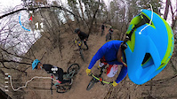
trail: West Coast
3:00 |
|
May 3, 2021
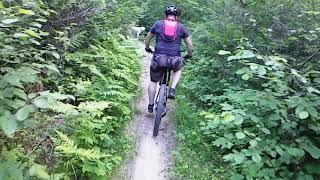
trail: Roller Coaster
39:40 |
268 |
Jul 24, 2022 , Steinbach
Recent Trail Reports
| status | trail | date | condition | info | user |
|---|---|---|---|---|---|
| RV Site Connector | Dec 31, 2025 @ 1:59pm (America/Winnipeg) Dec 31, 2025 | Snow Groomed | KenRM | ||
| Enchanted Prairie Chicken | Dec 31, 2025 @ 1:59pm (America/Winnipeg) Dec 31, 2025 | Snow Groomed | KenRM | ||
| Jetliner | Dec 31, 2025 @ 1:59pm (America/Winnipeg) Dec 31, 2025 | Snow Groomed | KenRM | ||
| Bullet Train | Dec 31, 2025 @ 1:59pm (America/Winnipeg) Dec 31, 2025 | Snow Groomed | KenRM | ||
| Bear Country | May 7, 2024 @ 11:43am May 7, 2024 | Ideal | overcomer | ||
| Bobsled | May 7, 2024 @ 11:43am May 7, 2024 | Variable | overcomer | ||
| Gutterball | May 7, 2024 @ 11:43am May 7, 2024 | Ideal | overcomer | ||
| Owl City | May 7, 2024 @ 11:43am May 7, 2024 | Very Dry | overcomer | ||
| Roller Coaster | May 7, 2024 @ 11:43am May 7, 2024 | Very Dry | overcomer | ||
| Enter Sandman | May 7, 2024 @ 11:43am May 7, 2024 | Very Dry | overcomer |
Activity Feed
| username | action | type | title | date |
|---|---|---|---|---|
| KenRM | add | report | activity #86421925 and 3 more | Dec 31, 2025 @ 7:33pm Dec 31, 2025 |
| markholloway | update | region | activity #84720287 | Nov 25, 2025 @ 2:12pm Nov 25, 2025 |
| markholloway | update | region | activity #84706800 | Nov 25, 2025 @ 9:45am Nov 25, 2025 |
| TrekBoy64 | wishlist | route | activity #80947870 | Sep 23, 2025 @ 6:13am Sep 23, 2025 |
| TrekBoy64 | wishlist | region | activity #79725575 | Sep 5, 2025 @ 8:45pm Sep 5, 2025 |
Recent Comments
| username | type | title | comment | date |
|---|---|---|---|---|
| trail | The trail through the clear-cut is rideable.... | Aug 12, 2020 @ 2:56pm Aug 12, 2020 | ||
| report | Hi, are the trails pretty wet right now? | Sep 23, 2019 @ 2:14pm Sep 23, 2019 |
Local Badges
-

10 Blue Trails18 awarded -

Epic Ride Climb 2k0 awarded -

Climbing 10k Badge0 awarded -

Climbing 100k Badge0 awarded -

Epic Ride Descent 2k0 awarded -

Descent 10k Badge0 awarded
Activity Type Stats
| activitytype | trails | distance | descent | descent distance | total vertical | rating | global rank | state rank | photos | reports | routes | ridelogs |
|---|---|---|---|---|---|---|---|---|---|---|---|---|
| Mountain Bike | 43 | 42 miles | 1,207 ft | 8 miles | 459 ft | #4,257 | #9 | 36 | 186 | 1 | 1,491 | |
| E-Bike | 7 | 10 miles | 112 ft | 4,783 ft | 436 ft | #7,061 | #15 | 110 | 7 | |||
| Horse | 22 | 10 miles | 705 ft | 4 miles | 121 ft | #2,272 | #6 | 96 | 1 | |||
| Hike | 41 | 34 miles | 1,089 ft | 7 miles | 459 ft | #6,027 | #16 | 184 | 67 | |||
| Trail Running | 41 | 34 miles | 1,089 ft | 7 miles | 459 ft | #5,530 | #10 | 184 | 28 | |||
| Nordic Ski | 16 | 10 miles | 705 ft | 4 miles | 121 ft | #1,067 | #12 | 67 | 198 |
Frequently Asked Questions About Steinbach
▼
What are the best places to ride in Steinbach?
Steinbach has 2 areas to explore for mountain biking. The top rated areas are:
▼
What are the highest rated mountain biking trails in Steinbach?
The highest rated mountain biking trails in Steinbach are:
- Limp Pine (4.2/5)
- Roller Derby (4.1/5)
- Bobsled (4.1/5)
- Exit Sandman (4.1/5)
- Red Pine Rollers (4/5)
▼
What is the best time of the year to ride in Steinbach?
Based on ride log data, the most popular months to ride in Steinbach are:
- May (21 activities)
- June (20 activities)
- October (16 activities)
▼
Where can I park to ride in Steinbach?
There are 3 parking locations listed in Steinbach. The most popular parking spots are: View all parking and trailhead locations on the map to plan your visit.
Activities
- By bikenboard69
 & contributors
 - Admins: MPP, MB, crislabossiere
- #15231 - 6,323 views
- steinbach activity log | embed map of Steinbach mountain bike trails | steinbach mountain biking points of interest
Downloading of trail gps tracks in kml & gpx formats is enabled for Steinbach.
You must login to download files.