close
-
Layers w
- Weather Layers
- Pro
- Pro
- Pro
- Pro
- Pro
- Pro
- More Layers
- Pro
- Pro
- Pro
- Pro
-
Upgrade to

3D
Trail Conditions
- Unknown
- Snow Groomed
- Snow Packed
- Snow Covered
- Snow Cover Partial
- Freeze/thaw Cycle
- Icy
- Prevalent Mud
- Wet
- Variable
- Ideal
- Dry
- Very Dry
Trail Flow (Ridden Direction)
Trailforks scans users ridelogs to determine the most popular direction each trail is ridden. A good flowing trail network will have most trails flowing in a single direction according to their intension.
The colour categories are based on what percentage of riders are riding a trail in its intended direction.
The colour categories are based on what percentage of riders are riding a trail in its intended direction.
- > 96%
- > 90%
- > 80%
- > 70%
- > 50%
- < 50%
- bi-directional trail
- no data
Trail Last Ridden
Trailforks scans ridelogs to determine the last time a trail was ridden.
- < 2 days
- < 1 week
- < 2 weeks
- < 1 month
- < 6 months
- > 6 months
Trail Ridden Direction
The intended direction a trail should be ridden.
- Downhill Only
- Downhill Primary
- Both Directions
- Uphill Primary
- Uphill Only
- One Direction
Contribute Details
Colors indicate trail is missing specified detail.
- Description
- Photos
- Description & Photos
- Videos
Trail Popularity ?
Trailforks scans ridelogs to determine which trails are ridden the most in the last 9 months.
Trails are compared with nearby trails in the same city region with a possible 25 colour shades.
Think of this as a heatmap, more rides = more kinetic energy = warmer colors.
- most popular
- popular
- less popular
- not popular
ATV/ORV/OHV Filter
Max Vehicle Width
inches
US Cell Coverage
Legend

Radar Time
Activity Recordings
Trailforks uses anonymized public activity data.
?
Activity Recordings
Trailforks uses anonymized public activity data.
?
Personal Heatmap
▶
Activity Types
all
/
none
▶
Options
2
Date range
month
–
Winter Trails
Warning
A routing network for winter maps does not exist. Selecting trails using the winter trails layer has been disabled.
Missing Trails
Most Popular
Least Popular
Trails are colored based on popularity. The more popular a trail is, the more red. Less popular trails trend towards green.
Jump Magnitude Heatmap
Heatmap of where riders jump on trails. Zoom in to see individual jumps, click circles to view jump details.
BC Backroad Status
![map legend]()
Service Road Atlas is a free to use, community-driven service for viewing and creating reports on the numerous back-country service roads around B.C. and Alberta.

Slope Aspect
Direction the slope faces
Trails Deemphasized
Trails are shown in grey.
Only show trails with no bike usage.
Suggested Layers
Based on selected activity type
Save the current map location and zoom level as your default home location whenever this page is loaded.
SavePopular Trail Networks
view all areas »
No description for Stellenbosch has been added yet!
Login or register to submit one.
Activities Click to view
- Mountain Bike
517 trails
- E-Bike
479 trails
- Gravel Bike
0 trails
- Adaptive Bike
0 trails
- Winter Fat Bike
0 trails
- Horse
15 trails
- Hike
364 trails
- Trail Running
365 trails
- ATV/ORV/OHV
8 trails
Region Details
- 145
- 2
- 172
- 142
- 22
- 2
Region Status
Open as of Jun 16, 2026Stats
- Avg Trail Rating
- Trails (view details)
- 535
- Trails Mountain Bike
- 520
- Trails E-Bike
- 479
- Trails Horse
- 15
- Trails Hike
- 365
- Trails Trail Running
- 365
- Trails ATV/ORV/OHV
- 8
- Total Distance
- 419 miles
- Total Descent
- 79,199 ft
- Total Vertical
- 4,874 ft
- Highest Trailhead
- 4,937 ft
- Reports
- 5,251
- Photos
- 1,130
- Ridden Counter
- 134,932
Articles
Video: Andrew Neethling Meets Clemens Kaudela in South Africa 'Mission to Ride'
May 19, 2021 from pinkbike.com
Clemens was in town building a new line at Hellsend Dirt Compound, so Andrew took the opportunity to hang out with Clemens for a chat, and to show...
Video: Niko Velasco Rips Through Scorched Trails in South Africa
Dec 19, 2020 from pinkbike.com
After a fire burned through the night on Niko Velasco's farm, he checked the trails by ripping through at a searing pace.
Video: Big Trains at The Halloween Jam at Hellsend Bike Compound
Nov 3, 2020 from pinkbike.com
A spooky jam, with all the local South African rippers.
Video: Whip Offs and Dirt Jump Jams at the 2020 Hellsend Dirt Party
Jul 14, 2020 from pinkbike.com
One last send session at the compound before the lockdown
Sub Regions
-
Banhoek Conservancy Trails
- 16
- 13
- 1
-
Bethlehem Plaas
- 9
- 8
- 1
-
Boschendal Wine Farm
- 2
- 12
- 10
-
Bottelary Hills Conservancy MTB Trails
- 89
- 16
-
Delvera Wine Estate
- 2
- 1
-
Dirtopia Trail Network - Murati & Uitkyk Wine Estates
- 7
- 17
-
Helderberg Trails
- 2
- 18
- 7
-
Hellsend Dirt Compound
- 4
- 1
-
Idas Valley Nature Area
- 3
-
Knorhoek
- 1
-
MTO Jonkershoek
- 1
- 16
- 11
- 6
-
Plaisir Trails
- 7
- 9
- 1
-
STF Botmaskop
- 4
- 7
-
STF Coetzenburg
- 1
- 5
- 1
-
STF Eden / Paradyskloof
- 9
- 1
-
STF G-Spot
- 6
- 3
-
STF Koloniesland
- 3
-
STF Mont Marie
- 3
- 5
Popular Stellenbosch Mountain Biking Trails
• 100 ★ 4.5 • 643 ft • 7 ft • 899 •
Highly rated popular blue difficulty singletrack. This multi-use trail can be used downhill only. Trail visibility is always easy to follow. On average it takes 4 minutes to complete this trail.
• 100 ★ 3.5 • 692 ft • 108 ft • 829 •
Popular green difficulty singletrack. This mountain bike primary trail can be used uphill primary and has a easy overall physical rating with a 108 ft blue climb. It features berm and jump. Trail visibility is always easy to follow. On average it takes minutes to complete this trail.
• 95 ★ 4.7 • 2,638 ft • 10 ft • 806 •
Challenging trail for experienced riders with above average technical skills.
• 100 ★ 4.7 • 430 ft • 0 ft • 774 •
Highly rated popular blue difficulty singletrack. This multi-use trail can be used downhill only. Trail visibility is always easy to follow. On average it takes minutes to complete this trail.
• 100 ★ 4.0 • 3,287 ft • 44 ft • 767 •
Popular green difficulty singletrack. This multi-use trail can be used both directions. On average it takes 3 minutes to complete this trail.
• 80 ★ 4.4 • 4,229 ft • 8 ft • 754 •
An awesome flowy trail featuring loads of jumps and berms sculpted by legendary trail builder Hylton Turvey.
Stellenbosch Mountain Bike Routes
The Prado Featured
12 miles • 2,157 ft • 13 • Loop •
The Prado route starts you off from the MTO Trails main gate and takes up the famous Irish Trail climb....
12 miles • 925 ft • 15 • Loop •
Open farm roads with great views onto the mountain ranges surrounding Stellenbosch with flowing single...
The Levo Featured
★ 1.0 • 12 miles • 2,541 ft • 12 • Loop •
The Levo route starts you off from the MTO Trails main gate and takes you up some meandering jeep track...
The Ibex Featured
11 miles • 1,996 ft • 10 • Loop •
The IBEX route starts you off from the MTO Trails main gate and takes up the famous Irish Trail climb....
The Hanger to The Top Mast Featured
★ 3.0 • 6 miles • 1,705 ft • 5 • Point to Point •
This climb is from the trail head at The Hanger Bike Co. all the way to "Top of the World" and the top of...
★ 3.0 • 15 miles • 2,269 ft • 3 • Loop •
25km MTB and trail run from Muratie
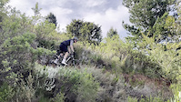
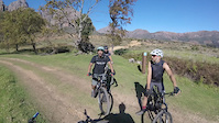
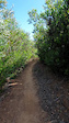
Photos of Stellenbosch Mountain Bike
Videos of Stellenbosch Mountain Bike
0:05 |
2 |
Sep 27, 2025

0:17 |
3 |
Sep 27, 2025
0:31 |
4 |
Sep 27, 2025
trail: Afterburner
0:21 |
148 |
Jun 9, 2021
trail: Boegoe Zag
0:16 |
61 |
Dec 15, 2020
trail: Eden Main Line
0:11 |
152 |
Dec 1, 2020

trail: Mach 1
0:26 |
292 |
Sep 22, 2020
trail: Eden Main Line
0:29 |
120 |
May 18, 2020
Current Trail Warnings
| status | trail | date | condition | user | info |
|---|---|---|---|---|---|
| Eden Connector to Top | Jun 7, 2026 @ 9:55am (Africa/Johannesburg) Jun 7, 2026 | Ideal | SchalkMarais | A number of trees down across the trail.... |
Recent Trail Reports
| status | trail | date | condition | info | user |
|---|---|---|---|---|---|
| Cobra | Jun 16, 2026 @ 11:05am (Africa/Maseru) Jun 16, 2026 | Ideal | SchalkMarais | ||
| Klipwerf | Jun 16, 2026 @ 11:05am (Africa/Maseru) Jun 16, 2026 | Ideal | SchalkMarais | ||
| Siamese | Jun 16, 2026 @ 11:05am (Africa/Maseru) Jun 16, 2026 | Dry | SchalkMarais | ||
| Afterburner | Jun 16, 2026 @ 11:05am (Africa/Maseru) Jun 16, 2026 | Variable | SchalkMarais | ||
| Banhoek Chilli Oil Tourist Trail | Jun 16, 2026 @ 11:05am (Africa/Maseru) Jun 16, 2026 | Variable | SchalkMarais | ||
| Trails SA Bartinney Tourist Trail | Jun 16, 2026 @ 11:05am (Africa/Maseru) Jun 16, 2026 | Ideal | SchalkMarais | ||
| Clouds Estate Tourist Trail | Jun 16, 2026 @ 11:05am (Africa/Maseru) Jun 16, 2026 | Unknown | SchalkMarais | ||
| Tokara to Kylemore Tourist trail | Jun 16, 2026 @ 11:05am (Africa/Maseru) Jun 16, 2026 | Ideal | SchalkMarais | ||
| Eden Main Line | Jun 6, 2026 @ 3:53pm (Africa/Maseru) Jun 6, 2026 | Ideal | SchalkMarais | ||
| Connector | Jun 6, 2026 @ 3:53pm (Africa/Maseru) Jun 6, 2026 | Unknown | SchalkMarais |
Activity Feed
| username | action | type | title | date |
|---|---|---|---|---|
| hreikreas | wishlist | trail | activity #97299621 | Jun 18, 2026 @ 11:38pm 1 day |
| hreikreas | wishlist | route | activity #97272845 | Jun 18, 2026 @ 1:20pm 2 days |
| SchalkMarais | add | report | activity #97166108 | Jun 17, 2026 @ 12:06am Jun 17, 2026 |
| SchalkMarais | add | report | activity #97166107 and 2 more | Jun 17, 2026 @ 12:06am Jun 17, 2026 |
| SchalkMarais | add | report | activity #97166104 and 3 more | Jun 17, 2026 @ 12:06am Jun 17, 2026 |
Recent Comments
| username | type | title | comment | date |
|---|---|---|---|---|
| trail | If you don't like rock gardens, stay away.... | Mar 29, 2026 @ 9:55am Mar 29, 2026 | ||
| report | W I think it’s time | Mar 27, 2026 @ 2:21am Mar 27, 2026 | ||
| report | Trail rerouted on request of Hazendal | Mar 20, 2026 @ 4:43am Mar 20, 2026 | ||
| trail | Very inflated rating, the maximum gap is only... | Mar 18, 2026 @ 12:12pm Mar 18, 2026 | ||
| trail | The trail rating is way off. It’s a single... | Feb 27, 2026 @ 10:04am Feb 27, 2026 |
Local Badges
-

Completionist0 awarded -
Completionist0 awarded -

10 Green Trails820 awarded -
Completionist0 awarded -
Completionist0 awarded -
Completionist0 awarded
Bike & Skill Parks
| name | type | city | rating |
|---|---|---|---|
| Helderberg Trails | bike park | Stellenbosch | |
| Polkadraai Bike Park | skill park | Stellenbosch | |
| Kylemore Pump Tracks | skill park | Stellenbosch | |
| Hellsend | skill park | Stellenbosch | |
| Boschendal Tree House pump track | skill park | Stellenbosch |
Local Trail Supporters
![]()
![]()
![]()
- Trails SA
![]()
![]()
- Mark G
- Pieter Van Wyk
- Old Bethlehem Trail team
- Old Bethlehem Farm
Activity Type Stats
| activitytype | trails | distance | descent | descent distance | total vertical | rating | global rank | state rank | photos | reports | routes | ridelogs |
|---|---|---|---|---|---|---|---|---|---|---|---|---|
| Mountain Bike | 517 | 372 miles | 61,033 ft | 152 miles | 2,822 ft | #67 | #1 | 1,025 | 5,258 | 99 | 67,900 | |
| E-Bike | 479 | 357 miles | 58,520 ft | 144 miles | 3,606 ft | #64 | #32 | 19 | 5,017 | 59 | 4,977 | |
| Horse | 15 | 19 miles | 1,854 ft | 9 miles | 1,070 ft | #212 | #5 | 952 | ||||
| Hike | 364 | 299 miles | 55,518 ft | 121 miles | 4,557 ft | #178 | #9 | 98 | 4,716 | 8 | 2,104 | |
| Trail Running | 365 | 299 miles | 54,360 ft | 120 miles | 4,557 ft | #144 | #7 | 5 | 4,711 | 18 | 10,654 | |
| ATV/ORV/OHV | 8 | 2 miles | 312 ft | 2,244 ft | 1,312 ft | #114 | #2 | 766 | 2 |
Frequently Asked Questions About Stellenbosch
▼
What are the best places to ride in Stellenbosch?
Stellenbosch has 20 areas to explore for mountain biking. The top rated areas are:
▼
What are the highest rated mountain biking trails in Stellenbosch?
The highest rated mountain biking trails in Stellenbosch are:
- G-Spot Main Line (4.5/5)
- Armageddon 3 (4.4/5)
- Irish Climb (4.4/5)
- Armageddon 4 (4.4/5)
- Armageddon 6 (4.3/5)
▼
What is the best time of the year to ride in Stellenbosch?
Based on ride log data, the most popular months to ride in Stellenbosch are:
- October (155 activities)
- September (124 activities)
- February (121 activities)
▼
Where can I park to ride in Stellenbosch?
There are 24 parking locations listed in Stellenbosch. The most popular parking spots are:
- Jonkershoek Nature Reserve Parking
- Stellenbosch Trail Fund Parking
- Paradyskloof Eden Parking
- Banhoek Chilli Oil Parking
- Parking
Activities
Trails
Points of Interest
- Restaurant: Fort Simon Wine Estate, Coffee shop & Deli (MTBers welcome) Other
- Viewpoint: Table mountain
- Bridge: Fish Eagle 2
- Bridge: Fish Eagle 4
- Cathedral Cave Sight
- [Trail Center] Mont Marie Wine Estate Other
- Bridge: Fish Eagle 1
- Bridge: Fish Eagle 5
- Viewpoint: Skaapsteker
- Baoushka Bistro Other
- Victoria Peak (5,210 ft)
- Banghoek Peak (4,948 ft)
- Third Ridge Peak (4,944 ft)
- By hartmut & contributors
- Admins: STF, Cape
- #5121 - 55,686 views
- stellenbosch activity log | embed map of Stellenbosch mountain bike trails | stellenbosch mountain biking points of interest polygons
Downloading of trail gps tracks in kml & gpx formats is enabled for Stellenbosch.
You must login to download files.