close
-
Layers w
- Weather Layers
- Pro
- Pro
- Pro
- Pro
- Pro
- Pro
- More Layers
- Pro
- Pro
- Pro
- Pro
-
Upgrade to

3D
Trail Conditions
- Unknown
- Snow Groomed
- Snow Packed
- Snow Covered
- Snow Cover Partial
- Freeze/thaw Cycle
- Icy
- Prevalent Mud
- Wet
- Variable
- Ideal
- Dry
- Very Dry
Trail Flow (Ridden Direction)
Trailforks scans users ridelogs to determine the most popular direction each trail is ridden. A good flowing trail network will have most trails flowing in a single direction according to their intension.
The colour categories are based on what percentage of riders are riding a trail in its intended direction.
The colour categories are based on what percentage of riders are riding a trail in its intended direction.
- > 96%
- > 90%
- > 80%
- > 70%
- > 50%
- < 50%
- bi-directional trail
- no data
Trail Last Ridden
Trailforks scans ridelogs to determine the last time a trail was ridden.
- < 2 days
- < 1 week
- < 2 weeks
- < 1 month
- < 6 months
- > 6 months
Trail Ridden Direction
The intended direction a trail should be ridden.
- Downhill Only
- Downhill Primary
- Both Directions
- Uphill Primary
- Uphill Only
- One Direction
Contribute Details
Colors indicate trail is missing specified detail.
- Description
- Photos
- Description & Photos
- Videos
Trail Popularity ?
Trailforks scans ridelogs to determine which trails are ridden the most in the last 9 months.
Trails are compared with nearby trails in the same city region with a possible 25 colour shades.
Think of this as a heatmap, more rides = more kinetic energy = warmer colors.
- most popular
- popular
- less popular
- not popular
ATV/ORV/OHV Filter
Max Vehicle Width
inches
US Cell Coverage
Legend

Radar Time
Activity Recordings
Trailforks uses anonymized public activity data.
?
Activity Recordings
Trailforks uses anonymized public activity data.
?
Personal Heatmap
▶
Activity Types
all
/
none
▶
Options
2
Date range
month
–
Winter Trails
Warning
A routing network for winter maps does not exist. Selecting trails using the winter trails layer has been disabled.
Missing Trails
Most Popular
Least Popular
Trails are colored based on popularity. The more popular a trail is, the more red. Less popular trails trend towards green.
Jump Magnitude Heatmap
Heatmap of where riders jump on trails. Zoom in to see individual jumps, click circles to view jump details.
BC Backroad Status
![map legend]()
Service Road Atlas is a free to use, community-driven service for viewing and creating reports on the numerous back-country service roads around B.C. and Alberta.

Slope Aspect
Direction the slope faces
Trails Deemphasized
Trails are shown in grey.
Only show trails with no bike usage.
Suggested Layers
Based on selected activity type
Save the current map location and zoom level as your default home location whenever this page is loaded.
Save
No description for Strängnäs has been added yet!
Login or register to submit one.
This region uses the Uk/Euro style trail grading system.
Activities Click to view
- Mountain Bike
390 trails
- E-Bike
1 trails
- Adaptive Bike
0 trails
- Horse
0 trails
- Hike
386 trails
- Trail Running
386 trails
- Dirtbike/Moto
0 trails
- ATV/ORV/OHV
0 trails
- Snowmobile
0 trails
- Snowshoe
0 trails
- Downhill Ski
0 trails
- Backcountry Ski
0 trails
- Nordic Ski
0 trails
Region Details
- 105
- 71
- 143
- 61
- 9
Region Status
Open as of May 29, 2026Stats
- Avg Trail Rating
- Trails (view details)
- 390
- Trails Mountain Bike
- 390
- Trails E-Bike
- 1
- Trails Hike
- 386
- Trails Trail Running
- 386
- Total Distance
- 204 miles
- Total Descent
- 12,154 ft
- Total Vertical
- 303 ft
- Highest Trailhead
- 313 ft
- Reports
- 959
- Photos
- 125
- Ridden Counter
- 5,100
Sub Regions
-
Åkers styckebruk
- 35
- 43
- 22
- 9
-
Löt
- 9
- 2
-
Mariefred
- 25
- 40
- 7
-
Strängnäs
- 7
- 31
- 23
-
Tosterö
- 4
- 20
- 7
Popular Strängnäs Mountain Biking Trails
• 90 ★ 4.7 • 1 mile • 54 ft • 43 •
Very nice part of the Ulva running trail - Up and down - Left and right - Tunnels in old forest and open areas.
• 90 ★ 4.0 • 2,697 ft • 3 ft • 42 •
Fun, fast and beautiful just near the lake Visnaren.
• 90 ★ 3.0 • 2,211 ft • 8 ft • 41 •
Nice transport trail - Fun if you have any power left in your legs.
• 90 ★ 3.5 • 2,264 ft • 0 ft • 41 •
Push to get some speed and you will have some fun! Nice nature, ends at the lake Malsjön.
• 90 ★ 0.0 • 771 ft • 16 ft • 40 •
Ulva running trail - not so fun just here.
• 75 ★ 5.0 • 2 miles • 231 ft • 38 •
Fast! Flow! A lot of laughs and very beautiful nature near the lake Marviken. World class!
• 95 ★ 0.0 • 846 ft • 2 ft • 37 •
Popular blue difficulty singletrack. This multi-use trail can be used both directions. Trail visibility is always easy to follow. On average it takes 1 minutes to complete this trail.
Strängnäs Mountain Bike Routes
★ 4.0 • 10 miles • 634 ft • 16 •
Start vid änden av golfbanans parkering, vid solblekta infotavlan. Rakt upp grus första 1 km, följ...
★ 5.0 • 8 miles • 621 ft • 14 • Loop •
Här får man nästan alla stigar på skjutfältet, man kan stycka upp det lite som man vill, alla stigar...
4 miles • 139 ft • 13 • Loop •
Stadsskogens MTB Slinga underhålls utav Strängnäs CK. Slingan korsar löparspåret ett flertal gånger,...
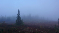
Photos of Strängnäs Mountain Bike
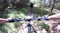
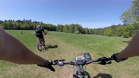
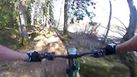
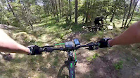
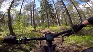
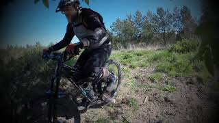
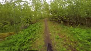
Videos of Strängnäs Mountain Bike
trail: Millsjön Östra
0:30 |
39 |
Dec 31, 2018
trail: Krampan Mot Fornborgen
0:01 |
27 |
Dec 31, 2018
trail: Sörmlandsleden Millsjön
3:40 |
48 |
Dec 31, 2018
0:02 |
35 |
Dec 26, 2018
trail: The Flow
2:27 |
64 |
Mar 13, 2018
trail: Bråtorp Övre Traversen
2:06 |
221 |
Jun 7, 2020 , Strängnäs
trail: DH4
0:17 |
364 |
May 11, 2020 , Strängnäs
trail: Svältenspåret
0:04 |
493 |
May 25, 2019 , Strängnäs
Current Trail Warnings
| status | trail | date | condition | user | info |
|---|---|---|---|---|---|
| The Flow | May 29, 2026 @ 6:55pm (Europe/Stockholm) May 29, 2026 | Variable | ChristofferODpb0W | Hike |
Recent Trail Reports
| status | trail | date | condition | info | user |
|---|---|---|---|---|---|
| The Dead End | Jul 8, 2025 @ 5:21pm Jul 8, 2025 | Variable | ChristofferODpb0W | ||
| Golf Course | Dec 29, 2024 @ 6:40am Dec 29, 2024 | Ideal | atakua | ||
| Access Dark Forest | Dec 29, 2024 @ 6:40am Dec 29, 2024 | Variable | atakua | ||
| Dark Forest | Dec 29, 2024 @ 6:40am Dec 29, 2024 | Variable | atakua | ||
| Rosenbergstigen | Dec 29, 2024 @ 6:40am Dec 29, 2024 | Variable | atakua | ||
| Flow At Gröntorp | Dec 29, 2024 @ 6:40am Dec 29, 2024 | Variable | atakua | ||
| Hallinge Access | Dec 29, 2024 @ 6:40am Dec 29, 2024 | Variable | atakua | ||
| Teknikbanan | Mar 26, 2024 @ 9:56am Mar 26, 2024 | Prevalent Mud | Torsken | ||
| Downhill, Uphill, Downhill... | Mar 26, 2024 @ 9:53am Mar 26, 2024 | Variable | Torsken | ||
| Braap! 2 | Mar 26, 2024 @ 9:52am Mar 26, 2024 | Wet | Torsken |
Activity Feed
| username | action | type | title | date |
|---|---|---|---|---|
| ChristofferODpb0W | comment | report | activity #95961307 | May 31, 2026 @ 11:22am May 31, 2026 |
| OrjanX | comment | report | activity #95840772 | May 30, 2026 @ 5:17am May 30, 2026 |
| ChristofferODpb0W | add | report | activity #95785081 | May 29, 2026 @ 9:55am May 29, 2026 |
| ChristofferODpb0W | ridden | trail | activity #95778316 | May 29, 2026 @ 8:11am May 29, 2026 |
| declimb | wishlist | trail | activity #92980241 | Apr 19, 2026 @ 2:14pm Apr 19, 2026 |
Recent Comments
| username | type | title | comment | date |
|---|---|---|---|---|
| report | Nu är den uppdaterad. Det är rester från... | May 31, 2026 @ 11:22am May 31, 2026 | ||
| report | Varning för vad? Vänligen gör en ny rapport... | May 30, 2026 @ 5:17am May 30, 2026 | ||
| trail | Stängd / borttagen | Nov 2, 2025 @ 1:12am Nov 2, 2025 | ||
| trail | Bra initiativ att redigera stigen istället. Tack! | Jun 15, 2025 @ 9:29am Jun 15, 2025 | ||
| trail | Ja om jag kunnat. Den säger att jag ska... | Jun 15, 2025 @ 8:45am Jun 15, 2025 |
Local Badges
-

Epic Ride Climb 2k22 awarded -

Climbing 10k Badge15 awarded -

Climbing 100k Badge3 awarded -

Epic Ride Descent 2k22 awarded -

Descent 10k Badge15 awarded -

Descent 100k Badge3 awarded
Activity Type Stats
| activitytype | trails | distance | descent | descent distance | total vertical | rating | global rank | state rank | photos | reports | routes | ridelogs |
|---|---|---|---|---|---|---|---|---|---|---|---|---|
| Mountain Bike | 390 | 203 miles | 12,129 ft | 83 miles | 305 ft | #818 | #54 | 126 | 959 | 8 | 4,825 | |
| E-Bike | 1 | #4,774 | #105 | 915 | 73 | |||||||
| Hike | 386 | 203 miles | 11,686 ft | 82 miles | 305 ft | #697 | #46 | 954 | 3 | 427 | ||
| Trail Running | 386 | 203 miles | 11,686 ft | 82 miles | 305 ft | #461 | #44 | 954 | 3 | 1,318 |
Frequently Asked Questions About Strängnäs
▼
What are the best places to ride in Strängnäs?
Strängnäs has 5 areas to explore for mountain biking. The top rated areas are:
▼
What are the highest rated mountain biking trails in Strängnäs?
The highest rated mountain biking trails in Strängnäs are:
- Ulva Löpspår (4.2/5)
- Sörmlandsleden Harsjön - Finnsjön (4.2/5)
- DH4 (4.2/5)
- Hygget Towards Lindvreten (4.2/5)
- Jimmies DH (4.2/5)
▼
What is the best time of the year to ride in Strängnäs?
Based on ride log data, the most popular months to ride in Strängnäs are:
- July (43 activities)
- May (24 activities)
- August (22 activities)
▼
Where can I park to ride in Strängnäs?
There are 9 parking locations listed in Strängnäs. The most popular parking spots are: View all parking and trailhead locations on the map to plan your visit.
Trails
Points of Interest
- By OrjanX
 TRAILFORKS Stgvrkt & contributors
 - Admins: ollesvenskonthetrail, JALLE, OrjanX, martinlindstr, Stockochsten
- #26209 - 4,844 views
- strängnäs activity log | embed map of Strängnäs mountain bike trails | strängnäs mountain biking points of interest
Downloading of trail gps tracks in kml & gpx formats is enabled for Strängnäs.
You must login to download files.