close
-
Layers w
- Weather Layers
- Pro
- Pro
- Pro
- Pro
- Pro
- Pro
- More Layers
- Pro
- Pro
- Pro
- Pro
-
Upgrade to

3D
Trail Conditions
- Unknown
- Snow Groomed
- Snow Packed
- Snow Covered
- Snow Cover Partial
- Freeze/thaw Cycle
- Icy
- Prevalent Mud
- Wet
- Variable
- Ideal
- Dry
- Very Dry
Trail Flow (Ridden Direction)
Trailforks scans users ridelogs to determine the most popular direction each trail is ridden. A good flowing trail network will have most trails flowing in a single direction according to their intension.
The colour categories are based on what percentage of riders are riding a trail in its intended direction.
The colour categories are based on what percentage of riders are riding a trail in its intended direction.
- > 96%
- > 90%
- > 80%
- > 70%
- > 50%
- < 50%
- bi-directional trail
- no data
Trail Last Ridden
Trailforks scans ridelogs to determine the last time a trail was ridden.
- < 2 days
- < 1 week
- < 2 weeks
- < 1 month
- < 6 months
- > 6 months
Trail Ridden Direction
The intended direction a trail should be ridden.
- Downhill Only
- Downhill Primary
- Both Directions
- Uphill Primary
- Uphill Only
- One Direction
Contribute Details
Colors indicate trail is missing specified detail.
- Description
- Photos
- Description & Photos
- Videos
Trail Popularity ?
Trailforks scans ridelogs to determine which trails are ridden the most in the last 9 months.
Trails are compared with nearby trails in the same city region with a possible 25 colour shades.
Think of this as a heatmap, more rides = more kinetic energy = warmer colors.
- most popular
- popular
- less popular
- not popular
ATV/ORV/OHV Filter
Max Vehicle Width
inches
US Cell Coverage
Legend

Radar Time
Activity Recordings
Trailforks uses anonymized public activity data.
?
Activity Recordings
Trailforks uses anonymized public activity data.
?
Personal Heatmap
▶
Activity Types
all
/
none
▶
Options
2
Date range
month
–
Winter Trails
Warning
A routing network for winter maps does not exist. Selecting trails using the winter trails layer has been disabled.
Missing Trails
Most Popular
Least Popular
Trails are colored based on popularity. The more popular a trail is, the more red. Less popular trails trend towards green.
Jump Magnitude Heatmap
Heatmap of where riders jump on trails. Zoom in to see individual jumps, click circles to view jump details.
BC Backroad Status
![map legend]()
Service Road Atlas is a free to use, community-driven service for viewing and creating reports on the numerous back-country service roads around B.C. and Alberta.

Slope Aspect
Direction the slope faces
Trails Deemphasized
Trails are shown in grey.
Only show trails with no bike usage.
Suggested Layers
Based on selected activity type
Save the current map location and zoom level as your default home location whenever this page is loaded.
Save
No description for Stratton Open Space has been added yet!
Login or register to submit one.
 google parking directions
Primary Trail Type: Cross-Country
eBikes Allowed:
No
Land Status: City Managed
google parking directions Activities Click to view
- Mountain Bike
26 trails
- Hike
28 trails
- Trail Running
28 trails
Region Details
- 4
- 9
- 7
- 4
- 1
Region Status
Caution as of Jun 2, 2026Stats
- Avg Trail Rating
- Trails (view details)
- 30
- Trails Mountain Bike
- 26
- Trails E-Bike
- 1
- Trails Hike
- 28
- Trails Trail Running
- 28
- Total Distance
- 17 miles
- Total Descent
- 3,469 ft
- Total Vertical
- 2,257 ft
- Highest Trailhead
- 8,345 ft
- Reports
- 1,208
- Photos
- 55
- Ridden Counter
- 22,481
Popular Stratton Open Space Mountain Biking Trails
• 100 ★ 4.7 • 3,875 ft • 0 ft • 2,253 •
Fast flowing descent with varying terrain. This trail was converted to downhill only in October 2019.
• 100 ★ 4.5 • 1,214 ft • 14 ft • 1,714 •
This is the new Advanced/difficult-rate Rock Armored section of the that riders can start on from Gold Camp Road.
• 100 ★ 3.0 • 1,667 ft • 117 ft • 1,093 •
Popular green difficulty singletrack. This mountain bike primary trail can be used both directions. On average it takes 3 minutes to complete this trail.
• 100 ★ 4.2 • 2,392 ft • 0 ft • 952 •
A fast flowy descent through a drainage. This is a bi-directional, multi-use trail so be aware of trail traffic when going downhill.
• 90 ★ 3.0 • 4,803 ft • 272 ft • 930 •
Winding singletrack with some technical rocks and moderate tight/loose switchbacks. High hiker presence. Fun in both directions.
• 100 ★ 3.5 • 705 ft • 38 ft • 750 •
Popular blue difficulty singletrack. This mountain bike primary trail can be used both directions. On average it takes minutes to complete this trail.
• 95 ★ 3.0 • 290 ft • 32 ft • 707 •
Popular green difficulty singletrack. This mountain bike primary trail can be used uphill primary. On average it takes 1 minutes to complete this trail.
• 95 ★ 4.0 • 4,629 ft • 0 ft • 536 •
Popular blue difficulty singletrack. This mountain bike primary trail can be used both directions. On average it takes 6 minutes to complete this trail.
Stratton Open Space Mountain Bike Routes
Captain Jacks Chute Route Featured
★ 3.8 • 13 miles • 2,098 ft • 8 • Loop •
This is a popular loop in the area. It provides some good singletrack climbing mixed with some slow easy...
Captain Jacks Chute La Veta Featured
12 miles • 2,068 ft • 8 •
This is basically the same as the standard Captain Jacks Chute Route but starting at the trailhead just...
★ 5.0 • 38 miles • 5,911 ft • 9 • Loop •
Looking for a full day of pedaling? This is it. Jones Park loop from Strattion Open Space is an amazing...
★ 5.0 • 13 miles • 2,148 ft • 20 • Loop •
This incorporates two great downhill trails by a moderate climb on Gold Camp Road. The route starts at...
12 miles • 1,979 ft • 5 • Loop •
The start is at the bottom of Captain Jacks. You can drive here or ride up Gold Camp to start. You'll...
15 miles • 2,639 ft • 6 • Loop •
The start is at the bottom of Captain Jacks. You can drive here or ride up Gold Camp to start. You'll...
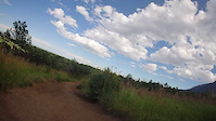
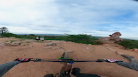
Photos of Stratton Open Space Mountain Bike
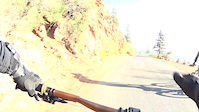
Videos of Stratton Open Space Mountain Bike
trail: Ridge Trail (Reservoir)
0:10 |
24 |
Jul 5, 2025
trail: Upper Chutes
0:36 |
|
Aug 29, 2024
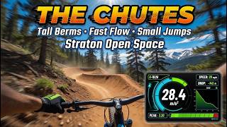
trail: The Chutes
4:35 |
197 |
May 28, 2014
trail: The Chutes
2:48 |
19 |
May 17, 2026 , Colorado Springs
trail: The Chutes
3:55 |
302 |
Sep 28, 2011

trail: The Chutes
3:45 |
692 |
Nov 10, 2021 , Colorado Springs

trail: The Chutes
4:25 |
568 |
Jun 3, 2021 , Colorado Springs

trail: The Chutes
13:23 |
508 |
Apr 21, 2021 , Colorado Springs
Recent Trail Reports
| status | trail | date | condition | info | user |
|---|---|---|---|---|---|
| Arroyo Grande Connector | May 1, 2026 @ 4:46pm (America/Denver) May 1, 2026 | Variable | Mrtonyd | ||
| Arroyo Grande | May 1, 2026 @ 4:46pm (America/Denver) May 1, 2026 | Ideal | Mrtonyd | ||
| Ladders | May 1, 2026 @ 4:46pm (America/Denver) May 1, 2026 | Variable | Mrtonyd | ||
| Chutes Connector | May 1, 2026 @ 4:46pm (America/Denver) May 1, 2026 | Ideal | Mrtonyd | ||
| Reservoir Access Road (E) | May 1, 2026 @ 4:46pm (America/Denver) May 1, 2026 | Ideal | Mrtonyd | ||
| The Chutes | Mar 10, 2026 @ 3:12pm (America/Denver) Mar 10, 2026 | Ideal | Dmac13 | ||
| Upper Chutes | Feb 8, 2026 @ 12:05pm (America/Denver) Feb 8, 2026 | Dry | chevelle2291 | ||
| Ridge (SOS) | Feb 8, 2026 @ 12:04pm (America/Denver) Feb 8, 2026 | Prevalent Mud | chevelle2291 | ||
| Patty Cake | Feb 3, 2026 @ 12:09pm (America/Denver) Feb 3, 2026 | Variable | Dri021 | ||
| Cresta Trail | Feb 3, 2026 @ 12:09pm (America/Denver) Feb 3, 2026 | Prevalent Mud | Dri021 |
Activity Feed
| username | action | type | title | date |
|---|---|---|---|---|
| Leaubeau | wishlist | route | activity #96894324 | Jun 13, 2026 @ 10:35am Jun 13, 2026 |
| dashraces | add | route | activity #96081499 and 1 more | Jun 2, 2026 @ 7:06am Jun 2, 2026 |
| BorneoBatman1979 | wishlist | route | activity #95400534 | May 24, 2026 @ 5:47am May 24, 2026 |
| CucheckGravity | add | video | activity #94931544 | May 17, 2026 @ 12:41pm May 17, 2026 |
| Bill2ADeVG | wishlist | route | activity #94873654 | May 16, 2026 @ 10:13pm May 16, 2026 |
Recent Comments
| username | type | title | comment | date |
|---|---|---|---|---|
| trail | Chamberlain, Ladders & Chutes were all in... | Sep 21, 2025 @ 6:40am Sep 21, 2025 | ||
| trail | AawE | Aug 5, 2024 @ 11:20am Aug 5, 2024 | ||
| trail | WeeEeAqqSs | Aug 5, 2024 @ 11:20am Aug 5, 2024 | ||
| trail | Rode this on my handcycle with no problems.... | Jul 31, 2023 @ 9:15am Jul 31, 2023 | ||
| trail | I’m an adaptive mountain biker riding an... | Jul 31, 2023 @ 9:13am Jul 31, 2023 |
Nearby Areas
| name | distance | ||||
|---|---|---|---|---|---|
| Bear Creek Park | 5 | 8 | 1 | 1.7 km | |
| North Cheyenne Cañon Park | 3 | 15 | 11 | 1 | 1.7 km |
| Dorchester Park | 1 | 2 | 2.6 km | ||
| Red Rock Canyon Open Space | 21 | 32 | 4 | 1 | 3.1 km |
| Fountain Park | 2 | 2 | 1 | 1 | 3.6 km |
Local Badges
-

Completionist2 awarded
Activity Type Stats
| activitytype | trails | distance | descent | descent distance | total vertical | rating | global rank | state rank | photos | reports | routes | ridelogs |
|---|---|---|---|---|---|---|---|---|---|---|---|---|
| Mountain Bike | 26 | 14 miles | 3,228 ft | 7 miles | 2,257 ft | #935 | #344 | 55 | 1,201 | 14 | 18,891 | |
| E-Bike | 1 | 935 | 1 | 557 | ||||||||
| Hike | 28 | 16 miles | 2,605 ft | 6 miles | 2,257 ft | #964 | #490 | 1,150 | 4 | 1,238 | ||
| Trail Running | 28 | 16 miles | 2,605 ft | 6 miles | 2,257 ft | #6,470 | #2,067 | 1,132 | 4 | 904 |
Frequently Asked Questions About Stratton Open Space
▼
What are the highest rated mountain biking trails in Stratton Open Space?
The highest rated mountain biking trails in Stratton Open Space are:
- The Chutes (4.5/5)
- Upper Chutes (4.3/5)
- Arroyo Grande (4.2/5)
- St Mary Falls Acc (4.1/5)
- Chamberlain (4.1/5)
▼
What is the best time of the year to ride in Stratton Open Space?
Based on ride log data, the most popular months to ride in Stratton Open Space are:
- July (159 activities)
- June (96 activities)
- May (78 activities)
▼
Where can I park to ride in Stratton Open Space?
There are 5 parking locations listed in Stratton Open Space. The most popular parking spots are: View all parking and trailhead locations on the map to plan your visit.
▼
What is the longest trail in Stratton Open Space?
The longest trail in Stratton Open Space is Chamberlain at 2.3 miles. View all trails sorted by distance.
Activities
Trails
- Hard trails in Stratton Open Space
- Easy trails in Stratton Open Space
- Favorite trails in Stratton Open Space
- Most ridden trails in Stratton Open Space
- Singletrack in Stratton Open Space
- Viewpoint trails in Stratton Open Space
- Trails with technical features in Stratton Open Space
- Race routes in Stratton Open Space
Points of Interest
- By lukeisdumb & contributors
- Admins: MWTA, COSMBA, COSMBA
- #4159 - 14,044 views
- stratton open space activity log | embed map of Stratton Open Space mountain bike trails | stratton open space mountain biking points of interest
Downloading of trail gps tracks in kml & gpx formats is enabled for Stratton Open Space.
You must login to download files.