close
-
Layers w
- Weather Layers
- Pro
- Pro
- Pro
- Pro
- Pro
- Pro
- More Layers
- Pro
- Pro
- Pro
- Pro
-
Upgrade to

3D
Trail Conditions
- Unknown
- Snow Groomed
- Snow Packed
- Snow Covered
- Snow Cover Partial
- Freeze/thaw Cycle
- Icy
- Prevalent Mud
- Wet
- Variable
- Ideal
- Dry
- Very Dry
Trail Flow (Ridden Direction)
Trailforks scans users ridelogs to determine the most popular direction each trail is ridden. A good flowing trail network will have most trails flowing in a single direction according to their intension.
The colour categories are based on what percentage of riders are riding a trail in its intended direction.
The colour categories are based on what percentage of riders are riding a trail in its intended direction.
- > 96%
- > 90%
- > 80%
- > 70%
- > 50%
- < 50%
- bi-directional trail
- no data
Trail Last Ridden
Trailforks scans ridelogs to determine the last time a trail was ridden.
- < 2 days
- < 1 week
- < 2 weeks
- < 1 month
- < 6 months
- > 6 months
Trail Ridden Direction
The intended direction a trail should be ridden.
- Downhill Only
- Downhill Primary
- Both Directions
- Uphill Primary
- Uphill Only
- One Direction
Contribute Details
Colors indicate trail is missing specified detail.
- Description
- Photos
- Description & Photos
- Videos
Trail Popularity ?
Trailforks scans ridelogs to determine which trails are ridden the most in the last 9 months.
Trails are compared with nearby trails in the same city region with a possible 25 colour shades.
Think of this as a heatmap, more rides = more kinetic energy = warmer colors.
- most popular
- popular
- less popular
- not popular
ATV/ORV/OHV Filter
Max Vehicle Width
inches
US Cell Coverage
Legend

Radar Time
Activity Recordings
Trailforks uses anonymized public activity data.
?
Activity Recordings
Trailforks uses anonymized public activity data.
?
Personal Heatmap
▶
Activity Types
all
/
none
▶
Options
2
Date range
month
–
Winter Trails
Warning
A routing network for winter maps does not exist. Selecting trails using the winter trails layer has been disabled.
Missing Trails
Most Popular
Least Popular
Trails are colored based on popularity. The more popular a trail is, the more red. Less popular trails trend towards green.
Jump Magnitude Heatmap
Heatmap of where riders jump on trails. Zoom in to see individual jumps, click circles to view jump details.
BC Backroad Status
![map legend]()
Service Road Atlas is a free to use, community-driven service for viewing and creating reports on the numerous back-country service roads around B.C. and Alberta.

Slope Aspect
Direction the slope faces
Trails Deemphasized
Trails are shown in grey.
Only show trails with no bike usage.
Suggested Layers
Based on selected activity type
Save the current map location and zoom level as your default home location whenever this page is loaded.
Save
No description for Stromberg has been added yet!
Login or register to submit one.
This region uses the Uk/Euro style trail grading system.
Activities Click to view
- Mountain Bike
6 trails
- E-Bike
6 trails
- Hike
2 trails
- Trail Running
2 trails
Region Details
- 2
- 2
- 1
- 1
Region Status
Open as of Jun 7, 2026Stats
- Avg Trail Rating
- Trails (view details)
- 6
- Trails Mountain Bike
- 6
- Trails E-Bike
- 6
- Trails Hike
- 2
- Trails Trail Running
- 2
- Total Distance
- 4 miles
- Total Descent
- 832 ft
- Total Vertical
- 559 ft
- Highest Trailhead
- 1,502 ft
- Reports
- 87
- Photos
- 47
- Ridden Counter
- 1,636
Sub Regions
-
Flowtrail Stromberg
- 2
- 1
- 1
Popular Stromberg Mountain Biking Trails
• 100 ★ 4.7 • 1 mile • 0 ft • 579 •
Der flowigere Trail der beiden mit kleineren Sprüngen, die alle umfahrbar und viele - aber nicht alle! - abrollbar sind. Die entsprechenden schwierigeren Sprünge sind dann gekennzeichnet (Totenkopfsymbol). Schwierigkeiten sind mit...
• 85 ★ 4.5 • 2,897 ft • 0 ft • 305 •
Jump Line mit vielen Sprüngen, die umfahrbar, aber nicht abrollbar sind (Gaps).
• 50 ★ 3.0 • 1,263 ft • 66 ft • 148 •
Moderately popular green difficulty singletrack. This mountain bike primary trail can be used both directions. On average it takes 2 minutes to complete this trail.
• 35 ★ 5.0 • 617 ft • 0 ft • 72 •
Less popular green difficulty singletrack. This mountain bike primary trail can be used downhill primary. On average it takes 3 minutes to complete this trail.
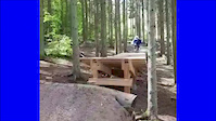
Photos of Stromberg Mountain Bike
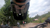
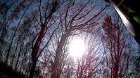
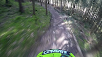
Videos of Stromberg Mountain Bike
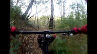
trail: Wild Hog
0:07 |
352 |
Sep 12, 2019
trail: Wild Hog
4:18 |
99 |
Jul 26, 2019
trail: Trail
0:45 |
41 |
Mar 23, 2017
trail: Wild Hog
0:52 |
430 |
Apr 4, 2015
trail: Trail
0:44 |
216 |
Oct 31, 2013

trail: Trail
3:25 |
156 |
Sep 8, 2012
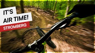
trail: No Jokes
2:33 |
46 |
Aug 18, 2025 , Stromberg
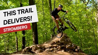
trail: Wild Hog
4:31 |
84 |
May 24, 2025 , Stromberg
Recent Trail Reports
| status | trail | date | condition | info | user |
|---|---|---|---|---|---|
| Wild Hog | Jun 7, 2026 @ 9:25am (Europe/Luxembourg) Jun 7, 2026 | Ideal | DenRa | ||
| Trail | Jun 7, 2026 @ 9:25am (Europe/Luxembourg) Jun 7, 2026 | Ideal | DenRa | ||
| Trail Rundkurs Stromberg | Jun 7, 2026 @ 9:25am (Europe/Luxembourg) Jun 7, 2026 | Ideal | DenRa | ||
| No Jokes | Apr 12, 2026 @ 11:29am (Europe/Berlin) Apr 12, 2026 | Ideal | prange | ||
| Forstweg | Apr 12, 2026 @ 11:29am (Europe/Berlin) Apr 12, 2026 | Ideal | prange | ||
| Forstweg | Aug 9, 2025 @ 6:44pm Aug 9, 2025 | Ideal | KeffnJens |
Activity Feed
| username | action | type | title | date |
|---|---|---|---|---|
| ChrisChanT | ridden | trail | activity #97260658 | Jun 18, 2026 @ 10:16am Jun 18, 2026 |
| DenRa | add | report | activity #96459729 and 2 more | Jun 7, 2026 @ 7:40am Jun 7, 2026 |
| Aleximus | ridden | trail | activity #95848555 and 1 more | May 30, 2026 @ 7:12am May 30, 2026 |
| dominikmeding | wishlist | region | activity #94580548 | May 12, 2026 @ 1:22pm May 12, 2026 |
| hOErgman | vote | trail | activity #93593040 | Apr 28, 2026 @ 11:01am Apr 28, 2026 |
Recent Comments
| username | type | title | comment | date |
|---|---|---|---|---|
| trail | Guter Zustand lohnt sich auf jeden! | Aug 23, 2021 @ 7:11am Aug 23, 2021 | ||
| trail | Super Trail mit schönen Sprüngen. Erstes... | May 24, 2021 @ 12:49am May 24, 2021 | ||
| trail | Super gebaut, schöne Sprünge in... | May 24, 2021 @ 12:46am May 24, 2021 | ||
| trail | Sehr geile Strecke, die den Namen Flowtrail... | Nov 4, 2017 @ 12:47pm Nov 4, 2017 |
Bike & Skill Parks
| name | type | city | rating |
|---|---|---|---|
| Flowtrail Stromberg | bike park | Stromberg | |
| Übungsparcours und Pumptrack | skill park | Stromberg |
Activity Type Stats
| activitytype | trails | distance | descent | descent distance | total vertical | rating | global rank | state rank | photos | reports | routes | ridelogs |
|---|---|---|---|---|---|---|---|---|---|---|---|---|
| Mountain Bike | 6 | 4 miles | 833 ft | 2 miles | 558 ft | #4,359 | #75 | 47 | 87 | 3,053 | ||
| E-Bike | 6 | 4 miles | 833 ft | 2 miles | 558 ft | #4,667 | #141 | 85 | 559 | |||
| Hike | 2 | 2 miles | 36 ft | 1,335 ft | 528 ft | #8,431 | #158 | 80 | 58 | |||
| Trail Running | 2 | 2 miles | 36 ft | 1,335 ft | 528 ft | #7,922 | #153 | 80 | 21 |
Frequently Asked Questions About Stromberg
▼
What are the best places to ride in Stromberg?
Stromberg has 1 areas to explore for mountain biking. The top rated areas are:
▼
What are the highest rated mountain biking trails in Stromberg?
The highest rated mountain biking trails in Stromberg are:
- Wild Hog (4.5/5)
- No Jokes (4.4/5)
- Trail Rundkurs Stromberg (4.1/5)
- Trail (3.8/5)
▼
What is the best time of the year to ride in Stromberg?
Based on ride log data, the most popular months to ride in Stromberg are:
- July (22 activities)
- May (20 activities)
- April (17 activities)
▼
Where can I park to ride in Stromberg?
There are 5 parking locations listed in Stromberg. The most popular parking spots are: View all parking and trailhead locations on the map to plan your visit.
Trails
Points of Interest
- By BastiEnduro & contributors
- Admins: PB, Janne88
- #5973 - 3,808 views
- stromberg activity log | embed map of Stromberg mountain bike trails | stromberg mountain biking points of interest
Downloading of trail gps tracks in kml & gpx formats is enabled for Stromberg.
You must login to download files.