close
-
Layers w
- Weather Layers
- Pro
- Pro
- Pro
- Pro
- Pro
- Pro
- More Layers
- Pro
- Pro
- Pro
- Pro
-
Upgrade to

3D
Trail Conditions
- Unknown
- Snow Groomed
- Snow Packed
- Snow Covered
- Snow Cover Partial
- Freeze/thaw Cycle
- Icy
- Prevalent Mud
- Wet
- Variable
- Ideal
- Dry
- Very Dry
Trail Flow (Ridden Direction)
Trailforks scans users ridelogs to determine the most popular direction each trail is ridden. A good flowing trail network will have most trails flowing in a single direction according to their intension.
The colour categories are based on what percentage of riders are riding a trail in its intended direction.
The colour categories are based on what percentage of riders are riding a trail in its intended direction.
- > 96%
- > 90%
- > 80%
- > 70%
- > 50%
- < 50%
- bi-directional trail
- no data
Trail Last Ridden
Trailforks scans ridelogs to determine the last time a trail was ridden.
- < 2 days
- < 1 week
- < 2 weeks
- < 1 month
- < 6 months
- > 6 months
Trail Ridden Direction
The intended direction a trail should be ridden.
- Downhill Only
- Downhill Primary
- Both Directions
- Uphill Primary
- Uphill Only
- One Direction
Contribute Details
Colors indicate trail is missing specified detail.
- Description
- Photos
- Description & Photos
- Videos
Trail Popularity ?
Trailforks scans ridelogs to determine which trails are ridden the most in the last 9 months.
Trails are compared with nearby trails in the same city region with a possible 25 colour shades.
Think of this as a heatmap, more rides = more kinetic energy = warmer colors.
- most popular
- popular
- less popular
- not popular
ATV/ORV/OHV Filter
Max Vehicle Width
inches
US Cell Coverage
Legend

Radar Time
Activity Recordings
Trailforks uses anonymized public activity data.
?
Activity Recordings
Trailforks uses anonymized public activity data.
?
Personal Heatmap
▶
Activity Types
all
/
none
▶
Options
2
Date range
month
–
Winter Trails
Warning
A routing network for winter maps does not exist. Selecting trails using the winter trails layer has been disabled.
Missing Trails
Most Popular
Least Popular
Trails are colored based on popularity. The more popular a trail is, the more red. Less popular trails trend towards green.
Jump Magnitude Heatmap
Heatmap of where riders jump on trails. Zoom in to see individual jumps, click circles to view jump details.
BC Backroad Status
![map legend]()
Service Road Atlas is a free to use, community-driven service for viewing and creating reports on the numerous back-country service roads around B.C. and Alberta.

Slope Aspect
Direction the slope faces
Trails Deemphasized
Trails are shown in grey.
Only show trails with no bike usage.
Suggested Layers
Based on selected activity type
Save the current map location and zoom level as your default home location whenever this page is loaded.
Save
No description for Stuttgart has been added yet!
Login or register to submit one.
This region uses the Uk/Euro style trail grading system.
Activities Click to view
- Mountain Bike
98 trails
- E-Bike
97 trails
- Gravel Bike
0 trails
- Adaptive Bike
0 trails
- Winter Fat Bike
0 trails
- Hike
93 trails
- Trail Running
93 trails
Region Details
- 72
- 23
- 1
Region Status
Caution as of Jun 12, 2026Stats
- Avg Trail Rating
- Trails (view details)
- 96
- Trails Mountain Bike
- 98
- Trails E-Bike
- 97
- Trails Hike
- 93
- Trails Trail Running
- 93
- Trails Snowshoe
- 1
- Total Distance
- 30 miles
- Total Descent
- 11,068 ft
- Total Vertical
- 691 ft
- Highest Trailhead
- 1,683 ft
- Reports
- 1,018
- Photos
- 30
- Ridden Counter
- 10,403
Popular Stuttgart Mountain Biking Trails
• 90 ★ 3.9 • 3,284 ft • 8 ft • 257 •
Finally, after a long fight (since 2006) for this trail, Stuttgart offers a downhill track starting in Degerloch and ending in Heslach. I'd describe this as a flow trail because the upper track is machinegroomed and even though there is...
• 75 ★ 3.3 • 682 ft • 0 ft • 152 •
This section isn't this hard to ride, it starts with very cool "zick-zack" berms that are so much fun to ride. However, there's a smaller roadgap (compared to other roadgaps) that is about 2 meters high and the distance you're jumping...
• 35 ★ 1.0 • 2,192 ft • 0 ft • 17 •
Less popular green difficulty singletrack. This mountain bike primary trail can be used downhill primary. On average it takes 10 minutes to complete this trail.
Heslacher Pumptrack Permanently Closed
• 5 ★ 4.0 • 1,417 ft • 3 ft • 7 •
Pumptrack under the bridge at Wildparkstrasse and Magstadterstrasse
• 25 ★ 0.0 • 1,289 ft • 0 ft • 4 •
Less popular green difficulty family friendly singletrack. This mountain bike primary trail can be used both directions with a 0 ft green climb. Trail visibility is always easy to follow. On average it takes 2 minutes to complete this trail.
Photos of Stuttgart Mountain Bike
Videos of Stuttgart Mountain Bike
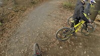
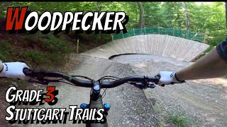
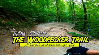
trail: Woodpecker Trail
3:29 |
804 |
Nov 14, 2015

trail: Woodpecker Trail
0:53 |
907 |
Nov 14, 2015
trail: Woodpecker Trail
3:57 |
99 |
Aug 12, 2025 , Stuttgart
trail: Woodpecker Trail
4:51 |
562 |
Jul 31, 2021 , Stuttgart

trail: Woodpecker Trail
4:43 |
922 |
Apr 10, 2019 , Stuttgart
Recent Trail Reports
| status | trail | date | condition | info | user |
|---|---|---|---|---|---|
| Woodpecker Trail | Jun 13, 2026 @ 8:09am (Europe/Busingen) Jun 12, 2026 | Ideal | Nerfminoshunter | ||
| Woodpecker Trail - Alternative Line | Jun 18, 2025 @ 3:36pm Jun 18, 2025 | Dry | ProCatGHG | ||
| Woodpecker Trail - Ausleitung | May 31, 2025 @ 2:28pm May 31, 2025 | Ideal | rpenman | ||
| Grüner Heiner | Jun 23, 2024 @ 9:55am Jun 23, 2024 | Dry | papachaotica | ||
| Brier and Bramble Trail | Apr 19, 2023 @ 12:25pm Apr 19, 2023 | Variable | juuro | ||
| Schaftrieb | Jun 30, 2018 @ 11:39pm Jun 30, 2018 | Dry | thors10 | ||
| Ludwigsburger Allee | Jun 30, 2018 @ 11:37pm Jun 30, 2018 | Dry | thors10 |
Activity Feed
| username | action | type | title | date |
|---|---|---|---|---|
| Simon2645 | wishlist | trail | activity #96436426 | Jun 7, 2026 @ 1:35am Jun 7, 2026 |
| Jay-L-77 | ridden | trail | activity #92771058 | Apr 16, 2026 @ 11:20pm Apr 16, 2026 |
| Jay-L-77 | ridden | trail | activity #92771037 | Apr 16, 2026 @ 11:19pm Apr 16, 2026 |
| Churcher | wishlist | region | activity #92209810 | Apr 8, 2026 @ 2:08pm Apr 8, 2026 |
| Marderhund | update | trail | activity #84045277 | Nov 12, 2025 @ 3:49pm Nov 12, 2025 |
Recent Comments
| username | type | title | comment | date |
|---|---|---|---|---|
| trail | Der Trail wäre wirklich geil, wenn er mal... | Jun 18, 2025 @ 3:25pm Jun 18, 2025 | ||
| trail | aktuell an div Stellen Baumfäll Arbeiten | Feb 15, 2023 @ 12:33pm Feb 15, 2023 | ||
| trail | Leider durch die intensive Nutzung extreme... | Apr 10, 2022 @ 7:43am Apr 10, 2022 | ||
| trail | Sehr geil aber hätte eine Wartung nötig | Jun 23, 2021 @ 2:32pm Jun 23, 2021 | ||
| trail | Not even a Black Line | Sep 20, 2019 @ 9:31am Sep 20, 2019 |
Local Badges
-

10 Green Trails123 awarded -

10 Blue Trails134 awarded -

Epic Ride Climb 2k139 awarded -

Climbing 10k Badge112 awarded -

Climbing 100k Badge22 awarded -

Epic Ride Descent 2k144 awarded
Bike & Skill Parks
| name | type | city | rating |
|---|---|---|---|
| Pumptrack Vaihingen | skill park | Stuttgart | |
| Pumptrack Plieningen | skill park | Stuttgart | |
| Pumptrack Fasanenhof | skill park | Stuttgart |
Activity Type Stats
| activitytype | trails | distance | descent | descent distance | total vertical | rating | global rank | state rank | photos | reports | routes | ridelogs |
|---|---|---|---|---|---|---|---|---|---|---|---|---|
| Mountain Bike | 98 | 30 miles | 11,066 ft | 24 miles | 692 ft | #908 | #8 | 30 | 1,018 | 25,458 | ||
| E-Bike | 97 | 30 miles | 11,066 ft | 24 miles | 692 ft | #1,000 | #25 | 977 | 5,810 | |||
| Hike | 93 | 29 miles | 10,387 ft | 23 miles | 692 ft | #2,253 | #22 | 980 | 372 | |||
| Trail Running | 93 | 29 miles | 10,387 ft | 23 miles | 692 ft | #1,687 | #20 | 980 | 1,238 | |||
| Snowshoe | 1 | 1,289 ft | 26 ft | 922 ft | 30 ft | 1 |
Frequently Asked Questions About Stuttgart
▼
What are the best places to ride in Stuttgart?
Stuttgart has 11 areas to explore for mountain biking.
▼
What are the highest rated mountain biking trails in Stuttgart?
The highest rated mountain biking trails in Stuttgart are:
- Woodpecker Trail (3.9/5)
- Woodpecker Trail - Alternative Line (3.6/5)
- Grüner Heiner (3.6/5)
- Brier and Bramble Trail (0/5)
▼
What is the best time of the year to ride in Stuttgart?
Based on ride log data, the most popular months to ride in Stuttgart are:
- July (78 activities)
- April (49 activities)
- June (39 activities)
▼
Where can I park to ride in Stuttgart?
Activities
Trails
Points of Interest
- By e-van & contributors
- Admins: HDRiders, Sasse82, sp00n82, martywis, Trailfürsorge, TrailfürsorgH
- #5620 - 20,383 views
- stuttgart activity log | embed map of Stuttgart mountain bike trails | stuttgart mountain biking points of interest
Downloading of trail gps tracks in kml & gpx formats is enabled for Stuttgart.
You must login to download files.