close
-
Layers w
- Weather Layers
- Pro
- Pro
- Pro
- Pro
- Pro
- Pro
- More Layers
- Pro
- Pro
- Pro
- Pro
-
Upgrade to

3D
Trail Conditions
- Unknown
- Snow Groomed
- Snow Packed
- Snow Covered
- Snow Cover Partial
- Freeze/thaw Cycle
- Icy
- Prevalent Mud
- Wet
- Variable
- Ideal
- Dry
- Very Dry
Trail Flow (Ridden Direction)
Trailforks scans users ridelogs to determine the most popular direction each trail is ridden. A good flowing trail network will have most trails flowing in a single direction according to their intension.
The colour categories are based on what percentage of riders are riding a trail in its intended direction.
The colour categories are based on what percentage of riders are riding a trail in its intended direction.
- > 96%
- > 90%
- > 80%
- > 70%
- > 50%
- < 50%
- bi-directional trail
- no data
Trail Last Ridden
Trailforks scans ridelogs to determine the last time a trail was ridden.
- < 2 days
- < 1 week
- < 2 weeks
- < 1 month
- < 6 months
- > 6 months
Trail Ridden Direction
The intended direction a trail should be ridden.
- Downhill Only
- Downhill Primary
- Both Directions
- Uphill Primary
- Uphill Only
- One Direction
Contribute Details
Colors indicate trail is missing specified detail.
- Description
- Photos
- Description & Photos
- Videos
Trail Popularity ?
Trailforks scans ridelogs to determine which trails are ridden the most in the last 9 months.
Trails are compared with nearby trails in the same city region with a possible 25 colour shades.
Think of this as a heatmap, more rides = more kinetic energy = warmer colors.
- most popular
- popular
- less popular
- not popular
ATV/ORV/OHV Filter
Max Vehicle Width
inches
US Cell Coverage
Legend

Radar Time
Activity Recordings
Trailforks uses anonymized public activity data.
?
Activity Recordings
Trailforks uses anonymized public activity data.
?
Personal Heatmap
▶
Activity Types
all
/
none
▶
Options
2
Date range
month
–
Winter Trails
Warning
A routing network for winter maps does not exist. Selecting trails using the winter trails layer has been disabled.
Missing Trails
Most Popular
Least Popular
Trails are colored based on popularity. The more popular a trail is, the more red. Less popular trails trend towards green.
Jump Magnitude Heatmap
Heatmap of where riders jump on trails. Zoom in to see individual jumps, click circles to view jump details.
BC Backroad Status
![map legend]()
Service Road Atlas is a free to use, community-driven service for viewing and creating reports on the numerous back-country service roads around B.C. and Alberta.

Slope Aspect
Direction the slope faces
Trails Deemphasized
Trails are shown in grey.
Only show trails with no bike usage.
Suggested Layers
Based on selected activity type
Save the current map location and zoom level as your default home location whenever this page is loaded.
SavePopular Trail Networks
view all areas »
No description for Sudeste has been added yet!
Login or register to submit one.
Region Details
- 646
- 50
- 735
- 1,104
- 567
- 138
- 10
Stats
- Avg Trail Rating
- Trails (view details)
- 3,310
- Trails Mountain Bike
- 3,334
- Trails E-Bike
- 1,845
- Trails Gravel Bike
- 4
- Trails Adaptive Bike
- 2
- Trails Winter Fat Bike
- 1
- Trails Horse
- 284
- Trails Hike
- 2,888
- Trails Trail Running
- 2,941
- Trails Dirtbike/Moto
- 223
- Trails Observed Trials
- 33
- Trails ATV/ORV/OHV
- 57
- Trails Snowmobile
- 1
- Trails Snowshoe
- 1
- Trails Downhill Ski
- 2
- Trails Backcountry Ski
- 1
- Trails Nordic Ski
- 1
- Total Distance
- 6,851 miles
- Total Descent
- 1,233,205 ft
- Total Vertical
- 6,419 ft
- Highest Trailhead
- 6,426 ft
- Reports
- 4,209
- Photos
- 1,696
- Ridden Counter
- 145,743
Sub Regions
- Espírito Santo (68)
- Alfredo Chaves (4)
- Gururu (3)
- Anchieta (1)
- Colatina (1)
- Domingos Martins (2)
- Guarapari (27)
- Buenos Aires (20)
- São Miguel (7)
- Pancas (0)
- Serra (7)
- Mestre Álvaro (6)
- XCO Carapina (1)
- Viana (6)
- Rampa do Urubú (4)
- Vila Velha (8)
- Morro do Moreno (8)
- vitoria (11)
- Morro da Fonte Grande (11)
- Morro do Moreno (0)
- Alfredo Chaves (4)
- Minas Gerais (2,415)
- Alfredo Vasconcelos (1)
- Antônio Carlos (4)
- Araponga (75)
- Serra do Brigadeiro (74)
- Barão de Cocais (28)
- Serra da Cambota (23)
- Barbacena (34)
- Barreiras (1)
- Belo Horizonte (179)
- Betim (20)
- Brumadinho (91)
- Barreiras (0)
- Brumadinho (0)
- Brumadinho (7)
- Casa Branca (30)
- Buritizeiro (22)
- Cachoeira Do Campo (1)
- Caeté (19)
- Cajuri (12)
- Capitolio (5)
- Carmo Do Cajuru (2)
- Carrancas (4)
- Cipó (1)
- Coimbra (7)
- Conceição do Mato Dentro (6)
- Confins (1)
- Congonhas (35)
- Conselheiro Lafaiete (2)
- Contagem (1)
- Coqueiral MG (2)
- Cristiano Otoni (15)
- Diamantina (113)
- Divinésia (6)
- Entre Rios de Minas (5)
- Ervália (7)
- Esmeraldas (6)
- Glaura (14)
- Governador Valadares (2)
- Guapé (2)
- Guaraciaba (12)
- Ibirité (2)
- Igarapé (3)
- Itabirito (18)
- Itauna (46)
- Itumirim (1)
- Juramento (1)
- Lagoa Da Prata (2)
- Lagoa Santa (69)
- Lavras (1)
- Lavras Mg (1)
- mariana - MG (16)
- Mateus Leme (9)
- Matozinhos (17)
- Moeda (11)
- Monte Celeste (7)
- MOnte Verde (1)
- Montes Claros (8)
- Muriaé (4)
- Nova Lima (774)
- BBC (13)
- Gandarela (261)
- Jambreiro (21)
- Lagoa dos Ingleses (91)
- Macacos (138)
- Parque Rola Moça (6)
- Serra da Calçada (123)
- Vale do Sol (69)
- Vila Del Rey (24)
- Oliveira (16)
- Ouro Branco (4)
- Ouro Preto (22)
- Sesc Ouro Preto (5)
- Paraopéba (4)
- Passa Quatro (6)
- Pedro Leopoldo (16)
- Pirapora (30)
- Poços Da Caldas (3)
- Ponte Nova (2)
- Porto Firme (4)
- Pouso Alto (4)
- Raposos (18)
- Rio Acima (21)
- Rosário De Limeira (8)
- Sabará (41)
- Pompeu / Pedra Riscada (0)
- Sabará (28)
- Sabará, MG (12)
- Salvador (8)
- Santa Bárbara (16)
- Santa Bárbara Do Tugúrio (12)
- Santa Luzia (11)
- Trilhas da Serra (10)
- Santa Rita Do Sapucai (1)
- Santana Do Riacho (50)
- Lapinha da Serra (19)
- Serra do Cipó (21)
- Santana Dos Montes (2)
- Santos Dumont (6)
- São Geraldo (15)
- São João Del Rei (55)
- São Lourenço (4)
- Senhora Dos Remédios (4)
- Sericita (6)
- Serro (16)
- Milho Verde (14)
- Teixeiras (4)
- Ubá (7)
- Unaí (1)
- Vespasiano (4)
- Viçosa (49)
- Visconde Do Rio Branco (9)
- Bike Park dos Irmãos (1)
- Bike Park Solar do Engenho (1)
- Parque Estadual da Serra do Papagaio (2)
- Parque Salão de Pedras (0)
- Serra da Canastra National Park (100)
- Serra do Curral (0)
- Alfredo Vasconcelos (1)
- Rio de Janeiro (298)
- Buzios (12)
- Carangola (1)
- Itaipava (6)
- Vale Da Lua (5)
- Macaé (2)
- Miguel Pereira (59)
- Governador Portela (0)
- Serra Azul (51)
- Natividade (1)
- Nilópolis (4)
- Niteroi (39)
- Parque da Cidade (21)
- Várzea das Moças (0)
- Vila Progresso (0)
- Nova Friburgo (17)
- Catarina (1)
- Morro do Porcelet (4)
- Sanandu Bike Park (10)
- Paracambi (1)
- Pati Do Alferes (3)
- Paulo De Frontin (3)
- Petrópolis (30)
- Caxambú (1)
- Morin (2)
- Vale das Videiras (14)
- Porciúncula (5)
- Resende (1)
- Rio De Janeiro (110)
- São gonçalo (2)
- Buzios (12)
- São Paulo (319)
- Aparecida (5)
- Araraquara (3)
- Bauru (2)
- Bernardino de Campos (2)
- Roça Trails (2)
- Bragança Paulista (6)
- Caçapava (8)
- Cachoeira Paulista (2)
- Campinas (2)
- Campos Do Jordão (48)
- Minalba (1)
- Zoom Bike Park (17)
- Cantareira-Serra (6)
- Cantareira (6)
- Caraguatatuba (1)
- Itu (2)
- Interior Paulista (0)
- Nore Bike Park (3)
- Itupeva (18)
- Jundiaí (12)
- Lençóis Paulista (1)
- Mairinque (1)
- Mairiporã (4)
- Paranapiacaba (Santo André) (5)
- Peruibe (1)
- Pindamonhangaba (13)
- Pico do Imbiri (12)
- Ribeirão Pires (38)
- Ribeirão Preto (5)
- Rio Claro (12)
- Santa Branca (1)
- Santo Antonio Do Pinhal (15)
- São Bernardo Do Campo (1)
- XCO Botuja (1)
- São Paulo (15)
- São Roque (2)
- Sao Sebastiao (3)
- Socorro (18)
- Vale das Pedras (13)
- Sorocaba (14)
- Inhaiba (7)
- Ubatuba (10)
- Costa Norte (8)
- Vinhedo-SP (1)
- Morro Azul (2)
- Quatinga (serra do mar ) (3)
- Serra do Japi (21)
- Taiaçupeba (Serra do Mar ) (0)
- Aparecida (5)
- Cascavel (1)
- Céu Azul (1)
- São Carlos (1)
- Sao Joao Batista da Gloria (110)
- Sete Lagoas (214)
- Varginha (1)
- Cordisgurgo (2)
Popular Sudeste Mountain Biking Trails
• 100 ★ 4.0 • 2,837 ft • 32 ft • 689 •
Popular green difficulty singletrack. This mountain bike primary trail. On average it takes 2 minutes to complete this trail.
• 95 ★ 5.0 • 1 mile • 266 ft • 612 •
Nova trilha construída para substituir a Antiga "Caveira" seguindo os preceitos do Decreto de Proteção das Trilhas. Descida divertida e flow, cuidado com alguns releves no meio do caminho, pilotos mais experientes podem tentar saltar...
• 95 ★ 4.7 • 2 miles • 112 ft • 609 •
Popular blue difficulty singletrack. This mountain bike primary trail can be used both directions and has a hard overall physical rating with a 112 ft blue climb. On average it takes 14 minutes to complete this trail.
• 90 ★ 5.0 • 4,823 ft • 0 ft • 588 •
Descida muito divertida dentro e fora da mata, alguns obstaculos e pulos para pilotos mais experientes.
• 90 ★ 5.0 • 3,573 ft • 117 ft • 574 •
Popular green difficulty doubletrack. This mountain bike primary trail can be used uphill primary and has a hard overall physical rating with a 117 ft black diamond climb. On average it takes 6 minutes to complete this trail.
• 90 ★ 0.0 • 2 miles • 358 ft • 557 •
Popular green difficulty singletrack. This mountain bike primary trail can be used uphill primary and has a hard overall physical rating with a 358 ft blue climb. On average it takes 23 minutes to complete this trail.
• 90 ★ 4.4 • 2 miles • 282 ft • 544 •
Trilha as margens do rio e com subida para a entrada do Condomínio Vale dos Pinhais.
• 100 ★ 4.5 • 1,008 ft • 2 ft • 539 •
Popular blue difficulty singletrack. This mountain bike primary trail can be used both directions and has a moderate overall physical rating with a 2 ft blue climb. On average it takes 1 minutes to complete this trail.
Sudeste Mountain Bike Routes
17 miles • 1,738 ft • 15 • Loop •
Percurso com kms de vantagens hahaha. Tranquilo mas longo. Levem hidratação e comida, não sujem a...
4,652 ft • 32 ft • 1 • Point to Point •
Trilha do Vaga-Lume adaptação do original que foi fechada por passar em propriedade privada. A maior...
13 miles • 1,486 ft • 13 • Loop •
Rota no retiro do chalé com dificuldade de fácil a moderada. A parte mais que exige mais habilidades...
★ 5.0 • 1 mile • 179 ft • 0 • Loop •
XCO Pontal Bike Park em Itabira MG. Circuito feito ao alto da monstanha da Pousada dos Pinheiros com vista...
2 miles • 531 ft • 0 • Point to Point •
Pontal Bike Park conta com circuito XCO, All Mountain (AM), Downhill, Pump Track em meio da natureza com...
13 miles • 2,232 ft • 4 • Point to Point •
Travessia entre a região do Seis pistas, em Nova Lima, e o Centro de Macacos passando pela região da...
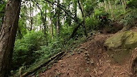
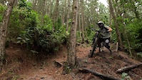
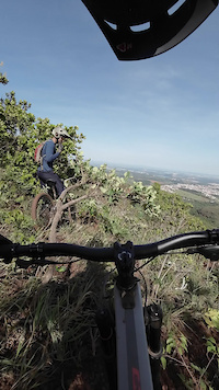
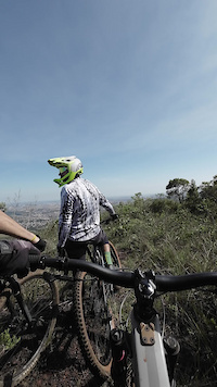
Photos of Sudeste Mountain Bike
Videos of Sudeste Mountain Bike
trail: Trilha da Onça
0:12 |
3 |
Mar 23, 2026
trail: Trilha da Onça
0:06 |
5 |
Mar 23, 2026
trail: Trilha da Onça
0:06 |
6 |
Mar 23, 2026
0:10 |
10 |
Jan 7, 2026
trail: Pe Grande
0:14 |
50 |
Feb 4, 2024
trail: Pe Grande
0:08 |
52 |
Feb 4, 2024
trail: Trilha Do Véi
0:30 |
8 |
Nov 8, 2023
trail: Trilha Do Véi
0:30 |
9 |
Nov 8, 2023
Recent Trail Reports
| status | trail | date | condition | info | user |
|---|---|---|---|---|---|
| Mago Serra do Japi | Jun 12, 2026 @ 10:40am (America/Sao_Paulo) Jun 12, 2026 | Ideal | edusallouti | ||
| 27 VOLTAS Gandarela | Jun 4, 2026 @ 3:00pm (America/Sao_Paulo) Jun 4, 2026 | Unknown | 8FROID | ||
| Computronics Gandarela | May 30, 2026 @ 8:04am (America/Sao_Paulo) May 30, 2026 | Dry | RodrigoLana | ||
| Teresa Cristina - Curva de Nível Macacos | May 17, 2026 @ 9:43am (America/Sao_Paulo) May 17, 2026 | Ideal | luishteixeira | ||
| Perdidas Da Cachoeira Macacos | May 17, 2026 @ 9:43am (America/Sao_Paulo) May 17, 2026 | Ideal | luishteixeira | ||
| Contorno Da Perdidas 2 Macacos | May 17, 2026 @ 9:43am (America/Sao_Paulo) May 17, 2026 | Ideal | luishteixeira | ||
| Lajinha Brumadinho | May 15, 2026 @ 7:46am (America/Sao_Paulo) May 15, 2026 | Unknown | RideOverMountain | ||
| Subida pra laje Brumadinho | May 15, 2026 @ 7:46am (America/Sao_Paulo) May 15, 2026 | Unknown | RideOverMountain | ||
| Lajona Brumadinho | May 15, 2026 @ 7:45am (America/Sao_Paulo) May 15, 2026 | Unknown | RideOverMountain | ||
| Ao lado do Tour de France Vale do Sol | May 11, 2026 @ 5:54am (America/Sao_Paulo) May 11, 2026 | Ideal | chbrito |
Activity Feed
| username | action | type | title | date |
|---|---|---|---|---|
| Fabricioznd9jc | ridden | trail | activity #97321120 | Jun 19, 2026 @ 8:48am 21 hours |
| Fabricioznd9jc | wishlist | trail | activity #97321025 and 2 more | Jun 19, 2026 @ 8:47am 21 hours |
| AMRios | comment | trail | activity #97115312 | Jun 16, 2026 @ 9:10am Jun 16, 2026 |
| RafaFernandes | wishlist | route | activity #97020596 | Jun 14, 2026 @ 8:11pm Jun 14, 2026 |
| RafaFernandes | wishlist | route | activity #97020554 | Jun 14, 2026 @ 8:09pm Jun 14, 2026 |
Recent Comments
| username | type | title | comment | date |
|---|---|---|---|---|
| trail | Muito boa | Jun 16, 2026 @ 9:10am Jun 16, 2026 | ||
| trail | está categorizado como trilha mas é... | May 27, 2026 @ 6:43pm May 27, 2026 | ||
| trail | A partir do km 1.5, depois da entrada do Bar... | May 2, 2026 @ 6:11pm May 2, 2026 | ||
| trail | Esse estradão conecta o amaro até o final da... | Mar 28, 2026 @ 9:55am Mar 28, 2026 | ||
| report | não sei como, mas fiz esse relato sobre a... | Feb 16, 2026 @ 3:02am Feb 16, 2026 |
Local Badges
-

10 Green Trails98 awarded -

Top 10 Trails0 awarded -

Climbing 10k Badge12 awarded -

Epic Ride Climb 2k29 awarded -

Climbing 100k Badge5 awarded -

Epic Ride Descent 2k29 awarded
Bike & Skill Parks
| name | type | city | rating |
|---|---|---|---|
| Nore Bike Park | bike park | Itu | |
| Zoom Bike Park | bike park | Campos do Jordão | |
| Interior Paulista | bike park | Itu | |
| XCO Botuja | bike park | São Bernardo do Campo | |
| Parque de Esportes Radicais | skill park | São Paulo |
Local Trail Supporters
- Thiago Velardi
![Avelar Sports]()
![]()
- Feio
![3 Vales]()
![]()
- Daniel brandao
![]()
- Enoque Ruela
- Adilson
Activity Type Stats
| activitytype | trails | distance | descent | descent distance | total vertical | rating | global rank | state rank | photos | reports | routes | ridelogs |
|---|---|---|---|---|---|---|---|---|---|---|---|---|
| Mountain Bike | 3,323 | 6,786 miles | 1,214,314 ft | 3,344 miles | 6,417 ft | 1,615 | 4,212 | 322 | 436,558 | |||
| E-Bike | 1,845 | 3,615 miles | 659,026 ft | 1,771 miles | 6,417 ft | 4 | 3,820 | 163 | 32,985 | |||
| Gravel Bike | 4 | 39 | 100 | |||||||||
| Adaptive Bike | 2 | 1 | ||||||||||
| Winter Fat Bike | 1 | 2 | 1 | |||||||||
| Horse | 284 | 576 miles | 76,998 ft | 259 miles | 6,253 ft | 449 | 11 | 3 | ||||
| Hike | 2,880 | 5,993 miles | 1,068,415 ft | 2,921 miles | 6,417 ft | 36 | 4,037 | 39 | 5,981 | |||
| Trail Running | 2,941 | 6,048 miles | 1,075,213 ft | 2,945 miles | 6,417 ft | 38 | 4,047 | 36 | 4,136 | |||
| Dirtbike/Moto | 223 | 330 miles | 41,332 ft | 150 miles | 6,263 ft | 2 | 452 | 12 | 50 | |||
| Observed Trials | 33 | 46 miles | 9,012 ft | 19 miles | 4,081 ft | 1 | 4 | |||||
| ATV/ORV/OHV | 57 | 86 miles | 7,201 ft | 31 miles | 4,226 ft | 448 | 2 | 18 | ||||
| Snowmobile | 1 | |||||||||||
| Snowshoe | 1 | 1 | ||||||||||
| Downhill Ski | 2 | 3,737 ft | 171 ft | 2,385 ft | 154 ft | 1 | 18 | |||||
| Backcountry Ski | 1 | 2 | 4 | |||||||||
| Nordic Ski | 1 | 5 |
Activities
Trails
Points of Interest
- Cachoeira Santo Antônio Viewpoint
- Ponte do Acaba Mundo Bridge
- Cachoeira Sentinela Viewpoint
- Cachoeira dos Cristais Viewpoint
- Pinheiros (vila) Viewpoint
- Cachoeira das Andorinhas Viewpoint
- Cachoeira das Fadas Viewpoint
- Mirante morro da janela Viewpoint
- Mirante do Pico do Imbiri Viewpoint
- Mirante Pinheiros da Antena Viewpoint
- Pico da Bandeira (2,813 m)
- Pedra da Mina (2,788 m)
- Pico do Calçado (2,777 m)
- By brenthillier
 NSMBA TRAILFORKS & contributors
 - Admins: chpw, chpw, Crer
- #8008 - 4,695 views
- sudeste activity log | embed map of Sudeste mountain bike trails | sudeste mountain biking points of interest polygons
Downloading of trail gps tracks in kml & gpx formats is enabled for Sudeste.
You must login to download files.