close
-
Layers w
- Weather Layers
- Pro
- Pro
- Pro
- Pro
- Pro
- Pro
- More Layers
- Pro
- Pro
- Pro
- Pro
-
Upgrade to

3D
Trail Conditions
- Unknown
- Snow Groomed
- Snow Packed
- Snow Covered
- Snow Cover Partial
- Freeze/thaw Cycle
- Icy
- Prevalent Mud
- Wet
- Variable
- Ideal
- Dry
- Very Dry
Trail Flow (Ridden Direction)
Trailforks scans users ridelogs to determine the most popular direction each trail is ridden. A good flowing trail network will have most trails flowing in a single direction according to their intension.
The colour categories are based on what percentage of riders are riding a trail in its intended direction.
The colour categories are based on what percentage of riders are riding a trail in its intended direction.
- > 96%
- > 90%
- > 80%
- > 70%
- > 50%
- < 50%
- bi-directional trail
- no data
Trail Last Ridden
Trailforks scans ridelogs to determine the last time a trail was ridden.
- < 2 days
- < 1 week
- < 2 weeks
- < 1 month
- < 6 months
- > 6 months
Trail Ridden Direction
The intended direction a trail should be ridden.
- Downhill Only
- Downhill Primary
- Both Directions
- Uphill Primary
- Uphill Only
- One Direction
Contribute Details
Colors indicate trail is missing specified detail.
- Description
- Photos
- Description & Photos
- Videos
Trail Popularity ?
Trailforks scans ridelogs to determine which trails are ridden the most in the last 9 months.
Trails are compared with nearby trails in the same city region with a possible 25 colour shades.
Think of this as a heatmap, more rides = more kinetic energy = warmer colors.
- most popular
- popular
- less popular
- not popular
ATV/ORV/OHV Filter
Max Vehicle Width
inches
US Cell Coverage
Legend

Radar Time
Activity Recordings
Trailforks uses anonymized public activity data.
?
Activity Recordings
Trailforks uses anonymized public activity data.
?
Personal Heatmap
▶
Activity Types
all
/
none
▶
Options
2
Date range
month
–
Winter Trails
Warning
A routing network for winter maps does not exist. Selecting trails using the winter trails layer has been disabled.
Missing Trails
Most Popular
Least Popular
Trails are colored based on popularity. The more popular a trail is, the more red. Less popular trails trend towards green.
Jump Magnitude Heatmap
Heatmap of where riders jump on trails. Zoom in to see individual jumps, click circles to view jump details.
BC Backroad Status
![map legend]()
Service Road Atlas is a free to use, community-driven service for viewing and creating reports on the numerous back-country service roads around B.C. and Alberta.

Slope Aspect
Direction the slope faces
Trails Deemphasized
Trails are shown in grey.
Only show trails with no bike usage.
Suggested Layers
Based on selected activity type
Save the current map location and zoom level as your default home location whenever this page is loaded.
SavePopular Trail Networks
view all areas »
No description for Summit County has been added yet!
Login or register to submit one.
Activities Click to view
- Mountain Bike
81 trails
- E-Bike
11 trails
- Horse
47 trails
- Hike
218 trails
- Trail Running
217 trails
- Snowshoe
106 trails
- Downhill Ski
18 trails
- Backcountry Ski
19 trails
- Nordic Ski
95 trails
Region Details
- 14
- 5
- 41
- 14
- 2
Stats
- Avg Trail Rating
- Trails (view details)
- 243
- Trails Mountain Bike
- 81
- Trails E-Bike
- 11
- Trails Gravel Bike
- 4
- Trails Adaptive Bike
- 3
- Trails Horse
- 47
- Trails Hike
- 218
- Trails Trail Running
- 217
- Trails Snowshoe
- 106
- Trails Downhill Ski
- 18
- Trails Backcountry Ski
- 19
- Trails Nordic Ski
- 95
- Total Distance
- 278 miles
- Total Descent
- 19,142 ft
- Total Vertical
- 607 ft
- Highest Trailhead
- 1,194 ft
- Reports
- 315
- Photos
- 44
- Ridden Counter
- 10,487
Articles

Entry to These 20 National Parks Won’t Cost You a Dime
Jan 21, 2025 from outsideonline.com
Most national parks have an entry fee, but not these. And they're all awesome places to visit.
Traveling on a Budget? These 10 U.S. National Parks Are the Most Affordable to Visit.
Jun 16, 2024 from outsideonline.com
Our parks expert has put together long weekend trips for as little as $204, with details on free entrance fees and campsites, and active...
Sub Regions
- Akron (27)
- Munroe Falls (7)
- Peninsula (46)
- Twinsburg (1)
Popular Summit County Mountain Biking Trails
• 100 ★ 4.6 • 2 miles • 193 ft • 520 •
A 2.3 mile trail for intermediate level bikers.
• 85 ★ 4.0 • 3,176 ft • 27 ft • 341 •
Popular green difficulty family friendly singletrack. This mountain bike primary trail and has a moderate overall physical rating with a 27 ft green climb. On average it takes 8 minutes to complete this trail.
• 80 ★ 4.0 • 3,780 ft • 38 ft • 313 •
Popular green difficulty family friendly singletrack. This mountain bike primary trail and has a moderate overall physical rating with a 38 ft green climb. On average it takes 3 minutes to complete this trail.
• 90 ★ 4.4 • 1,604 ft • 0 ft • 301 •
Highly rated popular black diamond difficulty singletrack. This mountain bike primary trail. On average it takes 4 minutes to complete this trail.
• 90 ★ 5.0 • 479 ft • 5 ft • 280 •
Popular blue difficulty family friendly singletrack. This mountain bike primary trail and has a moderate overall physical rating with a 5 ft blue climb. On average it takes minutes to complete this trail.
• 95 ★ 5.0 • 1 mile • 111 ft • 276 •
Popular green difficulty singletrack. This mountain bike primary trail and has a moderate overall physical rating with a 111 ft green climb. On average it takes 8 minutes to complete this trail.
• 90 ★ 4.4 • 1,194 ft • 11 ft • 274 •
Popular white difficulty singletrack. This mountain bike primary trail. On average it takes 1 minutes to complete this trail.
Summit County Mountain Bike Routes
★ 5.0 • 7 miles • 485 ft • 19 • Loop •
Hampton Hills full loop with connections noted in the normal direction
45 miles • 2,103 ft • 16 • Out & Back •
High School to Hampton for the full loop, then utilizing the bike and hike to get to Peninsula. Ride on...
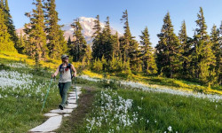
Photos of Summit County Mountain Bike
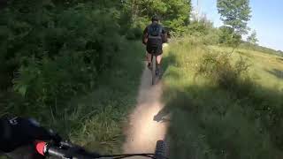
Videos of Summit County Mountain Bike
trail: East Rim Trail
2:13 |
547 |
Jul 7, 2022 , Peninsula
Recent Trail Reports
Activity Feed
| username | action | type | title | date |
|---|---|---|---|---|
| Parcolla | add | photo | activity #97010307 | Jun 14, 2026 @ 3:52pm 3 days |
| Javanigga | ridden | trail | activity #96832818 and 3 more | Jun 12, 2026 @ 3:53pm Jun 12, 2026 |
| Hickupville | ridden | trail | activity #96635462 | Jun 9, 2026 @ 4:05pm Jun 9, 2026 |
| msmcfate | update | trail | activity #96619907 | Jun 9, 2026 @ 11:36am Jun 9, 2026 |
| f1xedgear | add | report | activity #96509923 | Jun 7, 2026 @ 5:19pm Jun 7, 2026 |
Recent Comments
| username | type | title | comment | date |
|---|---|---|---|---|
| report | The towpath does not close. This comment is... | Apr 18, 2026 @ 5:07am Apr 18, 2026 | ||
| trail | So… no bikes allowed? | Jan 11, 2026 @ 7:45pm Jan 11, 2026 | ||
| trail | Bidirectional trails are generally a bad idea... | Oct 5, 2025 @ 6:36am Oct 5, 2025 | ||
| trail | This could be a really fun trail if the bottom... | Sep 2, 2025 @ 9:26am Sep 2, 2025 | ||
| trail | Not a MB trail | May 2, 2025 @ 8:22pm May 2, 2025 |
Local Badges
-

Epic Ride 50k186 awarded -

Mountain Biking 100k Badge0 awarded -

Epic Ride Descent 2k2 awarded -

Descent 10k Badge14 awarded -

Descent 100k Badge0 awarded -

Completionist0 awarded
Local Mountain Biking Directory
-
Performance Bike ShopBike Shop
-
Century Cycles - PeninsulaBike Shop
-
Century CyclesBike Shop
Local Trail Supporters
- Summit County Metro Parks
Activity Type Stats
| activitytype | trails | distance | descent | descent distance | total vertical | rating | global rank | state rank | photos | reports | routes | ridelogs |
|---|---|---|---|---|---|---|---|---|---|---|---|---|
| Mountain Bike | 81 | 154 miles | 5,778 ft | 57 miles | 574 ft | 41 | 311 | 3 | 14,965 | |||
| E-Bike | 11 | 94 miles | 1,473 ft | 36 miles | 545 ft | 232 | 588 | |||||
| Gravel Bike | 4 | 5 miles | 141 ft | 3 miles | 171 ft | 18 | 1 | 149 | ||||
| Adaptive Bike | 3 | 3 miles | 46 ft | 2 miles | 141 ft | 20 | ||||||
| Horse | 47 | 36 miles | 3,560 ft | 15 miles | 535 ft | 8 | 3 | |||||
| Hike | 218 | 266 miles | 17,848 ft | 105 miles | 607 ft | 3 | 296 | 2,123 | ||||
| Trail Running | 217 | 266 miles | 17,700 ft | 104 miles | 607 ft | 296 | 1,352 | |||||
| Snowshoe | 106 | 98 miles | 9,436 ft | 47 miles | 535 ft | 11 | ||||||
| Downhill Ski | 18 | 3 miles | 390 ft | 2,743 ft | 197 ft | 214 | ||||||
| Backcountry Ski | 19 | 11 miles | 1,129 ft | 5 miles | 364 ft | 4 | ||||||
| Nordic Ski | 95 | 72 miles | 7,684 ft | 30 miles | 535 ft | 53 |
Frequently Asked Questions About Summit County
▼
What are the best places to ride in Summit County?
Summit County has 17 areas to explore for mountain biking. The top rated areas are:
▼
What are the highest rated mountain biking trails in Summit County?
The highest rated mountain biking trails in Summit County are:
- East Rim Trail (4.4/5)
- Lamb Loop (4.4/5)
- Straightaway (4.2/5)
- Woodward Creek Loop (4.2/5)
- Post Line (4.2/5)
▼
What is the best time of the year to ride in Summit County?
Based on ride log data, the most popular months to ride in Summit County are:
- July (244 activities)
- August (188 activities)
- September (182 activities)
▼
What is the longest trail in Summit County?
The longest trail in Summit County is Lamb Loop at 4.4 miles. View all trails sorted by distance.
Activities
Trails
- By markholloway
 Trailforks Map Team & contributors
 - Admins: Chris-Campbell
- #23281 - 2,294 views
- summit county activity log | embed map of Summit County mountain bike trails | summit county mountain biking points of interest
Downloading of trail gps tracks in kml & gpx formats is enabled for Summit County.
You must login to download files.