close
-
Layers w
- Weather Layers
- Pro
- Pro
- Pro
- Pro
- Pro
- Pro
- More Layers
- Pro
- Pro
- Pro
- Pro
-
Upgrade to

3D
Trail Conditions
- Unknown
- Snow Groomed
- Snow Packed
- Snow Covered
- Snow Cover Partial
- Freeze/thaw Cycle
- Icy
- Prevalent Mud
- Wet
- Variable
- Ideal
- Dry
- Very Dry
Trail Flow (Ridden Direction)
Trailforks scans users ridelogs to determine the most popular direction each trail is ridden. A good flowing trail network will have most trails flowing in a single direction according to their intension.
The colour categories are based on what percentage of riders are riding a trail in its intended direction.
The colour categories are based on what percentage of riders are riding a trail in its intended direction.
- > 96%
- > 90%
- > 80%
- > 70%
- > 50%
- < 50%
- bi-directional trail
- no data
Trail Last Ridden
Trailforks scans ridelogs to determine the last time a trail was ridden.
- < 2 days
- < 1 week
- < 2 weeks
- < 1 month
- < 6 months
- > 6 months
Trail Ridden Direction
The intended direction a trail should be ridden.
- Downhill Only
- Downhill Primary
- Both Directions
- Uphill Primary
- Uphill Only
- One Direction
Contribute Details
Colors indicate trail is missing specified detail.
- Description
- Photos
- Description & Photos
- Videos
Trail Popularity ?
Trailforks scans ridelogs to determine which trails are ridden the most in the last 9 months.
Trails are compared with nearby trails in the same city region with a possible 25 colour shades.
Think of this as a heatmap, more rides = more kinetic energy = warmer colors.
- most popular
- popular
- less popular
- not popular
ATV/ORV/OHV Filter
Max Vehicle Width
inches
US Cell Coverage
Legend

Radar Time
Activity Recordings
Trailforks uses anonymized public activity data.
?
Activity Recordings
Trailforks uses anonymized public activity data.
?
Personal Heatmap
▶
Activity Types
all
/
none
▶
Options
2
Date range
month
–
Winter Trails
Warning
A routing network for winter maps does not exist. Selecting trails using the winter trails layer has been disabled.
Missing Trails
Most Popular
Least Popular
Trails are colored based on popularity. The more popular a trail is, the more red. Less popular trails trend towards green.
Jump Magnitude Heatmap
Heatmap of where riders jump on trails. Zoom in to see individual jumps, click circles to view jump details.
BC Backroad Status
![map legend]()
Service Road Atlas is a free to use, community-driven service for viewing and creating reports on the numerous back-country service roads around B.C. and Alberta.

Slope Aspect
Direction the slope faces
Trails Deemphasized
Trails are shown in grey.
Only show trails with no bike usage.
Suggested Layers
Based on selected activity type
Save the current map location and zoom level as your default home location whenever this page is loaded.
Save
No description for Sun City has been added yet!
Login or register to submit one.
 google parking directions
google parking directions Activities Click to view
- Mountain Bike
12 trails
- Hike
11 trails
- Trail Running
11 trails
Region Details
- 9
- 1
- 1
Region Status
Open as of May 17, 2026Stats
- Avg Trail Rating
- Trails (view details)
- 12
- Trails Mountain Bike
- 12
- Trails E-Bike
- 2
- Trails Hike
- 11
- Trails Trail Running
- 11
- Total Distance
- 6 miles
- Total Descent
- 542 ft
- Total Vertical
- 818 ft
- Highest Trailhead
- 3,401 ft
- Reports
- 21
- Photos
- 28
- Ridden Counter
- 627
Popular Sun City Mountain Biking Trails
• 85 ★ 0.0 • 1 mile • 367 ft • 120 •
Popular green difficulty doubletrack. This mountain bike primary trail can be used both directions and has a moderate overall physical rating with a 367 ft blue climb. On average it takes 14 minutes to complete this trail.
• 55 ★ 4.0 • 2 miles • 210 ft • 119 •
Fun multi-use trail. Great for walking, trail running, or for just riding your bikes on with friends and family.
• 55 ★ 4.0 • 2 miles • 339 ft • 73 •
If your time is limited this is short but fun ride, great for sessions to sharpen skills while still getting a great workout in.
• 25 ★ 5.0 • 1,152 ft • 0 ft • 5 •
Slow controlled tech gnar with skinny rock sections, rock gates, rock steps, loose scree over hard, pure loose steep sections. Some smaller mandatory shelf drops. Scout the bottom third or watch a video if unsure. Some moves want an...
• 20 ★ 0.0 • 2,470 ft • 0 ft • • hike
Less popular green difficulty singletrack. This hike primary trail can be used both directions and has a easy overall physical rating.
• 5 ★ 0.0 • 85 ft • 0 ft • • hike
Less popular green difficulty singletrack. This hike primary trail can be used both directions and has a easy overall physical rating.
• 5 ★ 0.0 • 128 ft • 0 ft • • hike
Less popular green difficulty singletrack. This hike primary trail can be used both directions and has a easy overall physical rating.
• 5 ★ 0.0 • 85 ft • 0 ft • • hike
Less popular green difficulty singletrack. This hike primary trail can be used both directions and has a easy overall physical rating.
Photos of Sun City Mountain Bike
Videos of Sun City Mountain Bike
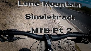
trail: Oh So Lonely
3:48 |
337 |
Jan 6, 2022 , Las Vegas
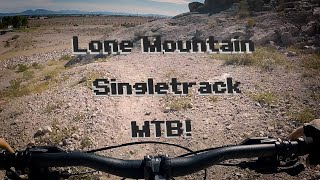
trail: Oh So Lonely
3:46 |
379 |
Jan 6, 2022 , Las Vegas
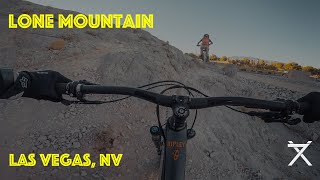
trail: Oh So Lonely
3:21 |
584 |
Jul 15, 2020 , Las Vegas
Recent Trail Reports
| status | trail | date | condition | info | user |
|---|---|---|---|---|---|
| Loner | Apr 4, 2025 @ 8:41am Apr 4, 2025 | Dry | MikeD702 | ||
| Lone Mountain Loop | Nov 10, 2024 @ 11:51am Nov 10, 2024 | Dry | JoeVjDZzT | ||
| Oh So Lonely | Nov 26, 2023 @ 1:54pm Nov 26, 2023 | Dry | Scooterinvegas |
Activity Feed
| username | action | type | title | date |
|---|---|---|---|---|
| vMIHAQzA | wishlist | trail | activity #95539140 | May 25, 2026 @ 7:14pm May 25, 2026 |
| shaggy135 | add | report | activity #94926956 | May 17, 2026 @ 11:50am May 17, 2026 |
| supersaiyanjoms | wishlist | trail | activity #94053074 | May 4, 2026 @ 3:38pm May 4, 2026 |
| dirtgomer | ridden | trail | activity #88063632 | Jan 30, 2026 @ 6:06pm Jan 30, 2026 |
| sdHRKo | difficultyvote | trail | activity #87371299 | Jan 17, 2026 @ 2:46pm Jan 17, 2026 |
Recent Comments
| username | type | title | comment | date |
|---|---|---|---|---|
| trail | If you’re looking for a challenge this is... | Dec 6, 2025 @ 12:20pm Dec 6, 2025 | ||
| trail | Not worth it. Lots of hikers, especially with... | Dec 22, 2024 @ 1:47pm Dec 22, 2024 | ||
| trail | A little bit washed out right now because of... | Aug 12, 2023 @ 7:28pm Aug 12, 2023 | ||
| trail | Flat and easy ride but still fun. Watch out... | Aug 12, 2023 @ 8:18am Aug 12, 2023 | ||
| trail | My first ride on Mountain bike. Did the Easy... | Jul 10, 2023 @ 11:04am Jul 10, 2023 |
Nearby Areas
| name | distance | ||||
|---|---|---|---|---|---|
| Da Burbs | 3 | 22 | 12 | 3 | 2.9 km |
| Pueblo Park | 1 | 3.7 km | |||
| Brian's Best | 3.8 km | ||||
| El Paramo | 2 | 7 | 4.7 km | ||
| Floyd Lamb Park At Tule Springs | 11 | 8 | 4 | 6.4 km |
Activity Type Stats
| activitytype | trails | distance | descent | descent distance | total vertical | rating | global rank | state rank | photos | reports | routes | ridelogs |
|---|---|---|---|---|---|---|---|---|---|---|---|---|
| Mountain Bike | 12 | 6 miles | 541 ft | 2 miles | 817 ft | #7,275 | #2,785 | 28 | 21 | 2,153 | ||
| E-Bike | 2 | 12 | 114 | |||||||||
| Hike | 11 | 6 miles | 541 ft | 2 miles | 817 ft | #11,008 | #4,403 | 1 | 21 | 424 | ||
| Trail Running | 11 | 6 miles | 541 ft | 2 miles | 817 ft | #11,662 | #4,552 | 21 | 815 |
Frequently Asked Questions About Sun City
▼
What are the highest rated mountain biking trails in Sun City?
The highest rated mountain biking trails in Sun City are:
- Oh So Lonely (4/5)
- Lone Mountain Loop (4/5)
- Loner (0/5)
- The Promenade (0/5)
- The Promenade (0/5)
▼
What is the best time of the year to ride in Sun City?
Based on ride log data, the most popular months to ride in Sun City are:
- November (26 activities)
- January (22 activities)
- October (20 activities)
▼
Where can I park to ride in Sun City?
▼
What is the longest trail in Sun City?
The longest trail in Sun City is Oh So Lonely at 2.3 miles. View all trails sorted by distance.
- By 702xventures & contributors
- Admins: Las Vegas, BLM NV GBNM
- #30610 - 3,977 views
- sun city activity log | embed map of Sun City mountain bike trails | sun city mountain biking points of interest
Downloading of trail gps tracks in kml & gpx formats is enabled for Sun City.
You must login to download files.