close
-
Layers w
- Weather Layers
- Pro
- Pro
- Pro
- Pro
- Pro
- Pro
- More Layers
- Pro
- Pro
- Pro
- Pro
-
Upgrade to

3D
Trail Conditions
- Unknown
- Snow Groomed
- Snow Packed
- Snow Covered
- Snow Cover Partial
- Freeze/thaw Cycle
- Icy
- Prevalent Mud
- Wet
- Variable
- Ideal
- Dry
- Very Dry
Trail Flow (Ridden Direction)
Trailforks scans users ridelogs to determine the most popular direction each trail is ridden. A good flowing trail network will have most trails flowing in a single direction according to their intension.
The colour categories are based on what percentage of riders are riding a trail in its intended direction.
The colour categories are based on what percentage of riders are riding a trail in its intended direction.
- > 96%
- > 90%
- > 80%
- > 70%
- > 50%
- < 50%
- bi-directional trail
- no data
Trail Last Ridden
Trailforks scans ridelogs to determine the last time a trail was ridden.
- < 2 days
- < 1 week
- < 2 weeks
- < 1 month
- < 6 months
- > 6 months
Trail Ridden Direction
The intended direction a trail should be ridden.
- Downhill Only
- Downhill Primary
- Both Directions
- Uphill Primary
- Uphill Only
- One Direction
Contribute Details
Colors indicate trail is missing specified detail.
- Description
- Photos
- Description & Photos
- Videos
Trail Popularity ?
Trailforks scans ridelogs to determine which trails are ridden the most in the last 9 months.
Trails are compared with nearby trails in the same city region with a possible 25 colour shades.
Think of this as a heatmap, more rides = more kinetic energy = warmer colors.
- most popular
- popular
- less popular
- not popular
ATV/ORV/OHV Filter
Max Vehicle Width
inches
US Cell Coverage
Legend

Radar Time
Activity Recordings
Trailforks uses anonymized public activity data.
?
Activity Recordings
Trailforks uses anonymized public activity data.
?
Personal Heatmap
▶
Activity Types
all
/
none
▶
Options
2
Date range
month
–
Winter Trails
Warning
A routing network for winter maps does not exist. Selecting trails using the winter trails layer has been disabled.
Missing Trails
Most Popular
Least Popular
Trails are colored based on popularity. The more popular a trail is, the more red. Less popular trails trend towards green.
Jump Magnitude Heatmap
Heatmap of where riders jump on trails. Zoom in to see individual jumps, click circles to view jump details.
BC Backroad Status
![map legend]()
Service Road Atlas is a free to use, community-driven service for viewing and creating reports on the numerous back-country service roads around B.C. and Alberta.

Slope Aspect
Direction the slope faces
Trails Deemphasized
Trails are shown in grey.
Only show trails with no bike usage.
Suggested Layers
Based on selected activity type
Save the current map location and zoom level as your default home location whenever this page is loaded.
SaveGreat area to start developing further XC skills while enjoying only a slight grade.
Area is also popular with horse riders.
Area is also popular with horse riders.
Primary Trail Type: Cross-Country
AKA: Airport Reserve
 google parking directions
 Activities Click to view
- Mountain Bike
37 trails
- E-Bike
35 trails
- Horse
34 trails
- Hike
36 trails
- Trail Running
36 trails
Region Details
- 7
- 10
- 19
- 1
Region Status
Caution as of May 16, 2026Stats
- Avg Trail Rating
- Trails (view details)
- 37
- Trails Mountain Bike
- 37
- Trails E-Bike
- 35
- Trails Horse
- 34
- Trails Hike
- 36
- Trails Trail Running
- 36
- Total Distance
- 26 miles
- Total Descent
- 2,155 ft
- Total Vertical
- 396 ft
- Highest Trailhead
- 543 ft
- Reports
- 220
- Photos
- 71
- Ridden Counter
- 3,130
Popular Suncoast Mountain Biking Trails
• 95 ★ 3.5 • 4,012 ft • 11 ft • 173 •
Popular green difficulty doubletrack. This mountain bike primary trail can be used both directions and has a easy overall physical rating with a 11 ft green climb. On average it takes 7 minutes to complete this trail.
• 95 ★ 3.0 • 1,066 ft • 6 ft • 159 •
This fun little trail connects you from to . Please be courteous of all trail users! This trail is frequently used by horse riders, hikers, bikers, dog walkers etc.
• 80 ★ 4.0 • 3,277 ft • 36 ft • 147 •
Popular blue difficulty singletrack. This mountain bike primary trail can be used both directions and has a moderate overall physical rating with a 36 ft blue climb. On average it takes 5 minutes to complete this trail.
• 90 ★ 0.0 • 1,547 ft • 30 ft • 139 •
Popular blue difficulty singletrack. This mountain bike primary trail can be used both directions and has a moderate overall physical rating with a 30 ft blue climb. On average it takes 1 minutes to complete this trail.
• 85 ★ 4.2 • 2 miles • 200 ft • 138 •
Relatively smooth trail that is a strong multi-use trail. Fun part of loop trails in this Suncoast trail system. Occasional rock bump or root drop throughout trail. Please be courteous to all trail users as you will encounter hikers,...
• 85 ★ 0.0 • 2,143 ft • 1 ft • 138 •
Popular blue difficulty singletrack. This mountain bike primary trail can be used both directions and has a moderate overall physical rating with a 1 ft blue climb. On average it takes 3 minutes to complete this trail.
• 90 ★ 4.0 • 983 ft • 11 ft • 132 •
Popular blue difficulty singletrack. This mountain bike primary trail can be used both directions and has a moderate overall physical rating with a 11 ft blue climb. On average it takes 1 minutes to complete this trail.
Suncoast Mountain Bike Routes
★ 3.5 • 8 miles • 419 ft • 23 • Loop •
Longer ride, counter-clockwise. approx. 45 min moderate pace. Nothing too technical, just longer.
★ 2.0 • 4 miles • 215 ft • 5 • Loop •
Counter-clockwise. 25-30 min, easy-mod pace: nothing too technical.
• 15 miles • 1,285 ft • 0 •
• 9 miles • 637 ft • 8 •
• 3 miles • 173 ft • 2 •
• 2 miles • 116 ft • 1 •
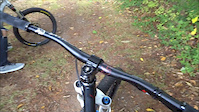
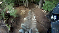
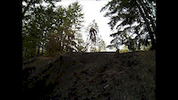
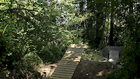
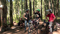
Photos of Suncoast Mountain Bike
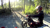
Videos of Suncoast Mountain Bike
trail: Friday
0:22 |
1039 |
Dec 24, 2014
trail: Friday
4:54 |
355 |
Oct 19, 2014

trail: Friday
0:32 |
397 |
Aug 18, 2014
trail: Friday
0:04 |
501 |
Apr 21, 2014
trail: Friday
0:44 |
2404 |
Aug 11, 2013

trail: Friday
0:07 |
11700 |
Jun 21, 2013
trail: Friday
2:55 |
3482 |
Jun 14, 2013
trail: Friday
4:14 |
237 |
May 7, 2013
Recent Trail Reports
| status | trail | date | condition | info | user |
|---|---|---|---|---|---|
| Kristensen | Mar 24, 2026 @ 5:16pm (America/Vancouver) Mar 24, 2026 | Prevalent Mud | ocoatta | ||
| Gutentite | Jan 2, 2026 @ 5:21pm (America/Vancouver) Jan 2, 2026 | Wet | ocoatta | ||
| Little Connector | Aug 7, 2025 @ 9:58am Aug 7, 2025 | Ideal | ocoatta | ||
| Ivy | Aug 2, 2025 @ 11:33am Aug 2, 2025 | Ideal | ocoatta | ||
| Polka Dot | Jun 23, 2025 @ 7:40am Jun 23, 2025 | Variable | DawnMyers | ||
| Rene's Canadian | Jun 14, 2025 @ 7:47am Jun 14, 2025 | Dry | DawnMyers | ||
| Technical Jungle | Apr 17, 2025 @ 3:32pm Apr 17, 2025 | Variable | JakeBoulder | ||
| Pine Tree | Apr 17, 2025 @ 3:30pm Apr 17, 2025 | Variable | JakeBoulder | ||
| Twin Eagles | Apr 17, 2025 @ 3:28pm Apr 17, 2025 | Wet | JakeBoulder | ||
| Dilemma | Apr 17, 2025 @ 3:27pm Apr 17, 2025 | Prevalent Mud | JakeBoulder |
Activity Feed
| username | action | type | title | date |
|---|---|---|---|---|
| iceman-paul | ridden | trail | activity #93595589 and 10 more | Apr 28, 2026 @ 11:36am Apr 28, 2026 |
| trailforks | add | video | activity #93039139 | Apr 20, 2026 @ 2:00pm Apr 20, 2026 |
| trailforks | add | video | activity #92667802 | Apr 15, 2026 @ 10:01am Apr 15, 2026 |
| trailforks | add | video | activity #92538668 | Apr 13, 2026 @ 8:00am Apr 13, 2026 |
| rojerebike | wishlist | trail | activity #91896728 and 2 more | Apr 4, 2026 @ 7:53am Apr 4, 2026 |
Recent Comments
| username | type | title | comment | date |
|---|---|---|---|---|
| trail | We called this “The Swamp” when we were... | Mar 21, 2026 @ 2:51pm Mar 21, 2026 | ||
| trail | Tried to access this trail from NWH road and... | Jun 23, 2025 @ 2:50pm Jun 23, 2025 | ||
| trail | More of a road. Tons of puddles. | Apr 17, 2025 @ 3:28pm Apr 17, 2025 | ||
| trail | Lots of secondary roads here, rode down one I... | Mar 28, 2025 @ 4:05pm Mar 28, 2025 | ||
| trail | For some reason the sign says 'Friday... | Mar 28, 2025 @ 4:04pm Mar 28, 2025 |
Nearby Areas
| name | distance | ||||
|---|---|---|---|---|---|
| West Lake Trails | 6 | 19 | 8 | 1 | 3.5 km |
| Blue Ridge | 2 | 1 | 4 km | ||
| Penticton Street Maze | 16 | 31 | 4.5 km | ||
| Duck Lake Trails | 13 | 53 | 9 | 5.1 km | |
| Gallagher Hill | 1 | 3 | 11 | 2 | 7.5 km |
Local Badges
-

Completionist0 awarded
Activity Type Stats
| activitytype | trails | distance | descent | descent distance | total vertical | rating | global rank | state rank | photos | reports | routes | ridelogs |
|---|---|---|---|---|---|---|---|---|---|---|---|---|
| Mountain Bike | 37 | 26 miles | 2,156 ft | 11 miles | 397 ft | #4,268 | #180 | 51 | 219 | 1 | 2,660 | |
| E-Bike | 35 | 26 miles | 2,149 ft | 11 miles | 397 ft | #4,235 | #159 | 186 | 89 | |||
| Horse | 34 | 25 miles | 2,080 ft | 10 miles | 397 ft | #1,178 | #39 | 106 | 6 | |||
| Hike | 36 | 25 miles | 2,087 ft | 10 miles | 397 ft | #3,154 | #145 | 20 | 219 | 538 | ||
| Trail Running | 36 | 25 miles | 2,087 ft | 10 miles | 397 ft | #5,669 | #201 | 219 | 625 |
Frequently Asked Questions About Suncoast
▼
What are the highest rated mountain biking trails in Suncoast?
The highest rated mountain biking trails in Suncoast are:
- Eggstension (4.1/5)
- Technical Jungle (4.1/5)
- Happy Face (4.1/5)
- Polka Dot (4/5)
- Bev's Connector (4/5)
▼
What is the best time of the year to ride in Suncoast?
Based on ride log data, the most popular months to ride in Suncoast are:
- August (86 activities)
- May (70 activities)
- July (69 activities)
▼
Where can I park to ride in Suncoast?
There are 2 parking locations listed in Suncoast. The most popular parking spots are:
▼
What is the longest trail in Suncoast?
The longest trail in Suncoast is Happy Face at 2.9 km. View all trails sorted by distance.
- By Rubrewer
 & contributors
 - Admins: QRCA, MMSC
- #9590 - 8,208 views
- suncoast activity log | embed map of Suncoast mountain bike trails | suncoast mountain biking points of interest
Downloading of trail gps tracks in kml & gpx formats is enabled for Suncoast.
You must login to download files.