close
-
Layers w
- Weather Layers
- Pro
- Pro
- Pro
- Pro
- Pro
- Pro
- More Layers
- Pro
- Pro
- Pro
- Pro
-
Upgrade to

3D
Trail Conditions
- Unknown
- Snow Groomed
- Snow Packed
- Snow Covered
- Snow Cover Partial
- Freeze/thaw Cycle
- Icy
- Prevalent Mud
- Wet
- Variable
- Ideal
- Dry
- Very Dry
Trail Flow (Ridden Direction)
Trailforks scans users ridelogs to determine the most popular direction each trail is ridden. A good flowing trail network will have most trails flowing in a single direction according to their intension.
The colour categories are based on what percentage of riders are riding a trail in its intended direction.
The colour categories are based on what percentage of riders are riding a trail in its intended direction.
- > 96%
- > 90%
- > 80%
- > 70%
- > 50%
- < 50%
- bi-directional trail
- no data
Trail Last Ridden
Trailforks scans ridelogs to determine the last time a trail was ridden.
- < 2 days
- < 1 week
- < 2 weeks
- < 1 month
- < 6 months
- > 6 months
Trail Ridden Direction
The intended direction a trail should be ridden.
- Downhill Only
- Downhill Primary
- Both Directions
- Uphill Primary
- Uphill Only
- One Direction
Contribute Details
Colors indicate trail is missing specified detail.
- Description
- Photos
- Description & Photos
- Videos
Trail Popularity ?
Trailforks scans ridelogs to determine which trails are ridden the most in the last 9 months.
Trails are compared with nearby trails in the same city region with a possible 25 colour shades.
Think of this as a heatmap, more rides = more kinetic energy = warmer colors.
- most popular
- popular
- less popular
- not popular
ATV/ORV/OHV Filter
Max Vehicle Width
inches
US Cell Coverage
Legend

Radar Time
Activity Recordings
Trailforks uses anonymized public activity data.
?
Activity Recordings
Trailforks uses anonymized public activity data.
?
Personal Heatmap
▶
Activity Types
all
/
none
▶
Options
2
Date range
month
–
Winter Trails
Warning
A routing network for winter maps does not exist. Selecting trails using the winter trails layer has been disabled.
Missing Trails
Most Popular
Least Popular
Trails are colored based on popularity. The more popular a trail is, the more red. Less popular trails trend towards green.
Jump Magnitude Heatmap
Heatmap of where riders jump on trails. Zoom in to see individual jumps, click circles to view jump details.
BC Backroad Status
![map legend]()
Service Road Atlas is a free to use, community-driven service for viewing and creating reports on the numerous back-country service roads around B.C. and Alberta.

Slope Aspect
Direction the slope faces
Trails Deemphasized
Trails are shown in grey.
Only show trails with no bike usage.
Suggested Layers
Based on selected activity type
Save the current map location and zoom level as your default home location whenever this page is loaded.
Save
No description for Sundance has been added yet!
Login or register to submit one.
Activities Click to view
- Mountain Bike
82 trails
- E-Bike
15 trails
- Gravel Bike
0 trails
- Adaptive Bike
0 trails
- Winter Fat Bike
0 trails
- Horse
25 trails
- Hike
80 trails
- Trail Running
75 trails
- Dirtbike/Moto
20 trails
- ATV/ORV/OHV
2 trails
- Snowmobile
0 trails
- Snowshoe
0 trails
- Downhill Ski
75 trails
- Nordic Ski
12 trails
Region Details
- 11
- 11
- 41
- 13
- 4
Region Status
Open as of Jun 7, 2026Stats
- Avg Trail Rating
- Trails (view details)
- 191
- Trails Mountain Bike
- 82
- Trails E-Bike
- 15
- Trails Horse
- 25
- Trails Hike
- 80
- Trails Trail Running
- 75
- Trails Dirtbike/Moto
- 20
- Trails ATV/ORV/OHV
- 2
- Trails Downhill Ski
- 75
- Trails Nordic Ski
- 12
- Total Distance
- 133 miles
- Total Descent
- 46,603 ft
- Total Vertical
- 6,028 ft
- Highest Trailhead
- 11,712 ft
- Reports
- 842
- Photos
- 351
- Ridden Counter
- 36,481
Sub Regions
-
Mt. Timpanogos
- 2
- 4
-
South Fork Provo Canyon
- 4
- 5
- 5
- 1
-
Sundance Mountain Resort
- 3
- 13
- 3
- 2
Popular Sundance Mountain Biking Trails
• 90 ★ 3.9 • 1,172 ft • 59 ft • 777 •
Tight turns with big roots, half exposed half in a deep forest. Some downhill, even a bit up and down. Fun Connector.
• 90 ★ 4.2 • 2 miles • 69 ft • 756 •
Great loop, one cliff, and the east side is very exposed, but a fun trail with good flow travelling north.
• 75 ★ 3.7 • 3,346 ft • 9 ft • 726 •
There are some really pretty sections along the trail. It is much less crowded than some of the main lines. It drops you off at the upper parking lot then you have to ride the road to get back to the lift.
• 95 ★ 3.6 • 2,792 ft • 0 ft • 702 •
This is a blue trail with one black feature (the which is the trail's namesake). The left line is ridable and the right line has a drop that kicks you into a very sharp left turn. Have fun!
• 85 ★ 3.2 • 374 ft • 2 ft • 694 •
Popular blue difficulty singletrack. This mountain bike primary trail can be used both directions. On average it takes minutes to complete this trail.
• 85 ★ 3.7 • 3,123 ft • 75 ft • 654 •
Not high speed, but about as fun as a climb can be, with a little log riser to roll over.
• 95 ★ 4.2 • 1,201 ft • 0 ft • 640 •
Excellent trail, flowy with nice berms, a little bump here and there, but pretty smooth.
• 80 ★ 2.9 • 1,820 ft • 113 ft • 627 •
This first little section is a great trail that most turn right onto the Snow Gauging trail. You can continue where it gets a bit tighter and grown over.
Sundance Mountain Bike Routes
AFC Fight Night Featured
★ 5.0 • 9 miles • 1,185 ft • 3 • Shuttled •
This is a local favorite loop to do after work and chase the light on some of the more technical trails in...
★ 4.0 • 13 miles • 2,422 ft • 5 • Loop •
This is a popular and fun loop in American Fork Canyon
★ 4.0 • 4 miles • 864 ft • 4 •
★ 5.0 • 9 miles • 1,724 ft • 11 • Loop •
Start at lower summit parking lot climb to summit, ride the ridge to the overlook (careful on the climb to...
★ 5.0 • 13 miles • 2,046 ft • 12 •
Fun loop from and back to Timpooneke.
★ 4.0 • 13 miles • 2,859 ft • 15 • Loop •
Park at Alpine Loop Summit parking lot and make your way clockwise through some of AF Canyon's best offerings.
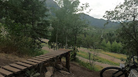
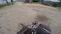
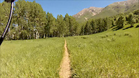
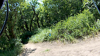
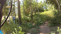
Photos of Sundance Mountain Bike
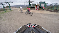
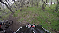
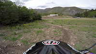
Videos of Sundance Mountain Bike
trail: Expert Trail
0:17 |
|
Oct 26, 2023
trail: Salamander
2:57 |
272 |
May 21, 2015
trail: Wildwood
2:21 |
161 |
May 21, 2015
trail: Boneyard
3:52 |
265 |
May 21, 2015
trail: Archie's Road Connector Loop
6:43 |
53 |
May 21, 2015
trail: Timpooneke-Chris Flat
0:31 |
423 |
Mar 19, 2015
trail: Scott's Pond
4:06 |
152 |
Mar 14, 2015
trail: Center Isle
3:04 |
136 |
Mar 14, 2015
Current Trail Warnings
| status | trail | date | condition | user | info |
|---|---|---|---|---|---|
| Expert (jump) | May 25, 2026 @ 7:08pm (America/Denver) May 25, 2026 | Dry | Bociancz | The trail was closed today and the wooden... |
Recent Trail Reports
| status | trail | date | condition | info | user |
|---|---|---|---|---|---|
| Timpooneke-Chris Flat | Jun 7, 2026 @ 11:24am (America/Denver) Jun 7, 2026 | Unknown | cam-lo | ||
| Mahogany Peak | Jun 7, 2026 @ 8:41am (America/Denver) Jun 7, 2026 | Dry | Spencermon | ||
| Horse Flat | May 28, 2026 @ 6:54am (America/Denver) May 28, 2026 | Ideal | cam-lo | ||
| Winter Pass | May 26, 2026 @ 4:09pm (America/Denver) May 26, 2026 | Ideal | cam-lo | ||
| Expert Trail | May 25, 2026 @ 5:33pm (America/Denver) May 25, 2026 | Dry | Bociancz | ||
| Upper Speedtrap | May 25, 2026 @ 5:32pm (America/Denver) May 25, 2026 | Very Dry | Bociancz | ||
| Upper Flow Trail | May 25, 2026 @ 5:32pm (America/Denver) May 25, 2026 | Very Dry | Bociancz | ||
| Big Springs Hollow | May 25, 2026 @ 11:19am (America/Boise) May 25, 2026 | Dry | Jodiraerod | ||
| Big Springs Hollow | May 25, 2026 @ 11:19am (America/Boise) May 25, 2026 | Ideal | Jodiraerod | ||
| Big Springs Hollow Trail | May 25, 2026 @ 11:19am (America/Boise) May 25, 2026 | Ideal | Jodiraerod |
National Scenic Trails & Official Routes
-
Great Western Trail
- Mountain Bike
- E-Bike
- Horse
- Hike
- Trail Running
- Dirtbike/Moto
- ATV/ORV/OHV

Activity Feed
| username | action | type | title | date |
|---|---|---|---|---|
| mA24mz | ridden | trail | activity #97281425 | Jun 18, 2026 @ 4:10pm 17 hours |
| piperksadler | wishlist | trail | activity #97276556 | Jun 18, 2026 @ 2:34pm 19 hours |
| UtahMTBMarcus | ridden | trail | activity #97193530 and 12 more | Jun 17, 2026 @ 10:20am 2 days |
| chase1000 | ridden | trail | activity #97104555 | Jun 16, 2026 @ 6:17am Jun 16, 2026 |
| qGPJzE | wishlist | route | activity #97047798 | Jun 15, 2026 @ 9:41am Jun 15, 2026 |
Recent Comments
| username | type | title | comment | date |
|---|---|---|---|---|
| trail | Best trail at Sundance | Oct 4, 2025 @ 8:15am Oct 4, 2025 | ||
| trail | This trail is a mess. Lots of fallen trees,... | Oct 26, 2024 @ 8:54pm Oct 26, 2024 | ||
| trail | Attempted this trail on my enduro dirt bike... | Oct 14, 2024 @ 1:39pm Oct 14, 2024 | ||
| trail | This is definitely a super-dark green if it's... | Oct 4, 2024 @ 4:50pm Oct 4, 2024 | ||
| report | What is the significant issue? | Sep 8, 2024 @ 9:04pm Sep 8, 2024 |
Local Badges
-

Top 10 Trails1 awarded -

Big Ride 30k1,741 awarded -

Epic Ride 50k1,214 awarded -

10 Expert Trails9 awarded -

Completionist3 awarded -
Completionist0 awarded
Activity Type Stats
| activitytype | trails | distance | descent | descent distance | total vertical | rating | global rank | state rank | photos | reports | routes | ridelogs |
|---|---|---|---|---|---|---|---|---|---|---|---|---|
| Mountain Bike | 82 | 74 miles | 19,140 ft | 35 miles | 4,157 ft | #1,304 | #497 | 220 | 811 | 56 | 17,005 | |
| E-Bike | 15 | 21 miles | 4,741 ft | 8 miles | 3,707 ft | #4,510 | #1,454 | 4 | 651 | 3 | 1,323 | |
| Horse | 25 | 40 miles | 10,384 ft | 18 miles | 4,065 ft | #1,214 | #758 | 279 | 6 | |||
| Hike | 80 | 89 miles | 18,376 ft | 30 miles | 6,027 ft | #581 | #269 | 99 | 768 | 21 | 5,283 | |
| Trail Running | 75 | 84 miles | 17,454 ft | 28 miles | 6,027 ft | #2,069 | #661 | 5 | 766 | 18 | 1,173 | |
| Dirtbike/Moto | 20 | 30 miles | 7,867 ft | 13 miles | 4,065 ft | #105 | #64 | 20 | 262 | 1 | 285 | |
| ATV/ORV/OHV | 2 | 3 miles | 82 ft | 1,401 ft | 1,165 ft | #839 | #379 | 2 | 193 | 16 | ||
| Downhill Ski | 75 | 20 miles | 22,106 ft | 18 miles | 2,152 ft | #265 | #107 | 4 | 2,395 | |||
| Nordic Ski | 12 | 4 miles | 522 ft | 1 mile | 446 ft | #1,091 | #475 | 13 | 430 |
Frequently Asked Questions About Sundance
▼
What are the best places to ride in Sundance?
Sundance has 4 areas to explore for mountain biking. The top rated areas are:
▼
What are the highest rated mountain biking trails in Sundance?
The highest rated mountain biking trails in Sundance are:
- Archies Loop (4.1/5)
- Grassy Field Cruise (4.1/5)
- Holman (4.1/5)
- Boneyard (4.1/5)
- Expert Trail (4.1/5)
▼
What is the best time of the year to ride in Sundance?
Based on ride log data, the most popular months to ride in Sundance are:
- July (310 activities)
- August (226 activities)
- June (225 activities)
▼
Where can I park to ride in Sundance?
There are 15 parking locations listed in Sundance. The most popular parking spots are: View all parking and trailhead locations on the map to plan your visit.
Activities
Trails
Points of Interest
- By canadaka
 Trailforks & contributors
 - Admins: jkwilliamz, UtahJohn, jpmcghee, jasonmalczyk, URMB, UVTA
- #4731 - 12,040 views
- sundance activity log | embed map of Sundance mountain bike trails | sundance mountain biking points of interest
Downloading of trail gps tracks in kml & gpx formats is enabled for Sundance.
You must login to download files.