close
-
Layers w
- Weather Layers
- Pro
- Pro
- Pro
- Pro
- Pro
- Pro
- More Layers
- Pro
- Pro
- Pro
- Pro
-
Upgrade to

3D
Trail Conditions
- Unknown
- Snow Groomed
- Snow Packed
- Snow Covered
- Snow Cover Partial
- Freeze/thaw Cycle
- Icy
- Prevalent Mud
- Wet
- Variable
- Ideal
- Dry
- Very Dry
Trail Flow (Ridden Direction)
Trailforks scans users ridelogs to determine the most popular direction each trail is ridden. A good flowing trail network will have most trails flowing in a single direction according to their intension.
The colour categories are based on what percentage of riders are riding a trail in its intended direction.
The colour categories are based on what percentage of riders are riding a trail in its intended direction.
- > 96%
- > 90%
- > 80%
- > 70%
- > 50%
- < 50%
- bi-directional trail
- no data
Trail Last Ridden
Trailforks scans ridelogs to determine the last time a trail was ridden.
- < 2 days
- < 1 week
- < 2 weeks
- < 1 month
- < 6 months
- > 6 months
Trail Ridden Direction
The intended direction a trail should be ridden.
- Downhill Only
- Downhill Primary
- Both Directions
- Uphill Primary
- Uphill Only
- One Direction
Contribute Details
Colors indicate trail is missing specified detail.
- Description
- Photos
- Description & Photos
- Videos
Trail Popularity ?
Trailforks scans ridelogs to determine which trails are ridden the most in the last 9 months.
Trails are compared with nearby trails in the same city region with a possible 25 colour shades.
Think of this as a heatmap, more rides = more kinetic energy = warmer colors.
- most popular
- popular
- less popular
- not popular
ATV/ORV/OHV Filter
Max Vehicle Width
inches
US Cell Coverage
Legend

Radar Time
Activity Recordings
Trailforks uses anonymized public activity data.
?
Activity Recordings
Trailforks uses anonymized public activity data.
?
Personal Heatmap
▶
Activity Types
all
/
none
▶
Options
2
Date range
month
–
Winter Trails
Warning
A routing network for winter maps does not exist. Selecting trails using the winter trails layer has been disabled.
Missing Trails
Most Popular
Least Popular
Trails are colored based on popularity. The more popular a trail is, the more red. Less popular trails trend towards green.
Jump Magnitude Heatmap
Heatmap of where riders jump on trails. Zoom in to see individual jumps, click circles to view jump details.
BC Backroad Status
![map legend]()
Service Road Atlas is a free to use, community-driven service for viewing and creating reports on the numerous back-country service roads around B.C. and Alberta.

Slope Aspect
Direction the slope faces
Trails Deemphasized
Trails are shown in grey.
Only show trails with no bike usage.
Suggested Layers
Based on selected activity type
Save the current map location and zoom level as your default home location whenever this page is loaded.
SavePopular Trail Networks
view all areas »
No description for Surrey has been added yet!
Login or register to submit one.
This region uses the Uk/Euro style trail grading system.
Activities Click to view
- Mountain Bike
405 trails
- E-Bike
136 trails
- Horse
18 trails
- Hike
512 trails
- Trail Running
511 trails
- Dirtbike/Moto
5 trails
Region Details
- 114
- 150
- 91
- 20
- 10
Stats
- Avg Trail Rating
- Trails (view details)
- 430
- Trails Mountain Bike
- 405
- Trails E-Bike
- 136
- Trails Horse
- 18
- Trails Hike
- 512
- Trails Trail Running
- 511
- Trails Dirtbike/Moto
- 5
- Total Distance
- 243 miles
- Total Descent
- 33,758 ft
- Total Vertical
- 958 ft
- Highest Trailhead
- 961 ft
- Reports
- 8,000
- Photos
- 665
- Ridden Counter
- 134,437
Articles
British Councillor Objects to Local Bike Park Due to Fears of Child Molesters & 'Aggressive Males'
Jun 22, 2021 from pinkbike.com
The scrutiny committee ended up narrowly rejecting the proposal.

Video: Local eMTB Laps with Brendan Fairclough
Jan 31, 2020 from pinkbike.com
The big dog hits corner after corner on his local trails in Surrey, England.
Video: Brendan Fairclough and Andrew Neethling Hit Up the Surrey Hills - Chasing Trail Ep. 23
Aug 23, 2019 from pinkbike.com
Brendan Fairclough and Andrew Neethling check out the amazing trails on offer in the Surrey Hills.
Sub Regions
- Camberley (15)
- Deepcut woods (3)
- Thibet (2)
- Dorking (216)
- North Downs (15)
- Surrey Hills (196)
- The Hurtwood (74)
- Egham (1)
- Epsom (8)
- Farnham (2)
- Guildford (8)
- Holmbury (2)
- Leatherhead (7)
- Leith Hill (1)
- Redlands Woods (3)
- Oxshott (1)
- Oxshott Heath (0)
- Prince's Covert (1)
- Reigate (7)
- Richmond upon Thames (71)
- East Sheen Common (7)
- Ham (21)
- Ham Avenues/The Copse (3)
- Ham Lands (22)
- Latchmere Recreational Area (2)
- Petersham Common Woods (1)
- Petersham Lodge Woods (0)
- Richmond Park (12)
- Woking (51)
- Chobham Common (0)
- Esher Common (6)
Popular Surrey Mountain Biking Trails
• 100 ★ 4.3 • 3,665 ft • 17 ft • 2,649 •
A popular trail for the Stravista's as it has a couple of bomb holes, some decent Berms and requires some hard pedalling to get a decent time. Not the most technically challenging but puts a smile on your face (careful of the very bumpy...
• 100 ★ 4.4 • 4,016 ft • 31 ft • 2,430 •
A popular surrey hills classic that starts with some routes and then flows into a new section with jumps and rollers and huge berms. Lots of fun and can be taken quite quickly.
• 100 ★ 4.4 • 2,223 ft • 8 ft • 2,300 •
Up's and Down's all the way (like dropping into Yogurt Pots...) with a few berms thrown in. Not the best when very muddy but a great challenge and must visit trail in Surrey Hills
• 100 ★ 4.5 • 1,316 ft • 0 ft • 2,111 •
Small bombholes alongside Lawbrook Lane before dropping into off camber rooty section and descending through steep berms and over small rollable jumps and a small double. After you cross the fireroad there is now a large gap jump, a new...
• 100 ★ 4.5 • 1,627 ft • 13 ft • 1,915 •
This is the 2nd part of called , the beginning and ending have been altered.
• 90 ★ 4.4 • 2,434 ft • 12 ft • 1,744 •
Following some hefty revisions by the local Ranger this trail retains it's sloppy wet start, but opens up into a fun, fast and flowing descent off the hill; the gaps are gone, as are the drops but still keeps enough interest to make...
• 100 ★ 3.0 • 1,536 ft • 0 ft • 1,686 •
Popular green difficulty doubletrack. This mountain bike primary trail can be used both directions. On average it takes 5 minutes to complete this trail.
Surrey Mountain Bike Routes
★ 5.0 • 22 miles • 2,088 ft • 2 • Loop •
Mountain Biking UK magazine - Dirty Weekender, Big Day out in the Surrey Hills. Issue 371. Please consider...
★ 3.3 • 18 miles • 2,279 ft • 13 •
A 19 Mile ride around Surrey Hills taking in some of the best bits... including 2 visits to Peaslake...
16 miles • 1,694 ft • 8 •
Nice loop circuit from Gomshall rail station. Mixed terrain and plenty of good views. This ride really...
3 miles • 349 ft • 6 • Loop •
A quick 5k lap that includes three brilliant trails. A nice flat to spin on before a progressive climb to...
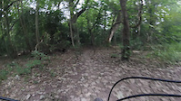
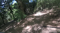
Photos of Surrey Mountain Bike
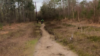
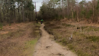
Videos of Surrey Mountain Bike
trail: Yogurt Pots
2:14 |
232 |
Jun 11, 2022
trail: Disco Biscuit
0:57 |
502 |
Apr 2, 2022
trail: land of nod
0:16 |
19 |
Mar 20, 2022
trail: Telegraph Row
0:16 |
406 |
Feb 18, 2022
trail: Telegraph Row
0:16 |
|
Feb 17, 2022
trail: Flinty Badman
2:50 |
372 |
Aug 29, 2021
trail: Flinty Badman
2:51 |
86 |
Aug 27, 2021
trail: Ricin Beans
3:00 |
168 |
Jun 3, 2021
Current Trail Warnings
| status | trail | date | condition | user | info |
|---|---|---|---|---|---|
| Secret Santa Surrey Hills | Jun 19, 2026 @ 6:21pm (Europe/London) Jun 19, 2026 | Dry | fartymarty | ||
| Golden Nugget Surrey Hills | Jun 21, 2026 @ 1:47pm (Europe/London) 2 days | Very Dry | eqsound | Tree down after last Right hand berm.... |
Recent Trail Reports
| status | trail | date | condition | info | user |
|---|---|---|---|---|---|
| Trail North Downs | Jun 19, 2026 @ 6:21pm (Europe/London) Jun 19, 2026 | Dry | fartymarty | ||
| Trail Surrey Hills | Jun 19, 2026 @ 6:21pm (Europe/London) Jun 19, 2026 | Dry | fartymarty | ||
| Path Surrey Hills | Jun 19, 2026 @ 6:21pm (Europe/London) Jun 19, 2026 | Dry | fartymarty | ||
| Trail Surrey Hills | Jun 19, 2026 @ 6:21pm (Europe/London) Jun 19, 2026 | Very Dry | fartymarty | ||
| Summer Lightning Surrey Hills | Jun 9, 2026 @ 9:18am (Europe/London) Jun 9, 2026 | Variable | Jxroussel | ||
| Horsham Road to Leith Hill Road Surrey Hills | Jun 9, 2026 @ 9:18am (Europe/London) Jun 9, 2026 | Ideal | Jxroussel | ||
| Telegraph Row Surrey Hills | Jun 9, 2026 @ 9:18am (Europe/London) Jun 9, 2026 | Ideal | Jxroussel | ||
| Yogurt Pots Surrey Hills | Jun 9, 2026 @ 9:18am (Europe/London) Jun 9, 2026 | Wet | Jxroussel | ||
| Barry Knows Best Surrey Hills | Jun 9, 2026 @ 9:18am (Europe/London) Jun 9, 2026 | Variable | Jxroussel | ||
| BKB return Surrey Hills | Jun 9, 2026 @ 9:18am (Europe/London) Jun 9, 2026 | Variable | Jxroussel |
Activity Feed
| username | action | type | title | date |
|---|---|---|---|---|
| fartymarty | add | report | activity #97551508 | Jun 22, 2026 @ 3:41am 1 day |
| fartymarty | add | report | activity #97551505 and 4 more | Jun 22, 2026 @ 3:41am 1 day |
| EDavies10 | ridden | trail | activity #97505596 | Jun 21, 2026 @ 11:35am 2 days |
| Dukeinlondon | ridden | trail | activity #97477399 | Jun 21, 2026 @ 6:16am 2 days |
| eqsound | add | report | activity #97475741 | Jun 21, 2026 @ 5:47am 2 days |
Recent Comments
| username | type | title | comment | date |
|---|---|---|---|---|
| trail | Yoghurt Pots? This always used to be called... | Dec 30, 2025 @ 2:08am Dec 30, 2025 | ||
| trail | Nice play area in the woods to practice some... | Nov 30, 2025 @ 2:24pm Nov 30, 2025 | ||
| trail | There was a small drop off over a fallen tree... | Sep 29, 2025 @ 7:30am Sep 29, 2025 | ||
| trail | There was a small drop off near the top over a... | Sep 29, 2025 @ 7:28am Sep 29, 2025 | ||
| report | very sandy - like riding through a sand pit,... | Aug 27, 2025 @ 12:49am Aug 27, 2025 |
Local Badges
-

Climbing 100k Badge0 awarded -

Epic Ride Climb 2k20 awarded -

Climbing 10k Badge50 awarded -

Completionist0 awarded -

Epic Ride Descent 2k20 awarded -

Descent 10k Badge50 awarded
Bike & Skill Parks
| name | type | city | rating |
|---|---|---|---|
| Teddington Lock Jumps | skill park | Richmond upon Thames | |
| Dorking West Dirt Jumps | skill park | Dorking | |
| Runnymede BMX Track | skill park | Egham | |
| East Sheen Common Jumps | skill park | Richmond upon Thames |
Activity Type Stats
| activitytype | trails | distance | descent | descent distance | total vertical | rating | global rank | state rank | photos | reports | routes | ridelogs |
|---|---|---|---|---|---|---|---|---|---|---|---|---|
| Mountain Bike | 405 | 220 miles | 28,560 ft | 93 miles | 958 ft | 647 | 8,000 | 47 | 242,000 | |||
| E-Bike | 136 | 53 miles | 7,129 ft | 25 miles | 810 ft | 1 | 7,269 | 9 | 22,308 | |||
| Horse | 18 | 8 miles | 538 ft | 3 miles | 761 ft | 1,023 | 3 | |||||
| Hike | 512 | 232 miles | 29,403 ft | 101 miles | 958 ft | 17 | 7,881 | 1 | 5,340 | |||
| Trail Running | 511 | 232 miles | 29,396 ft | 101 miles | 958 ft | 7,880 | 10,632 | |||||
| Dirtbike/Moto | 5 | 4 miles | 650 ft | 3 miles | 469 ft | 1,022 | 5 |
Frequently Asked Questions About Surrey
▼
What are the best places to ride in Surrey?
Surrey has 21 areas to explore for mountain biking. The top rated areas are:
▼
What are the highest rated mountain biking trails in Surrey?
The highest rated mountain biking trails in Surrey are:
- Supernova (4.4/5)
- Yogurt Pots (4.3/5)
- Charlie Bronson (Gunbucket) (4.3/5)
- John the Baptist (T2 - T4) (4.3/5)
- El Capitan (4.3/5)
▼
What is the best time of the year to ride in Surrey?
Based on ride log data, the most popular months to ride in Surrey are:
- July (910 activities)
- May (716 activities)
- June (687 activities)
▼
What is the longest trail in Surrey?
The longest trail in Surrey is Stane Street at 5.5 km. View all trails sorted by distance.
Activities
Trails
- By brenthillier
 NSMBA TRAILFORKS & contributors
 - Admins: UKTP, 20twenty-p, wisey, MathieuC, cemoorelife
- #3425 - 17,396 views
- surrey activity log | embed map of Surrey mountain bike trails | surrey mountain biking points of interest polygons
Downloading of trail gps tracks in kml & gpx formats is enabled for Surrey.
You must login to download files.