close
-
Layers w
- Weather Layers
- Pro
- Pro
- Pro
- Pro
- Pro
- Pro
- More Layers
- Pro
- Pro
- Pro
- Pro
-
Upgrade to

3D
Trail Conditions
- Unknown
- Snow Groomed
- Snow Packed
- Snow Covered
- Snow Cover Partial
- Freeze/thaw Cycle
- Icy
- Prevalent Mud
- Wet
- Variable
- Ideal
- Dry
- Very Dry
Trail Flow (Ridden Direction)
Trailforks scans users ridelogs to determine the most popular direction each trail is ridden. A good flowing trail network will have most trails flowing in a single direction according to their intension.
The colour categories are based on what percentage of riders are riding a trail in its intended direction.
The colour categories are based on what percentage of riders are riding a trail in its intended direction.
- > 96%
- > 90%
- > 80%
- > 70%
- > 50%
- < 50%
- bi-directional trail
- no data
Trail Last Ridden
Trailforks scans ridelogs to determine the last time a trail was ridden.
- < 2 days
- < 1 week
- < 2 weeks
- < 1 month
- < 6 months
- > 6 months
Trail Ridden Direction
The intended direction a trail should be ridden.
- Downhill Only
- Downhill Primary
- Both Directions
- Uphill Primary
- Uphill Only
- One Direction
Contribute Details
Colors indicate trail is missing specified detail.
- Description
- Photos
- Description & Photos
- Videos
Trail Popularity ?
Trailforks scans ridelogs to determine which trails are ridden the most in the last 9 months.
Trails are compared with nearby trails in the same city region with a possible 25 colour shades.
Think of this as a heatmap, more rides = more kinetic energy = warmer colors.
- most popular
- popular
- less popular
- not popular
ATV/ORV/OHV Filter
Max Vehicle Width
inches
US Cell Coverage
Legend

Radar Time
Activity Recordings
Trailforks uses anonymized public activity data.
?
Activity Recordings
Trailforks uses anonymized public activity data.
?
Personal Heatmap
▶
Activity Types
all
/
none
▶
Options
2
Date range
month
–
Winter Trails
Warning
A routing network for winter maps does not exist. Selecting trails using the winter trails layer has been disabled.
Missing Trails
Most Popular
Least Popular
Trails are colored based on popularity. The more popular a trail is, the more red. Less popular trails trend towards green.
Jump Magnitude Heatmap
Heatmap of where riders jump on trails. Zoom in to see individual jumps, click circles to view jump details.
BC Backroad Status
![map legend]()
Service Road Atlas is a free to use, community-driven service for viewing and creating reports on the numerous back-country service roads around B.C. and Alberta.

Slope Aspect
Direction the slope faces
Trails Deemphasized
Trails are shown in grey.
Only show trails with no bike usage.
Suggested Layers
Based on selected activity type
Save the current map location and zoom level as your default home location whenever this page is loaded.
Save
No description for Surrey has been added yet!
Login or register to submit one.
Activities Click to view
- Mountain Bike
79 trails
- E-Bike
20 trails
- Adaptive Bike
0 trails
- Hike
84 trails
- Trail Running
84 trails
Region Details
- 14
- 17
- 45
- 1
Region Status
Open as of Jun 20, 2026Stats
- Avg Trail Rating
- Trails (view details)
- 78
- Trails Mountain Bike
- 80
- Trails E-Bike
- 20
- Trails Hike
- 84
- Trails Trail Running
- 84
- Total Distance
- 45 miles
- Total Descent Distance
- 16 miles
- Total Descent
- 2,023 ft
- Total Vertical
- 411 ft
- Highest Trailhead
- 414 ft
- Reports
- 240
- Photos
- 185
- Ridden Counter
- 4,378
Sub Regions
-
Crescent Beach
-
Green Timbers Urban Forest
- 1
- 22
-
South Surrey Bike Park
- 1
-
Sunnyside Acres Urban Forest Park
- 7
- 3
-
Surrey Bend Regional Park
- 6
-
Tynehead Regional Park
- 1
- 12
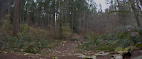
Popular Surrey Mountain Biking Trails
• 95 ★ 4.4 • 3 miles • 183 ft • 422 •
XC loop. Mostly flat with a few flowy pumptrack sections
• 90 ★ 0.0 • 1 mile • 46 ft • 88 •
Popular white difficulty paved path. This multi-use trail can be used both directions. On average it takes 5 minutes to complete this trail.
• 85 ★ 5.0 • 2 miles • 10 ft • 73 •
Popular white difficulty paved path. This multi-use trail can be used both directions. On average it takes 5 minutes to complete this trail.
• 90 ★ 3.5 • 2,096 ft • 11 ft • 69 •
Popular white difficulty singletrack. This multi-use trail can be used both directions. On average it takes 2 minutes to complete this trail.
• 95 ★ 3.0 • 696 ft • 10 ft • 65 •
Popular white difficulty singletrack. This multi-use trail can be used both directions. On average it takes minutes to complete this trail.
• 75 ★ 0.0 • 4,806 ft • 49 ft • 65 •
Popular white difficulty paved path. This multi-use trail can be used both directions. On average it takes 4 minutes to complete this trail.
• 85 ★ 0.0 • 961 ft • 6 ft • 61 •
Popular white difficulty singletrack. This multi-use trail can be used both directions. On average it takes 1 minutes to complete this trail.
• 50 ★ 5.0 • 2 miles • 3 ft • 58 •
Moderately popular white difficulty paved path. This multi-use trail can be used both directions. On average it takes 8 minutes to complete this trail.
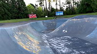
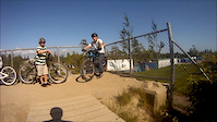
Photos of Surrey Mountain Bike
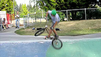
Videos of Surrey Mountain Bike
0:09 |
|
Jun 16, 2020
trail: Junkyard Dog Loop
0:08 |
267 |
Dec 13, 2018
0:19 |
553 |
Jun 8, 2013

0:48 |
97 |
Dec 27, 2012
0:06 |
1231 |
Nov 17, 2011

trail: Junkyard Dog Loop
7:58 |
232 |
Jan 24, 2025 , Surrey
trail: Junkyard Dog Loop
7:42 |
282 |
Jan 18, 2025 , Surrey

trail: Junkyard Dog Loop
2:03 |
137 |
Jan 3, 2025 , Surrey
Current Trail Warnings
| status | trail | date | condition | user | info |
|---|---|---|---|---|---|
| BC Parkway | May 25, 2026 @ 4:37pm (America/Vancouver) May 25, 2026 | Dry | Exploration | Gravel Bike Under Construction. To be replaced by the... |
Recent Trail Reports
| status | trail | date | condition | info | user |
|---|---|---|---|---|---|
| Wild Flower Greenway | Jun 20, 2026 @ 11:52am (America/Vancouver) Jun 20, 2026 | Dry | CraigHinCA | ||
| Wild Flower Greenway | Jun 20, 2026 @ 11:52am (America/Vancouver) Jun 20, 2026 | Dry | CraigHinCA | ||
| Douglas Fir Trail | Mar 15, 2026 @ 11:01am (America/Vancouver) Mar 15, 2026 | Ideal | CraigHinCA | ||
| Quibble Creek Trail | Mar 15, 2026 @ 11:01am (America/Vancouver) Mar 15, 2026 | Ideal | CraigHinCA | ||
| Junkyard Dog Loop | Aug 25, 2025 @ 7:46am Aug 25, 2025 | Ideal | AlexanderSh | ||
| Birch Trail | May 18, 2025 @ 1:14pm May 18, 2025 | Ideal | CraigHinCA | ||
| Skyline Trail | May 18, 2025 @ 1:14pm May 18, 2025 | Ideal | CraigHinCA | ||
| Hemlock Trail | Jan 27, 2025 @ 2:49pm Jan 27, 2025 | Variable | davidadnum | ||
| Hemlock Trail | Jan 27, 2025 @ 2:49pm Jan 27, 2025 | Variable | davidadnum | ||
| Willow Trail | Jan 12, 2025 @ 11:20am Jan 12, 2025 | Ideal | CraigHinCA |
Activity Feed
| username | action | type | title | date |
|---|---|---|---|---|
| Alanep0503 | ridden | trail | activity #97608046 | Jun 22, 2026 @ 11:33pm 21 hours |
| CraigHinCA | add | report | activity #97448737 and 1 more | Jun 20, 2026 @ 6:40pm Jun 20, 2026 |
| Finn19 | ridden | trail | activity #97211022 | Jun 17, 2026 @ 2:55pm Jun 17, 2026 |
| FjGICX | ridden | trail | activity #96417442 | Jun 6, 2026 @ 5:11pm Jun 6, 2026 |
| awhite76 | add | report | activity #96086975 | Jun 2, 2026 @ 8:42am Jun 2, 2026 |
Recent Comments
| username | type | title | comment | date |
|---|---|---|---|---|
| trail | Bikes are not permitted on this trail | Mar 11, 2026 @ 8:22pm Mar 11, 2026 | ||
| trail | There is a Board missing and nails poking out... | Aug 4, 2025 @ 7:40pm Aug 4, 2025 | ||
| trail | Soooo gnarly 2000 meter gap don’t do if not... | May 26, 2025 @ 9:50pm May 26, 2025 | ||
| skillpark | Dirt seems awesome but they have eliminated... | Jun 7, 2022 @ 9:18am Jun 7, 2022 | ||
| trail | Trails on great condition. Currently... | May 9, 2020 @ 4:20pm May 9, 2020 |
Local Badges
-

Epic Mountain Bike Climb 2k1 awarded -

Climbing 10k Badge24 awarded -

Mountain Biking 100k Badge0 awarded -

Epic Ride Descent 2k1 awarded -

Descent 10k Badge24 awarded -

Descent 100k Badge0 awarded
Bike & Skill Parks
| name | type | city | rating |
|---|---|---|---|
| Invergarry Park | skill park | Surrey | |
| South Surrey Dirt Jumps | skill park | Surrey | |
| Cloverdale Bike Park | skill park | Surrey | |
| Invergarry Bike Park | skill park | Surrey | |
| Port Kells Dirt Jumps | skill park | Surrey |
Activity Type Stats
| activitytype | trails | distance | descent | descent distance | total vertical | rating | global rank | state rank | photos | reports | routes | ridelogs |
|---|---|---|---|---|---|---|---|---|---|---|---|---|
| Mountain Bike | 79 | 45 miles | 2,024 ft | 16 miles | 410 ft | #2,496 | #77 | 193 | 284 | 15,503 | ||
| E-Bike | 20 | 18 miles | 958 ft | 8 miles | 390 ft | #2,880 | #78 | 240 | 504 | |||
| Hike | 84 | 45 miles | 2,024 ft | 16 miles | 410 ft | #2,881 | #88 | 283 | 610 | |||
| Trail Running | 84 | 45 miles | 2,024 ft | 16 miles | 410 ft | #2,178 | #70 | 283 | 1,587 |
Frequently Asked Questions About Surrey
▼
What are the best places to ride in Surrey?
Surrey has 6 areas to explore for mountain biking. The top rated areas are:
▼
What are the highest rated mountain biking trails in Surrey?
The highest rated mountain biking trails in Surrey are:
- Junkyard Dog Loop (4.2/5)
- Green Timbers Greenway (4.1/5)
- Green Timbers Greenway (4.1/5)
- Douglas-Fir Trail (4/5)
- Salal Trail (4/5)
▼
What is the best time of the year to ride in Surrey?
Based on ride log data, the most popular months to ride in Surrey are:
- July (124 activities)
- August (101 activities)
- May (84 activities)
▼
Where can I park to ride in Surrey?
Activities
Trails
Points of Interest
- By brenthillier
 NSMBA TRAILFORKS & contributors
 - Admins: SORCE
- #7666 - 16,433 views
- surrey activity log | embed map of Surrey mountain bike trails | surrey mountain biking points of interest
Downloading of trail gps tracks in kml & gpx formats is enabled for Surrey.
You must login to download files.