close
-
Layers w
- Weather Layers
- Pro
- Pro
- Pro
- Pro
- Pro
- Pro
- More Layers
- Pro
- Pro
- Pro
- Pro
-
Upgrade to

3D
Trail Conditions
- Unknown
- Snow Groomed
- Snow Packed
- Snow Covered
- Snow Cover Partial
- Freeze/thaw Cycle
- Icy
- Prevalent Mud
- Wet
- Variable
- Ideal
- Dry
- Very Dry
Trail Flow (Ridden Direction)
Trailforks scans users ridelogs to determine the most popular direction each trail is ridden. A good flowing trail network will have most trails flowing in a single direction according to their intension.
The colour categories are based on what percentage of riders are riding a trail in its intended direction.
The colour categories are based on what percentage of riders are riding a trail in its intended direction.
- > 96%
- > 90%
- > 80%
- > 70%
- > 50%
- < 50%
- bi-directional trail
- no data
Trail Last Ridden
Trailforks scans ridelogs to determine the last time a trail was ridden.
- < 2 days
- < 1 week
- < 2 weeks
- < 1 month
- < 6 months
- > 6 months
Trail Ridden Direction
The intended direction a trail should be ridden.
- Downhill Only
- Downhill Primary
- Both Directions
- Uphill Primary
- Uphill Only
- One Direction
Contribute Details
Colors indicate trail is missing specified detail.
- Description
- Photos
- Description & Photos
- Videos
Trail Popularity ?
Trailforks scans ridelogs to determine which trails are ridden the most in the last 9 months.
Trails are compared with nearby trails in the same city region with a possible 25 colour shades.
Think of this as a heatmap, more rides = more kinetic energy = warmer colors.
- most popular
- popular
- less popular
- not popular
ATV/ORV/OHV Filter
Max Vehicle Width
inches
US Cell Coverage
Legend

Radar Time
Activity Recordings
Trailforks uses anonymized public activity data.
?
Activity Recordings
Trailforks uses anonymized public activity data.
?
Personal Heatmap
▶
Activity Types
all
/
none
▶
Options
2
Date range
month
–
Winter Trails
Warning
A routing network for winter maps does not exist. Selecting trails using the winter trails layer has been disabled.
Missing Trails
Most Popular
Least Popular
Trails are colored based on popularity. The more popular a trail is, the more red. Less popular trails trend towards green.
Jump Magnitude Heatmap
Heatmap of where riders jump on trails. Zoom in to see individual jumps, click circles to view jump details.
BC Backroad Status
![map legend]()
Service Road Atlas is a free to use, community-driven service for viewing and creating reports on the numerous back-country service roads around B.C. and Alberta.

Slope Aspect
Direction the slope faces
Trails Deemphasized
Trails are shown in grey.
Only show trails with no bike usage.
Suggested Layers
Based on selected activity type
Save the current map location and zoom level as your default home location whenever this page is loaded.
Save
No description for Swansea has been added yet!
Login or register to submit one.
This region uses the Uk/Euro style trail grading system.
Activities Click to view
- Mountain Bike
12 trails
- E-Bike
5 trails
- Adaptive Bike
0 trails
- Winter Fat Bike
0 trails
- Horse
0 trails
- Hike
10 trails
- Trail Running
10 trails
- Dirtbike/Moto
0 trails
- ATV/ORV/OHV
0 trails
- Nordic Ski
0 trails
Region Details
- 2
- 4
- 4
- 1
Region Status
Open as of May 10, 2026Stats
- Avg Trail Rating
- Trails (view details)
- 12
- Trails Mountain Bike
- 12
- Trails E-Bike
- 5
- Trails Hike
- 10
- Trails Trail Running
- 10
- Total Distance
- 7 miles
- Total Descent
- 1,902 ft
- Total Vertical
- 746 ft
- Highest Trailhead
- 766 ft
- Reports
- 63
- Photos
- 10
- Ridden Counter
- 860
Sub Regions
-
Clyne Valley Woods
- 3
- 4
-
Gower National Landscape
Popular Swansea Mountain Biking Trails
• 50 ★ 4.3 • 3,930 ft • 26 ft • 90 •
Flowing trail that features descending switchback berms and a short uphill section 2/3rds of the way through.
• 100 ★ 3.0 • 632 ft • 120 ft • 82 •
Popular blue difficulty singletrack. This mountain bike primary trail can be used uphill primary. On average it takes 1 minutes to complete this trail.
• 70 ★ 4.0 • 1,953 ft • 23 ft • 82 •
Red graded trail featuring berms and tabletop style jumps.
• 95 ★ 3.0 • 983 ft • 114 ft • 81 •
Popular blue difficulty singletrack. This mountain bike primary trail can be used uphill primary. On average it takes 3 minutes to complete this trail.
• 60 ★ 4.0 • 533 ft • 10 ft • 58 •
Moderately popular red difficulty singletrack. This mountain bike primary trail can be used downhill primary. On average it takes 1 minutes to complete this trail.
Swansea Mountain Bike Routes
3,717 ft • 285 ft • 0 •
The red graded climb from the cycle path at the bottom to the top of millers descent.
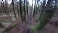
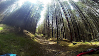
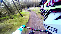
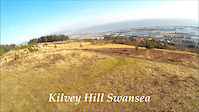
Photos of Swansea Mountain Bike
Videos of Swansea Mountain Bike

trail: Kilvey
0:18 |
274 |
Oct 7, 2020
trail: Kilvey
0:21 |
397 |
Nov 29, 2017
trail: Kilvey
0:00 |
171 |
Feb 6, 2017

trail: Kilvey
8:26 |
189 |
Jan 23, 2017
trail: Kilvey
5:00 |
124 |
Jul 28, 2015
trail: Kilvey
3:14 |
582 |
May 14, 2015
trail: Kilvey
0:21 |
689 |
May 12, 2015
trail: Kilvey
4:06 |
123 |
Mar 21, 2015
Recent Trail Reports
| status | trail | date | condition | info | user |
|---|---|---|---|---|---|
| Clyne Cycle Path | May 9, 2026 @ 7:23am (Europe/London) May 8, 2026 | Ideal | Philbertski | ||
| Millers crossing | Mar 21, 2026 @ 7:25pm (Europe/London) Mar 21, 2026 | Dry | OsianRScirI | ||
| Sanitised Strip | Sep 6, 2025 @ 9:56am Sep 6, 2025 | Ideal | ThexMiniman | ||
| Clyne Climb | Sep 6, 2025 @ 9:56am Sep 6, 2025 | Ideal | ThexMiniman | ||
| Clyne Climb | Sep 6, 2025 @ 9:56am Sep 6, 2025 | Ideal | ThexMiniman | ||
| Clyne climb | Sep 6, 2025 @ 9:56am Sep 6, 2025 | Ideal | ThexMiniman | ||
| Plonker | Apr 8, 2023 @ 10:13pm Apr 8, 2023 | Ideal | GavinT808 | ||
| Rodney | Apr 8, 2023 @ 10:13pm Apr 8, 2023 | Ideal | GavinT808 | ||
| Out of the black | Nov 7, 2019 @ 10:22am Nov 7, 2019 | Prevalent Mud | Ferdagangs | ||
| Fire-road to Sanitised Strip | Nov 28, 2017 @ 4:42am Nov 28, 2017 | Wet | wonkle |
Activity Feed
| username | action | type | title | date |
|---|---|---|---|---|
| Jacobl2u7fb | vote | trail | activity #94790297 | May 15, 2026 @ 10:30pm May 15, 2026 |
| dastone | add | video | activity #94542339 | May 12, 2026 @ 12:00am May 12, 2026 |
| JamessXxDeA | wishlist | route | activity #94484144 | May 11, 2026 @ 2:35am May 11, 2026 |
| Philbertski | add | report | activity #94438707 | May 10, 2026 @ 10:09am May 10, 2026 |
| Philbertski | add | report | activity #94438706 | May 10, 2026 @ 10:09am May 10, 2026 |
Recent Comments
| username | type | title | comment | date |
|---|---|---|---|---|
| trail | I am digging' the plastic bags on buddy's feet... | Mar 17, 2025 @ 1:20pm Mar 17, 2025 | ||
| trail | Squirrels! | Oct 28, 2022 @ 9:55am Oct 28, 2022 | ||
| trail | Nothing there don't waste your time extremely... | Jul 19, 2020 @ 9:32am Jul 19, 2020 | ||
| trail | It has Rated as a Red Trail, built by Back on... | Oct 27, 2014 @ 4:44am Oct 27, 2014 |
Local Badges
-

Epic Ride Climb 2k21 awarded -

Climbing 10k Badge18 awarded -

Climbing 100k Badge1 awarded -

Epic Ride Descent 2k22 awarded -

Descent 10k Badge18 awarded -

Descent 100k Badge1 awarded
Bike & Skill Parks
| name | type | city | rating |
|---|---|---|---|
| Dunvant Pumptrack | skill park | Swansea |
Activity Type Stats
| activitytype | trails | distance | descent | descent distance | total vertical | rating | global rank | state rank | photos | reports | routes | ridelogs |
|---|---|---|---|---|---|---|---|---|---|---|---|---|
| Mountain Bike | 12 | 7 miles | 1,903 ft | 4 miles | 745 ft | #8,080 | #302 | 10 | 63 | 2 | 4,918 | |
| E-Bike | 5 | 3 miles | 702 ft | 1 mile | 289 ft | #5,417 | #228 | 61 | 946 | |||
| Hike | 10 | 5 miles | 1,047 ft | 3 miles | 745 ft | #8,118 | #241 | 54 | 1 | 486 | ||
| Trail Running | 10 | 5 miles | 1,047 ft | 3 miles | 745 ft | #8,018 | #245 | 54 | 1 | 133 |
Frequently Asked Questions About Swansea
▼
What are the best places to ride in Swansea?
Swansea has 1 areas to explore for mountain biking. The top rated areas are:
▼
What are the highest rated mountain biking trails in Swansea?
The highest rated mountain biking trails in Swansea are:
- Kilvey (4.4/5)
- Sanitised Strip (4.1/5)
- Millers crossing (4/5)
- Rodney (4/5)
- Plonker (4/5)
▼
What is the best time of the year to ride in Swansea?
Based on ride log data, the most popular months to ride in Swansea are:
- July (40 activities)
- November (39 activities)
- May (23 activities)
▼
Where can I park to ride in Swansea?
Check the Swansea trail map for trailhead and parking information. Community members regularly update access and parking details for trails in the area.
- By jimbodunnig
 & contributors
 - Admins: apply
- #5608 - 4,984 views
- swansea activity log | embed map of Swansea mountain bike trails |
Downloading of trail gps tracks in kml & gpx formats is enabled for Swansea.
You must login to download files.