close
-
Layers w
- Weather Layers
- Pro
- Pro
- Pro
- Pro
- Pro
- Pro
- More Layers
- Pro
- Pro
- Pro
- Pro
-
Upgrade to

3D
Trail Conditions
- Unknown
- Snow Groomed
- Snow Packed
- Snow Covered
- Snow Cover Partial
- Freeze/thaw Cycle
- Icy
- Prevalent Mud
- Wet
- Variable
- Ideal
- Dry
- Very Dry
Trail Flow (Ridden Direction)
Trailforks scans users ridelogs to determine the most popular direction each trail is ridden. A good flowing trail network will have most trails flowing in a single direction according to their intension.
The colour categories are based on what percentage of riders are riding a trail in its intended direction.
The colour categories are based on what percentage of riders are riding a trail in its intended direction.
- > 96%
- > 90%
- > 80%
- > 70%
- > 50%
- < 50%
- bi-directional trail
- no data
Trail Last Ridden
Trailforks scans ridelogs to determine the last time a trail was ridden.
- < 2 days
- < 1 week
- < 2 weeks
- < 1 month
- < 6 months
- > 6 months
Trail Ridden Direction
The intended direction a trail should be ridden.
- Downhill Only
- Downhill Primary
- Both Directions
- Uphill Primary
- Uphill Only
- One Direction
Contribute Details
Colors indicate trail is missing specified detail.
- Description
- Photos
- Description & Photos
- Videos
Trail Popularity ?
Trailforks scans ridelogs to determine which trails are ridden the most in the last 9 months.
Trails are compared with nearby trails in the same city region with a possible 25 colour shades.
Think of this as a heatmap, more rides = more kinetic energy = warmer colors.
- most popular
- popular
- less popular
- not popular
ATV/ORV/OHV Filter
Max Vehicle Width
inches
US Cell Coverage
Legend

Radar Time
Activity Recordings
Trailforks uses anonymized public activity data.
?
Activity Recordings
Trailforks uses anonymized public activity data.
?
Personal Heatmap
▶
Activity Types
all
/
none
▶
Options
2
Date range
month
–
Winter Trails
Warning
A routing network for winter maps does not exist. Selecting trails using the winter trails layer has been disabled.
Missing Trails
Most Popular
Least Popular
Trails are colored based on popularity. The more popular a trail is, the more red. Less popular trails trend towards green.
Jump Magnitude Heatmap
Heatmap of where riders jump on trails. Zoom in to see individual jumps, click circles to view jump details.
BC Backroad Status
![map legend]()
Service Road Atlas is a free to use, community-driven service for viewing and creating reports on the numerous back-country service roads around B.C. and Alberta.

Slope Aspect
Direction the slope faces
Trails Deemphasized
Trails are shown in grey.
Only show trails with no bike usage.
Suggested Layers
Based on selected activity type
Save the current map location and zoom level as your default home location whenever this page is loaded.
SaveBeautiful park. Open to families, hikers, runners, bird watchers and mountain bikers.
 google parking directions
 Activities Click to view
- Mountain Bike
9 trails
- E-Bike
6 trails
- Hike
10 trails
- Trail Running
10 trails
Region Details
- 4
- 1
- 1
Region Status
Caution as of Jun 12, 2026Stats
- Avg Trail Rating
- Trails (view details)
- 6
- Trails Mountain Bike
- 9
- Trails E-Bike
- 6
- Trails Hike
- 10
- Trails Trail Running
- 10
- Total Distance
- 5 miles
- Total Descent Distance
- 2 miles
- Total Descent
- 393 ft
- Total Vertical
- 111 ft
- Highest Trailhead
- 1,123 ft
- Reports
- 210
- Photos
- 223
- Ridden Counter
- 962
Popular Swanson Park Mountain Biking Trails
• 80 ★ 4.2 • 2 miles • 105 ft • 180 •
Highly rated popular green difficulty family friendly singletrack. This multi-use trail can be used one direction and has a easy overall physical rating with a 105 ft green climb. It features bridge. Trail visibility is always easy to follow. On average it takes 38 minutes to complete this trail.
• 100 ★ 0.0 • 2 miles • 241 ft • 72 •
Popular green difficulty family friendly singletrack. This multi-use trail can be used one direction and has a easy overall physical rating with a 241 ft green climb. It features bridge.
• 95 ★ 0.0 • 873 ft • 50 ft • 60 •
Narrow trail, steep sections, rock drop, rooty climb.
• 70 ★ 0.0 • 3,274 ft • 32 ft • 58 •
Narrow ridgeline with rocks, random metal bits, wooden stair steps, and roots.
• 60 ★ 0.0 • 318 ft • 0 ft • 53 •
The bypasses " " and section behind the fire station. It rides along the fire road and back into the trees.
• 20 ★ 0.0 • 236 ft • 0 ft • 9 •
This is an optional downhill that is a little steeper and faster than regular trail.
• 5 ★ 0.0 • 348 ft • 19 ft •
This trail makes neighborhood access possible.
Swanson Park Mountain Bike Routes
Swanson Main Loop Featured
5 miles • 387 ft • 1 • Loop •
Great loop to hike or ride cross country mtbs.
• 15 miles • 1,514 ft • 34 •
• 21 miles • 1,159 ft • 36 •
• 17 miles • 388 ft • 0 •
• 10 miles • 1,101 ft • 27 •
• 8 miles • 925 ft • 4 •
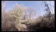
Photos of Swanson Park Mountain Bike
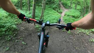
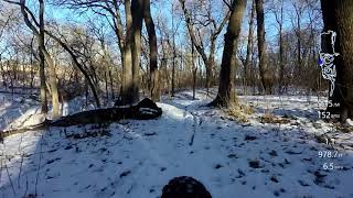
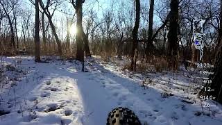
Videos of Swanson Park Mountain Bike
trail: Swanson Park Trail
0:47 |
1009 |
Nov 4, 2014
5:34 |
305 |
Mar 28, 2024
trail: Swanson Park Trail
32:30 |
314 |
Oct 4, 2020 , Bellevue
trail: Swanson Park Trail
31:19 |
264 |
Oct 4, 2020 , Bellevue
trail: Swanson Park Trail
31:00 |
492 |
Oct 4, 2020 , Bellevue

trail: Swanson Park Trail
32:49 |
438 |
Sep 27, 2020 , Bellevue
Current Trail Warnings
| status | trail | date | condition | user | info |
|---|---|---|---|---|---|
| Swanson Park Trail | Jun 12, 2026 @ 2:08am (America/Chicago) Jun 12, 2026 | Unknown | Johnkrecek | Very wet Thursday. Cleared tree at bridge. |
Recent Trail Reports
| status | trail | date | condition | info | user |
|---|---|---|---|---|---|
| Swanson Park Trail Pt 1 | Apr 27, 2026 @ 4:21pm (America/Chicago) Apr 27, 2026 | Prevalent Mud | GeNo994 | ||
| Root Of All Evil | Apr 3, 2026 @ 2:35pm (America/Los_Angeles) Apr 3, 2026 | Wet | handstand THOR | ||
| NICA Route | Apr 3, 2026 @ 2:35pm (America/Los_Angeles) Apr 3, 2026 | Wet | handstand THOR | ||
| Tetanus Ridge | Apr 3, 2026 @ 2:35pm (America/Los_Angeles) Apr 3, 2026 | Wet | handstand THOR | ||
| Ridgeline Bypass | Apr 3, 2026 @ 2:35pm (America/Los_Angeles) Apr 3, 2026 | Wet | handstand THOR |
Activity Feed
| username | action | type | title | date |
|---|---|---|---|---|
| Johnkrecek | add | report | activity #96787869 | Jun 12, 2026 @ 12:08am Jun 12, 2026 |
| srobins259 | wishlist | trail | activity #96384284 | Jun 6, 2026 @ 10:16am Jun 6, 2026 |
| handstand | add | report | activity #95648302 | May 27, 2026 @ 11:18am May 27, 2026 |
| dRBAxA | wishlist | trail | activity #95491772 | May 25, 2026 @ 8:36am May 25, 2026 |
| metbigbird | add | report | activity #94705636 | May 14, 2026 @ 12:20pm May 14, 2026 |
Recent Comments
| username | type | title | comment | date |
|---|---|---|---|---|
| report | Thanks for the report. | Nov 26, 2025 @ 12:29pm Nov 26, 2025 | ||
| report | You are correct. Next step, need to get the... | Aug 21, 2025 @ 12:41pm Aug 21, 2025 | ||
| report | Rode it this weekend and the trail was getting... | Aug 20, 2025 @ 11:22am Aug 20, 2025 | ||
| trail | The new signage is great, I today was the... | Jun 1, 2025 @ 9:14am Jun 1, 2025 | ||
| report | It was 2 hours, I think I got the report... | May 18, 2025 @ 7:05pm May 18, 2025 |
Nearby Areas
| name | distance | ||||
|---|---|---|---|---|---|
| Mandan Park | 10 | 2.5 km | |||
| Jewell Park | 1 | 3.6 km | |||
| Lake Manawa | 3 | 5.3 km | |||
| Walnut Creek | 2 | 11 | 5.7 km | ||
| Adams Park | 2 | 2 | 8.2 km |
Activity Type Stats
| activitytype | trails | distance | descent | descent distance | total vertical | rating | global rank | state rank | photos | reports | routes | ridelogs |
|---|---|---|---|---|---|---|---|---|---|---|---|---|
| Mountain Bike | 9 | 5 miles | 394 ft | 2 miles | 112 ft | #7,604 | #2,921 | 434 | 203 | 1 | 1,360 | |
| E-Bike | 6 | 5 miles | 394 ft | 2 miles | 112 ft | #8,335 | #2,600 | 4 | 207 | 1 | 124 | |
| Hike | 10 | 5 miles | 394 ft | 2 miles | 112 ft | #14,041 | #6,108 | 216 | 1 | 74 | ||
| Trail Running | 10 | 5 miles | 394 ft | 2 miles | 112 ft | #14,632 | #6,279 | 216 | 1 | 19 |
Frequently Asked Questions About Swanson Park
▼
What are the highest rated mountain biking trails in Swanson Park?
The highest rated mountain biking trails in Swanson Park are:
- Swanson Park Trail (4.1/5)
- Alternate Steep Line (0/5)
- NICA Route (0/5)
- Ridgeline Bypass (0/5)
- West Neighborhood Connector (0/5)
▼
What is the best time of the year to ride in Swanson Park?
Based on ride log data, the most popular months to ride in Swanson Park are:
- July (12 activities)
- April (6 activities)
- August (5 activities)
▼
Where can I park to ride in Swanson Park?
There are 1 parking locations listed in Swanson Park. The most popular parking spots are:
▼
What is the longest trail in Swanson Park?
The longest trail in Swanson Park is Swanson Park Trail Pt 1 at 2.4 miles. View all trails sorted by distance.
Activities
Trails
- By brenthillier
 NSMBA TRAILFORKS & contributors
 - Admins: THOR
- #3608 - 7,155 views
- swanson park activity log | embed map of Swanson Park mountain bike trails | swanson park mountain biking points of interest
Downloading of trail gps tracks in kml & gpx formats is enabled for Swanson Park.
You must login to download files.