close
-
Layers w
- Weather Layers
- Pro
- Pro
- Pro
- Pro
- Pro
- Pro
- More Layers
- Pro
- Pro
- Pro
- Pro
-
Upgrade to

3D
Trail Conditions
- Unknown
- Snow Groomed
- Snow Packed
- Snow Covered
- Snow Cover Partial
- Freeze/thaw Cycle
- Icy
- Prevalent Mud
- Wet
- Variable
- Ideal
- Dry
- Very Dry
Trail Flow (Ridden Direction)
Trailforks scans users ridelogs to determine the most popular direction each trail is ridden. A good flowing trail network will have most trails flowing in a single direction according to their intension.
The colour categories are based on what percentage of riders are riding a trail in its intended direction.
The colour categories are based on what percentage of riders are riding a trail in its intended direction.
- > 96%
- > 90%
- > 80%
- > 70%
- > 50%
- < 50%
- bi-directional trail
- no data
Trail Last Ridden
Trailforks scans ridelogs to determine the last time a trail was ridden.
- < 2 days
- < 1 week
- < 2 weeks
- < 1 month
- < 6 months
- > 6 months
Trail Ridden Direction
The intended direction a trail should be ridden.
- Downhill Only
- Downhill Primary
- Both Directions
- Uphill Primary
- Uphill Only
- One Direction
Contribute Details
Colors indicate trail is missing specified detail.
- Description
- Photos
- Description & Photos
- Videos
Trail Popularity ?
Trailforks scans ridelogs to determine which trails are ridden the most in the last 9 months.
Trails are compared with nearby trails in the same city region with a possible 25 colour shades.
Think of this as a heatmap, more rides = more kinetic energy = warmer colors.
- most popular
- popular
- less popular
- not popular
ATV/ORV/OHV Filter
Max Vehicle Width
inches
US Cell Coverage
Legend

Radar Time
Activity Recordings
Trailforks uses anonymized public activity data.
?
Activity Recordings
Trailforks uses anonymized public activity data.
?
Personal Heatmap
▶
Activity Types
all
/
none
▶
Options
2
Date range
month
–
Winter Trails
Warning
A routing network for winter maps does not exist. Selecting trails using the winter trails layer has been disabled.
Missing Trails
Most Popular
Least Popular
Trails are colored based on popularity. The more popular a trail is, the more red. Less popular trails trend towards green.
Jump Magnitude Heatmap
Heatmap of where riders jump on trails. Zoom in to see individual jumps, click circles to view jump details.
BC Backroad Status
![map legend]()
Service Road Atlas is a free to use, community-driven service for viewing and creating reports on the numerous back-country service roads around B.C. and Alberta.

Slope Aspect
Direction the slope faces
Trails Deemphasized
Trails are shown in grey.
Only show trails with no bike usage.
Suggested Layers
Based on selected activity type
Save the current map location and zoom level as your default home location whenever this page is loaded.
Save
No description for Swindon has been added yet!
Login or register to submit one.
This region uses the Uk/Euro style trail grading system.
Activities Click to view
- Mountain Bike
4 trails
- Hike
3 trails
- Trail Running
3 trails
Stats
- Avg Trail Rating
- Trails (view details)
- 4
- Trails Mountain Bike
- 4
- Trails E-Bike
- 2
- Trails Hike
- 3
- Trails Trail Running
- 3
- Total Distance
- 5 miles
- Total Descent
- 571 ft
- Total Vertical
- 367 ft
- Highest Trailhead
- 707 ft
- Reports
- 39
- Photos
- 25
- Ridden Counter
- 297
Sub Regions
- Marlborough (1)
- Swindon (2)
- Wiltshire (1)
- West Woods (1)
Popular Swindon Mountain Biking Trails
• 100 ★ 4.2 • 855 ft • 1 ft • 38 •
One of many runs in West woods. This one zig zags down a gully with a few jumps. Slippery when wet!
• 50 ★ 0.0 • 2,221 ft • 0 ft • 9 • • hike
Chalky path with step drop offs of uneven sizes. uneven surface with gulley's from water drainage. Easier in summer months and when surface is dry.
• 100 ★ 0.0 • 1 mile • 31 ft • 9 •
Popular blue difficulty singletrack. This mountain bike primary trail can be used both directions. On average it takes 13 minutes to complete this trail.
Swindon Mountain Bike Routes
11 miles • 820 ft • 0 • Point to Point •
Pewsey Station to start of the National Ridgeway 11.5m
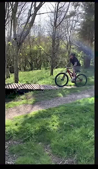
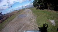
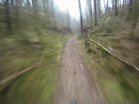
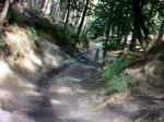
Photos of Swindon Mountain Bike


Recent Trail Reports
| status | trail | date | condition | info | user |
|---|---|---|---|---|---|
| Croft MTB Swindon | Mar 14, 2026 @ 9:10am (Europe/London) Mar 14, 2026 | Unknown | DylanJ0dV8J | ||
| Chalk Path Swindon | Jun 7, 2023 @ 6:30am Jun 7, 2023 | Dry | ed0102 |
Activity Feed
| username | action | type | title | date |
|---|---|---|---|---|
| WillieJacobsz | add | directory | activity #94762861 | May 15, 2026 @ 12:33pm May 15, 2026 |
| oscarshipway01 | like | directory | activity #93234512 and 1 more | Apr 23, 2026 @ 12:54pm Apr 23, 2026 |
| DylanJ0dV8J | add | report | activity #90535530 | Mar 14, 2026 @ 2:10am Mar 14, 2026 |
| Archiek5BgZ0 | difficultyvote | trail | activity #68253803 | Mar 23, 2025 @ 2:47am Mar 23, 2025 |
| AlexisaOyEso | add | report | activity #51931284 | May 1, 2024 @ 6:05am May 1, 2024 |
Recent Comments
| username | type | title | comment | date |
|---|---|---|---|---|
| trail | Not a bad one, hidden away is some big jumps,... | May 1, 2023 @ 7:28am May 1, 2023 | ||
| trail | This trail is mainly aimed at Beginner level... | Mar 25, 2023 @ 10:32am Mar 25, 2023 | ||
| trail | Awesome little trail. I haven't ridden off... | Oct 17, 2020 @ 11:08am Oct 17, 2020 | ||
| trail | Really well made track. Did the red. Impressed... | Oct 17, 2020 @ 9:23am Oct 17, 2020 | ||
| trail | Rode this today, was a good little track! A... | May 12, 2020 @ 12:50pm May 12, 2020 |
Bike & Skill Parks
| name | type | city | rating |
|---|---|---|---|
| Bromham Pumptrack | skill park | Wiltshire | |
| Wroughton BMX Pump Track | skill park | Swindon |
Local Mountain Biking Directory
-
MB Swindon
-
eCycle UK - Marlborough
-
National Trust
![National Trust]()
-
Hargrove CyclesBike Shop
-
Mitchell CyclesBike Shop
-
Bertie MafoonsBike Shop
Activity Type Stats
| activitytype | trails | distance | descent | descent distance | total vertical | rating | global rank | state rank | photos | reports | routes | ridelogs |
|---|---|---|---|---|---|---|---|---|---|---|---|---|
| Mountain Bike | 4 | 5 miles | 571 ft | 2 miles | 367 ft | 25 | 39 | 1 | 14,725 | |||
| E-Bike | 2 | 2 miles | 404 ft | 2 miles | 230 ft | 20 | 398 | |||||
| Hike | 3 | 2 miles | 502 ft | 2 miles | 285 ft | 28 | 1,146 | |||||
| Trail Running | 3 | 2 miles | 502 ft | 2 miles | 285 ft | 28 | 80 |
- By gaisford & contributors
- Admins: UKTP, 20twenty-p, wisey, MathieuC, cemoorelife
- #3388 - 13,864 views
- swindon activity log | embed map of Swindon mountain bike trails |
Downloading of trail gps tracks in kml & gpx formats is enabled for Swindon.
You must login to download files.