
close
-
Layers w
- Weather Layers
- Pro
- Pro
- Pro
- Pro
- Pro
- Pro
- More Layers
- Pro
- Pro
- Pro
- Pro
-
Upgrade to

3D
Trail Conditions
- Unknown
- Snow Groomed
- Snow Packed
- Snow Covered
- Snow Cover Partial
- Freeze/thaw Cycle
- Icy
- Prevalent Mud
- Wet
- Variable
- Ideal
- Dry
- Very Dry
Trail Flow (Ridden Direction)
Trailforks scans users ridelogs to determine the most popular direction each trail is ridden. A good flowing trail network will have most trails flowing in a single direction according to their intension.
The colour categories are based on what percentage of riders are riding a trail in its intended direction.
The colour categories are based on what percentage of riders are riding a trail in its intended direction.
- > 96%
- > 90%
- > 80%
- > 70%
- > 50%
- < 50%
- bi-directional trail
- no data
Trail Last Ridden
Trailforks scans ridelogs to determine the last time a trail was ridden.
- < 2 days
- < 1 week
- < 2 weeks
- < 1 month
- < 6 months
- > 6 months
Trail Ridden Direction
The intended direction a trail should be ridden.
- Downhill Only
- Downhill Primary
- Both Directions
- Uphill Primary
- Uphill Only
- One Direction
Contribute Details
Colors indicate trail is missing specified detail.
- Description
- Photos
- Description & Photos
- Videos
Trail Popularity ?
Trailforks scans ridelogs to determine which trails are ridden the most in the last 9 months.
Trails are compared with nearby trails in the same city region with a possible 25 colour shades.
Think of this as a heatmap, more rides = more kinetic energy = warmer colors.
- most popular
- popular
- less popular
- not popular
ATV/ORV/OHV Filter
Max Vehicle Width
inches
US Cell Coverage
Legend

Radar Time
Activity Recordings
Trailforks uses anonymized public activity data.
?
Activity Recordings
Trailforks uses anonymized public activity data.
?
Personal Heatmap
▶
Activity Types
all
/
none
▶
Options
2
Date range
month
–
Winter Trails
Warning
A routing network for winter maps does not exist. Selecting trails using the winter trails layer has been disabled.
Missing Trails
Most Popular
Least Popular
Trails are colored based on popularity. The more popular a trail is, the more red. Less popular trails trend towards green.
Jump Magnitude Heatmap
Heatmap of where riders jump on trails. Zoom in to see individual jumps, click circles to view jump details.
BC Backroad Status
![map legend]()
Service Road Atlas is a free to use, community-driven service for viewing and creating reports on the numerous back-country service roads around B.C. and Alberta.

Slope Aspect
Direction the slope faces
Trails Deemphasized
Trails are shown in grey.
Only show trails with no bike usage.
Suggested Layers
Based on selected activity type
Save the current map location and zoom level as your default home location whenever this page is loaded.
SaveThe Syringa Trail Network encompasses three distinct properties: Pine Street Woods (the northern 180 acres), Sherwood Forest (140 acres in the southeast of the network) and VTT (100 acres on the southwest of the network).
There are two official parking lots for the Syringa Trail System: Inside Pine Street Woods and at VTT. Pine Street Woods parking lot is accessed on the north end of West Pine Street, 1/4 mile after the road turns to gravel when heading west from Sandpoint. VTT parking lot is accessed from the south end of West Pine, half a mile north of Hwy 2. Both lots have facilities, including outhouse and a trailhead kiosk. The VTT trailhead includes a bicycle work station.
Pine Street Woods, owned and managed by Kaniksu Land Trust, is open for use seven days a week from dawn until dusk. The parking area is open from 7 am until 7 pm. These 180 acres of rolling hills, healthy woodlands, and beckoning trails provide a place for our community to learn and play, forever. The trails in Pine Street Woods include several narrow, singletrack loops designed for hikers, trail runners, and beginner mountain bikers, as well as several miles of wide, "social" trails, which are groomed for nordic skiing in the winter. Several of the narrow trail loops are also groomed with a singletrack grooming machine for enjoyment by fat tire bikers and snowshoers in the winter.
Southeast of the PSW meadow is Sherwood Forest, a private property under conservation easement with Kaniksu Land Trust. There are about 6 miles of narrow singletrack trail on the property, but the southernmost 16 acres is a private residence and should be avoided. If you see a "private road" sign, turn back and head into the forest onto the singletrack. The trails were all built and are maintained by Pend Oreille Pedalers, and offer a more advanced option than the beginner trails of Pine Street Woods, although the East Side Trail and Ripple offer intermediate bikers some fun, easy options.
Finally, the 100 acres immediately west of Sherwood Forest is the newest addition to the Syringa Trail Network. Acquired by a local couple that is passionate about mountain biking, VTT is home to a growing network of mountain bike-focused trails, including the 1.7 mile beginner loop "Rotarian" which starts and finished from the VTT parking lot (opened in 2021), Green Heart, Momentum, Chaos Theory, and more blue and black trails currently under development.
This is a strictly non-motorized trail network. Any motorized users should be reported to the Pedalers at http://pendoreillepedalers.org/contact/
To get involved as a volunteer on trail projects in the Syringa Trail Network, follow Kaniksu Land Trust, the Pend Oreille Pedalers, or the Sandpoint Nordic Club on social media or look them up online.
There are two official parking lots for the Syringa Trail System: Inside Pine Street Woods and at VTT. Pine Street Woods parking lot is accessed on the north end of West Pine Street, 1/4 mile after the road turns to gravel when heading west from Sandpoint. VTT parking lot is accessed from the south end of West Pine, half a mile north of Hwy 2. Both lots have facilities, including outhouse and a trailhead kiosk. The VTT trailhead includes a bicycle work station.
Pine Street Woods, owned and managed by Kaniksu Land Trust, is open for use seven days a week from dawn until dusk. The parking area is open from 7 am until 7 pm. These 180 acres of rolling hills, healthy woodlands, and beckoning trails provide a place for our community to learn and play, forever. The trails in Pine Street Woods include several narrow, singletrack loops designed for hikers, trail runners, and beginner mountain bikers, as well as several miles of wide, "social" trails, which are groomed for nordic skiing in the winter. Several of the narrow trail loops are also groomed with a singletrack grooming machine for enjoyment by fat tire bikers and snowshoers in the winter.
Southeast of the PSW meadow is Sherwood Forest, a private property under conservation easement with Kaniksu Land Trust. There are about 6 miles of narrow singletrack trail on the property, but the southernmost 16 acres is a private residence and should be avoided. If you see a "private road" sign, turn back and head into the forest onto the singletrack. The trails were all built and are maintained by Pend Oreille Pedalers, and offer a more advanced option than the beginner trails of Pine Street Woods, although the East Side Trail and Ripple offer intermediate bikers some fun, easy options.
Finally, the 100 acres immediately west of Sherwood Forest is the newest addition to the Syringa Trail Network. Acquired by a local couple that is passionate about mountain biking, VTT is home to a growing network of mountain bike-focused trails, including the 1.7 mile beginner loop "Rotarian" which starts and finished from the VTT parking lot (opened in 2021), Green Heart, Momentum, Chaos Theory, and more blue and black trails currently under development.
This is a strictly non-motorized trail network. Any motorized users should be reported to the Pedalers at http://pendoreillepedalers.org/contact/
To get involved as a volunteer on trail projects in the Syringa Trail Network, follow Kaniksu Land Trust, the Pend Oreille Pedalers, or the Sandpoint Nordic Club on social media or look them up online.
source: Kaniksu Land Trust - PSW
Primary Trail Type: Cross-Country
AKA: PSW
Land Status: Community Forest
Land Manager: Kaniksu and Trust
 google parking directions
 Access Info:
Traveling west on Pine Street, the access road is located approximately 1/4 mile past the end of the pavement on W. Pine Street, on the left hand side of the street. There is no access from Pine Street Hill.
Links
Region Supporters & Maintainers
![]()
Kaniksu Land Trust
2019 - 2020Sponsor![]()
Pend Oreille Pedalers
2019 - 2020Maintainer- Sandpoint Nordic Club
2019 - 2020Maintainer


Activities Click to view
- Mountain Bike
21 trails
- E-Bike
10 trails
- Hike
40 trails
- Trail Running
41 trails
Region Details
- 5
- 3
- 10
Region Status
Open as of Apr 30, 2026
Stats
- Avg Trail Rating
- Trails (view details)
- 15
- Trails Mountain Bike
- 43
- Trails E-Bike
- 10
- Trails Horse
- 1
- Trails Hike
- 41
- Trails Trail Running
- 41
- Trails Snowshoe
- 1
- Trails Nordic Ski
- 1
- Total Distance
- 18 miles
- Total Descent Distance
- 8 miles
- Total Descent
- 3,296 ft
- Total Vertical
- 554 ft
- Highest Trailhead
- 2,658 ft
- Reports
- 287
- Photos
- 101
- Ridden Counter
- 8,301
Popular Syringa Trail System Mountain Biking Trails
• 100 ★ 4.6 • 3,271 ft • 237 ft • 551 •
is a green, multi-use, multi-direction, arterial (wide) trail. It connects with a 2-mile loop called with the current trail network known as Pine Street Woods. was completed in the fall of 2021 and makes for a nice loop around the lower...
• 100 ★ 4.2 • 2,723 ft • 123 ft • 453 •
was built by Collaborative Trails in spring 2020. It offers a narrow trail route from the PSW parking lot up to the viewpoint. Eventually, will tie into the trail, which is anticipated to be built in fall of 2020 or spring 2021. will be...
• 100 ★ 3.0 • 577 ft • 10 ft • 437 •
provides a 1.6 mile tour of the lower boundary of VTT, wrapping its way eastward from the bottom of to the property line with Sherwood Forest, south into the lower reaches of VTT, then west to the new gravel parking lot. From just below...
• 95 ★ 4.9 • 4,183 ft • 107 ft • 419 •
is another Collaborative Trails project with the Pend Oreille Pedalers and the private property owners of the "VTT" property on which this trail sits. Built in the summer of 2020 offers a roller coaster ride through dark cedar forest up...
• 95 ★ 4.0 • 3,130 ft • 49 ft • 416 •
was started in late October 2020, and will be finished in the Spring of 2021. It makes up the SW corner of the PSW perimeter trail and will offer riders a new lop from the top of down to or back to .
• 100 ★ 3.5 • 1,667 ft • 84 ft • 377 •
connects to the Pine Street Woods parking lot. The trail was opened in late October 2020 for winter grooming operations. The corridor is clear, although the trail is not yet machine built. When the snow melts in the spring the trail...
• 90 ★ 3.7 • 1 mile • 336 ft • 347 •
Greta's offers the closest access point to the Syringa Trail Network from Sandpoint. The trailhead has extremely limited space for vehicles, so this access point is best used for people riding their bike from home or town. Check out...
• 90 ★ 4.9 • 2,372 ft • 13 ft • 340 •
is a blue tech trail starting in Pine Street Woods and descending to join in the lower levels of VTT. The trail features several rock slabs of intermediate difficulty, providing a nice warm-up for the steeper and more technical Chaos...
Syringa Trail System Mountain Bike Routes
5 miles • 907 ft • 6 • Race •
Shred Fest XC race long course for POP end of season party on October 29th, 2023
3 miles • 371 ft • 4 • Race •
Shred Fest short course for POP's end of season party on October 29th, 2023.
Photos of Syringa Trail System Mountain Bike
Videos of Syringa Trail System Mountain Bike
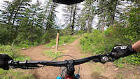
trail: Zen Garden
4:13 |
87 |
May 26, 2022
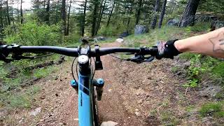
trail: Zen Garden
3:12 |
31 |
Apr 30, 2026 , Sandpoint
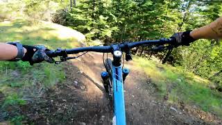
trail: Good Grief
3:10 |
29 |
Apr 30, 2026 , Sandpoint
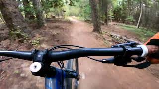
trail: Greta's Segway
6:35 |
107 |
Sep 30, 2024 , Sandpoint

trail: Zen Garden
2:59 |
112 |
Sep 30, 2024 , Sandpoint

trail: Good Grief
3:09 |
152 |
Sep 30, 2024 , Sandpoint
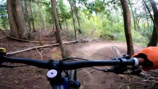
trail: West Side Trail
143 |
Sep 10, 2024 , Sandpoint
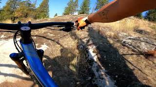
trail: Wabi Sabi (侘 寂)
146 |
Sep 7, 2024 , Sandpoint
Recent Trail Reports
| status | trail | date | condition | info | user |
|---|---|---|---|---|---|
| Rotarian | Apr 30, 2026 @ 7:31am (America/Los_Angeles) Apr 30, 2026 | Ideal | ridethepiggy | ||
| Good Grief | Apr 30, 2026 @ 7:31am (America/Los_Angeles) Apr 30, 2026 | Ideal | ridethepiggy | ||
| Zen Garden - Green Heart connector | Apr 30, 2026 @ 7:31am (America/Los_Angeles) Apr 30, 2026 | Ideal | ridethepiggy | ||
| Green Heart | Apr 30, 2026 @ 7:31am (America/Los_Angeles) Apr 30, 2026 | Ideal | ridethepiggy | ||
| Owl | Jan 5, 2026 @ 2:54pm (America/Los_Angeles) Jan 5, 2026 | Snow Groomed | Rwzimmer | ||
| Pinecone | Jan 5, 2026 @ 2:54pm (America/Los_Angeles) Jan 5, 2026 | Snow Groomed | Rwzimmer | ||
| Grandma's Trail | Jan 5, 2026 @ 2:54pm (America/Los_Angeles) Jan 5, 2026 | Snow Groomed | Rwzimmer | ||
| Greta's Segway | Jan 5, 2026 @ 2:54pm (America/Los_Angeles) Jan 5, 2026 | Snow Groomed | Rwzimmer | ||
| Zen Garden | Sep 26, 2025 @ 11:16am (America/Creston) Sep 26, 2025 | Ideal | cire831 | ||
| Meadow Trail | Sep 16, 2025 @ 2:20pm (America/Los_Angeles) Sep 16, 2025 | Dry | Godzillawa |
Activity Feed
| username | action | type | title | date |
|---|---|---|---|---|
| JosephP7CGJD | wishlist | region | activity #98574073 | Jul 6, 2026 @ 7:46am 2 days |
| welkerjason | add | trail | activity #98042535 | Jun 28, 2026 @ 8:22pm Jun 28, 2026 |
| rosencratz | ridden | trail | activity #98035260 | Jun 28, 2026 @ 5:10pm Jun 28, 2026 |
| djohnson1121 | wishlist | trail | activity #97540101 | Jun 21, 2026 @ 8:14pm Jun 21, 2026 |
| LBeacham | wishlist | trail | activity #97366328 | Jun 19, 2026 @ 9:58pm Jun 19, 2026 |
Recent Comments
| username | type | title | comment | date |
|---|---|---|---|---|
| trail | A great little meander through the woods. | Sep 20, 2025 @ 2:35pm Sep 20, 2025 | ||
| trail | The two statements below are rather accurate.... | Sep 20, 2025 @ 2:31pm Sep 20, 2025 | ||
| trail | Down dog is a dusty mess now. Need some moisture. | Sep 10, 2025 @ 11:17am Sep 10, 2025 | ||
| trail | Definitely a dark blue. Trends to black when... | May 21, 2025 @ 5:57am May 21, 2025 | ||
| report | 5 | May 18, 2025 @ 5:47pm May 18, 2025 |
Nearby Areas
| name | distance | ||||
|---|---|---|---|---|---|
| Lower Basin Trails | 10 | 8 | 2 | 5.1 km | |
| Gold Hill | 2 | 15 | 3 | 5.1 km | |
| Schweitzer | 38 | 13 | 2 | 6.9 km | |
| Panhandle Bike Ranch | 1 | 5 | 4 | 2 | 8.8 km |
| Blacktail Mountain | 2 | 10.9 km |
Local Badges
-

Completionist0 awarded


Activity Type Stats
| activitytype | trails | distance | descent | descent distance | total vertical | rating | global rank | state rank | photos | reports | routes | ridelogs |
|---|---|---|---|---|---|---|---|---|---|---|---|---|
| Mountain Bike | 21 | 18 miles | 3,297 ft | 8 miles | 554 ft | #2,163 | #736 | 104 | 294 | 2 | 5,917 | |
| E-Bike | 10 | 4 miles | 955 ft | 2 miles | 407 ft | #7,382 | #2,159 | 2 | 220 | 343 | ||
| Horse | 1 | 2,428 ft | 256 ft | 1,991 ft | 240 ft | 33 | 1 | |||||
| Hike | 40 | 17 miles | 2,720 ft | 7 miles | 554 ft | #7,605 | #2,800 | 292 | 455 | |||
| Trail Running | 41 | 17 miles | 2,720 ft | 7 miles | 554 ft | #6,046 | 292 | 604 | ||||
| Snowshoe | 1 | 102 ft | 3 ft | #498 | #285 | 34 | ||||||
| Nordic Ski | 1 | #295 | #179 | 1 | 175 |
Frequently Asked Questions About Syringa Trail System
▼
What are the highest rated mountain biking trails in Syringa Trail System?
The highest rated mountain biking trails in Syringa Trail System are:
- Wabi Sabi (侘 寂) (4.6/5)
- Zen Garden (4.5/5)
- Momentum (4.5/5)
- Cracker Pants (4.4/5)
- Downward Dog (4.4/5)
▼
What is the best time of the year to ride in Syringa Trail System?
Based on ride log data, the most popular months to ride in Syringa Trail System are:
- July (48 activities)
- May (29 activities)
- June (27 activities)
▼
Where can I park to ride in Syringa Trail System?
There are 5 parking locations listed in Syringa Trail System. The most popular parking spots are: View all parking and trailhead locations on the map to plan your visit.
▼
What is the longest trail in Syringa Trail System?
The longest trail in Syringa Trail System is Rotarian at 1.6 miles. View all trails sorted by distance.
Activities
Trails
- By chuktA
 TRAILFORKS NFTA & contributors
 - Admins: POP
- #32578 - 23,129 views
- syringa trail system activity log | embed map of Syringa Trail System mountain bike trails | syringa trail system mountain biking points of interest
Downloading of trail gps tracks in kml & gpx formats is enabled for Syringa Trail System.
You must login to download files.