close
-
Layers w
- Weather Layers
- Pro
- Pro
- Pro
- Pro
- Pro
- Pro
- More Layers
- Pro
- Pro
- Pro
- Pro
-
Upgrade to

3D
Trail Conditions
- Unknown
- Snow Groomed
- Snow Packed
- Snow Covered
- Snow Cover Partial
- Freeze/thaw Cycle
- Icy
- Prevalent Mud
- Wet
- Variable
- Ideal
- Dry
- Very Dry
Trail Flow (Ridden Direction)
Trailforks scans users ridelogs to determine the most popular direction each trail is ridden. A good flowing trail network will have most trails flowing in a single direction according to their intension.
The colour categories are based on what percentage of riders are riding a trail in its intended direction.
The colour categories are based on what percentage of riders are riding a trail in its intended direction.
- > 96%
- > 90%
- > 80%
- > 70%
- > 50%
- < 50%
- bi-directional trail
- no data
Trail Last Ridden
Trailforks scans ridelogs to determine the last time a trail was ridden.
- < 2 days
- < 1 week
- < 2 weeks
- < 1 month
- < 6 months
- > 6 months
Trail Ridden Direction
The intended direction a trail should be ridden.
- Downhill Only
- Downhill Primary
- Both Directions
- Uphill Primary
- Uphill Only
- One Direction
Contribute Details
Colors indicate trail is missing specified detail.
- Description
- Photos
- Description & Photos
- Videos
Trail Popularity ?
Trailforks scans ridelogs to determine which trails are ridden the most in the last 9 months.
Trails are compared with nearby trails in the same city region with a possible 25 colour shades.
Think of this as a heatmap, more rides = more kinetic energy = warmer colors.
- most popular
- popular
- less popular
- not popular
ATV/ORV/OHV Filter
Max Vehicle Width
inches
US Cell Coverage
Legend

Radar Time
Activity Recordings
Trailforks uses anonymized public activity data.
?
Activity Recordings
Trailforks uses anonymized public activity data.
?
Personal Heatmap
▶
Activity Types
all
/
none
▶
Options
2
Date range
month
–
Winter Trails
Warning
A routing network for winter maps does not exist. Selecting trails using the winter trails layer has been disabled.
Missing Trails
Most Popular
Least Popular
Trails are colored based on popularity. The more popular a trail is, the more red. Less popular trails trend towards green.
Jump Magnitude Heatmap
Heatmap of where riders jump on trails. Zoom in to see individual jumps, click circles to view jump details.
BC Backroad Status
![map legend]()
Service Road Atlas is a free to use, community-driven service for viewing and creating reports on the numerous back-country service roads around B.C. and Alberta.

Slope Aspect
Direction the slope faces
Trails Deemphasized
Trails are shown in grey.
Only show trails with no bike usage.
Suggested Layers
Based on selected activity type
Save the current map location and zoom level as your default home location whenever this page is loaded.
Save
No description for Taiwan has been added yet!
Login or register to submit one.
Region Details
- 10
- 1
- 49
- 90
- 35
- 3
Stats
- Avg Trail Rating
- Trails (view details)
- 188
- Trails Mountain Bike
- 191
- Trails E-Bike
- 100
- Trails Gravel Bike
- 1
- Trails Adaptive Bike
- 1
- Trails Winter Fat Bike
- 1
- Trails Hike
- 364
- Trails Trail Running
- 251
- Trails Dirtbike/Moto
- 4
- Trails ATV/ORV/OHV
- 2
- Total Distance
- 378 miles
- Total Descent
- 133,176 ft
- Total Vertical
- 9,663 ft
- Highest Trailhead
- 9,707 ft
- Reports
- 438
- Photos
- 573
- Ridden Counter
- 3,215
Sub Regions
- Kaohsiung (19)
- Kaohsiung (10)
- Shoushan 壽山 (5)
- Pingtung (6)
- Kaohsiung (10)
- Kenting (1)
- Taoyuan (2)
- Hsinchu (13)
- Linkou (5)
- Liu Gui (1)
- Miaoli (8)
- Nantou (8)
- New Taipei City (16)
- Guan Yin Shan (1)
- Taichung (15)
- Taipei (70)
- DanFeng Mt. 丹鳳山 (13)
- Maokong Gondola Trails 貓空 (6)
- Skilift 五指山 (33)
- Yang Ming Shan 陽明山 (10)
- Taoyuan (14)
- GuiShan District (3)
- YILAN (12)
- Zaoqiao 造橋 (2)
- Miaoli (0)
- Yang Mei (0)
Popular Taiwan Mountain Biking Trails
• 100 ★ 5.0 • 2,178 ft • 0 ft • 92 •
Popular blue difficulty singletrack. This mountain bike primary trail can be used both directions. On average it takes 2 minutes to complete this trail.
• 95 ★ 5.0 • 1,850 ft • 0 ft • 75 •
Popular blue difficulty singletrack. This mountain bike primary trail can be used both directions. On average it takes 2 minutes to complete this trail.
• 95 ★ 5.0 • 1 mile • 92 ft • 61 •
Bosvark is a diverse forest line with multiple line options and jumps
• 85 ★ 3.8 • 3,474 ft • 0 ft • 52 •
Popular blue difficulty singletrack. This mountain bike primary trail can be used downhill primary and has a moderate overall physical rating with a 0 ft blue climb. It features berm, drop, jump, rock face and rock garden. On average it takes 7 minutes to complete this trail.
• 30 ★ 0.0 • 3,599 ft • 0 ft • 50 •
Open flowing single track with berms. 2 drops on the lower section with go around access as alternate to the side.
• 95 ★ 5.0 • 1,089 ft • 31 ft • 49 • • hike
Popular blue difficulty doubletrack. This hike primary trail can be used both directions and has a hard overall physical rating with a 31 ft black diamond climb. It features drop, jump, rock face and rock garden. On average it takes 7 minutes to complete this trail.
• 70 ★ 0.0 • 1,699 ft • 0 ft • 42 •
Popular black diamond difficulty mixed. This multi-use trail can be used downhill primary and has a moderate overall physical rating with a 0 ft black diamond climb. It features drop and rock garden. Trail visibility is always easy to follow. On average it takes 8 minutes to complete this trail.
Taiwan Mountain Bike Routes
★ 5.0 • 4 miles • 726 ft • 0 • Point to Point •
WuJiouTong Trail. 五酒桶山繞一圈+營盤坑古道下山 Combination of dirt road, paved road and...
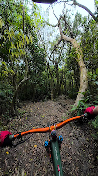
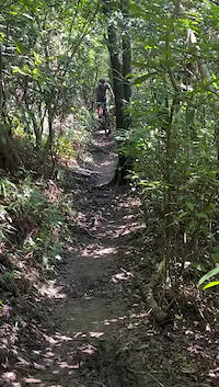
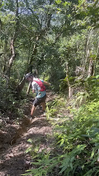
Photos of Taiwan Mountain Bike
Videos of Taiwan Mountain Bike
trail: 五指山 Ski Lift 1-2 段
0:59 |
8 |
Apr 5, 2026

trail: 楓櫃斗湖
0:00 |
22 |
Feb 29, 2024
0:08 |
78 |
Aug 13, 2023
0:13 |
47 |
Aug 13, 2023

trail: 南亞林道 Nan Ya trail
0:59 |
46 |
Jun 16, 2023

trail: 水碓公園 Shuidui Park
0:31 |
15 |
Feb 14, 2023

trail: 南亞林道 Nan Ya trail
0:15 |
26 |
Feb 9, 2023

trail: 南亞林道 Nan Ya trail
0:12 |
|
Feb 8, 2023
Recent Comments
| username | type | title | comment | date |
|---|---|---|---|---|
| trail | picture wise it looks more like a green (max... | Jun 16, 2025 @ 12:47pm Jun 16, 2025 | ||
| trail | ... | May 1, 2025 @ 9:26pm May 1, 2025 | ||
| trail | ... | Apr 30, 2025 @ 1:56am Apr 30, 2025 | ||
| trail | ... | Apr 9, 2025 @ 8:47am Apr 9, 2025 | ||
| trail | ... | Apr 9, 2025 @ 3:09am Apr 9, 2025 |
Bike & Skill Parks
| name | type | city | rating |
|---|---|---|---|
| Yetopia Trail Center | skill park | YILAN | |
| 彩虹輪狀車練習場 Rainbow Riverside Park Pumptrack | skill park | Taipei |
Activity Type Stats
| activitytype | trails | distance | descent | descent distance | total vertical | rating | global rank | state rank | photos | reports | routes | ridelogs |
|---|---|---|---|---|---|---|---|---|---|---|---|---|
| Mountain Bike | 190 | 378 miles | 133,176 ft | 188 miles | 9,662 ft | #63 | 541 | 440 | 20 | 53,040 | ||
| E-Bike | 100 | 177 miles | 52,628 ft | 83 miles | 8,468 ft | #55 | 26 | 415 | 8 | 4,328 | ||
| Gravel Bike | 1 | #42 | 1 | 192 | ||||||||
| Adaptive Bike | 1 | #39 | 1 | |||||||||
| Winter Fat Bike | 1 | #40 | 3 | |||||||||
| Hike | 364 | 364 miles | 129,738 ft | 181 miles | 9,662 ft | #52 | 6 | 434 | 11 | 5,822 | ||
| Trail Running | 251 | 364 miles | 129,623 ft | 181 miles | 9,662 ft | #59 | 433 | 12 | 648 | |||
| Dirtbike/Moto | 4 | 34 miles | 4,839 ft | 12 miles | 7,352 ft | #55 | 23 | 12 | ||||
| ATV/ORV/OHV | 2 | 15 miles | 3,773 ft | 4 miles | 6,526 ft | #49 | 22 | 5 |
Activities
Trails
Points of Interest
- By canadaka
 Trailforks & contributors
 - Admins: LRT, claudedore, davieangel
- #3254 - 29,468 views
- taiwan activity log | embed map of Taiwan mountain bike trails | taiwan mountain biking points of interest
Downloading of trail gps tracks in kml & gpx formats is enabled for Taiwan.
You must login to download files.