close
-
Layers w
- Weather Layers
- Pro
- Pro
- Pro
- Pro
- Pro
- Pro
- More Layers
- Pro
- Pro
- Pro
- Pro
-
Upgrade to

3D
Trail Conditions
- Unknown
- Snow Groomed
- Snow Packed
- Snow Covered
- Snow Cover Partial
- Freeze/thaw Cycle
- Icy
- Prevalent Mud
- Wet
- Variable
- Ideal
- Dry
- Very Dry
Trail Flow (Ridden Direction)
Trailforks scans users ridelogs to determine the most popular direction each trail is ridden. A good flowing trail network will have most trails flowing in a single direction according to their intension.
The colour categories are based on what percentage of riders are riding a trail in its intended direction.
The colour categories are based on what percentage of riders are riding a trail in its intended direction.
- > 96%
- > 90%
- > 80%
- > 70%
- > 50%
- < 50%
- bi-directional trail
- no data
Trail Last Ridden
Trailforks scans ridelogs to determine the last time a trail was ridden.
- < 2 days
- < 1 week
- < 2 weeks
- < 1 month
- < 6 months
- > 6 months
Trail Ridden Direction
The intended direction a trail should be ridden.
- Downhill Only
- Downhill Primary
- Both Directions
- Uphill Primary
- Uphill Only
- One Direction
Contribute Details
Colors indicate trail is missing specified detail.
- Description
- Photos
- Description & Photos
- Videos
Trail Popularity ?
Trailforks scans ridelogs to determine which trails are ridden the most in the last 9 months.
Trails are compared with nearby trails in the same city region with a possible 25 colour shades.
Think of this as a heatmap, more rides = more kinetic energy = warmer colors.
- most popular
- popular
- less popular
- not popular
ATV/ORV/OHV Filter
Max Vehicle Width
inches
US Cell Coverage
Legend

Radar Time
Activity Recordings
Trailforks uses anonymized public activity data.
?
Activity Recordings
Trailforks uses anonymized public activity data.
?
Personal Heatmap
▶
Activity Types
all
/
none
▶
Options
2
Date range
month
–
Winter Trails
Warning
A routing network for winter maps does not exist. Selecting trails using the winter trails layer has been disabled.
Missing Trails
Most Popular
Least Popular
Trails are colored based on popularity. The more popular a trail is, the more red. Less popular trails trend towards green.
Jump Magnitude Heatmap
Heatmap of where riders jump on trails. Zoom in to see individual jumps, click circles to view jump details.
BC Backroad Status
![map legend]()
Service Road Atlas is a free to use, community-driven service for viewing and creating reports on the numerous back-country service roads around B.C. and Alberta.

Slope Aspect
Direction the slope faces
Trails Deemphasized
Trails are shown in grey.
Only show trails with no bike usage.
Suggested Layers
Based on selected activity type
Save the current map location and zoom level as your default home location whenever this page is loaded.
Save
No description for Talamello has been added yet!
Login or register to submit one.
This region uses the Uk/Euro style trail grading system.
Activities Click to view
- Mountain Bike
24 trails
- E-Bike
22 trails
- Adaptive Bike
0 trails
- Hike
17 trails
- Trail Running
17 trails
Region Details
- 4
- 8
- 5
Region Status
Open as of Dec 7, 2025Stats
- Avg Trail Rating
- Trails (view details)
- 20
- Trails Mountain Bike
- 24
- Trails E-Bike
- 22
- Trails Hike
- 17
- Trails Trail Running
- 17
- Total Distance
- 13 miles
- Total Descent Distance
- 7 miles
- Total Descent
- 6,268 ft
- Total Vertical
- 1,621 ft
- Highest Trailhead
- 2,848 ft
- Reports
- 146
- Photos
- 8
- Ridden Counter
- 1,490
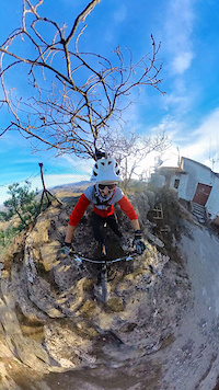
Popular Talamello Mountain Biking Trails
• 95 ★ 4.3 • 1 mile • 0 ft • 101 •
for a smoother ride, with jumps and berms - not as rough as the main DH line
• 100 ★ 4.5 • 4,678 ft • 0 ft • 100 •
Downhill track with rockgardens and some steep lines. Good with DH and enduro/allmountain bikes.
• 70 ★ 4.0 • 5,276 ft • 60 ft • 96 •
Fun trail, part of the Talamello riding area. It starts with some rocky gardens and tight switchbacks (Antenne), it becomes larger for few hundreds meters.
• 45 ★ 3.8 • 2 miles • 64 ft • 79 •
The full , with the new central part. A must ride when here, long, steep, technical and fun!
• 50 ★ 0.0 • 436 ft • 0 ft • 52 •
Moderately popular green difficulty singletrack. This mountain bike primary trail can be used downhill primary. On average it takes 1 minutes to complete this trail.
• 90 ★ 2.0 • 1,660 ft • 54 ft • 42 •
West to east slightly downhill - reverse hard to ride in a couple of points
• 80 ★ 2.0 • 1,070 ft • 6 ft • 39 •
Older version of the trail. Has some off camber rock faces, more "cross-country" than the new trail.
Videos of Talamello Mountain Bike
trail: Take-Off Trail
0:32 |
21 |
Jan 8, 2024
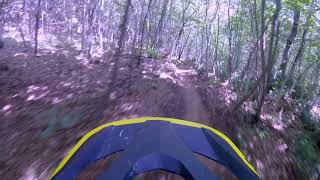
trail: Wolf trail
9:38 |
748 |
Jun 16, 2020 , Talamello
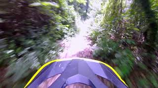
trail: Antenne
5:58 |
597 |
Jun 10, 2020 , Talamello
Recent Trail Reports
| status | trail | date | condition | info | user |
|---|---|---|---|---|---|
| Antenne | Oct 1, 2025 @ 3:34pm (Europe/Rome) Oct 1, 2025 | Dry | taggio | ||
| Il Pozzo | Oct 1, 2025 @ 3:33pm (Europe/Rome) Oct 1, 2025 | Dry | taggio | ||
| Wolf trail | Oct 1, 2025 @ 3:31pm (Europe/Rome) Oct 1, 2025 | Dry | taggio | ||
| DH | Jul 14, 2025 @ 8:09am Jul 14, 2025 | Ideal | Chiere | ||
| Enduro Line | Jul 14, 2025 @ 8:09am Jul 14, 2025 | Ideal | Chiere | ||
| Monte Pincio access road | Jul 14, 2025 @ 8:09am Jul 14, 2025 | Ideal | Chiere | ||
| Wolf exit | Jul 19, 2024 @ 1:37am Jul 19, 2024 | Ideal | Chiere | ||
| Take-Off Trail | May 19, 2024 @ 12:02am May 19, 2024 | Ideal | ninosanta | ||
| Risalita M.te Aquilone (parte seconda) | May 19, 2024 @ 12:02am May 19, 2024 | Ideal | ninosanta | ||
| Connessione | Apr 26, 2024 @ 12:21am Apr 26, 2024 | Ideal | Talebano |
Activity Feed
| username | action | type | title | date |
|---|---|---|---|---|
| MarcorKskuF | wishlist | region | activity #94622194 | May 13, 2026 @ 6:11am May 13, 2026 |
| Andrea321 | add | poi | activity #88769224 | Feb 12, 2026 @ 12:42am Feb 12, 2026 |
| Riccardou9ym84 | ridden | trail | activity #85247706 | Dec 8, 2025 @ 8:09am Dec 8, 2025 |
| Bordons | ridden | trail | activity #84738122 | Nov 26, 2025 @ 1:55am Nov 26, 2025 |
| taggio | add | report | activity #81477743 and 2 more | Oct 1, 2025 @ 6:31am Oct 1, 2025 |
Recent Comments
| username | type | title | comment | date |
|---|---|---|---|---|
| report | Il trail più divertente del comprensiorio ;)... | Dec 22, 2020 @ 2:45am Dec 22, 2020 | ||
| trail | Ho fatto antenne e la seconda parte di Wolf.... | Aug 10, 2020 @ 3:43am Aug 10, 2020 |
Local Badges
-

Epic Mountain Bike Climb 2k142 awarded -

Climbing 10k Badge21 awarded -

Mountain Biking 100k Badge0 awarded -

Epic Ride Descent 2k142 awarded -

Descent 10k Badge22 awarded -

Descent 100k Badge0 awarded
Bike & Skill Parks
| name | type | city | rating |
|---|---|---|---|
| Fratte | skill park | Talamello |
Activity Type Stats
| activitytype | trails | distance | descent | descent distance | total vertical | rating | global rank | state rank | photos | reports | routes | ridelogs |
|---|---|---|---|---|---|---|---|---|---|---|---|---|
| Mountain Bike | 24 | 13 miles | 6,270 ft | 7 miles | 1,621 ft | #8,541 | #780 | 8 | 147 | 1,078 | ||
| E-Bike | 22 | 9 miles | 6,109 ft | 6 miles | 1,575 ft | #4,840 | #466 | 145 | 370 | |||
| Hike | 17 | 10 miles | 3,510 ft | 4 miles | 1,621 ft | #8,210 | #498 | 138 | 28 | |||
| Trail Running | 17 | 10 miles | 3,510 ft | 4 miles | 1,621 ft | #7,783 | #490 | 138 | 5 |
Frequently Asked Questions About Talamello
▼
What are the highest rated mountain biking trails in Talamello?
The highest rated mountain biking trails in Talamello are:
- DH (4.1/5)
- Enduro Line (4.1/5)
- Antenne (4/5)
- Wolf trail (3.9/5)
- Il Pozzo (3.9/5)
▼
What is the best time of the year to ride in Talamello?
Based on ride log data, the most popular months to ride in Talamello are:
- July (4 activities)
- October (3 activities)
- November (2 activities)
▼
Where can I park to ride in Talamello?
Check the Talamello trail map for trailhead and parking information. Community members regularly update access and parking details for trails in the area.
▼
What is the longest trail in Talamello?
The longest trail in Talamello is Wolf trail at 1.9 miles. View all trails sorted by distance.
Activities
Trails
- By keruride
 & contributors
 - Admins: apply
- #24804 - 2,793 views
- talamello activity log | embed map of Talamello mountain bike trails | talamello mountain biking points of interest
Downloading of trail gps tracks in kml & gpx formats is enabled for Talamello.
You must login to download files.