close
-
Layers w
- Weather Layers
- Pro
- Pro
- Pro
- Pro
- Pro
- Pro
- More Layers
- Pro
- Pro
- Pro
- Pro
-
Upgrade to

3D
Trail Conditions
- Unknown
- Snow Groomed
- Snow Packed
- Snow Covered
- Snow Cover Partial
- Freeze/thaw Cycle
- Icy
- Prevalent Mud
- Wet
- Variable
- Ideal
- Dry
- Very Dry
Trail Flow (Ridden Direction)
Trailforks scans users ridelogs to determine the most popular direction each trail is ridden. A good flowing trail network will have most trails flowing in a single direction according to their intension.
The colour categories are based on what percentage of riders are riding a trail in its intended direction.
The colour categories are based on what percentage of riders are riding a trail in its intended direction.
- > 96%
- > 90%
- > 80%
- > 70%
- > 50%
- < 50%
- bi-directional trail
- no data
Trail Last Ridden
Trailforks scans ridelogs to determine the last time a trail was ridden.
- < 2 days
- < 1 week
- < 2 weeks
- < 1 month
- < 6 months
- > 6 months
Trail Ridden Direction
The intended direction a trail should be ridden.
- Downhill Only
- Downhill Primary
- Both Directions
- Uphill Primary
- Uphill Only
- One Direction
Contribute Details
Colors indicate trail is missing specified detail.
- Description
- Photos
- Description & Photos
- Videos
Trail Popularity ?
Trailforks scans ridelogs to determine which trails are ridden the most in the last 9 months.
Trails are compared with nearby trails in the same city region with a possible 25 colour shades.
Think of this as a heatmap, more rides = more kinetic energy = warmer colors.
- most popular
- popular
- less popular
- not popular
ATV/ORV/OHV Filter
Max Vehicle Width
inches
US Cell Coverage
Legend

Radar Time
Activity Recordings
Trailforks uses anonymized public activity data.
?
Activity Recordings
Trailforks uses anonymized public activity data.
?
Personal Heatmap
▶
Activity Types
all
/
none
▶
Options
2
Date range
month
–
Winter Trails
Warning
A routing network for winter maps does not exist. Selecting trails using the winter trails layer has been disabled.
Missing Trails
Most Popular
Least Popular
Trails are colored based on popularity. The more popular a trail is, the more red. Less popular trails trend towards green.
Jump Magnitude Heatmap
Heatmap of where riders jump on trails. Zoom in to see individual jumps, click circles to view jump details.
BC Backroad Status
![map legend]()
Service Road Atlas is a free to use, community-driven service for viewing and creating reports on the numerous back-country service roads around B.C. and Alberta.

Slope Aspect
Direction the slope faces
Trails Deemphasized
Trails are shown in grey.
Only show trails with no bike usage.
Suggested Layers
Based on selected activity type
Save the current map location and zoom level as your default home location whenever this page is loaded.
Save
No description for Tantallon has been added yet!
Login or register to submit one.
Activities Click to view
- Mountain Bike
114 trails
- E-Bike
58 trails
- Gravel Bike
62 trails
- Adaptive Bike
0 trails
- Winter Fat Bike
0 trails
- Horse
46 trails
- Hike
128 trails
- Trail Running
125 trails
- Dirtbike/Moto
54 trails
- ATV/ORV/OHV
70 trails
- Snowmobile
47 trails
- Snowshoe
115 trails
- Backcountry Ski
16 trails
- Nordic Ski
55 trails
Region Details
- 60
- 1
- 16
- 21
- 15
Region Status
Caution as of Jan 6, 2026Local Trail Association
Stats
- Avg Trail Rating
- Trails (view details)
- 127
- Trails Mountain Bike
- 115
- Trails E-Bike
- 58
- Trails Gravel Bike
- 62
- Trails Horse
- 46
- Trails Hike
- 128
- Trails Trail Running
- 125
- Trails Dirtbike/Moto
- 54
- Trails ATV/ORV/OHV
- 70
- Trails Snowmobile
- 47
- Trails Snowshoe
- 115
- Trails Backcountry Ski
- 16
- Trails Nordic Ski
- 55
- Total Distance
- 291 miles
- Total Descent
- 18,747 ft
- Total Vertical
- 654 ft
- Highest Trailhead
- 675 ft
- Reports
- 919
- Photos
- 98
- Ridden Counter
- 2,366
Sub Regions
-
Bowater Trails
- 3
- 13
- 14
-
Five Bridge Lakes Wilderness Area
-
Jerry Lawrence Provincial Park
-
Western Crown Lands
- 12
- 1
- 1
Popular Tantallon Mountain Biking Trails
• 80 ★ 4.5 • 20 miles • 234 ft • 120 •
Located just 30 minutes from downtown Halifax, the St. Margaret’s Bay Area Trail is a 33km multi-use (walking, cycling, ATVing, horse-back riding, snowmobiling, snowshoeing and skiing) recreational Trail with some of the most stunning...
• 90 ★ 1.0 • 2,254 ft • 6 ft • 56 •
Another technical singletrack with some fall line climbs and lots of rocks, roots, and soft tread.
• 100 ★ 3.0 • 1 mile • 52 ft • 49 •
Technical singletrack in the Bowater riding area. Lots of rocks, roots, and loam. The gaps between trees are knuckle busting narrow, and there are plenty of tight technical turns. Most of the climbs are steep as well. There's several...
• 100 ★ 4.0 • 4,268 ft • 171 ft • 49 •
This access road starts at . Once you cross the overpass look for the yellow gate on your right. Ride around the yellow gate and follow the road. Once you cross the bridge over the follow the road, or ride on the double track on the...
• 95 ★ 4.0 • 889 ft • 0 ft • 46 •
A fun trail. One of two Jigsaw exits to the Pipeline Doubletrack. This trail starts out as a loamy and rocky descent in the woods, and opens into a fast and technical rock garden at the hydro cut. There is a rooty drop near the pipeline.
• 95 ★ 3.0 • 981 ft • 44 ft • 45 •
Technical singletrack trail in the Bowater riding area. This trail is an extension of that leads out to Road and the Trail. Lots of roots and tight turns. Some trail braiding and deep ruts from motos. There's a steep chute and a muddy...
• 100 ★ 3.0 • 2,005 ft • 14 ft • 44 •
The Upper Portion of the Jigsaw system. This trail starts on the hydro cut and snakes its way through the woods to the five-fingers, where it splits into -5. Lots of technical turns and tight trees. The tread surface is primarily loam.
• 90 ★ 3.0 • 1,060 ft • 0 ft • 43 •
Technical singletrack trail in the Bowater riding area. This trail starts at and leads out to passing through a gravel pit.
Tantallon Mountain Bike Routes
★ 4.0 • 33 miles • 1,353 ft • 6 • Out & Back •
This 53km route starts and finishes at the Train Station Bike and Bean. The first leg takes riders east on...
Dracula Flow Featured
10 miles • 962 ft • 14 • Loop •
Mixed difficulty route with technical trails and logging road climbs. Janky, real janky. Trails in order:...
Train Gang's Tour D'Ingram Featured
★ 5.0 • 36 miles • 2,274 ft • 0 • Loop •
The Tour D'Ingram is a 55km+ loop of the St. Margarets Bay back country. This route winds through the...
Train Gang's Triple Shot Featured
18 miles • 861 ft • 0 • Loop •
This 28km gravel loop starts and ends at the Train Station Bike & Bean. The first 15 km are relatively...
★ 4.0 • 143 miles • 3,060 ft • 5 • Out & Back •
The Bluenose Bikepacking Route winds through the St. Margaret's Bay and Mahone Bay portions of Nova...
★ 3.5 • 18 miles • 849 ft • 2 • Loop •
This is a classic old school mountain bike loop, used to be a race course in the late 80's early 90's. Do...
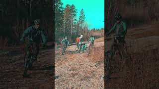
Photos of Tantallon Mountain Bike
Videos of Tantallon Mountain Bike
trail: Number 2
0:09 |
96 |
Jan 4, 2025 , Tantallon

trail: Jigsaw 5
0:50 |
13582 |
Dec 15, 2007

trail: Crooked Finger
3:43 |
132 |
Dec 16, 2024 , Tantallon
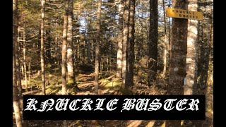
trail: Knuckle Buster
7:40 |
116 |
Dec 16, 2024 , Tantallon
Recent Trail Reports
| status | trail | date | condition | info | user |
|---|---|---|---|---|---|
| Old Halifax Road | Jan 6, 2026 @ 6:49am (America/Halifax) Jan 6, 2026 | Variable | bent6543 TRAILFORKS | ||
| Pipeline Doubletrack | Dec 6, 2025 @ 10:30am (America/Halifax) Dec 6, 2025 | Snow Cover Partial | thunderbox | ||
| Knuckle Buster Exit Stage Left | Dec 6, 2025 @ 10:30am (America/Halifax) Dec 6, 2025 | Snow Cover Partial | thunderbox | ||
| Morrison Hall | Dec 6, 2025 @ 10:30am (America/Halifax) Dec 6, 2025 | Snow Cover Partial | thunderbox | ||
| Jigsaw 2 | Dec 6, 2025 @ 10:30am (America/Halifax) Dec 6, 2025 | Snow Cover Partial | thunderbox | ||
| Jigsaw Connector | Dec 6, 2025 @ 10:30am (America/Halifax) Dec 6, 2025 | Snow Cover Partial | thunderbox | ||
| Jigsaw 4 | Dec 6, 2025 @ 10:30am (America/Halifax) Dec 6, 2025 | Snow Cover Partial | thunderbox | ||
| Jigsaw 3 | Dec 6, 2025 @ 10:30am (America/Halifax) Dec 6, 2025 | Snow Cover Partial | thunderbox | ||
| Upper Jigsaw | Dec 6, 2025 @ 10:30am (America/Halifax) Dec 6, 2025 | Snow Cover Partial | thunderbox | ||
| Power Thirst | Dec 6, 2025 @ 10:30am (America/Halifax) Dec 6, 2025 | Snow Cover Partial | thunderbox |
Activity Feed
| username | action | type | title | date |
|---|---|---|---|---|
| bent6543 | update | skillpark | activity #96761667 | Jun 11, 2026 @ 2:33pm Jun 11, 2026 |
| Sataber | wishlist | route | activity #95431223 | May 24, 2026 @ 11:40am May 24, 2026 |
| MohamedusUZGO | wishlist | trail | activity #94929770 | May 17, 2026 @ 12:21pm May 17, 2026 |
| Brenda2ttZ3D | wishlist | region | activity #93451751 | Apr 26, 2026 @ 9:31am Apr 26, 2026 |
| thunderbox | update | trail | activity #92938270 | Apr 19, 2026 @ 5:11am Apr 19, 2026 |
Recent Comments
| username | type | title | comment | date |
|---|---|---|---|---|
| trail | N Also known as “Trail To Hell” | Dec 5, 2024 @ 7:54pm Dec 5, 2024 | ||
| trail | Signs up indicating sanctioned trail,... | Oct 16, 2024 @ 3:10pm Oct 16, 2024 | ||
| trail | Signage indicates that this trail has been... | Oct 5, 2024 @ 5:07pm Oct 5, 2024 | ||
| report | Surely you've got room for a chainsaw on that... | Oct 3, 2024 @ 5:46am Oct 3, 2024 | ||
| trail | The SMATVA has put a ton of work into this... | Sep 23, 2024 @ 2:13pm Sep 23, 2024 |
Local Badges
-
Tour D'Ingram Finisher12 awarded -

Train Gang's Pipeline Rd. Challenge0 awarded -

Completionist0 awarded -
Completionist0 awarded -

Epic Ride 50k228 awarded -

10 Blue Trails2 awarded
Bike & Skill Parks
| name | type | city | rating |
|---|---|---|---|
| Kai Matthews Bike Park | skill park | Tantallon |
Activity Type Stats
| activitytype | trails | distance | descent | descent distance | total vertical | rating | global rank | state rank | photos | reports | routes | ridelogs |
|---|---|---|---|---|---|---|---|---|---|---|---|---|
| Mountain Bike | 114 | 269 miles | 16,430 ft | 124 miles | 653 ft | #1,133 | #4 | 88 | 913 | 17 | 3,336 | |
| E-Bike | 58 | 206 miles | 11,211 ft | 98 miles | 614 ft | #752 | #2 | 1 | 819 | 13 | 33 | |
| Gravel Bike | 62 | #261 | #13 | 12 | 18 | 14 | 61 | |||||
| Horse | 46 | 194 miles | 10,167 ft | 92 miles | 614 ft | #169 | #2 | 395 | ||||
| Hike | 128 | 288 miles | 18,622 ft | 133 miles | 653 ft | #686 | #2 | 1 | 912 | 11 | 385 | |
| Trail Running | 125 | 285 miles | 18,481 ft | 132 miles | 653 ft | #496 | #1 | 912 | 10 | 375 | ||
| Dirtbike/Moto | 54 | 190 miles | 11,506 ft | 87 miles | 620 ft | #140 | #2 | 377 | 27 | |||
| ATV/ORV/OHV | 70 | 250 miles | 14,140 ft | 116 miles | 653 ft | #36 | #1 | 397 | 29 | |||
| Snowmobile | 47 | 202 miles | 10,515 ft | 95 miles | 614 ft | #34 | #1 | 377 | ||||
| Snowshoe | 115 | 254 miles | 16,033 ft | 118 miles | 614 ft | #41 | #1 | 555 | 6 | 28 | ||
| Backcountry Ski | 16 | 57 miles | 2,897 ft | 27 miles | 482 ft | #394 | #2 | 420 | 1 | |||
| Nordic Ski | 55 | 155 miles | 8,566 ft | 72 miles | 614 ft | #185 | #1 | 449 | 2 | 2 |
Frequently Asked Questions About Tantallon
▼
What are the best places to ride in Tantallon?
Tantallon has 6 areas to explore for mountain biking. The top rated areas are:
▼
What are the highest rated mountain biking trails in Tantallon?
The highest rated mountain biking trails in Tantallon are:
- St. Margarets Bay Trail (4.1/5)
- Harvey Dauphinee Connector Trail (4.1/5)
- Morrison Hall (4/5)
- Northeast River Access Trail (4/5)
- Jigsaw 3 (4/5)
▼
What is the best time of the year to ride in Tantallon?
Based on ride log data, the most popular months to ride in Tantallon are:
- February (37 activities)
- May (35 activities)
- August (30 activities)
▼
Where can I park to ride in Tantallon?
There are 7 parking locations listed in Tantallon. The most popular parking spots are: View all parking and trailhead locations on the map to plan your visit.
Activities
- Tantallon Mountain Biking Trails
- Tantallon E-Biking Trails
- Tantallon Gravel Biking Trails
- Tantallon Horseback Trails
- Tantallon Hiking Trails
- Tantallon Trail Running Trails
- Tantallon Dirtbiking Trails
- Tantallon ATVing/Offroading Trails
- Tantallon Snowmobiling Trails
- Tantallon Snowshoeing Trails
- Tantallon Backcountry Skiing Trails
- Tantallon Nordic Skiing Trails
Trails
- By Tuzlo & contributors
- Admins: bent6543
- #12339 - 6,689 views
- tantallon activity log | embed map of Tantallon mountain bike trails | tantallon mountain biking points of interest
Downloading of trail gps tracks in kml & gpx formats is enabled for Tantallon.
You must login to download files.