close
-
Layers w
- Weather Layers
- Pro
- Pro
- Pro
- Pro
- Pro
- Pro
- More Layers
- Pro
- Pro
- Pro
- Pro
-
Upgrade to

3D
Trail Conditions
- Unknown
- Snow Groomed
- Snow Packed
- Snow Covered
- Snow Cover Partial
- Freeze/thaw Cycle
- Icy
- Prevalent Mud
- Wet
- Variable
- Ideal
- Dry
- Very Dry
Trail Flow (Ridden Direction)
Trailforks scans users ridelogs to determine the most popular direction each trail is ridden. A good flowing trail network will have most trails flowing in a single direction according to their intension.
The colour categories are based on what percentage of riders are riding a trail in its intended direction.
The colour categories are based on what percentage of riders are riding a trail in its intended direction.
- > 96%
- > 90%
- > 80%
- > 70%
- > 50%
- < 50%
- bi-directional trail
- no data
Trail Last Ridden
Trailforks scans ridelogs to determine the last time a trail was ridden.
- < 2 days
- < 1 week
- < 2 weeks
- < 1 month
- < 6 months
- > 6 months
Trail Ridden Direction
The intended direction a trail should be ridden.
- Downhill Only
- Downhill Primary
- Both Directions
- Uphill Primary
- Uphill Only
- One Direction
Contribute Details
Colors indicate trail is missing specified detail.
- Description
- Photos
- Description & Photos
- Videos
Trail Popularity ?
Trailforks scans ridelogs to determine which trails are ridden the most in the last 9 months.
Trails are compared with nearby trails in the same city region with a possible 25 colour shades.
Think of this as a heatmap, more rides = more kinetic energy = warmer colors.
- most popular
- popular
- less popular
- not popular
ATV/ORV/OHV Filter
Max Vehicle Width
inches
US Cell Coverage
Legend

Radar Time
Activity Recordings
Trailforks uses anonymized public activity data.
?
Activity Recordings
Trailforks uses anonymized public activity data.
?
Personal Heatmap
▶
Activity Types
all
/
none
▶
Options
2
Date range
month
–
Winter Trails
Warning
A routing network for winter maps does not exist. Selecting trails using the winter trails layer has been disabled.
Missing Trails
Most Popular
Least Popular
Trails are colored based on popularity. The more popular a trail is, the more red. Less popular trails trend towards green.
Jump Magnitude Heatmap
Heatmap of where riders jump on trails. Zoom in to see individual jumps, click circles to view jump details.
BC Backroad Status
![map legend]()
Service Road Atlas is a free to use, community-driven service for viewing and creating reports on the numerous back-country service roads around B.C. and Alberta.

Slope Aspect
Direction the slope faces
Trails Deemphasized
Trails are shown in grey.
Only show trails with no bike usage.
Suggested Layers
Based on selected activity type
Save the current map location and zoom level as your default home location whenever this page is loaded.
Save
No description for Taranaki has been added yet!
Login or register to submit one.
Activities Click to view
- Mountain Bike
285 trails
- E-Bike
172 trails
- Hike
377 trails
- Trail Running
330 trails
Stats
- Avg Trail Rating
- Trails (view details)
- 460
- Trails Mountain Bike
- 289
- Trails E-Bike
- 172
- Trails Hike
- 378
- Trails Trail Running
- 330
- Total Distance
- 286 miles
- Total Descent
- 50,417 ft
- Total Vertical
- 8,080 ft
- Highest Trailhead
- 8,089 ft
- Reports
- 4,662
- Photos
- 962
- Ridden Counter
- 39,832
Sub Regions
- Hawera (1)
- New Plymouth (261)
- Busing Forest (28)
- Mangamahoe Mountain Bike Park (119)
Popular Taranaki Mountain Biking Trails
• 100 ★ 4.4 • 1,480 ft • 8 ft • 557 •
Originally built between 2010 and 2012, this trail has plenty of jumps and berms. Extensively rebuilt and extended in 2025.
• 100 ★ 3.3 • 2,293 ft • 173 ft • 541 •
was built using TSB Community Trust funding. This trail forms the fastest from the front gate up to the . A good steady climb all the way.
• 90 ★ 4.9 • 2,802 ft • 42 ft • 524 •
The first half of Mandatory was built in 3 working bee's over 8 days. The second half was built using TSB Community Trust money. It's a tribute to what can be achieved with local funding and volunteers motivated enough to move a heap of...
• 100 ★ 4.2 • 1,831 ft • 15 ft • 507 •
Initially built with Lion Foundation money, and extensively enhanced and extended by volunteers since. The track has been completely rebuilt in 2024 with funding from TOI. This short track is wide, flowing with basic tabletops and 2...
• 100 ★ 3.0 • 482 ft • 7 ft • 498 •
Popular blue difficulty singletrack. This mountain bike primary trail can be used uphill primary and has a hard overall physical rating with a 7 ft blue climb. On average it takes minutes to complete this trail.
• 100 ★ 3.4 • 810 ft • 66 ft • 495 •
This is the main uptrack to get to the Million $ loop trails that are on the top of a hill at the northern end of the MTB park. It starts on the main gravel road with a short steep run-up and then climbs with a few undulations around...
Taranaki Mountain Bike Routes
Blue Route - Intro to Mangas Featured
★ 5.0 • 7 miles • 971 ft • 17 • Loop •
A good starter route that will help familiarise you with the sorthern and central areas of the park and...
Lake Mangamahoe Gravel Loop Featured
★ 4.0 • 3 miles • 287 ft • 2 • Loop •
An easy combination gravel , a wide walking track, a public gravel road, and a little bit of single track...
Green Route - Family Trails Featured
★ 5.0 • 2 miles • 324 ft • 4 • Loop •
All wide well-formed tracks that are great for little wheels and begineers. does have a couple of steepish...
Mangamahoe XC Mission Featured
★ 4.0 • 13 miles • 2,317 ft • 10 • Loop •
A longer XC-style route that will take you to all corners of the park and includes many of Mangas classic...
★ 3.0 • 2 miles • 164 ft • 11 •
A collection of Mangas flow trails from top to bottom with little jumps
11 miles • 2,103 ft • 29 • Loop •
Managahoe 20K Loop, mix of easy & advanced trails.
Photos of Taranaki Mountain Bike
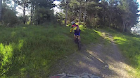
Videos of Taranaki Mountain Bike

trail: Lake Mangamahoe Loop Track
0:15 |
67 |
Oct 26, 2023
trail: Mandatory Powerplay
0:56 |
372 |
Nov 12, 2020
trail: Dozer Ridge
0:11 |
627 |
Oct 28, 2020
trail: Operator
0:58 |
793 |
May 25, 2020

20:02 |
470 |
Dec 15, 2019
trail: Let It Roll
2:51 |
499 |
Oct 22, 2019

trail: Captain America
2:18 |
483 |
Jan 8, 2016
trail: Flow
0:28 |
487 |
Jan 2, 2014
Recent Trail Reports
| status | trail | date | condition | info | user |
|---|---|---|---|---|---|
| Carrington Walkway Taranaki | Jan 11, 2026 @ 12:05pm (Pacific/Auckland) Jan 10, 2026 | Unknown | ptharris | ||
| Matekai Park Track Taranaki | Jan 6, 2026 @ 9:26am (Pacific/Auckland) Jan 5, 2026 | Unknown | creid58 | ||
| Stumpy's Mayhem Mangamahoe Mountain Bike Park | Nov 24, 2025 @ 10:33pm (Pacific/Auckland) Nov 24, 2025 | Ideal | YellowEyed NPMB | ||
| Buzzcut Mangamahoe Mountain Bike Park | Aug 29, 2025 @ 1:38pm Aug 29, 2025 | Wet | YellowEyed NPMB | ||
| Stumpys Revenge Mangamahoe Mountain Bike Park | Jul 18, 2025 @ 1:47pm Jul 18, 2025 | Wet | YellowEyed NPMB | ||
| Cash Flow Mangamahoe Mountain Bike Park | Jun 8, 2025 @ 10:00am Jun 8, 2025 | Ideal | Luke2441 | ||
| Climb-Ax Mangamahoe Mountain Bike Park | Jun 8, 2025 @ 10:00am Jun 8, 2025 | Variable | Luke2441 | ||
| Slice Of Heaven Mangamahoe Mountain Bike Park | Jun 8, 2025 @ 10:00am Jun 8, 2025 | Variable | Luke2441 | ||
| Out House Loop Mangamahoe Mountain Bike Park | Feb 20, 2025 @ 11:49pm Feb 20, 2025 | Variable | snapperguts | ||
| Mangamahoe Forest Road Mangamahoe Mountain Bike Park | Oct 13, 2024 @ 7:58am Oct 13, 2024 | Variable | ryandaffbikes |
Activity Feed
| username | action | type | title | date |
|---|---|---|---|---|
| YellowEyed | add | trail | activity #96259379 | Jun 4, 2026 @ 4:25pm Jun 4, 2026 |
| YellowEyed | update | trail | activity #96124355 | Jun 2, 2026 @ 5:54pm Jun 2, 2026 |
| YellowEyed | update | trail | activity #96057299 | Jun 1, 2026 @ 7:09pm Jun 1, 2026 |
| jamiegX65TJ | difficultyvote | trail | activity #95682353 | May 27, 2026 @ 7:59pm May 27, 2026 |
| jamiegX65TJ | ridden | trail | activity #95681955 and 3 more | May 27, 2026 @ 7:51pm May 27, 2026 |
Recent Comments
| username | type | title | comment | date |
|---|---|---|---|---|
| trail | Bikes not allowed | Jan 10, 2026 @ 3:06pm Jan 10, 2026 | ||
| report | fixed | Nov 24, 2025 @ 1:37am Nov 24, 2025 | ||
| report | fixed | Nov 24, 2025 @ 1:32am Nov 24, 2025 | ||
| trail | Tree down after first jump | Sep 13, 2025 @ 5:13pm Sep 13, 2025 | ||
| trail | Nice new gap at the end | Oct 31, 2024 @ 6:20pm Oct 31, 2024 |
Local Badges
-

10 Green Trails150 awarded -

10 Blue Trails327 awarded -

Epic Ride Climb 2k50 awarded -

Climbing 10k Badge82 awarded -

Climbing 100k Badge15 awarded -

Epic Ride Descent 2k52 awarded
Bike & Skill Parks
| name | type | city | rating |
|---|---|---|---|
| ROTOZ Dirtjump Park | skill park | New Plymouth | |
| New Plymouth BMX Track | skill park | New Plymouth | |
| Hawera BMX Track | skill park | Hawera | |
| New Plymouth BMX Club Track | skill park | New Plymouth | |
| Busing Forest Skills Park | skill park | New Plymouth |
Local Trail Association
Activity Type Stats
| activitytype | trails | distance | descent | descent distance | total vertical | rating | global rank | state rank | photos | reports | routes | ridelogs |
|---|---|---|---|---|---|---|---|---|---|---|---|---|
| Mountain Bike | 285 | 100 miles | 16,322 ft | 49 miles | 1,496 ft | 951 | 4,656 | 14 | 27,118 | |||
| E-Bike | 172 | 74 miles | 7,667 ft | 35 miles | 1,496 ft | 4,233 | 10 | 2,991 | ||||
| Hike | 377 | 261 miles | 41,010 ft | 113 miles | 8,081 ft | 13 | 4,365 | 2 | 1,989 | |||
| Trail Running | 330 | 164 miles | 19,386 ft | 74 miles | 6,404 ft | 4,363 | 7 | 4,847 |
Frequently Asked Questions About Taranaki
▼
What are the best places to ride in Taranaki?
Taranaki has 4 areas to explore for mountain biking. The top rated areas are:
▼
What are the highest rated mountain biking trails in Taranaki?
The highest rated mountain biking trails in Taranaki are:
- Mandatory Powerplay (4.5/5)
- Slam City (4.3/5)
- Reverb Ridge (4.3/5)
- No.2 DH (4.3/5)
- Anti Climb-Ax - Lower (4.2/5)
▼
What is the best time of the year to ride in Taranaki?
Based on ride log data, the most popular months to ride in Taranaki are:
- February (181 activities)
- January (147 activities)
- December (132 activities)
▼
What is the longest trail in Taranaki?
The longest trail in Taranaki is Coastal Walkway at 9.5 km. View all trails sorted by distance.
Activities
Trails
Points of Interest
- [falls] Dawson Falls / Te Rere o Kapuni Other
- Dawson Falls Mountain Lodge
- Dawson Falls Lookout Viewpoint
- Dawson Falls Visitor Centre Information
- Dawson Falls Visitor Center Lookout Viewpoint
- Freedom Camping
- Stratford Plateau Lookout Viewpoint
- Jacksons Lookout Summit
- North Egmont Overflow Car Park Viewing Platform Viewpoint
- Egmont National Park Visitor Centre Information
- By brenthillier
 NSMBA TRAILFORKS & contributors
 - Admins: TFNZ, lintbagger
- #3648 - 20,797 views
- taranaki activity log | embed map of Taranaki mountain bike trails | taranaki mountain biking points of interest
Downloading of trail gps tracks in kml & gpx formats is enabled for Taranaki.
You must login to download files.