close
-
Layers w
- Weather Layers
- Pro
- Pro
- Pro
- Pro
- Pro
- Pro
- More Layers
- Pro
- Pro
- Pro
- Pro
-
Upgrade to

3D
Trail Conditions
- Unknown
- Snow Groomed
- Snow Packed
- Snow Covered
- Snow Cover Partial
- Freeze/thaw Cycle
- Icy
- Prevalent Mud
- Wet
- Variable
- Ideal
- Dry
- Very Dry
Trail Flow (Ridden Direction)
Trailforks scans users ridelogs to determine the most popular direction each trail is ridden. A good flowing trail network will have most trails flowing in a single direction according to their intension.
The colour categories are based on what percentage of riders are riding a trail in its intended direction.
The colour categories are based on what percentage of riders are riding a trail in its intended direction.
- > 96%
- > 90%
- > 80%
- > 70%
- > 50%
- < 50%
- bi-directional trail
- no data
Trail Last Ridden
Trailforks scans ridelogs to determine the last time a trail was ridden.
- < 2 days
- < 1 week
- < 2 weeks
- < 1 month
- < 6 months
- > 6 months
Trail Ridden Direction
The intended direction a trail should be ridden.
- Downhill Only
- Downhill Primary
- Both Directions
- Uphill Primary
- Uphill Only
- One Direction
Contribute Details
Colors indicate trail is missing specified detail.
- Description
- Photos
- Description & Photos
- Videos
Trail Popularity ?
Trailforks scans ridelogs to determine which trails are ridden the most in the last 9 months.
Trails are compared with nearby trails in the same city region with a possible 25 colour shades.
Think of this as a heatmap, more rides = more kinetic energy = warmer colors.
- most popular
- popular
- less popular
- not popular
ATV/ORV/OHV Filter
Max Vehicle Width
inches
US Cell Coverage
Legend

Radar Time
Activity Recordings
Trailforks uses anonymized public activity data.
?
Activity Recordings
Trailforks uses anonymized public activity data.
?
Personal Heatmap
▶
Activity Types
all
/
none
▶
Options
2
Date range
month
–
Winter Trails
Warning
A routing network for winter maps does not exist. Selecting trails using the winter trails layer has been disabled.
Missing Trails
Most Popular
Least Popular
Trails are colored based on popularity. The more popular a trail is, the more red. Less popular trails trend towards green.
Jump Magnitude Heatmap
Heatmap of where riders jump on trails. Zoom in to see individual jumps, click circles to view jump details.
BC Backroad Status
![map legend]()
Service Road Atlas is a free to use, community-driven service for viewing and creating reports on the numerous back-country service roads around B.C. and Alberta.

Slope Aspect
Direction the slope faces
Trails Deemphasized
Trails are shown in grey.
Only show trails with no bike usage.
Suggested Layers
Based on selected activity type
Save the current map location and zoom level as your default home location whenever this page is loaded.
SaveTarcento è adagiata sulle pendici dei monti Chiampeon, Stella e Bernadia ed è caratterizzata dalla splendida varietà del suo ambiente e dalla sua funzione di cerniera fra l'alta Valle del Torre e la zona pedemontana delle Prealpi Giulie.
Tra le sue strade con le ville liberty, rivivrai la Belle Epoque, per poi goderti le atmosfere sospese della suggestiva passeggiata a fianco del torrente Torre.
Imperdibile il 5 e 6 gennaio di ogni anno l'Epifania friulana, che si consuma tra corse con carri infuocati e grandi falò propiziatori: i pignarûi.
Poco lontano da qui meritano una visita, da marzo fino a settembre, le spettacolari Grotte di Villanova tra stalagmiti e laghetti sotterranei.
Mentre sul monte Bernadia, che sovrasta Tarcento, puoi effettuare piacevoli escursioni e scoprire un fortino utilizzato durante i conflitti bellici.
This region uses the Uk/Euro style trail grading system.
Activities Click to view
- Mountain Bike
18 trails
- E-Bike
8 trails
- Gravel Bike
0 trails
- Adaptive Bike
0 trails
- Winter Fat Bike
0 trails
- Hike
18 trails
- Trail Running
18 trails
Region Details
- 5
- 2
- 11
Region Status
Caution as of 22 hoursStats
- Avg Trail Rating
- Trails (view details)
- 18
- Trails Mountain Bike
- 18
- Trails E-Bike
- 8
- Trails Hike
- 18
- Trails Trail Running
- 18
- Total Distance
- 20 miles
- Total Descent
- 5,223 ft
- Total Vertical
- 1,606 ft
- Highest Trailhead
- 2,375 ft
- Reports
- 238
- Photos
- 10
- Ridden Counter
- 789
Sub Regions
-
Bernadia Trail Area (Tarcento)
-
Campeon
- 1
- 6
Popular Tarcento Mountain Biking Trails
• 85 ★ 3.0 • 2,083 ft • 0 ft • 55 •
Popular blue difficulty singletrack. This mountain bike primary trail can be used downhill only and has a moderate overall physical rating with a 0 ft blue climb. On average it takes 3 minutes to complete this trail.
• 55 ★ 4.0 • 4,934 ft • 23 ft • 51 •
Moderately popular blue difficulty singletrack. This mountain bike primary trail can be used downhill primary and has a moderate overall physical rating with a 23 ft blue climb. On average it takes 14 minutes to complete this trail.
• 95 ★ 5.0 • 2,205 ft • 0 ft • 47 •
Popular blue difficulty singletrack. This mountain bike primary trail can be used downhill primary and has a moderate overall physical rating with a 0 ft blue climb. On average it takes 2 minutes to complete this trail.
• 70 ★ 3.0 • 3,902 ft • 33 ft • 47 •
Popular blue difficulty singletrack. This mountain bike primary trail can be used downhill primary and has a hard overall physical rating with a 33 ft blue climb. On average it takes 6 minutes to complete this trail.
• 80 ★ 4.0 • 1 mile • 571 ft • 44 •
Popular green difficulty doubletrack. This mountain bike primary trail can be used uphill primary and has a moderate overall physical rating with a 571 ft blue climb. Trail visibility is always easy to follow. On average it takes 14 minutes to complete this trail.
• 75 ★ 3.0 • 4,426 ft • 20 ft • 28 •
Popular blue difficulty doubletrack. This mountain bike primary trail can be used both directions and has a moderate overall physical rating with a 20 ft blue climb. On average it takes 3 minutes to complete this trail.
• 45 ★ 3.0 • 3,445 ft • 0 ft • 24 •
Il sentiero parte in single track e intersecandosi con la vecchia strada nel bosco che portava a Stella arriva a Malemaseria dove si congiunge con la strada asfaltata.
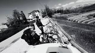
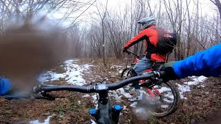
Videos of Tarcento Mountain Bike
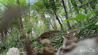
trail: Troi di Julie
0:08 |
8 |
Apr 6, 2026
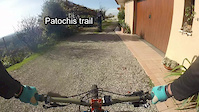
trail: Patochis
4:35 |
205 |
Nov 17, 2018
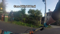
trail: Case Pittini
3:00 |
192 |
Nov 17, 2018
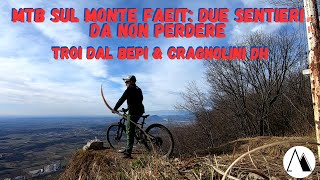
trail: Cragnolini DH
15:15 |
170 |
Mar 24, 2023 , Tarcento
trail: Troi de strie
7:32 |
359 |
May 2, 2021 , Tarcento
2:52 |
215 |
Feb 26, 2021
Recent Trail Reports
| status | trail | date | condition | info | user |
|---|---|---|---|---|---|
| Cragnolini DH | Jun 22, 2026 @ 8:19pm (Europe/Rome) 22 hours | Ideal | Davidew57d7Z | ||
| Troi de strie | May 29, 2026 @ 10:24pm (Europe/Rome) May 29, 2026 | Ideal | LuigiPrimiceri | ||
| Zaiama DH Connection | Apr 25, 2026 @ 9:41am (Europe/Ljubljana) Apr 25, 2026 | Ideal | Fabrizior | ||
| Troi di Julie | Apr 6, 2026 @ 11:15am (Europe/Rome) Apr 6, 2026 | Ideal | LuigiPrimiceri | ||
| Case Pittini | Mar 30, 2026 @ 3:53pm (Europe/Ljubljana) Mar 30, 2026 | Dry | Fabrizior | ||
| St. Eufemia DH | Mar 19, 2026 @ 12:21pm (Europe/Ljubljana) Mar 19, 2026 | Ideal | MauroP | ||
| Campeon jpc (ju pe culine) | Mar 1, 2026 @ 11:28am (Europe/Ljubljana) Mar 1, 2026 | Ideal | Fabrizior | ||
| Campeon Nord jpc (ju pe culine) | Mar 1, 2026 @ 11:28am (Europe/Ljubljana) Mar 1, 2026 | Ideal | Fabrizior | ||
| Campeon DH | Jan 7, 2026 @ 3:03pm (Europe/Rome) Jan 7, 2026 | Dry | maxmisdaris MGNR | ||
| Crosis | Jan 7, 2026 @ 3:01pm (Europe/Rome) Jan 7, 2026 | Dry | maxmisdaris MGNR |
Activity Feed
| username | action | type | title | date |
|---|---|---|---|---|
| Davidew57d7Z | add | report | activity #97574454 | Jun 22, 2026 @ 11:19am 22 hours |
| LuigiPrimiceri | add | report | activity #95798973 and 1 more | May 29, 2026 @ 1:29pm May 29, 2026 |
| Fabrizior | add | report | activity #95396402 | May 24, 2026 @ 4:43am May 24, 2026 |
| Fabrizior | add | report | activity #93358512 | Apr 25, 2026 @ 8:23am Apr 25, 2026 |
| roybatty | add | report | activity #92542465 | Apr 13, 2026 @ 9:17am Apr 13, 2026 |
Recent Comments
| username | type | title | comment | date |
|---|---|---|---|---|
| trail | Praticamente una forestale senza difficoltà... | Aug 19, 2023 @ 9:41am Aug 19, 2023 | ||
| trail | Sentiero interrotto per frana (?) a metà... | Mar 6, 2022 @ 11:35am Mar 6, 2022 |
Local Badges
-

Epic Mountain Bike Climb 2k32 awarded -

Climbing 10k Badge8 awarded -

Mountain Biking 100k Badge0 awarded -

Epic Ride Descent 2k32 awarded -

Descent 10k Badge8 awarded -

Descent 100k Badge0 awarded
Activity Type Stats
| activitytype | trails | distance | descent | descent distance | total vertical | rating | global rank | state rank | photos | reports | routes | ridelogs |
|---|---|---|---|---|---|---|---|---|---|---|---|---|
| Mountain Bike | 18 | 20 miles | 5,223 ft | 8 miles | 1,608 ft | #7,668 | #660 | 10 | 238 | 758 | ||
| E-Bike | 8 | 6 miles | 1,555 ft | 2 miles | 1,319 ft | #7,062 | #764 | 159 | 52 | |||
| Hike | 18 | 20 miles | 5,223 ft | 8 miles | 1,608 ft | #7,643 | #442 | 233 | 47 | |||
| Trail Running | 18 | 20 miles | 5,223 ft | 8 miles | 1,608 ft | #7,193 | #426 | 234 | 133 |
Frequently Asked Questions About Tarcento
▼
What are the best places to ride in Tarcento?
Tarcento has 2 areas to explore for mountain biking. The top rated areas are:
▼
What are the highest rated mountain biking trails in Tarcento?
The highest rated mountain biking trails in Tarcento are:
- Troi de strie (4.3/5)
- Campeon jpc (ju pe culine) (4.1/5)
- Cragnolini DH (4.1/5)
- Rabagnolo (4/5)
- Troi di Julie (4/5)
▼
What is the best time of the year to ride in Tarcento?
Based on ride log data, the most popular months to ride in Tarcento are:
- October (8 activities)
- August (7 activities)
- November (5 activities)
▼
Where can I park to ride in Tarcento?
Activities
Trails
Points of Interest
- By maxmisdaris
 MGNR & contributors
 - Admins: maxmisdaris
- #17699 - 2,760 views
- tarcento activity log | embed map of Tarcento mountain bike trails | tarcento mountain biking points of interest
Downloading of trail gps tracks in kml & gpx formats is enabled for Tarcento.
You must login to download files.