close
-
Layers w
- Weather Layers
- Pro
- Pro
- Pro
- Pro
- Pro
- Pro
- More Layers
- Pro
- Pro
- Pro
- Pro
-
Upgrade to

3D
Trail Conditions
- Unknown
- Snow Groomed
- Snow Packed
- Snow Covered
- Snow Cover Partial
- Freeze/thaw Cycle
- Icy
- Prevalent Mud
- Wet
- Variable
- Ideal
- Dry
- Very Dry
Trail Flow (Ridden Direction)
Trailforks scans users ridelogs to determine the most popular direction each trail is ridden. A good flowing trail network will have most trails flowing in a single direction according to their intension.
The colour categories are based on what percentage of riders are riding a trail in its intended direction.
The colour categories are based on what percentage of riders are riding a trail in its intended direction.
- > 96%
- > 90%
- > 80%
- > 70%
- > 50%
- < 50%
- bi-directional trail
- no data
Trail Last Ridden
Trailforks scans ridelogs to determine the last time a trail was ridden.
- < 2 days
- < 1 week
- < 2 weeks
- < 1 month
- < 6 months
- > 6 months
Trail Ridden Direction
The intended direction a trail should be ridden.
- Downhill Only
- Downhill Primary
- Both Directions
- Uphill Primary
- Uphill Only
- One Direction
Contribute Details
Colors indicate trail is missing specified detail.
- Description
- Photos
- Description & Photos
- Videos
Trail Popularity ?
Trailforks scans ridelogs to determine which trails are ridden the most in the last 9 months.
Trails are compared with nearby trails in the same city region with a possible 25 colour shades.
Think of this as a heatmap, more rides = more kinetic energy = warmer colors.
- most popular
- popular
- less popular
- not popular
ATV/ORV/OHV Filter
Max Vehicle Width
inches
US Cell Coverage
Legend

Radar Time
Activity Recordings
Trailforks uses anonymized public activity data.
?
Activity Recordings
Trailforks uses anonymized public activity data.
?
Personal Heatmap
▶
Activity Types
all
/
none
▶
Options
2
Date range
month
–
Winter Trails
Warning
A routing network for winter maps does not exist. Selecting trails using the winter trails layer has been disabled.
Missing Trails
Most Popular
Least Popular
Trails are colored based on popularity. The more popular a trail is, the more red. Less popular trails trend towards green.
Jump Magnitude Heatmap
Heatmap of where riders jump on trails. Zoom in to see individual jumps, click circles to view jump details.
BC Backroad Status
![map legend]()
Service Road Atlas is a free to use, community-driven service for viewing and creating reports on the numerous back-country service roads around B.C. and Alberta.

Slope Aspect
Direction the slope faces
Trails Deemphasized
Trails are shown in grey.
Only show trails with no bike usage.
Suggested Layers
Based on selected activity type
Save the current map location and zoom level as your default home location whenever this page is loaded.
Save
No description for Tarnów has been added yet!
Login or register to submit one.
This region uses the Uk/Euro style trail grading system.
Activities Click to view
- Mountain Bike
20 trails
- E-Bike
20 trails
- Gravel Bike
0 trails
- Adaptive Bike
0 trails
- Horse
1 trails
- Hike
13 trails
- Trail Running
13 trails
- Observed Trials
0 trails
- Snowshoe
0 trails
- Downhill Ski
0 trails
- Backcountry Ski
0 trails
- Nordic Ski
0 trails
Region Details
- 5
- 5
- 5
- 1
- 3
Region Status
Open as of Apr 3, 2026Stats
- Avg Trail Rating
- Trails (view details)
- 19
- Trails Mountain Bike
- 20
- Trails E-Bike
- 20
- Trails Horse
- 1
- Trails Hike
- 13
- Trails Trail Running
- 13
- Total Distance
- 4 miles
- Total Descent Distance
- 2 miles
- Total Descent
- 1,444 ft
- Total Vertical
- 395 ft
- Highest Trailhead
- 1,168 ft
- Reports
- 317
- Photos
- 22
- Ridden Counter
- 647
Sub Regions
-
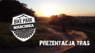
Bike Park Marcinka
- 4
- 5
- 1
- 3
Popular Tarnów Mountain Biking Trails
• 75 ★ 5.0 • 3,855 ft • 3 ft • 57 •
Łatwa trasa typu flow. Najdłuższa na terenie Bike Park Marcinka. Liczy ponad 20 bardzo płynnych band i zakrętów, występują na niej liczne łagodne muldy. Wymaga podstawowych umiejetnosci jak pokonywanie band ostrych zakretów -...
• 85 ★ 5.0 • 2,329 ft • 0 ft • 56 •
Trasa zjazdowe typu Flow przeznaczona dla zaawansowanych osób. Występują liczne ciasne i bardzo szybkie bandy, muldy oraz stoliki.
• 65 ★ 5.0 • 2,552 ft • 0 ft • 38 •
Trasa zjazdowa typu FR/DH, znajdują się na niej liczne uskoki i gapy.
• 50 ★ 5.0 • 2,300 ft • 295 ft • 38 •
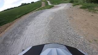
Jest to trasa podjazdowa, która pozwala dostać się z parkingu zlokalizowane przy Parku Biegowym Marcinka wprost na start tras zjazdowych.
• 20 ★ 0.0 • 246 ft • 0 ft • 15 •
Less popular black difficulty singletrack. This mountain bike primary trail can be used downhill only and has a moderate overall physical rating with a 0 ft green climb. It features berm, jump and gap jump. Trail visibility is always easy to follow. On average it takes minutes to complete this trail.
• 15 ★ 5.0 • 371 ft • 0 ft • 15 •
Odnoga prowadząca przez drop z palet, wąwóz wprost na step up
Tarnów Mountain Bike Routes
7 miles • 627 ft • 0 •
CC Route, from Raven Forest to St. Martin Hill. Very Easy and not to long. I recommend to go first to...
29 miles • 3,245 ft • 0 • Loop •
Start spod Mościckiego Centrum Kultury w Tarnowie. Pętla MTB, sporo technicznych odcinków leśnych,...
41 miles • 3,375 ft • 0 • Loop •
Trasa pozwalająca w szybki sposób dojechać z Tarnowa ( start spod Mościckiego Centrum Kultury ) w...
Photos of Tarnów Mountain Bike
Videos of Tarnów Mountain Bike

trail: Spycek
0:33 |
22 |
May 3, 2025

trail: Ukryta
0:16 |
25 |
Nov 5, 2022

trail: Przecinak
8:33 |
158 |
May 30, 2022 , Tarnów
trail: Teściu
8:33 |
289 |
May 30, 2022 , Tarnów
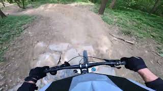
trail: Spycek
0:41 |
385 |
May 30, 2022 , Tarnów
trail: Przecinak
2:47 |
347 |
May 30, 2022 , Tarnów

trail: Spycek
8:33 |
643 |
May 28, 2022 , Tarnów

trail: Teściu
0:33 |
618 |
May 26, 2022 , Tarnów
Recent Trail Reports
| status | trail | date | condition | info | user |
|---|---|---|---|---|---|
| Droga dojazdowa | Apr 3, 2026 @ 2:51pm (Europe/Warsaw) Apr 3, 2026 | Wet | galaktycznyseba | ||
| BemBem | Apr 3, 2026 @ 2:51pm (Europe/Warsaw) Apr 3, 2026 | Ideal | galaktycznyseba | ||
| Spycek | Aug 27, 2025 @ 5:12pm Aug 27, 2025 | Ideal | Panek | ||
| Ukryta | Aug 27, 2025 @ 5:12pm Aug 27, 2025 | Unknown | Panek | ||
| Podkręcony #2 | Aug 27, 2025 @ 5:12pm Aug 27, 2025 | Ideal | Panek | ||
| Przecinak | Aug 27, 2025 @ 5:12pm Aug 27, 2025 | Dry | Panek | ||
| Baśka górna | Aug 27, 2025 @ 5:12pm Aug 27, 2025 | Ideal | Panek | ||
| Baśka dolna | Aug 27, 2025 @ 5:12pm Aug 27, 2025 | Ideal | Panek | ||
| Teściu | Jul 31, 2025 @ 5:32pm Jul 31, 2025 | Variable | Panek | ||
| Droga dojazdowa | Jul 31, 2025 @ 5:32pm Jul 31, 2025 | Variable | Panek |
Activity Feed
| username | action | type | title | date |
|---|---|---|---|---|
| galaktycznyseba | vote | trail | activity #92550832 | Apr 13, 2026 @ 11:47am Apr 13, 2026 |
| galaktycznyseba | add | report | activity #92060359 and 1 more | Apr 6, 2026 @ 9:37am Apr 6, 2026 |
| galaktycznyseba | vote | trail | activity #92059898 | Apr 6, 2026 @ 9:31am Apr 6, 2026 |
| AntoniDtZqrR | ridden | trail | activity #91992161 | Apr 5, 2026 @ 10:52am Apr 5, 2026 |
| galaktycznyseba | wishlist | trail | activity #90498115 and 8 more | Mar 13, 2026 @ 10:12am Mar 13, 2026 |
Local Badges
-

Epic Mountain Bike Climb 2k4 awarded -

Climbing 10k Badge7 awarded -

Mountain Biking 100k Badge0 awarded -

Epic Ride Descent 2k4 awarded -

Descent 10k Badge7 awarded -

Descent 100k Badge0 awarded
Bike & Skill Parks
| name | type | city | rating |
|---|---|---|---|
| Dirt park | skill park | Tarnów | |
| Step-up Lipie | skill park | Tarnów | |
| Pump Track Marcinka | skill park | Tarnów |
Local Mountain Biking Directory
-
Sport SerwisBike Shop
Activity Type Stats
| activitytype | trails | distance | descent | descent distance | total vertical | rating | global rank | state rank | photos | reports | routes | ridelogs |
|---|---|---|---|---|---|---|---|---|---|---|---|---|
| Mountain Bike | 20 | 4 miles | 1,444 ft | 2 miles | 397 ft | #3,585 | #71 | 17 | 317 | 7 | 4,402 | |
| E-Bike | 20 | 4 miles | 1,444 ft | 2 miles | 397 ft | #4,041 | #334 | 315 | 5 | 52 | ||
| Horse | 1 | 971 ft | 46 ft | 781 ft | 46 ft | #887 | #268 | 1 | ||||
| Hike | 13 | 2 miles | 230 ft | 2,631 ft | 397 ft | #7,008 | #134 | 281 | 77 | |||
| Trail Running | 13 | 2 miles | 230 ft | 2,631 ft | 397 ft | #6,442 | #128 | 281 | 11 |
Frequently Asked Questions About Tarnów
▼
What are the best places to ride in Tarnów?
Tarnów has 1 areas to explore for mountain biking. The top rated areas are:
▼
What are the highest rated mountain biking trails in Tarnów?
The highest rated mountain biking trails in Tarnów are:
- Podkręcony #2 (4.1/5)
- Ukryta (4.1/5)
- Spycek (4.1/5)
- Przecinak (4.1/5)
- Baśka górna (4.1/5)
▼
What is the best time of the year to ride in Tarnów?
Based on ride log data, the most popular months to ride in Tarnów are:
- July (15 activities)
- August (10 activities)
- April (6 activities)
▼
Where can I park to ride in Tarnów?
There are 4 parking locations listed in Tarnów. The most popular parking spots are: View all parking and trailhead locations on the map to plan your visit.
Activities
Trails
- tarnów activity log | embed map of Tarnów mountain bike trails | tarnów mountain biking points of interest
Downloading of trail gps tracks in kml & gpx formats is enabled for Tarnów.
You must login to download files.