close
-
Layers w
- Weather Layers
- Pro
- Pro
- Pro
- Pro
- Pro
- Pro
- More Layers
- Pro
- Pro
- Pro
- Pro
-
Upgrade to

3D
Trail Conditions
- Unknown
- Snow Groomed
- Snow Packed
- Snow Covered
- Snow Cover Partial
- Freeze/thaw Cycle
- Icy
- Prevalent Mud
- Wet
- Variable
- Ideal
- Dry
- Very Dry
Trail Flow (Ridden Direction)
Trailforks scans users ridelogs to determine the most popular direction each trail is ridden. A good flowing trail network will have most trails flowing in a single direction according to their intension.
The colour categories are based on what percentage of riders are riding a trail in its intended direction.
The colour categories are based on what percentage of riders are riding a trail in its intended direction.
- > 96%
- > 90%
- > 80%
- > 70%
- > 50%
- < 50%
- bi-directional trail
- no data
Trail Last Ridden
Trailforks scans ridelogs to determine the last time a trail was ridden.
- < 2 days
- < 1 week
- < 2 weeks
- < 1 month
- < 6 months
- > 6 months
Trail Ridden Direction
The intended direction a trail should be ridden.
- Downhill Only
- Downhill Primary
- Both Directions
- Uphill Primary
- Uphill Only
- One Direction
Contribute Details
Colors indicate trail is missing specified detail.
- Description
- Photos
- Description & Photos
- Videos
Trail Popularity ?
Trailforks scans ridelogs to determine which trails are ridden the most in the last 9 months.
Trails are compared with nearby trails in the same city region with a possible 25 colour shades.
Think of this as a heatmap, more rides = more kinetic energy = warmer colors.
- most popular
- popular
- less popular
- not popular
ATV/ORV/OHV Filter
Max Vehicle Width
inches
US Cell Coverage
Legend

Radar Time
Activity Recordings
Trailforks uses anonymized public activity data.
?
Activity Recordings
Trailforks uses anonymized public activity data.
?
Personal Heatmap
▶
Activity Types
all
/
none
▶
Options
2
Date range
month
–
Winter Trails
Warning
A routing network for winter maps does not exist. Selecting trails using the winter trails layer has been disabled.
Missing Trails
Most Popular
Least Popular
Trails are colored based on popularity. The more popular a trail is, the more red. Less popular trails trend towards green.
Jump Magnitude Heatmap
Heatmap of where riders jump on trails. Zoom in to see individual jumps, click circles to view jump details.
BC Backroad Status
![map legend]()
Service Road Atlas is a free to use, community-driven service for viewing and creating reports on the numerous back-country service roads around B.C. and Alberta.

Slope Aspect
Direction the slope faces
Trails Deemphasized
Trails are shown in grey.
Only show trails with no bike usage.
Suggested Layers
Based on selected activity type
Save the current map location and zoom level as your default home location whenever this page is loaded.
Save
No description for Tàrrega has been added yet!
Login or register to submit one.
This region uses the Uk/Euro style trail grading system.
Activities Click to view
- Mountain Bike
95 trails
- E-Bike
95 trails
- Adaptive Bike
0 trails
- Hike
94 trails
- Trail Running
94 trails
Region Details
- 44
- 36
- 10
- 3
Region Status
Caution as of May 14, 2026Stats
- Avg Trail Rating
- Trails (view details)
- 93
- Trails Mountain Bike
- 95
- Trails E-Bike
- 95
- Trails Horse
- 2
- Trails Hike
- 94
- Trails Trail Running
- 94
- Total Distance
- 59 miles
- Total Descent Distance
- 23 miles
- Total Descent
- 6,305 ft
- Total Vertical
- 948 ft
- Highest Trailhead
- 1,992 ft
- Reports
- 66
- Photos
- 2
- Ridden Counter
- 1,226
Sub Regions
-
Serra d'Almenara - Agramunt
- 15
- 4
Popular Tàrrega Mountain Biking Trails
• 95 ★ 0.0 • 2,375 ft • 27 ft • 38 •
Esasy trail, you can ride it in both directions to link with
• 55 ★ 3.0 • 1,440 ft • 53 ft • 37 •
Singletrack bidireccional pero amb fort desnivell, a la meitat del sender trobareu una trinxera/bunker de la guerra civil.
• 55 ★ 2.0 • 5,098 ft • 60 ft • 37 •
Singletrack bidireccional pero amb fort desnivell, a la meitat del sender trobareu una trinxera/bunker de la guerra civil.
• 95 ★ 3.0 • 1 mile • 56 ft • 36 •
Popular green difficulty singletrack. This multi-use trail can be used both directions. On average it takes 5 minutes to complete this trail.
• 50 ★ 0.0 • 1 mile • 129 ft • 36 •
Singletrack bidireccional pero amb fort desnivell, a la meitat del sender trobareu una trinxera/bunker de la guerra civil.
• 60 ★ 3.0 • 2,018 ft • 107 ft • 32 •
Sender rapid que enllaça el creuament dels Quatre camins amb el camí Verdu-Granyena, bidireccional
• 85 ★ 4.0 • 2 miles • 241 ft • 28 •
Primer tram d'aquest sender trenca-cames interminable. Els diferents trams discorren per terreny àrid amb poca vegetació i sovint passos sobre roca i algun petit drop, on es succeeixen pujades i baixades. Es divideix en diferents...
• 70 ★ 0.0 • 1,959 ft • 0 ft • 28 •
Singletrack bidireccional pero amb fort desnivell, a la meitat del sender trobareu una trinxera/bunker de la guerra civil.
Tàrrega Mountain Bike Routes
39 miles • 1,817 ft • 1 • Loop •
Agrumunt to Artesa direct though small towns on dirt roads
Videos of Tàrrega Mountain Bike
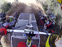
trail: Garrigues
0:50 |
260 |
Dec 21, 2013
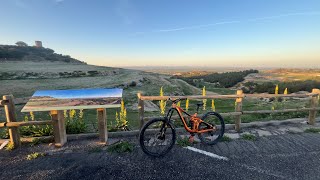
trail: Lo Desfiladero
4:30 |
124 |
Apr 14, 2024 , Tàrrega

trail: Garrigues
3:29 |
84 |
Jun 27, 2010
Recent Trail Reports
| status | trail | date | condition | info | user |
|---|---|---|---|---|---|
| Codina | Apr 17, 2025 @ 1:03am Apr 17, 2025 | Ideal | totheparrots | ||
| Lo Desfiladero | Sep 11, 2024 @ 8:18am Sep 11, 2024 | Variable | bandidos | ||
| Serra de Bellmunt 1 | Sep 11, 2024 @ 8:18am Sep 11, 2024 | Dry | bandidos | ||
| Serrallonga | Apr 24, 2024 @ 11:48am Apr 24, 2024 | Dry | Locuiner | ||
| Cal Torrillo | Apr 24, 2024 @ 11:48am Apr 24, 2024 | Dry | Locuiner | ||
| Conector | Apr 24, 2024 @ 11:48am Apr 24, 2024 | Dry | Locuiner | ||
| PR la Donzell | Apr 24, 2024 @ 11:48am Apr 24, 2024 | Dry | Locuiner | ||
| 4 camins (dreta) | Apr 12, 2024 @ 8:00am Apr 12, 2024 | Dry | Improving | ||
| La guineu | Apr 12, 2024 @ 8:00am Apr 12, 2024 | Dry | Improving | ||
| Enllaç Antiguineu-La Guineu | Apr 12, 2024 @ 8:00am Apr 12, 2024 | Dry | Improving |
Activity Feed
| username | action | type | title | date |
|---|---|---|---|---|
| snaker4 | update | region | activity #94966263 | May 18, 2026 @ 3:32am May 18, 2026 |
| snaker4 | update | route | activity #94966235 | May 18, 2026 @ 3:31am May 18, 2026 |
| eGANTXyV | add | route | activity #94966217 | May 18, 2026 @ 3:30am May 18, 2026 |
| totheparrots | add | report | activity #69786562 | Apr 17, 2025 @ 1:08am Apr 17, 2025 |
| totheparrots | add | trail | activity #61653656 | Nov 12, 2024 @ 2:06am Nov 12, 2024 |
Local Badges
-

Epic Mountain Bike Climb 2k3 awarded -

Climbing 10k Badge6 awarded -

Mountain Biking 100k Badge0 awarded -

Epic Ride Descent 2k3 awarded -

Descent 10k Badge6 awarded -

Descent 100k Badge0 awarded
Bike & Skill Parks
| name | type | city | rating |
|---|---|---|---|
| Indkørsel til Bellpuig mx | skill park | Tàrrega |
Activity Type Stats
| activitytype | trails | distance | descent | descent distance | total vertical | rating | global rank | state rank | photos | reports | routes | ridelogs |
|---|---|---|---|---|---|---|---|---|---|---|---|---|
| Mountain Bike | 95 | 59 miles | 6,306 ft | 23 miles | 948 ft | #6,049 | #329 | 66 | 1 | 1,119 | ||
| E-Bike | 95 | 59 miles | 6,306 ft | 23 miles | 948 ft | #2,391 | #304 | 2 | 65 | 1 | 28 | |
| Horse | 2 | 1,266 ft | 184 ft | 62 ft | ||||||||
| Hike | 94 | 58 miles | 6,093 ft | 22 miles | 948 ft | #3,851 | #272 | 66 | 20 | |||
| Trail Running | 94 | 58 miles | 6,093 ft | 22 miles | 948 ft | #3,269 | #263 | 66 | 135 |
Frequently Asked Questions About Tàrrega
▼
What are the best places to ride in Tàrrega?
Tàrrega has 1 areas to explore for mountain biking. The top rated areas are:
▼
What are the highest rated mountain biking trails in Tàrrega?
The highest rated mountain biking trails in Tàrrega are:
- Serrallonga (4.1/5)
- Cal Torrillo (4.1/5)
- La guineu (4/5)
- Serra de Bellmunt 1 (4/5)
- PR la Donzell (4/5)
▼
What is the best time of the year to ride in Tàrrega?
Based on ride log data, the most popular months to ride in Tàrrega are:
- April (2 activities)
- March (1 activities)
▼
Where can I park to ride in Tàrrega?
There are 2 parking locations listed in Tàrrega. The most popular parking spots are:
Activities
Trails
- By totheparrots
 & contributors
 - Admins: snaker4, kai-bcn, EdgarSoler
- #41307 - 918 views
- tàrrega activity log | embed map of Tàrrega mountain bike trails | tàrrega mountain biking points of interest
Downloading of trail gps tracks in kml & gpx formats is enabled for Tàrrega.
You must login to download files.