close
-
Layers w
- Weather Layers
- Pro
- Pro
- Pro
- Pro
- Pro
- Pro
- More Layers
- Pro
- Pro
- Pro
- Pro
-
Upgrade to

3D
Trail Conditions
- Unknown
- Snow Groomed
- Snow Packed
- Snow Covered
- Snow Cover Partial
- Freeze/thaw Cycle
- Icy
- Prevalent Mud
- Wet
- Variable
- Ideal
- Dry
- Very Dry
Trail Flow (Ridden Direction)
Trailforks scans users ridelogs to determine the most popular direction each trail is ridden. A good flowing trail network will have most trails flowing in a single direction according to their intension.
The colour categories are based on what percentage of riders are riding a trail in its intended direction.
The colour categories are based on what percentage of riders are riding a trail in its intended direction.
- > 96%
- > 90%
- > 80%
- > 70%
- > 50%
- < 50%
- bi-directional trail
- no data
Trail Last Ridden
Trailforks scans ridelogs to determine the last time a trail was ridden.
- < 2 days
- < 1 week
- < 2 weeks
- < 1 month
- < 6 months
- > 6 months
Trail Ridden Direction
The intended direction a trail should be ridden.
- Downhill Only
- Downhill Primary
- Both Directions
- Uphill Primary
- Uphill Only
- One Direction
Contribute Details
Colors indicate trail is missing specified detail.
- Description
- Photos
- Description & Photos
- Videos
Trail Popularity ?
Trailforks scans ridelogs to determine which trails are ridden the most in the last 9 months.
Trails are compared with nearby trails in the same city region with a possible 25 colour shades.
Think of this as a heatmap, more rides = more kinetic energy = warmer colors.
- most popular
- popular
- less popular
- not popular
ATV/ORV/OHV Filter
Max Vehicle Width
inches
US Cell Coverage
Legend

Radar Time
Activity Recordings
Trailforks uses anonymized public activity data.
?
Activity Recordings
Trailforks uses anonymized public activity data.
?
Personal Heatmap
▶
Activity Types
all
/
none
▶
Options
2
Date range
month
–
Winter Trails
Warning
A routing network for winter maps does not exist. Selecting trails using the winter trails layer has been disabled.
Missing Trails
Most Popular
Least Popular
Trails are colored based on popularity. The more popular a trail is, the more red. Less popular trails trend towards green.
Jump Magnitude Heatmap
Heatmap of where riders jump on trails. Zoom in to see individual jumps, click circles to view jump details.
BC Backroad Status
![map legend]()
Service Road Atlas is a free to use, community-driven service for viewing and creating reports on the numerous back-country service roads around B.C. and Alberta.

Slope Aspect
Direction the slope faces
Trails Deemphasized
Trails are shown in grey.
Only show trails with no bike usage.
Suggested Layers
Based on selected activity type
Save the current map location and zoom level as your default home location whenever this page is loaded.
SaveSomersets County Town, being nestled between the Blackdown and Quantock Hills, and within a short distance from Exmoor is within reach of great riding. As well as being situated on the M5 making it easily accessible from other towns.
This region uses the Uk/Euro style trail grading system.
Activities Click to view
- Mountain Bike
166 trails
- E-Bike
143 trails
- Gravel Bike
0 trails
- Adaptive Bike
0 trails
- Winter Fat Bike
0 trails
- Horse
39 trails
- Hike
132 trails
- Trail Running
131 trails
Region Details
- 60
- 3
- 33
- 45
- 21
- 4
Region Status
Open as of May 27, 2026Stats
- Avg Trail Rating
- Trails (view details)
- 167
- Trails Mountain Bike
- 166
- Trails E-Bike
- 143
- Trails Horse
- 39
- Trails Hike
- 132
- Trails Trail Running
- 131
- Total Distance
- 85 miles
- Total Descent
- 23,827 ft
- Total Vertical
- 1,074 ft
- Highest Trailhead
- 1,245 ft
- Reports
- 1,013
- Photos
- 304
- Ridden Counter
- 22,988
Sub Regions
-
Blackdown Hills
- 4
-
Kings Cliff
- 4
- 4
- 2
-
Quantock Hills
- 3
- 25
- 39
- 14
- 3
-
Wych Lodge
- 2
- 5
- 1
Popular Taunton Mountain Biking Trails
• 100 ★ 4.0 • 912 ft • 0 ft • 445 •
Popular blue difficulty singletrack. This mountain bike primary trail can be used downhill primary. On average it takes 6 minutes to complete this trail.
• 80 ★ 4.0 • 3,077 ft • 11 ft • 401 •
Trail contains two man-made drops One small one in after entering the tree line, avoid line is to the left. One larger one further on, avoid-line is to the right. leads straight into Somerton Combe after a sharp right hander after the...
• 80 ★ 3.5 • 3,169 ft • 11 ft • 389 •
Trail contains two man-made drops One small one in after entering the tree line, avoid line is to the left. One larger one further on, avoid-line is to the right. leads straight into Somerton Combe after a sharp right hander after the...
• 100 ★ 4.4 • 879 ft • 0 ft • 366 •
Popular blue difficulty singletrack. This mountain bike primary trail can be used downhill primary. On average it takes 1 minutes to complete this trail.
• 100 ★ 5.0 • 1,417 ft • 0 ft • 362 •
2 of 3 jumps tracks. All of which start on the same . Can be extended by following Race Track 2. Race Track 2 + = Triscombe DH Jump Track full run
• 85 ★ 3.5 • 1 mile • 352 ft • 344 •
Popular green difficulty mixed. This mountain bike primary trail can be used both directions and has a hard overall physical rating with a 352 ft black diamond climb. On average it takes 29 minutes to complete this trail.
• 85 ★ 4.6 • 4,931 ft • 3 ft • 336 •
A Quantocks mtb magazine route and guidebook favourite. A steep fast, flat out descent that leads to a winding criss-crossing singletrack and a few stream crossings. Not technical, just flat out fun. Be wary of the getting caught in a...
• 95 ★ 4.0 • 478 ft • 28 ft • 329 •
Popular blue difficulty singletrack. This mountain bike primary trail can be used downhill primary and has a moderate overall physical rating. It features drop and jump. On average it takes minutes to complete this trail.
Taunton Mountain Bike Routes
★ 5.0 • 19 miles • 2,481 ft • 5 • Loop •
Quantocks Killer Loop from MBR June 2011
★ 5.0 • 17 miles • 2,029 ft • 3 •
This route ticks off almost all of the classics. Alongside the plentiful flowing, natural singletrack,...
★ 5.0 • 12 miles • 1,844 ft • 8 • Out & Back •
A loop that shows both common ways up to the Quantock Ridge. descents: bincombe, , higher hare knap ->...
★ 5.0 • 14 miles • 1,961 ft • 9 •
Quantock Trail Riders route for the 1st Anniversary ride Saturday, 21 September 2019 at 10:00...
★ 5.0 • 12 miles • 961 ft • 0 • Loop •
This is a shared cycle and walking bridleway which forms a loop around Staple Fitzpaine in the beautiful...
★ 3.5 • 12 miles • 1,787 ft • 8 •
QTR - Social #1 Quantock Trail Riders Group : https://www.facebook.com/groups/231012140901430/
Photos of Taunton Mountain Bike
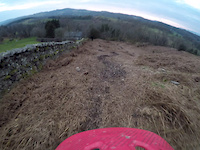
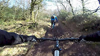
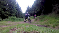
Videos of Taunton Mountain Bike

trail: Old Grumpy DH
2:03 |
151 |
Oct 7, 2021

0:50 |
70 |
May 23, 2021

trail: Old Grumpy DH
0:46 |
101 |
May 21, 2021

trail: Ski Run
3:12 |
178 |
May 11, 2021

trail: Jump Track 2 DH
0:00 |
432 |
Dec 9, 2020
trail: Track
0:13 |
67 |
Mar 6, 2020
0:44 |
565 |
Apr 24, 2018
0:30 |
573 |
Jun 26, 2016
Current Trail Warnings
| status | trail | date | condition | user | info |
|---|---|---|---|---|---|
| Bin Lid | May 23, 2026 @ 10:28am (Europe/London) May 23, 2026 | Dry | HardtailJu |
Recent Trail Reports
| status | trail | date | condition | info | user |
|---|---|---|---|---|---|
| Bincombe | May 24, 2026 @ 3:29pm (Europe/London) May 24, 2026 | Ideal | OllyIm | ||
| Five Lords Singletrack | May 24, 2026 @ 3:29pm (Europe/London) May 24, 2026 | Dry | OllyIm | ||
| Dark Tunnel | May 24, 2026 @ 3:29pm (Europe/London) May 24, 2026 | Ideal | OllyIm | ||
| Sweep | May 24, 2026 @ 3:29pm (Europe/London) May 24, 2026 | Ideal | OllyIm | ||
| Frog Combe | May 24, 2026 @ 3:29pm (Europe/London) May 24, 2026 | Variable | OllyIm | ||
| Forest Track | May 23, 2026 @ 10:28am (Europe/London) May 23, 2026 | Ideal | HardtailJu | ||
| Fire Road | May 23, 2026 @ 10:28am (Europe/London) May 23, 2026 | Dry | HardtailJu | ||
| Fire Road (Great Wood) | May 23, 2026 @ 10:28am (Europe/London) May 23, 2026 | Ideal | HardtailJu | ||
| Seven Wells Wood | May 23, 2026 @ 10:28am (Europe/London) May 23, 2026 | Ideal | HardtailJu | ||
| Great Bear | May 23, 2026 @ 10:28am (Europe/London) May 23, 2026 | Ideal | HardtailJu |
Activity Feed
| username | action | type | title | date |
|---|---|---|---|---|
| Ben-studley | ridden | trail | activity #96591859 | Jun 9, 2026 @ 2:05am Jun 9, 2026 |
| MattReynolds6 | checkin | route | activity #96278662 | Jun 4, 2026 @ 11:31pm Jun 4, 2026 |
| MattReynolds6 | ridden | route | activity #96278661 | Jun 4, 2026 @ 11:31pm Jun 4, 2026 |
| MattReynolds6 | wishlist | route | activity #96214878 | Jun 4, 2026 @ 3:44am Jun 4, 2026 |
| trailforks | add | video | activity #95750213 | May 28, 2026 @ 7:00pm May 28, 2026 |
Recent Comments
| username | type | title | comment | date |
|---|---|---|---|---|
| trail | G | Aug 9, 2025 @ 3:14am Aug 9, 2025 | ||
| trail | Not a blue. Nice flowing start and a... | Jun 17, 2023 @ 10:01am Jun 17, 2023 | ||
| trail | A great descent, a real challenge. Steeper... | Jun 10, 2021 @ 11:45am Jun 10, 2021 | ||
| trail | Would highly recommend that you come and check... | Mar 29, 2021 @ 6:40pm Mar 29, 2021 | ||
| trail | Steep and technical, properly tricky if it’s... | Oct 10, 2020 @ 10:50am Oct 10, 2020 |
Local Badges
-

Epic Ride Climb 2k42 awarded -

Climbing 10k Badge82 awarded -

Climbing 100k Badge12 awarded -

Epic Ride Descent 2k49 awarded -

Descent 10k Badge82 awarded -

Descent 100k Badge12 awarded
Bike & Skill Parks
| name | type | city | rating |
|---|---|---|---|
| Taunton BMX Track | skill park | Taunton |
Activity Type Stats
| activitytype | trails | distance | descent | descent distance | total vertical | rating | global rank | state rank | photos | reports | routes | ridelogs |
|---|---|---|---|---|---|---|---|---|---|---|---|---|
| Mountain Bike | 166 | 83 miles | 23,455 ft | 47 miles | 1,073 ft | #735 | #30 | 290 | 1,013 | 22 | 19,949 | |
| E-Bike | 143 | 72 miles | 21,024 ft | 41 miles | 971 ft | #940 | #49 | 966 | 2 | 2,432 | ||
| Horse | 39 | 26 miles | 4,009 ft | 10 miles | 896 ft | #643 | #26 | 237 | ||||
| Hike | 132 | 76 miles | 17,280 ft | 39 miles | 1,073 ft | #1,315 | #35 | 14 | 949 | 1 | 465 | |
| Trail Running | 131 | 76 miles | 17,080 ft | 38 miles | 1,073 ft | #1,530 | #37 | 947 | 1 | 536 |
Frequently Asked Questions About Taunton
▼
What are the best places to ride in Taunton?
Taunton has 4 areas to explore for mountain biking. The top rated areas are:
▼
What are the highest rated mountain biking trails in Taunton?
The highest rated mountain biking trails in Taunton are:
- Original Triscombe DH split 2 (4.4/5)
- Frog Combe Singletrack (4.3/5)
- Bincombe (4.3/5)
- Weacombe Descent (4.3/5)
- Bicknoller Combe (4.3/5)
▼
What is the best time of the year to ride in Taunton?
Based on ride log data, the most popular months to ride in Taunton are:
- April (67 activities)
- September (61 activities)
- May (56 activities)
▼
Where can I park to ride in Taunton?
There are 10 parking locations listed in Taunton. The most popular parking spots are:
- Triscombe Stone Car Park
- Lydeard Hill Car Park
- Dead Woman's Ditch Car Park
- Holford Bowling Green Car Park
- Sandy Beds Car Park
Activities
Trails
- By 20twenty-p
 TVTA & contributors
 - Admins: wisey, MathieuC, cemoorelife, Canopy
- #5949 - 14,092 views
- taunton activity log | embed map of Taunton mountain bike trails | taunton mountain biking points of interest
Downloading of trail gps tracks in kml & gpx formats is enabled for Taunton.
You must login to download files.