close
-
Layers w
- Weather Layers
- Pro
- Pro
- Pro
- Pro
- Pro
- Pro
- More Layers
- Pro
- Pro
- Pro
- Pro
-
Upgrade to

3D
Trail Conditions
- Unknown
- Snow Groomed
- Snow Packed
- Snow Covered
- Snow Cover Partial
- Freeze/thaw Cycle
- Icy
- Prevalent Mud
- Wet
- Variable
- Ideal
- Dry
- Very Dry
Trail Flow (Ridden Direction)
Trailforks scans users ridelogs to determine the most popular direction each trail is ridden. A good flowing trail network will have most trails flowing in a single direction according to their intension.
The colour categories are based on what percentage of riders are riding a trail in its intended direction.
The colour categories are based on what percentage of riders are riding a trail in its intended direction.
- > 96%
- > 90%
- > 80%
- > 70%
- > 50%
- < 50%
- bi-directional trail
- no data
Trail Last Ridden
Trailforks scans ridelogs to determine the last time a trail was ridden.
- < 2 days
- < 1 week
- < 2 weeks
- < 1 month
- < 6 months
- > 6 months
Trail Ridden Direction
The intended direction a trail should be ridden.
- Downhill Only
- Downhill Primary
- Both Directions
- Uphill Primary
- Uphill Only
- One Direction
Contribute Details
Colors indicate trail is missing specified detail.
- Description
- Photos
- Description & Photos
- Videos
Trail Popularity ?
Trailforks scans ridelogs to determine which trails are ridden the most in the last 9 months.
Trails are compared with nearby trails in the same city region with a possible 25 colour shades.
Think of this as a heatmap, more rides = more kinetic energy = warmer colors.
- most popular
- popular
- less popular
- not popular
ATV/ORV/OHV Filter
Max Vehicle Width
inches
US Cell Coverage
Legend

Radar Time
Activity Recordings
Trailforks uses anonymized public activity data.
?
Activity Recordings
Trailforks uses anonymized public activity data.
?
Personal Heatmap
▶
Activity Types
all
/
none
▶
Options
2
Date range
month
–
Winter Trails
Warning
A routing network for winter maps does not exist. Selecting trails using the winter trails layer has been disabled.
Missing Trails
Most Popular
Least Popular
Trails are colored based on popularity. The more popular a trail is, the more red. Less popular trails trend towards green.
Jump Magnitude Heatmap
Heatmap of where riders jump on trails. Zoom in to see individual jumps, click circles to view jump details.
BC Backroad Status
![map legend]()
Service Road Atlas is a free to use, community-driven service for viewing and creating reports on the numerous back-country service roads around B.C. and Alberta.

Slope Aspect
Direction the slope faces
Trails Deemphasized
Trails are shown in grey.
Only show trails with no bike usage.
Suggested Layers
Based on selected activity type
Save the current map location and zoom level as your default home location whenever this page is loaded.
SaveTaunus Hills overlooking Wiesbaden
Primary Trail Type: Cross-Country
Land Status: State Forest
 google parking directions
This region uses the Uk/Euro style trail grading system.
Activities Click to view
- Mountain Bike
15 trails
- E-Bike
15 trails
- Hike
14 trails
- Trail Running
14 trails
Region Details
- 4
- 4
- 3
- 1
Region Status
Open as of Jun 13, 2026Stats
- Avg Trail Rating
- Trails (view details)
- 12
- Trails Mountain Bike
- 15
- Trails E-Bike
- 15
- Trails Hike
- 14
- Trails Trail Running
- 14
- Total Distance
- 9 miles
- Total Descent
- 2,044 ft
- Total Vertical
- 1,190 ft
- Highest Trailhead
- 1,913 ft
- Reports
- 55
- Photos
- 54
- Ridden Counter
- 468
Popular Taunus Mountain Biking Trails
Gravity Trail Schläferskopf Permanently Closed
• 40 ★ 4.8 • 4,806 ft • 0 ft • 141 •
Rocky powerline trail. The beginning 2 sections are a bit more steep and technical, the rest of the trail gets more mellow and flowy. In general the trail offers a lot of jumps, gaps and drops. Perfect, if you're looking for air time.
• 75 ★ 4.8 • 646 ft • 0 ft • 27 •
Popular blue difficulty singletrack. This mountain bike primary trail can be used downhill primary. Trail visibility is always easy to follow. On average it takes minutes to complete this trail.
• 50 ★ 4.0 • 3,720 ft • 0 ft • 18 •
Moderately popular green difficulty singletrack. This mountain bike primary trail can be used downhill primary. Trail visibility is always easy to follow. On average it takes 10 minutes to complete this trail.
• 35 ★ 0.0 • 2,096 ft • 0 ft • 12 •
Less popular green difficulty singletrack. This mountain bike primary trail can be used both directions. On average it takes 2 minutes to complete this trail.
• 15 ★ 5.0 • 3,399 ft • 0 ft • 9 •
Flowiger Trail mit kleinem Kicker, der umfahren werden kann. Angenehmes Gefälle, gut zu sehen.
• 5 ★ 0.0 • 1,721 ft • 38 ft • 4 •
Visibility of the track is not ideal. There are some tracks but they arnt that obvious. Follow the accessroad down until it looks like there are some tracks of the abondon road. then follow the GPS coords down. The middle part is not...
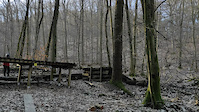
Photos of Taunus Mountain Bike
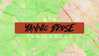
Videos of Taunus Mountain Bike
trail: Gravity Trail Schläferskopf
0:12 |
501 |
Mar 8, 2021
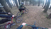
trail: Gravity Trail Schläferskopf
0:41 |
1026 |
Apr 10, 2016
trail: Gravity Trail Schläferskopf
4:37 |
397 |
Aug 2, 2022 , Wiesbaden
Recent Trail Reports
| status | trail | date | condition | info | user |
|---|---|---|---|---|---|
| Gravity Trail Schläferskopf | Jun 13, 2026 @ 2:10pm (Europe/Berlin) Jun 13, 2026 | Unknown | MarcelGIpBc0 | ||
| Rassel Trail | May 1, 2026 @ 12:19am (Europe/Berlin) Apr 30, 2026 | Ideal | letsgosurfin | ||
| Gravity Trail climb | May 15, 2025 @ 11:41am May 15, 2025 | Very Dry | JeanMirage | ||
| Rassel Ost | Oct 8, 2023 @ 4:26am Oct 8, 2023 | Dry | nitro-nik | ||
| Schlaferskopf DH Climb | Aug 20, 2022 @ 1:28am Aug 20, 2022 | Ideal | ShawnStang | ||
| Shortcut down to Obernhain | Apr 18, 2019 @ 7:35am Apr 18, 2019 | Dry | xtcccc |
Activity Feed
| username | action | type | title | date |
|---|---|---|---|---|
| MarcelGIpBc0 | comment | trail | activity #96864769 | Jun 13, 2026 @ 5:13am Jun 13, 2026 |
| MarcelGIpBc0 | add | report | activity #96864553 | Jun 13, 2026 @ 5:10am Jun 13, 2026 |
| mtjbjet | wishlist | trail | activity #94008917 | May 3, 2026 @ 11:47pm May 3, 2026 |
| letsgosurfin | add | report | activity #93737733 | Apr 30, 2026 @ 3:19pm Apr 30, 2026 |
| DIM89ON | wishlist | region | activity #93420002 | Apr 26, 2026 @ 2:15am Apr 26, 2026 |
Recent Comments
| username | type | title | comment | date |
|---|---|---|---|---|
| trail | Trail is inofficially usable again especially... | Jun 13, 2026 @ 5:13am Jun 13, 2026 | ||
| trail | It was closed 1,5 year ago. I hoped that for... | Sep 16, 2023 @ 6:07am Sep 16, 2023 | ||
| trail | Is not closed, rode today. | Sep 16, 2023 @ 3:54am Sep 16, 2023 | ||
| trail | IT is Closed and IT seems it requires some... | May 7, 2022 @ 5:26am May 7, 2022 |
Nearby Areas
| name | distance | ||||
|---|---|---|---|---|---|
| Platte | 14 | 11 | 2.8 km | ||
| Flowtrail am Hahnwald | 2 | 1 | 6.2 km | ||
| Flowtrail Heidenrod | 1 | 2 | 9.2 km | ||
| Staufen | 4 | 2 | 11.1 km | ||
| Flowtrail Stromberg | 2 | 1 | 21.6 km |
Activity Type Stats
| activitytype | trails | distance | descent | descent distance | total vertical | rating | global rank | state rank | photos | reports | routes | ridelogs |
|---|---|---|---|---|---|---|---|---|---|---|---|---|
| Mountain Bike | 15 | 9 miles | 2,044 ft | 4 miles | 1,191 ft | #3,335 | #40 | 54 | 57 | 1,860 | ||
| E-Bike | 15 | 9 miles | 2,044 ft | 4 miles | 1,191 ft | #2,831 | #56 | 43 | 268 | |||
| Hike | 14 | 8 miles | 1,391 ft | 3 miles | 1,191 ft | #4,378 | #56 | 43 | 71 | |||
| Trail Running | 14 | 8 miles | 1,391 ft | 3 miles | 1,191 ft | #3,510 | #53 | 43 | 13 |
Frequently Asked Questions About Taunus
▼
What are the highest rated mountain biking trails in Taunus?
The highest rated mountain biking trails in Taunus are:
- Rassel Trail (4.3/5)
- Rassel Ost (4.1/5)
- Hallgarter Zange east down (4/5)
- Unkenbaum-Trail (0/5)
- Shortcut down to Obernhain (0/5)
▼
What is the best time of the year to ride in Taunus?
Based on ride log data, the most popular months to ride in Taunus are:
- June (28 activities)
- September (20 activities)
- April (18 activities)
▼
Where can I park to ride in Taunus?
There are 2 parking locations listed in Taunus. The most popular parking spots are:
▼
What is the longest trail in Taunus?
The longest trail in Taunus is Hallgarter Zange east down at 1.1 km. View all trails sorted by distance.
- By bikrboy38 & contributors
- Admins: apply
- #11477 - 8,059 views
- taunus activity log | embed map of Taunus mountain bike trails | taunus mountain biking points of interest
Downloading of trail gps tracks in kml & gpx formats is enabled for Taunus.
You must login to download files.