close
-
Layers w
- Weather Layers
- Pro
- Pro
- Pro
- Pro
- Pro
- Pro
- More Layers
- Pro
- Pro
- Pro
- Pro
-
Upgrade to

3D
Trail Conditions
- Unknown
- Snow Groomed
- Snow Packed
- Snow Covered
- Snow Cover Partial
- Freeze/thaw Cycle
- Icy
- Prevalent Mud
- Wet
- Variable
- Ideal
- Dry
- Very Dry
Trail Flow (Ridden Direction)
Trailforks scans users ridelogs to determine the most popular direction each trail is ridden. A good flowing trail network will have most trails flowing in a single direction according to their intension.
The colour categories are based on what percentage of riders are riding a trail in its intended direction.
The colour categories are based on what percentage of riders are riding a trail in its intended direction.
- > 96%
- > 90%
- > 80%
- > 70%
- > 50%
- < 50%
- bi-directional trail
- no data
Trail Last Ridden
Trailforks scans ridelogs to determine the last time a trail was ridden.
- < 2 days
- < 1 week
- < 2 weeks
- < 1 month
- < 6 months
- > 6 months
Trail Ridden Direction
The intended direction a trail should be ridden.
- Downhill Only
- Downhill Primary
- Both Directions
- Uphill Primary
- Uphill Only
- One Direction
Contribute Details
Colors indicate trail is missing specified detail.
- Description
- Photos
- Description & Photos
- Videos
Trail Popularity ?
Trailforks scans ridelogs to determine which trails are ridden the most in the last 9 months.
Trails are compared with nearby trails in the same city region with a possible 25 colour shades.
Think of this as a heatmap, more rides = more kinetic energy = warmer colors.
- most popular
- popular
- less popular
- not popular
ATV/ORV/OHV Filter
Max Vehicle Width
inches
US Cell Coverage
Legend

Radar Time
Activity Recordings
Trailforks uses anonymized public activity data.
?
Activity Recordings
Trailforks uses anonymized public activity data.
?
Personal Heatmap
▶
Activity Types
all
/
none
▶
Options
2
Date range
month
–
Winter Trails
Warning
A routing network for winter maps does not exist. Selecting trails using the winter trails layer has been disabled.
Missing Trails
Most Popular
Least Popular
Trails are colored based on popularity. The more popular a trail is, the more red. Less popular trails trend towards green.
Jump Magnitude Heatmap
Heatmap of where riders jump on trails. Zoom in to see individual jumps, click circles to view jump details.
BC Backroad Status
![map legend]()
Service Road Atlas is a free to use, community-driven service for viewing and creating reports on the numerous back-country service roads around B.C. and Alberta.

Slope Aspect
Direction the slope faces
Trails Deemphasized
Trails are shown in grey.
Only show trails with no bike usage.
Suggested Layers
Based on selected activity type
Save the current map location and zoom level as your default home location whenever this page is loaded.
Save
No description for Telluride has been added yet!
Login or register to submit one.
Activities Click to view
- Mountain Bike
113 trails
- E-Bike
61 trails
- Gravel Bike
0 trails
- Adaptive Bike
0 trails
- Winter Fat Bike
0 trails
- Horse
41 trails
- Hike
134 trails
- Trail Running
124 trails
- Dirtbike/Moto
13 trails
- ATV/ORV/OHV
12 trails
- Snowshoe
4 trails
- Downhill Ski
170 trails
- Backcountry Ski
2 trails
- Nordic Ski
8 trails
Region Details
- 19
- 7
- 15
- 47
- 22
- 5
Region Status
Caution as of Jun 9, 2026Stats
- Avg Trail Rating
- Trails (view details)
- 330
- Trails Mountain Bike
- 113
- Trails E-Bike
- 61
- Trails Horse
- 41
- Trails Hike
- 134
- Trails Trail Running
- 124
- Trails Dirtbike/Moto
- 13
- Trails ATV/ORV/OHV
- 12
- Trails Snowshoe
- 4
- Trails Downhill Ski
- 180
- Trails Backcountry Ski
- 2
- Trails Nordic Ski
- 8
- Total Distance
- 400 miles
- Total Descent
- 164,788 ft
- Total Vertical
- 6,309 ft
- Highest Trailhead
- 14,228 ft
- Reports
- 1,300
- Photos
- 343
- Ridden Counter
- 45,058
Articles

Video: Ode to Mountain Biking in Telluride, Colorado in 'Say Less, Ride More'
Aug 3, 2024 from pinkbike.com
A summer of bikes with friends in Telluride, Colorado.

Telluride Gravel Race returns for a summery June edition
Jun 14, 2023 from other
The event debuted last October; last weekend, Durango locals Sarah Sturm and Payson McElveen won the climbing-heavy race.

Race Report: Big Mountain Enduro Round 3 - Telluride, CO
Aug 7, 2019 from pinkbike.com
The third stop of the Yeti Cycles Big Mountain Enduro presented by Maxxis hit the road to the mighty San Juans for some true big mountain riding...
Sub Regions
-
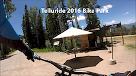
Telluride Bike Park
- 1
- 2
- 7
- 9
- 1
-
Telluride Bike Park Cross Country Trails
- 1
- 4
- 2
- 1
Popular Telluride Mountain Biking Trails
• 85 ★ 4.6 • 9 miles • 866 ft • 1,966 •
Trail is the premier single track trail in the region. **This trail is part of the Bike Park and requires a XC or Bike Park Pass during operating days/hours** Daily, June 18 - September 18, 2022: 9 AM - 5 PM, Weekends September 24 -...
• 95 ★ 3.4 • 3 miles • 89 ft • 854 •
This trail is part of the Bike Park. Access during Bike Park operations requires a XC or Bike Park pass. Intermediate trail from the top of the Gondola down to Mountain that alternates between open ski runs and trees. The Beginning is...
• 100 ★ 3.5 • 2,070 ft • 20 ft • 770 •
Popular green difficulty family friendly singletrack. This multi-use trail can be used both directions and has a easy overall physical rating with a 20 ft green climb. Trail visibility is always easy to follow. On average it takes 3 minutes to complete this trail.
• 100 ★ 4.7 • 3 miles • 342 ft • 767 •
Highly rated popular blue difficulty singletrack. This multi-use trail can be used both directions and has a easy overall physical rating with a 342 ft green climb. Trail visibility is always easy to follow. On average it takes 21 minutes to complete this trail.
• 90 ★ 0.0 • 1,112 ft • 48 ft • 685 •
Popular blue difficulty singletrack. This mountain bike primary trail can be used downhill primary. On average it takes 5 minutes to complete this trail.
• 100 ★ 3.6 • 1 mile • 4 ft • 651 •
Popular blue difficulty singletrack. This multi-use trail can be used downhill primary and has a moderate overall physical rating with a 4 ft blue climb. Trail visibility is always easy to follow. On average it takes 8 minutes to complete this trail.
• 95 ★ 4.3 • 3,682 ft • 78 ft • 625 •
Fun fast bench cut that connects mountain down to the vallley floor. Nothing crazy technical. Ride with caution though as it’s a popular hiking trail
• 90 ★ 4.4 • 2 miles • 0 ft • 572 •
Some of the best singletrack in the area. Can be ridden as a loop from the Telluride Bike Park (via & Magic ) or from Lakes (**XC pass required if accessing from Telluride Bike Park) or as a shuttle from highway 145 and Illium Rd.
Telluride Mountain Bike Routes
★ 5.0 • 21 miles • 2,004 ft • 3 • Point to Point •
Take the Gondola to San Sophia station and ride back to Telluride. **This route includes trails in the...
★ 4.5 • 16 miles • 1,771 ft • 8 • Loop •
Utilize the town gondola (pass required during bike park operating hours) as your start/finish and begin a...
★ 4.0 • 16 miles • 4,565 ft • 3 • Loop •
A Telluride expert classic, this route will take you up to 13,000 ft. with over 4,000 ft. of climbing....
★ 5.0 • 3 miles • 52 ft • 1 • Point to Point •
Top to Bottom Lap off Lift 4
★ 3.5 • 33 miles • 6,970 ft • 31 •
Telluride will be one of the newest locations to host the Big Mountain Enduro with a combination of...
2 miles • 84 ft • 4 • Point to Point •
Fun Top to bottom lap with a little bit of everything. to to Log Jams to to Lower Hopper and then Lower .
Photos of Telluride Mountain Bike
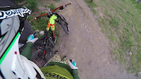
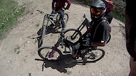
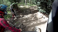
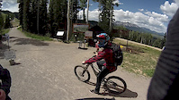
Videos of Telluride Mountain Bike

trail: Remine Creek
0:05 |
101 |
May 2, 2022

trail: World Cup
8:52 |
82 |
Jun 6, 2017
trail: Wasatch Trail
2:41 |
24720 |
Dec 7, 2016
trail: No Brainer
3:12 |
44 |
Jul 15, 2016
trail: World Cup
3:38 |
127 |
Jul 7, 2015
trail: World Cup
16:06 |
244 |
Nov 11, 2013
trail: World Cup
0:40 |
90 |
Nov 11, 2013
trail: World Cup
0:39 |
97 |
Nov 11, 2013
Recent Trail Reports
| status | trail | date | condition | info | user |
|---|---|---|---|---|---|
| Mill Creek Cutoff | Jun 9, 2026 @ 12:15pm (America/Denver) Jun 9, 2026 | Dry | winslowsc | ||
| Doka to Dallas | Jun 9, 2026 @ 12:15pm (America/Denver) Jun 9, 2026 | Dry | winslowsc | ||
| Alta | Jun 8, 2026 @ 12:43pm (America/Denver) Jun 8, 2026 | Ideal | Shawnsrides | ||
| Sunshine T35 | Jun 8, 2026 @ 12:41pm (America/Denver) Jun 8, 2026 | Very Dry | Shawnsrides | ||
| Magic Meadow | Jun 8, 2026 @ 12:39pm (America/Denver) Jun 8, 2026 | Very Dry | Shawnsrides | ||
| Eider Creek | May 24, 2026 @ 2:21pm (America/Denver) May 24, 2026 | Dry | brinkedge | ||
| Eider to Mill Connector | Mar 28, 2026 @ 3:21pm (America/Denver) Mar 28, 2026 | Ideal | jbrkick | ||
| Mill Creek Road | Mar 28, 2026 @ 3:21pm (America/Denver) Mar 28, 2026 | Ideal | jbrkick | ||
| Remine Creek | Mar 27, 2026 @ 11:12am (America/Denver) Mar 27, 2026 | Dry | Fish81435 | ||
| Aldasoro | Mar 27, 2026 @ 11:12am (America/Denver) Mar 27, 2026 | Dry | Fish81435 |
Activity Feed
| username | action | type | title | date |
|---|---|---|---|---|
| fifthandgoal | wishlist | trail | activity #97181919 and 1 more | Jun 17, 2026 @ 7:25am 1 day |
| brynnehitch | wishlist | trail | activity #97162689 and 2 more | Jun 16, 2026 @ 10:04pm 2 days |
| Skoofer | ridden | trail | activity #97138259 | Jun 16, 2026 @ 2:32pm 2 days |
| Skoofer | ridden | trail | activity #97138243 and 3 more | Jun 16, 2026 @ 2:32pm 2 days |
| justboofit | wishlist | route | activity #97079439 | Jun 15, 2026 @ 6:14pm 3 days |
Recent Comments
| username | type | title | comment | date |
|---|---|---|---|---|
| trail | Can you add it to the map? | Oct 6, 2025 @ 7:58am Oct 6, 2025 | ||
| trail | DH single track is sanctioned and parallels... | Oct 5, 2025 @ 2:28pm Oct 5, 2025 | ||
| trail | I missed the part about the climbing! There is... | Sep 28, 2025 @ 7:01pm Sep 28, 2025 | ||
| trail | Fun trail when the bike park is closed. Free... | Sep 28, 2025 @ 6:55pm Sep 28, 2025 | ||
| report | Highly recommended to start at the top of... | Sep 15, 2025 @ 2:31pm Sep 15, 2025 |
Local Badges
-

2025 Telluride Funduro Blue Badge15 awarded -

I Only Ride Park43 awarded -

Max-imum Hopper216 awarded -

Telluride Funduro Practice Badge318 awarded -

Big Ride 30k2,451 awarded -

Epic Ride 50k631 awarded
Bike & Skill Parks
| name | type | city | rating |
|---|---|---|---|
| Telluride Bike Park | bike park | Telluride | |
| Telluride Ski Resort | bike park | Telluride |
Local Trail Supporters
- Telluride Bike Park
![Outside Festival – Southwest]()
Activity Type Stats
| activitytype | trails | distance | descent | descent distance | total vertical | rating | global rank | state rank | photos | reports | routes | ridelogs |
|---|---|---|---|---|---|---|---|---|---|---|---|---|
| Mountain Bike | 113 | 222 miles | 59,764 ft | 126 miles | 5,246 ft | #614 | #229 | 320 | 1,282 | 22 | 15,461 | |
| E-Bike | 61 | 130 miles | 36,181 ft | 73 miles | 6,280 ft | #1,050 | #805 | 1,091 | 5 | 549 | ||
| Horse | 41 | 109 miles | 21,778 ft | 52 miles | 4,593 ft | #339 | #468 | 196 | 2 | 2 | ||
| Hike | 134 | 295 miles | 77,746 ft | 148 miles | 6,309 ft | 25 | 706 | 44 | 4,424 | |||
| Trail Running | 124 | 258 miles | 68,406 ft | 130 miles | 6,309 ft | #484 | #189 | 703 | 33 | 1,452 | ||
| Dirtbike/Moto | 13 | 62 miles | 16,362 ft | 34 miles | 5,207 ft | #538 | #183 | 109 | 25 | |||
| ATV/ORV/OHV | 12 | 54 miles | 14,199 ft | 29 miles | 5,207 ft | #390 | #118 | 105 | 18 | |||
| Snowshoe | 4 | 12 miles | 1,201 ft | 4 miles | 4,091 ft | #535 | #196 | 14 | 15 | 37 | ||
| Downhill Ski | 170 | 82 miles | 78,914 ft | 78 miles | 4,426 ft | #79 | #35 | 3 | 4,490 | |||
| Backcountry Ski | 2 | 6 miles | 1,155 ft | 3 miles | 1,906 ft | #356 | #72 | 14 | 1,374 | |||
| Nordic Ski | 8 | 6 miles | 597 ft | 2 miles | 2,448 ft | #595 | #199 | 21 | 413 |
Frequently Asked Questions About Telluride
▼
What are the best places to ride in Telluride?
Telluride has 3 areas to explore for mountain biking. The top rated areas are:
▼
What are the highest rated mountain biking trails in Telluride?
The highest rated mountain biking trails in Telluride are:
- Valley Floor (4.3/5)
- Tommy Knocker (4.3/5)
- Prospect (4.3/5)
- Ore Hopper (4.3/5)
- Penelope's Cruise (4.3/5)
▼
What is the best time of the year to ride in Telluride?
Based on ride log data, the most popular months to ride in Telluride are:
- July (501 activities)
- August (378 activities)
- September (300 activities)
▼
Where can I park to ride in Telluride?
There are 23 parking locations listed in Telluride. The most popular parking spots are: View all parking and trailhead locations on the map to plan your visit.
Activities
Trails
Points of Interest
- Sunshine Campground Camping
- Woods Lake Campground Camping
- North Pole Hut Cabin
- Blue Lakes Hut Cabin
- Bear Creek Falls Sight
- Rockslide Viewpoint
- Crystal Viewpoint
- TommyKnocker Rest Stop Sight
- Ballard Mountain Summit
- Ajax Peak Summit
- Mount Wilson (14,255 ft)
- Mount Sneffels (14,127 ft)
- El Diente Peak (14,052 ft)
- By canadaka
 Trailforks & contributors
 - Admins: Telluride, SJMA
- #4949 - 30,863 views
- telluride activity log | embed map of Telluride mountain bike trails | telluride mountain biking points of interest
Downloading of trail gps tracks in kml & gpx formats is enabled for Telluride.
You must login to download files.