close
-
Layers w
- Weather Layers
- Pro
- Pro
- Pro
- Pro
- Pro
- Pro
- More Layers
- Pro
- Pro
- Pro
- Pro
-
Upgrade to

3D
Trail Conditions
- Unknown
- Snow Groomed
- Snow Packed
- Snow Covered
- Snow Cover Partial
- Freeze/thaw Cycle
- Icy
- Prevalent Mud
- Wet
- Variable
- Ideal
- Dry
- Very Dry
Trail Flow (Ridden Direction)
Trailforks scans users ridelogs to determine the most popular direction each trail is ridden. A good flowing trail network will have most trails flowing in a single direction according to their intension.
The colour categories are based on what percentage of riders are riding a trail in its intended direction.
The colour categories are based on what percentage of riders are riding a trail in its intended direction.
- > 96%
- > 90%
- > 80%
- > 70%
- > 50%
- < 50%
- bi-directional trail
- no data
Trail Last Ridden
Trailforks scans ridelogs to determine the last time a trail was ridden.
- < 2 days
- < 1 week
- < 2 weeks
- < 1 month
- < 6 months
- > 6 months
Trail Ridden Direction
The intended direction a trail should be ridden.
- Downhill Only
- Downhill Primary
- Both Directions
- Uphill Primary
- Uphill Only
- One Direction
Contribute Details
Colors indicate trail is missing specified detail.
- Description
- Photos
- Description & Photos
- Videos
Trail Popularity ?
Trailforks scans ridelogs to determine which trails are ridden the most in the last 9 months.
Trails are compared with nearby trails in the same city region with a possible 25 colour shades.
Think of this as a heatmap, more rides = more kinetic energy = warmer colors.
- most popular
- popular
- less popular
- not popular
ATV/ORV/OHV Filter
Max Vehicle Width
inches
US Cell Coverage
Legend

Radar Time
Activity Recordings
Trailforks uses anonymized public activity data.
?
Activity Recordings
Trailforks uses anonymized public activity data.
?
Personal Heatmap
▶
Activity Types
all
/
none
▶
Options
2
Date range
month
–
Winter Trails
Warning
A routing network for winter maps does not exist. Selecting trails using the winter trails layer has been disabled.
Missing Trails
Most Popular
Least Popular
Trails are colored based on popularity. The more popular a trail is, the more red. Less popular trails trend towards green.
Jump Magnitude Heatmap
Heatmap of where riders jump on trails. Zoom in to see individual jumps, click circles to view jump details.
BC Backroad Status
![map legend]()
Service Road Atlas is a free to use, community-driven service for viewing and creating reports on the numerous back-country service roads around B.C. and Alberta.

Slope Aspect
Direction the slope faces
Trails Deemphasized
Trails are shown in grey.
Only show trails with no bike usage.
Suggested Layers
Based on selected activity type
Save the current map location and zoom level as your default home location whenever this page is loaded.
SavePopular Trail Networks
view all areas »
No description for Tennessee has been added yet!
Login or register to submit one.
Region Details
- 334
- 90
- 445
- 542
- 210
- 36
- 4
Stats
- Avg Trail Rating
- Trails (view details)
- 2,716
- Trails Mountain Bike
- 1,675
- Trails E-Bike
- 1,100
- Trails Gravel Bike
- 172
- Trails Adaptive Bike
- 263
- Trails Winter Fat Bike
- 107
- Trails Horse
- 189
- Trails Hike
- 2,371
- Trails Trail Running
- 2,324
- Trails Dirtbike/Moto
- 5
- Trails Observed Trials
- 4
- Trails ATV/ORV/OHV
- 21
- Trails Snowshoe
- 4
- Trails Downhill Ski
- 11
- Trails Nordic Ski
- 4
- Total Distance
- 3,549 miles
- Total Descent
- 507,657 ft
- Total Vertical
- 6,365 ft
- Highest Trailhead
- 6,583 ft
- Reports
- 20,400
- Photos
- 5,400
- Ridden Counter
- 301,516
Articles

Race Replay: 2026 Windrock Bike Park - Downhill Southeast Round 2
Apr 14, 2026 from pinkbike.com
Tune in for some more free DH coverage courtesy of the fine folks over at Gravity Cooperative.

Race Replay: 2026 Trials Training Center - Downhill Southeast Round 1
Mar 10, 2026 from pinkbike.com
More high-quality, and free racing coverage from The Gravity Cooperative

The Best Summer Weekend Trips of 2025
Jun 3, 2025 from outsideonline.com
There are only 14 weekends between Memorial Day and Labor Day this year. So you better make them count.

The 12 Most Stunning Trails in the U.S.
May 29, 2025 from outsideonline.com
In celebration of National Trails Day, discover some of the best hikes in the U.S.—from slot canyons to grasslands, waterfalls, and secluded...
Sub Regions
- Eastern Tennessee (Eastern Time) (1,073)
- Anderson County (259)
- Bledsoe County (1)
- Blount County (26)
- Bradley County (6)
- Campbell County (3)
- Carter County (25)
- Cherokee NF Tellico Ranger District (3)
- Claiborne County (2)
- Cocke County (5)
- Cumberland County (14)
- Grainger County (1)
- Greene County (10)
- Hamblen County (34)
- Hamilton County (158)
- Hancock County (0)
- Jefferson County (0)
- Johnson County (7)
- Knox County (250)
- Loudon County (1)
- Marion County (33)
- McMinn County (2)
- Meigs County (1)
- Monroe County (8)
- Morgan County (0)
- Polk County (56)
- Roane County (13)
- Scott County (22)
- Sevier County (17)
- Sullivan County (66)
- Unicoi County (43)
- Union County (1)
- Washington County (37)
- Middle Tennessee (481)
- Coffee County (1)
- Davidson County (88)
- DeKalb County (0)
- Dickson County (25)
- Fentress County (0)
- Franklin County (64)
- Grundy County (0)
- Jackson County (0)
- Macon County (0)
- Maury County (25)
- Montgomery County (23)
- Putnam County (34)
- Robertson County (1)
- Rutherford County (29)
- Smith County (7)
- Sumner County (55)
- Van Buren County (10)
- Warren County (5)
- White County (7)
- Williamson County (66)
- Wilson County (44)
- Western Tennessee (131)
- Benton County (0)
- Fayette County (8)
- Hardin County (13)
- Henry County (2)
- Lake County (1)
- Lawrence County (0)
- Madison County (15)
- Obion County (3)
- Shelby County (49)
- Weakley County (1)
Popular Tennessee Mountain Biking Trails
• 100 ★ 4.5 • 1 mile • 303 ft • 2,443 •
Highly rated popular blue difficulty singletrack. This multi-use trail can be used both directions with a 303 ft blue climb. Adaptive MTB rating: amtb blue. On average it takes 14 minutes to complete this trail.
• 100 ★ 4.9 • 522 ft • 9 ft • 2,184 •
An intermediate gravel jump line at the new Preserve Bike Park.
• 100 ★ 3.6 • 958 ft • 21 ft • 2,122 •
Popular green difficulty family friendly gravel path. This multi-use trail can be used both directions and has a easy overall physical rating with a 21 ft green climb. Adaptive MTB rating: amtb green. Trail visibility is always easy to follow. On average it takes 2 minutes to complete this trail.
• 95 ★ 4.6 • 3,455 ft • 0 ft • 1,926 •
Highly rated popular blue difficulty singletrack. This mountain bike primary trail can be used downhill only. It features berm and jump. On average it takes 7 minutes to complete this trail.
• 100 ★ 4.7 • 3,701 ft • 0 ft • 1,806 •
Highly rated popular green difficulty machine groomed. This mountain bike primary trail can be used downhill only and has a moderate overall physical rating. It features berm, jump and roller coaster. Adaptive MTB rating: amtb blue. Trail visibility is always easy to follow. On average it takes 6 minutes to complete this trail.
• 95 ★ 4.8 • 4,370 ft • 61 ft • 1,735 •
Probably the best beginner friendly mountain bike trail in Knoxville. Short, easy, smooth with very few roots or rocks. Suitable for children.
• 95 ★ 4.1 • 1 mile • 77 ft • 1,680 •
Highly rated popular green difficulty singletrack. This multi-use trail can be used both directions and has a moderate overall physical rating with a 77 ft green climb. Adaptive MTB rating: amtb green. On average it takes 8 minutes to complete this trail.
Tennessee Mountain Bike Routes
Go Nuts Nut Gobbler XC 2020 Featured
★ 4.5 • 7 miles • 677 ft • 3 •
Go Nuts Nut Gobbler XC Race November 22, 2020
Bear Wheels Full Route Featured
★ 5.0 • 8 miles • 761 ft • 3 • Loop •
Longest and most common route including , , and Trails.
Horton South Full Loop Featured
★ 5.0 • 7 miles • 326 ft • 1 • Loop •
About 7 miles of single track XC riding.
12 miles • 936 ft • 5 • Loop •
Starting at the , this route offers a slightly longer cross-country effort while maintaining ESNP’s...
13 miles • 1,814 ft • 7 • Loop •
Start with a great view of Chattanooga from East Overlook before you head out for some of the best riding...
SORBA Chattanooga: Blue Lollipop Featured
10 miles • 1,162 ft • 4 •
After a climb up , you will enjoy a quick lap around before zipping back down the way you came to enjoy a...
Videos of Tennessee Mountain Bike
featured
![]()

trail: Double Shot
0:33 |
315 |
Jun 16, 2023
featured
![Greenbriar Wooded Hiking & Biking Trail]()

7:05 |
251 |
Jun 30, 2024 , Columbia
featured
![Defeated Creek - Grizzly Bear MTB Trail Descent]()

trail: Grizzly Bear
11:04 |
491 |
May 2, 2023 , Carthage
featured
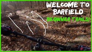
![Barfield Intermediate 1 - Trail Ride or ASMR?]()
trail: Thunderlips
25:04 |
483 |
Apr 5, 2022 , Murfreesboro

trail: Thunderhead
0:22 |
51 |
Dec 7, 2025

trail: Ober Chute
0:10 |
21 |
Oct 4, 2025
trail: YYZ
0:09 |
12 |
Sep 29, 2025
National Scenic Trails & Official Routes
-
River To Clouds
- Mountain Bike
- E-Bike
- Hike
- Trail Running

Activity Feed
| username | action | type | title | date |
|---|---|---|---|---|
| rysparks | wishlist | region | activity #97543563 | Jun 21, 2026 @ 10:28pm 11 hours |
| Srandol3 | wishlist | region | activity #97538979 | Jun 21, 2026 @ 7:37pm 14 hours |
| wacopacco | ridden | trail | activity #97537323 | Jun 21, 2026 @ 6:49pm 15 hours |
| wacopacco | ridden | trail | activity #97537157 and 4 more | Jun 21, 2026 @ 6:44pm 15 hours |
| rysparks | wishlist | region | activity #97522132 | Jun 21, 2026 @ 2:42pm 19 hours |
Recent Comments
| username | type | title | comment | date |
|---|---|---|---|---|
| report | Thank you for keeping the trails clear! | Jun 19, 2026 @ 8:28am Jun 19, 2026 | ||
| report | Thank you for clearing the trail! | Jun 19, 2026 @ 8:27am Jun 19, 2026 | ||
| report | 3 8” logs total, all close to cemetery | Jun 19, 2026 @ 8:21am Jun 19, 2026 | ||
| report | Thanks for tackling that downed tree full of... | Jun 17, 2026 @ 7:52pm Jun 17, 2026 | ||
| report | Thanks Chris! | Jun 17, 2026 @ 7:50pm Jun 17, 2026 |
Local Badges
-

10 Green Trails902 awarded -

Epic Ride 50k10 awarded -

Epic Ride Climb 2k14 awarded -
Epic Ride Climb 2k15 awarded -

Climbing 10k Badge18 awarded -

Climbing 100k Badge22 awarded
Bike & Skill Parks
| name | type | city | rating |
|---|---|---|---|
| Windrock Bike Park | bike park | Oliver Springs | |
| Ober Mountain | bike park | Gatlinburg | |
| Baker Creek Bike Park | skill park | Knoxville | |
| Music City BMX | skill park | Nashville | |
| Chunky | skill park | Jasper |
Upcoming Local Events
Activity Type Stats
| activitytype | trails | distance | descent | descent distance | total vertical | rating | global rank | state rank | photos | reports | routes | ridelogs |
|---|---|---|---|---|---|---|---|---|---|---|---|---|
| Mountain Bike | 1,670 | 1,854 miles | 246,978 ft | 764 miles | 6,306 ft | #35 | 4,718 | 20,324 | 236 | 299,577 | ||
| E-Bike | 1,100 | 1,115 miles | 137,510 ft | 455 miles | 4,616 ft | #30 | 29 | 17,569 | 113 | 14,821 | ||
| Gravel Bike | 172 | 336 miles | 30,958 ft | 135 miles | 3,294 ft | #35 | 2 | 1,040 | 27 | 1,483 | ||
| Adaptive Bike | 263 | 376 miles | 33,202 ft | 146 miles | 3,294 ft | #33 | 1 | 2,379 | 1 | 9 | ||
| Winter Fat Bike | 107 | 100 miles | 9,452 ft | 39 miles | 3,166 ft | #42 | 520 | 31 | 14 | |||
| Horse | 189 | 371 miles | 42,080 ft | 144 miles | 5,758 ft | #39 | 2 | 1,810 | 1 | 58 | ||
| Hike | 2,370 | 3,295 miles | 450,600 ft | 1,324 miles | 6,365 ft | #35 | 539 | 19,147 | 47 | 27,137 | ||
| Trail Running | 2,324 | 3,234 miles | 441,493 ft | 1,300 miles | 6,365 ft | #36 | 39 | 19,135 | 49 | 17,226 | ||
| Dirtbike/Moto | 5 | 21 miles | 2,657 ft | 8 miles | 2,625 ft | #43 | 3 | 1,715 | 86 | |||
| Observed Trials | 4 | 10 miles | 1,178 ft | 5 miles | 3,251 ft | #35 | 1 | 52 | 1 | 58 | ||
| ATV/ORV/OHV | 21 | 27 miles | 4,347 ft | 12 miles | 3,760 ft | #42 | 2 | 1,713 | 1 | 31 | ||
| Snowshoe | 4 | 4 miles | 157 ft | 3,291 ft | 1,811 ft | #48 | 4 | 17 | ||||
| Downhill Ski | 11 | 2 miles | 1,299 ft | 2 miles | 548 ft | #41 | 5 | 367 | ||||
| Nordic Ski | 4 | 4 miles | 157 ft | 3,291 ft | 1,811 ft | #46 | 6 | 56 |
Activities
- Tennessee Mountain Biking Trails
- Tennessee E-Biking Trails
- Tennessee Gravel Biking Trails
- Tennessee Adaptive Biking Trails
- Tennessee Winter Fat Biking Trails
- Tennessee Horseback Trails
- Tennessee Hiking Trails
- Tennessee Trail Running Trails
- Tennessee Dirtbiking Trails
- Tennessee ATVing/Offroading Trails
- Tennessee Skiing Trails
Trails
Points of Interest
- Shared Bridge
- A.T. Shelters: Double Spring Gap Shelter Cabin
- Indian Flats Falls Sight
- Silers Bald Shelter Cabin
- A.T. Shelters: Derrick Knob Shelter Cabin
- A.T. Shelters: Russell Field Shelter Cabin
- A.T. Shelters: Spence Field Shelter Cabin
- Stringer's Overlook Viewpoint
- Twentymile Creek Cascade Sight
- A.T. Shelters: Mollies Ridge Shelter Cabin
- Mount le Conte - High Top (6,588 ft)
- Mount Le Conte (6,588 ft)
- Cliff Top (6,555 ft)
- By canadaka
 Trailforks & contributors
 - Admins: Map Team, IMBA, chuktA, msmcfate, WillieJacobsz, PlumbBobM, ReckitRolley, colinreuter, SORBA, lscarmic
- #3186 - 38,128 views
- tennessee activity log | embed map of Tennessee mountain bike trails | tennessee mountain biking points of interest polygons
Downloading of trail gps tracks in kml & gpx formats is enabled for Tennessee.
You must login to download files.