close
-
Layers w
- Weather Layers
- Pro
- Pro
- Pro
- Pro
- Pro
- Pro
- More Layers
- Pro
- Pro
- Pro
- Pro
-
Upgrade to

3D
Trail Conditions
- Unknown
- Snow Groomed
- Snow Packed
- Snow Covered
- Snow Cover Partial
- Freeze/thaw Cycle
- Icy
- Prevalent Mud
- Wet
- Variable
- Ideal
- Dry
- Very Dry
Trail Flow (Ridden Direction)
Trailforks scans users ridelogs to determine the most popular direction each trail is ridden. A good flowing trail network will have most trails flowing in a single direction according to their intension.
The colour categories are based on what percentage of riders are riding a trail in its intended direction.
The colour categories are based on what percentage of riders are riding a trail in its intended direction.
- > 96%
- > 90%
- > 80%
- > 70%
- > 50%
- < 50%
- bi-directional trail
- no data
Trail Last Ridden
Trailforks scans ridelogs to determine the last time a trail was ridden.
- < 2 days
- < 1 week
- < 2 weeks
- < 1 month
- < 6 months
- > 6 months
Trail Ridden Direction
The intended direction a trail should be ridden.
- Downhill Only
- Downhill Primary
- Both Directions
- Uphill Primary
- Uphill Only
- One Direction
Contribute Details
Colors indicate trail is missing specified detail.
- Description
- Photos
- Description & Photos
- Videos
Trail Popularity ?
Trailforks scans ridelogs to determine which trails are ridden the most in the last 9 months.
Trails are compared with nearby trails in the same city region with a possible 25 colour shades.
Think of this as a heatmap, more rides = more kinetic energy = warmer colors.
- most popular
- popular
- less popular
- not popular
ATV/ORV/OHV Filter
Max Vehicle Width
inches
US Cell Coverage
Legend

Radar Time
Activity Recordings
Trailforks uses anonymized public activity data.
?
Activity Recordings
Trailforks uses anonymized public activity data.
?
Personal Heatmap
▶
Activity Types
all
/
none
▶
Options
2
Date range
month
–
Winter Trails
Warning
A routing network for winter maps does not exist. Selecting trails using the winter trails layer has been disabled.
Missing Trails
Most Popular
Least Popular
Trails are colored based on popularity. The more popular a trail is, the more red. Less popular trails trend towards green.
Jump Magnitude Heatmap
Heatmap of where riders jump on trails. Zoom in to see individual jumps, click circles to view jump details.
BC Backroad Status
![map legend]()
Service Road Atlas is a free to use, community-driven service for viewing and creating reports on the numerous back-country service roads around B.C. and Alberta.

Slope Aspect
Direction the slope faces
Trails Deemphasized
Trails are shown in grey.
Only show trails with no bike usage.
Suggested Layers
Based on selected activity type
Save the current map location and zoom level as your default home location whenever this page is loaded.
Save
No description for Terenzo has been added yet!
Login or register to submit one.
This region uses the Uk/Euro style trail grading system.
Activities Click to view
- Mountain Bike
53 trails
- E-Bike
30 trails
- Adaptive Bike
1 trails
- Hike
44 trails
- Trail Running
46 trails
Region Details
- 10
- 9
- 15
- 2
Region Status
Caution as of May 4, 2026Stats
- Avg Trail Rating
- Trails (view details)
- 38
- Trails Mountain Bike
- 53
- Trails E-Bike
- 30
- Trails Adaptive Bike
- 1
- Trails Winter Fat Bike
- 1
- Trails Horse
- 1
- Trails Hike
- 44
- Trails Trail Running
- 46
- Total Distance
- 27 miles
- Total Descent
- 11,179 ft
- Total Vertical
- 2,731 ft
- Highest Trailhead
- 3,363 ft
- Reports
- 104
- Photos
- 51
- Ridden Counter
- 882
Sub Regions
-
Cassio
- 9
- 14
- 2
Popular Terenzo Mountain Biking Trails
• 60 ★ 4.7 • 1 mile • 29 ft • 47 •
Sentiero realizzato recentemente che prevede una prima parte di mangia e bevi sul crinale che scende verso la val Taro, poi si trasforma in un bel flow nel bosco, il tutto condito da alcuni rilanci e da qualche salto drop naturale...
• 95 ★ 4.5 • 2,884 ft • 0 ft • 38 •
Popular blue difficulty singletrack. This mountain bike primary trail. It features drop. On average it takes 4 minutes to complete this trail.
• 75 ★ 0.0 • 5,155 ft • 95 ft • 37 •
Prima parte nel bosco tra i Pini,seconda parte su carraia
• 70 ★ 0.0 • 1,699 ft • 0 ft • 28 •
Variante del trail numero 2 (da imboccarsi poco più avanti, in prossimità dell'antenna) della Ciclopista MTB - "I Salti del Diavolo".
• 85 ★ 4.0 • 3,104 ft • 8 ft • 28 •
Recente sentiero che dalla vetta di Monte Cassio conduce fino all'area pic-nic presso la Strada della Cisa; attraversa due volte la strada della pineta, percorribile anche in salita. Il sentiero è unico, con evidente accesso, ma se non...
• 5 ★ 0.0 • 5,036 ft • 194 ft • 27 •
Tratto finale del percorso n. 2 della Ciclopista MTB "I Salti del Diavolo", distribuito tutto nella Val Baganza e che, con un primo tratto in discesa ed una successiva risalita, conduce dalla Strada della Cisa fino ai pressi...
• 50 ★ 0.0 • 2 miles • 364 ft • 24 •
Il lungo tracciato che parte dalla cima del Monte Cassio presenta tre diverse sezioni: - parte alta: nel sottobosco, il fogliame invade spesso il tracciato; è necessario prestare attenzione a rami e piccole buche potenzialmente...
• 80 ★ 0.0 • 1 mile • 0 ft • 18 •
Carraia che dal centro di Cassio porta al nuovo ponte dei Salti del Diavolo sul torrente Baganza. La parta alta, ripida è sassosa, è pericolosa in discesa e molto impegnativa in salita, evitabile con la variante da poco realizzata
Terenzo Mountain Bike Routes
★ 5.0 • 15 miles • 3,096 ft • 2 • Loop •
Anello semplice e intuitivo per salire fino a Monte Cassio dalla Val Taro scendendo il . Lunga salita...
9 miles • 2,156 ft • 2 • Loop • Race •
Itinerario proposto da UISP Parma per l'evento RampiTour2020
7 miles • 1,433 ft • 1 • Loop • Race •
Quattordicesima tappa della serie di itinerari proposto da UISP Parma per l'evento RampiTour2020
7 miles • 1,547 ft • 1 • Loop • Race •
Itinerario proposto da UISP Parma per l'evento RampiTour2020
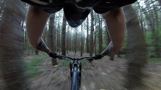
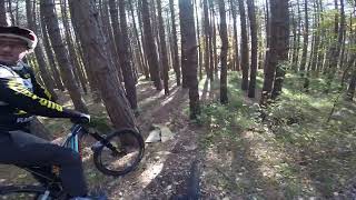
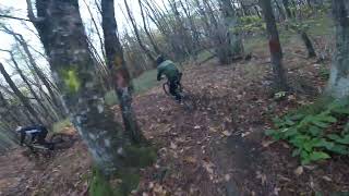
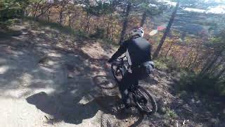
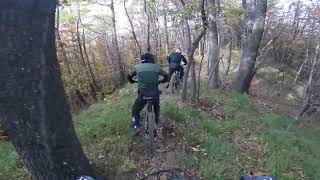
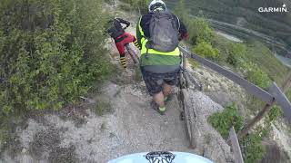
Photos of Terenzo Mountain Bike
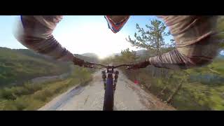
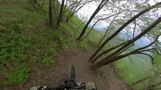
Videos of Terenzo Mountain Bike
trail: High Speed
2:47 |
76 |
Sep 3, 2025 , Terenzo
trail: Billy Goat
5:37 |
59 |
Sep 2, 2025 , Terenzo
trail: TAV Trail
8:50 |
25 |
Sep 2, 2025 , Terenzo
trail: High Speed
3:42 |
199 |
Dec 15, 2022 , Terenzo
trail: Orange
6:26 |
290 |
Dec 15, 2022 , Terenzo
trail: Billy Goat
7:27 |
307 |
Dec 15, 2022 , Terenzo
trail: Devil Trail
9:11 |
277 |
Dec 15, 2022 , Terenzo
trail: TAV Trail
14:37 |
236 |
Jun 28, 2022 , Terenzo
Recent Trail Reports
Activity Feed
| username | action | type | title | date |
|---|---|---|---|---|
| Orso | add | report | activity #94063172 | May 4, 2026 @ 6:10pm May 4, 2026 |
| GABRI3RIDE | vote | trail | activity #93459831 and 6 more | Apr 26, 2026 @ 10:53am Apr 26, 2026 |
| dariomangoni | update | trail | activity #93131573 and 2 more | Apr 21, 2026 @ 11:49pm Apr 21, 2026 |
| alexfs | add | trail | activity #93131433 and 3 more | Apr 21, 2026 @ 11:44pm Apr 21, 2026 |
| alexfs | add | trail | activity #92804548 and 2 more | Apr 17, 2026 @ 12:12pm Apr 17, 2026 |
Recent Comments
| username | type | title | comment | date |
|---|---|---|---|---|
| trail | Agosto 2025 trail molto sporco e abbandonato... | Aug 24, 2025 @ 1:06am Aug 24, 2025 | ||
| trail | Praticamente una carraia dall’inizio alla... | May 4, 2025 @ 4:58am May 4, 2025 | ||
| trail | Il trail, inizialmente su carraia ben drenata,... | Apr 5, 2024 @ 5:40pm Apr 5, 2024 | ||
| trail | Trail che parte dalla sommità del Monte... | Apr 5, 2024 @ 5:32pm Apr 5, 2024 | ||
| trail | Prima parte sulla cresta spaziale! Poi il... | Apr 16, 2023 @ 8:04am Apr 16, 2023 |
Local Badges
-

Completionist0 awarded -

Epic Mountain Bike Climb 2k15 awarded -

Climbing 10k Badge1 awarded -

Mountain Biking 100k Badge0 awarded -

Epic Ride Descent 2k15 awarded -

Descent 10k Badge1 awarded
Activity Type Stats
| activitytype | trails | distance | descent | descent distance | total vertical | rating | global rank | state rank | photos | reports | routes | ridelogs |
|---|---|---|---|---|---|---|---|---|---|---|---|---|
| Mountain Bike | 53 | 27 miles | 11,181 ft | 14 miles | 2,730 ft | #3,693 | #213 | 51 | 104 | 4 | 371 | |
| E-Bike | 30 | 7 miles | 3,235 ft | 5 miles | 2,674 ft | #5,804 | #578 | 86 | 1 | 105 | ||
| Adaptive Bike | 1 | #564 | #552 | |||||||||
| Winter Fat Bike | 1 | #7,502 | #637 | |||||||||
| Horse | 1 | 2 miles | 938 ft | 2 miles | 873 ft | 3 | ||||||
| Hike | 44 | 25 miles | 8,934 ft | 12 miles | 2,730 ft | #6,432 | #330 | 103 | 13 | |||
| Trail Running | 46 | 26 miles | 9,531 ft | 13 miles | 2,730 ft | #5,734 | #302 | 103 |
Frequently Asked Questions About Terenzo
▼
What are the best places to ride in Terenzo?
Terenzo has 1 areas to explore for mountain biking. The top rated areas are:
▼
What are the highest rated mountain biking trails in Terenzo?
The highest rated mountain biking trails in Terenzo are:
- Devil Trail (4.2/5)
- Billy Goat (4.1/5)
- High Speed (4.1/5)
- Twister Trail (4/5)
- Escort Advisor (4/5)
▼
What is the best time of the year to ride in Terenzo?
Based on ride log data, the most popular months to ride in Terenzo are:
- July (4 activities)
- September (3 activities)
- October (2 activities)
▼
Where can I park to ride in Terenzo?
Check the Terenzo trail map for trailhead and parking information. Community members regularly update access and parking details for trails in the area.
Activities
Trails
- By denitopia
 TRAILFORKS VTA & contributors
 - Admins: dariomangoni
- #15189 - 1,555 views
- terenzo activity log | embed map of Terenzo mountain bike trails | terenzo mountain biking points of interest
Downloading of trail gps tracks in kml & gpx formats is enabled for Terenzo.
You must login to download files.